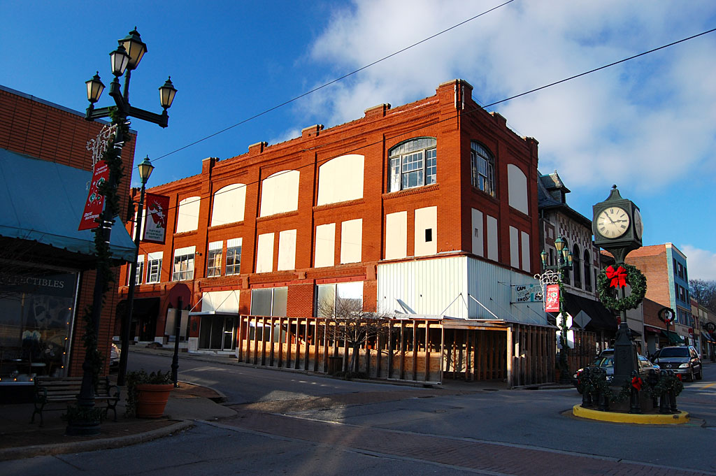
I was walking east on Themis toward the Common Pleas Courthouse trying to spot the old Teen Age Club that got to bouncing so hard one night that the city inspector shut it down because he was afraid the floor might collapse. On the opposite of the street was a nondescript red brick building that had a plaque on it. (Click on any photo to make it larger.)
 The Rotary Club plaque read, “Telephone Service. In 1877 the first long distance telephone line in Missouri was completed December 18, 1877, between Cape Girardeau and Jackson. In 1896 here in a 10′ x 12′ second floor room the city’s first telephone exchange was established by A.R. Ponder, L.J. Albert, J.F. Brooks and M.A. Dennison doing business as the Cape Girardeau Telephone Company.”
As a former telecommunications manager, I was vaguely intrigued.
I flashed back to when I was offered the telecom job just before I left on vacation to head back to Cape in the early ’90s. I knew absolutely nothing about phone stuff, but I remember thinking as I was going through little villages like Old Appleton, “Wow, if I take this job I’ll have a bigger phone system than this town.”
That call to Jackson
 I put the story on the back burner for a slow day. When Friend Shari Stiver and I took a stroll down Main Street one day when we were both in town, she said she’d like to swing by to look at the old telephone exchange, which had also been the Sturdivant Bank, the oldest bank in Southeast Missouri.
“The call may have originated in Cape,” she said, “but do you have any idea where it terminated in Jackson?”
Somehow or another, knowing Shari, I was pretty sure I was going to find out.
“The first call rang in my great-grandfather’s kitchen,” she elaborated. “He was the J.F. Brooks mentioned on the plaque. He was the engineer who laid out the railroad for Louis Houck. Houck wanted to be able to get hold of him, so he had him pull a phone line between Cape and Jackson.”
Major Brooks “advanced” down to Advance
 “Are we talking about the Major James Francis Brooks who Houck told to ‘advance’ down the line another mile to a stand of mulberry trees where land for a train depot could be bought for $10 an acre instead of $30 an acre in Lakeville?”
That “advance” turned out to become Advance, Missouri, Mother’s hometown.”
Yep, it was the same guy. Major Brooks’ engineering ended up resulting in the establishment of many of the small towns like Sturdivant, Brownwood, Blomeyer and Delta.
Brooks came west on a spotted pony
Shari added that her great-grandmother, “Bookie” (Florence Adele Turnbaugh Brooks) played telephone operator after the initial excitement of the first couple of calls died down. Maj. Brooks got his engineering degree at Vineyard College in Kansas City after he rode his spotted pony west with a wagon train to get there.
The Turnbaughs were Southerners who owned slaves, which Shari suspects caused some heated discussions over a bottle of whiskey on the front porch of the Turnbaugh house in Jackson.
Brooks created SEMO terraces
 The excellent history, A Missouri Railroad Pioneer: The Life of Louis Houck (Missouri Biography Series), describes how Houck was concerned with preserving the pastoral beauty of Normal School (which became SEMO) and reducing water runoff so he hired Maj. Brooks to landscape the terraces on the east side of Academic Hall that are still visible today.
The book said that part of the project was to build a two-foot sandstone retaining wall along Normal Avenue, “although admittedly this last project was more to stop wayward farm animals from straying onto the grounds.”
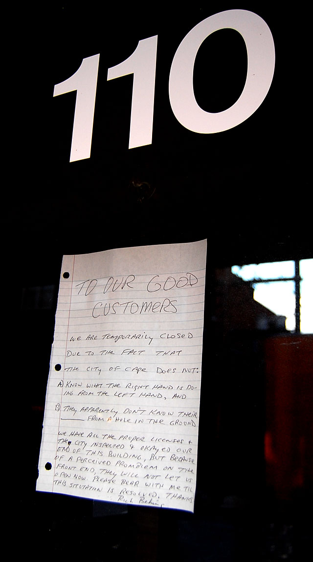
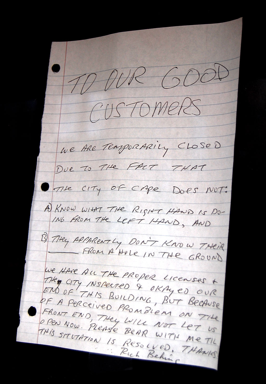
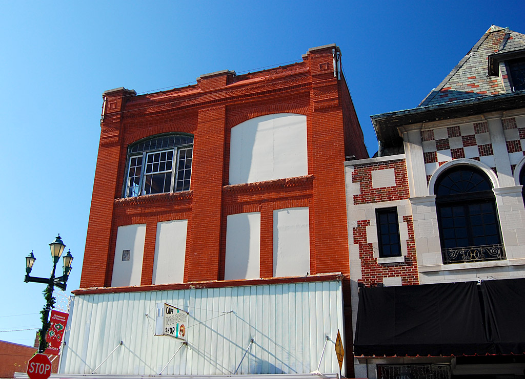
101 North Main condemned
 The landmark building has been condemned by the city. You can read the details of the wrangling in this Missourian story by Melissa Miller.
Cable reinforces wall
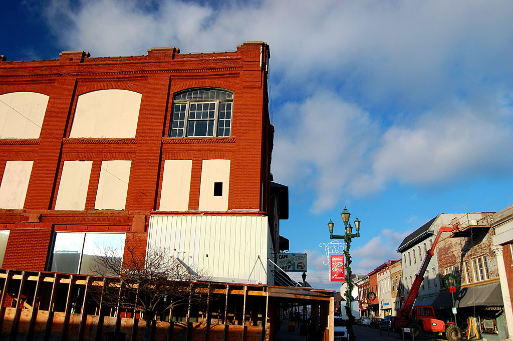
 As much as I love old buildings, I can see what the concern is. When you look through the gallery of photos taken over a three-year period, you can see that the upper level has deteriorated to the point that a covered walkway had to be constructed to protect passersby from falling wayward bricks.
A double cable around the top of the building keeps the walls from sagging outward. I don’t know that I can argue with a Missourian commenter who wrote, “Look how the front is shifting out. If it falls about all the plywood awning will do is separate the bodies better from the rubble.”
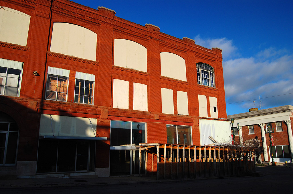
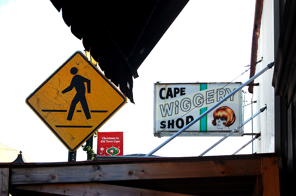
Sign says Cape Wiggery
 I’m not sure what the last business was to be in the building. The sign still says Cape Wiggery Shop. The 1969 City Directory said Kay’s was in there.
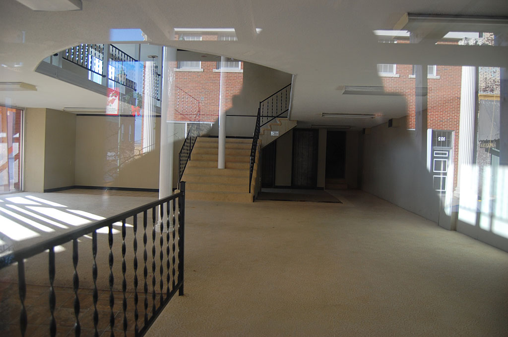
Interior has been cleaned out
 The inside, at least from looking through the window, looks pretty clean.
It’ll be missed
 I’ve made some iconic pictures of the building over the years, so I’ll miss it if it’s pulled down. It would be nice to think it could be saved, but it sure has the sniff of a parking lot about it, based on what I’ve seen and the news stories.
101 North Main photo gallery
Click on any photo to make it larger, then click on the left or right side of the image to move through the gallery. (Thanks to Shari for the Jackson house picture and for sharing the story of her great-grandfather.)

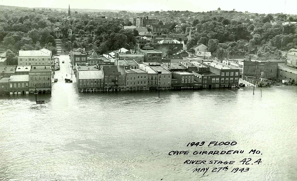 After I ran photos of the Flood of 1943 from Dad’s scrapbook, a member of the Lamkin Family sent me this aerial photo of the flood. I asked who took it so I could credit the photographer, and he said, “No idea. It hung in my grandfather’s office for as long as I recall.”