Quarries and Corrections

Strack Quarry - Fruitland 10-18-2012I did a couple of pieces about what I thought was the Strack Quarry in Fruitland near Saxony Lutheran High School. Several readers gently suggested that I might be wrong about which quarry I had photographed and I had this sinking feeling they might be right.

Laura Simon had an aerial photo in the January 16, 2013, Missourian that confirmed my fears: yep, I had been photographing the Heartland Materials facility, which is immediately south of the high school. I focused on it because it was the closest to the school.

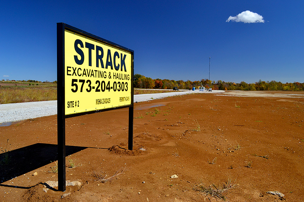
When I was home in October, I made it a point to track down the REAL Strack quarry off Hwy 61 coming into Fruitland. Their permit to mine is back on hold pending an appeal.

Just scratching the surface

Strack Quarry - Fruitland 10-18-2012
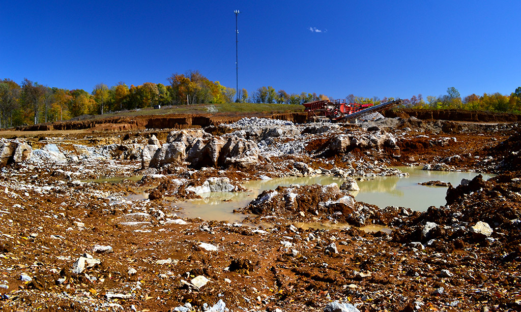
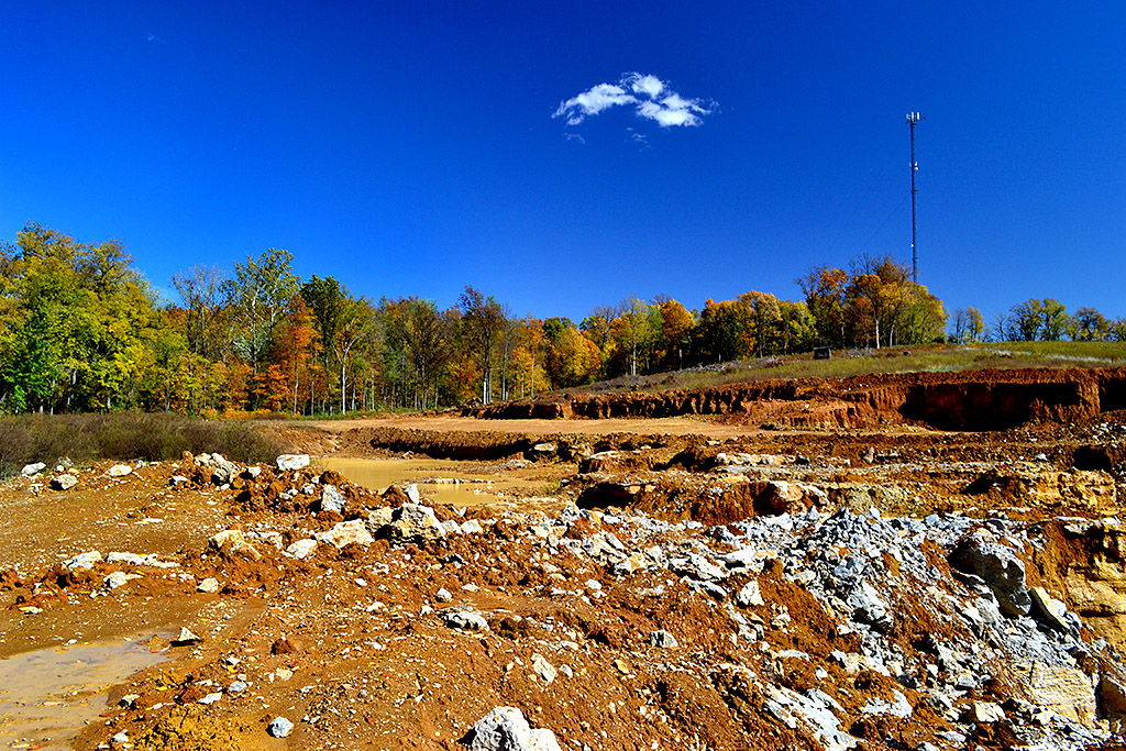
So far it looks like Strack has been just scratching the surface by hauling away the overburden and using it for fill along the highway. You can see here how they’ve been scraping away the hillside.

Nobody working the pit

Strack Quarry - Fruitland 10-18-2012
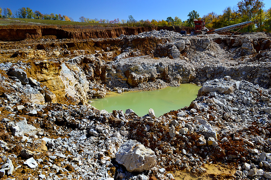
Nobody was working the pit the day I was there. I didn’t see any Keep Out signs, but the heavy gumbo mud that nearly sucked my shoes off provided an effective barrier to getting close.

Setting the record straight

Strack Quarry - Fruitland 10-18-2012So, much to my embarrassment, these two stories show the Heartland site, not Strack.


Fruitland Quarry in News Again

Fruitland’s Strack Quarry is back in the news again. I’m not even going to try to figure out what the latest wrangle is all about. I’ll let you go to Keith Lewis‘ story in The Missourian to try to figure out how a quarry that had approval to operate and which has moved a bunch of overburden and started poking a big hole in the ground can be told to put the brakes on.

When I was home last summer, I climbed a berm in on the south side of the Saxony Lutheran High School and shot a 360-degree panorama with the school behind me and a graveled area that is on the quarry property in front of me. I’ve marked the photo with compass directions to make it a little clearer. Click on the photo to make it larger.

Aerial looking north

I took this aerial photo April 17, 2011. The quarry property would be at the bottom of the picture.The yellow X marks the approximate place I was standing when I took the panorama. Highway 61 is at the top left. The Y-shaped building near the center of the photo is the high school.

Google Map shows scope of work


View Larger Map
This Google Map will give you an idea of how much land has been cleared for the project. If I’m reading the latest ruling correctly, the pit itself is outside the 1,000-foot latest requirement, but the latest interpretation would require the whole operation to be 1,000 feet away, even though the north end of the property alongside CR 601 is behind a berm that is as high as the rooftop of the school.

Area quarry stories


Mother Nature’s a Tease

Mother and I took a swing over to Jackson so I could get my Wib’s BBQ fix. The sky to the west looked dark blue and the radar was painting lots of reds and yellows. As soon as the server had taken our order, there was a brilliant flash outside the window. To be on the safe side, I went out to the car to get the umbrella.

That probably doomed Mother’s corn crop down at Dutchtown. It didn’t rain at Wib’s. This guy’s field doesn’t look all that great, either.

I stood on a high piece of ground in Fruitland trying to get a look at a controversial quarry there. I missed a couple of good lightning bolts (they missed me, too. Otherwise you wouldn’t be reading this). No rain.

Egypt Mills Trinity Lutheran Church

After my presentation at the Altenburg Museum Tuesday night, Tom Neumeyer mentioned that he had seen a large Steinhoff headstone at the Trinity Lutheran Church at Egypt Mills.

So, we went out past the KFVS TV tower (once the world’s tallest structure), to check it out. We found several stones and recognized some of the names, but they weren’t part of our immediate clan.

I liked the look of this small outbuilding and took a couple of frames while being teased by rumbles and flashes. (You can click on the photos to make them larger.)

Heat records shattered

Heat records are being shattered as are records for the number of days in a row the temperature has hit 100 or higher.  The last time St. Louis was this hot for this long was in 1936, said Jim Keeney, a meteorologist with the National Weather Service Central Region Headquarters in Kansas City, Mo. Then, the city recorded 13 days in a row of temperatures 100 degrees Fahrenheit or over. That devastating heat wave of the mid-’30s killed thousands of people and destroyed many crops.

We see clouds build up, hear thunder, see impressive radar returns, then the storms dissipate or split, going around Cape.

Hoping to walk to Tower Rock

The Southeast Missouri Geocaching folks are keeping a close eye on the Mississippi River gauges at Chester and Cape Girardeau. When the Chester gauge reads 0 and / or the Cape gauge reads 7, the water is low enough to walk across to Tower Rock, just south of Wittenberg. The gauges are at 5.39 and 11.23, with a gentle rise predicted.

Brother Mark and I picked our way to it October 12, 2003. He climbed to the top of the rock with his bicycle for reasons only he could explain.