When this aerial photo of Tower Rock was taken April 17, 2011, the river gauge in Cape was at about 43 feet and heading higher. The half-moon bay downstream and to the right of The Rock was a big circular corn field until the Flood of 1993, Gerard Fiehler of the Altenburg Lutheran Heritage Center and Museum said. The flood created a huge scour basin that’s a good 25 or 30 feet deep and several football fields across. Trees that grew along the basin are probably in the Gulf of Mexico today.
Click on any photo to make it larger.
We climbed Tower Rock in 2003
 Brother Mark and I climbed to the top of Tower Rock in 2003. When the river stage in Cape is about six or seven feet, it’s possible to walk across to the rocky island. (It’s about 14 feet and falling on Nov. 7, 2011)
BE CAREFUL. If the water’s more than a few inches deep, it can sweep your feet right our from under you. Missionary Father Marquette, who explored the area by canoe in 1673, said the “savages” believed Tower Rock to be “the demon that devours travelers.”
This view to the south shows the remnants of a quarry that was worked off and on for 135 years until almost all of the rock was exhausted in 1972. At normal river levels, only a little rock, if any sticks out of the water.
Low water uncovers artifacts
 Despite the tremendous volume of water that sweeps over the area even in normal times, traces of track and tipple car wheels survive. These wheels could date to the late 1800s, Tower Rock, a book distributed by the Perry County Historical Society, says. The author thinks they may have been buried until the 500-year floor of 1993 uncovered them.
Acme Stone Crusher survives
 Tower Rock identifies this rusting metal object as a steam-powered Acme rock crusher. A similar or the same crusher was used across the river in Grand Tower in the mid 1870s.
Steamboat tieup
 Not far from the crusher is this dual-ring steamboat tieup. There are several different styles on the jetty, the oldest dating to the 1830s to 1850s. The quarry was most active from the Civil War through the Great Depression.
Now’s the time to see Tower Rock Quarry
 If you’re going to go, go while the weather is nice and the river is low. This opportunity doesn’t come often.
Tower Rock isn’t some place you stop on the way to somewhere else. You have to REALLY want to go there. You start by passing through Altenburg on Missouri Hwy A. (It’s worth stopping at the excellent Lutheran Heritage Center and Museum. In fact, I printed a couple dozen scenic photo books for their gift shop to sell to gauge if there’s a demand for them. They’re going for $14, a steal.)
Might be longest suspension pipeline in world
 After going up and down some steep hills, just before you get to what’s left of the German pioneer village Wittenberg (Population: two buildings and three people), you’ll see a small sign off to the right pointing to Perry County 460, a steep and washboarded gravel road. As you drive along that road, you’ll spot what may still be the longest suspension pipeline in the world, that carries gas from Texas to Chicago. Not far from there, the road narrows and you pass through an area of fallen trees. I’ve spotted a momma deer and her two fawns twice on this stretch.
Stop, Look and Listen
 Now things get interesting if this is your first trip. You’ll make a sharp 90-degree bend to the left and cross over the BNSF railroad tracks and make an immediate right-hand 90-degree turn paralleling the river. After not seeing any trains at the crossing for years, two have passed on my last two visits: Stop, Look and Listen.
The stretch along the river is narrow and there’s a steep drop-off to the water, but you seldom meet a car. Eventually, you’ll come upon a parking area at the Tower Rock Natural Area, donated by Mr. and Mrs. Charles Bussen to the Missouri Conservation Department.
If there are any persimmons left, give them a try. You won’t find any anywhere else that are sweeter.
Shameless Plug: Buy My Book
 {Shameless Plug: don’t forget to stop in at the Altenburg Museum to pick up a copy of my Tower Rock book. The museum folks are nice and they’re going to be setting up their Christmas Tree exhibit in the next week or so. It’s worth seeing.]
UPDATE: The Tower Rock book is now out of print.

 When I did a post about the huge quarry just south and west of Old Appleton in July, Dennis Mize and Tom Mueller mentioned that there was a small African American cemetery located near the quarry.
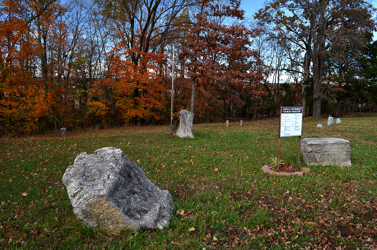
 Dennis and Tom were right. Just west of Hwy 61 on KK was the African American Church Cemetery marked by a sign that listed some of the names and family histories of those interred there.
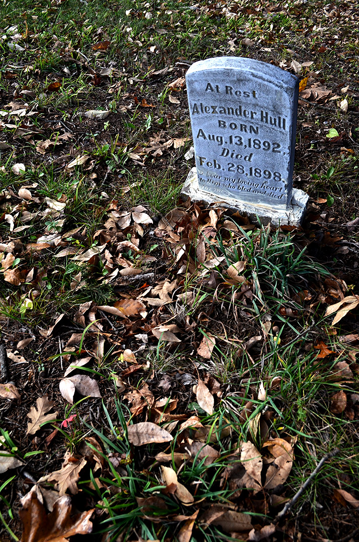 Alexander Hull was born in 1892, and died in 1898, before his 5th birthday. His stone was one of the easiest to read. It looked like it had been reattached to its base recently
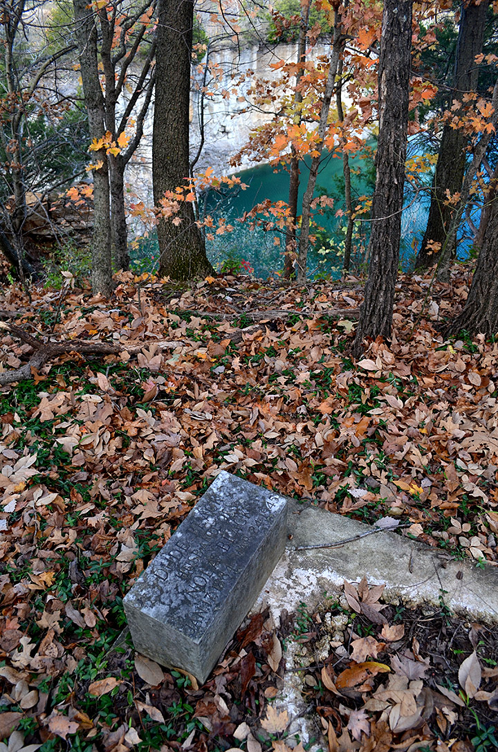 When I strolled down the hill into a wooded area, the quarry popped into view. This grave was almost at the edge of a dead (pun not intended) drop-off. I could only wonder how many bones had been crushed along with the limestone over the years.
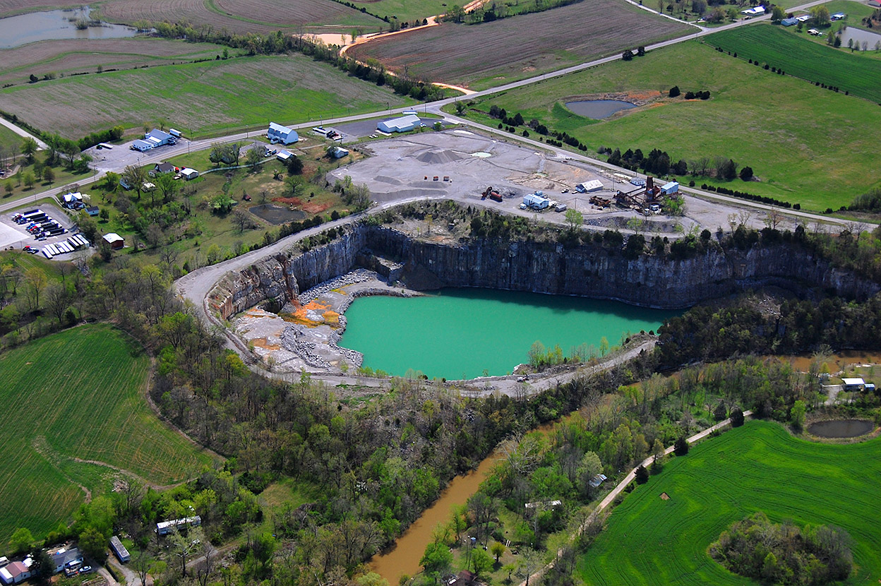
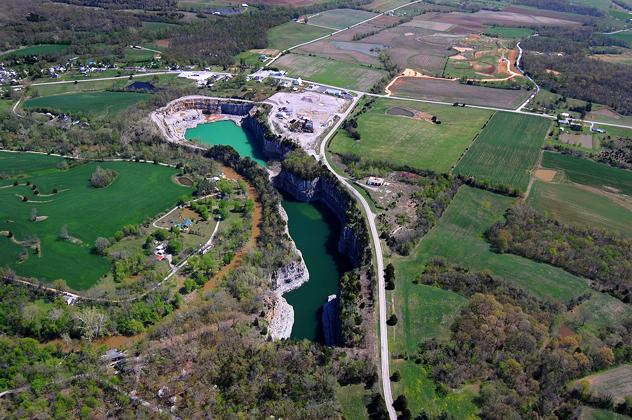
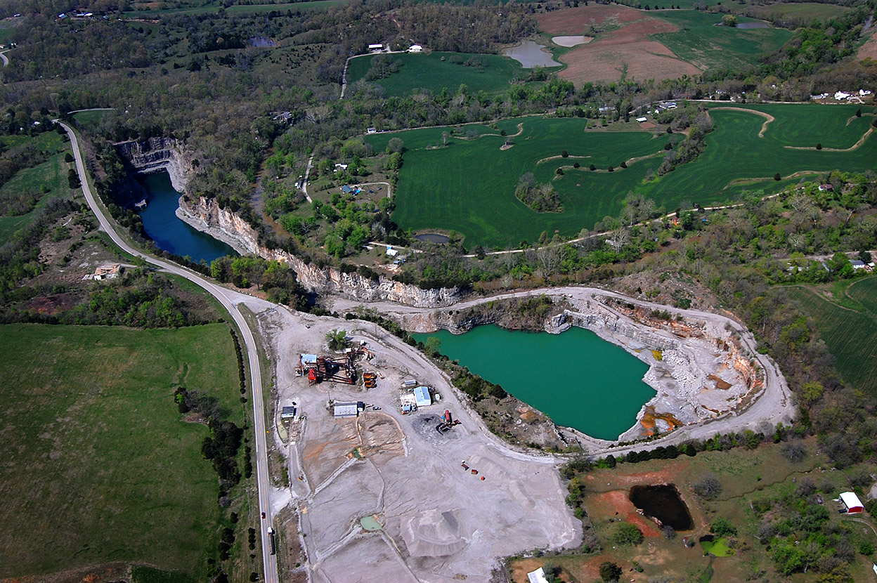
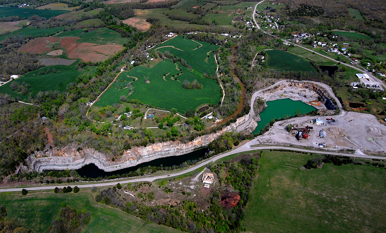
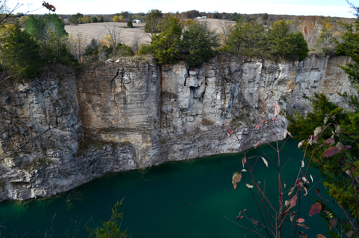 I’m going to guess the stone walls rising above the water are at least 75 to 100 feet tall. Apple Creek runs between the quarry and the farmland in the background. It must have been a challenge to keep ahead of the water when it was an active quarry.
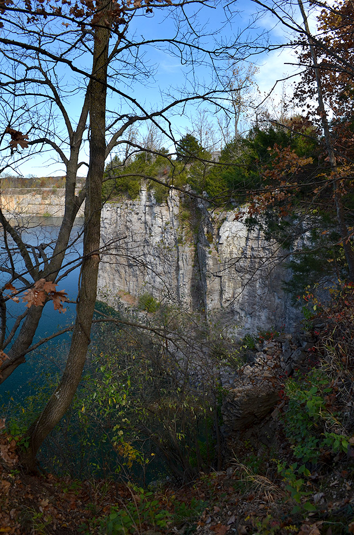 I didn’t spend much time walking around that area of the graveyard. The ground sloped down toward the quarry and some of the overburden didn’t look stable. I had no desire to end up as a splash or worse.
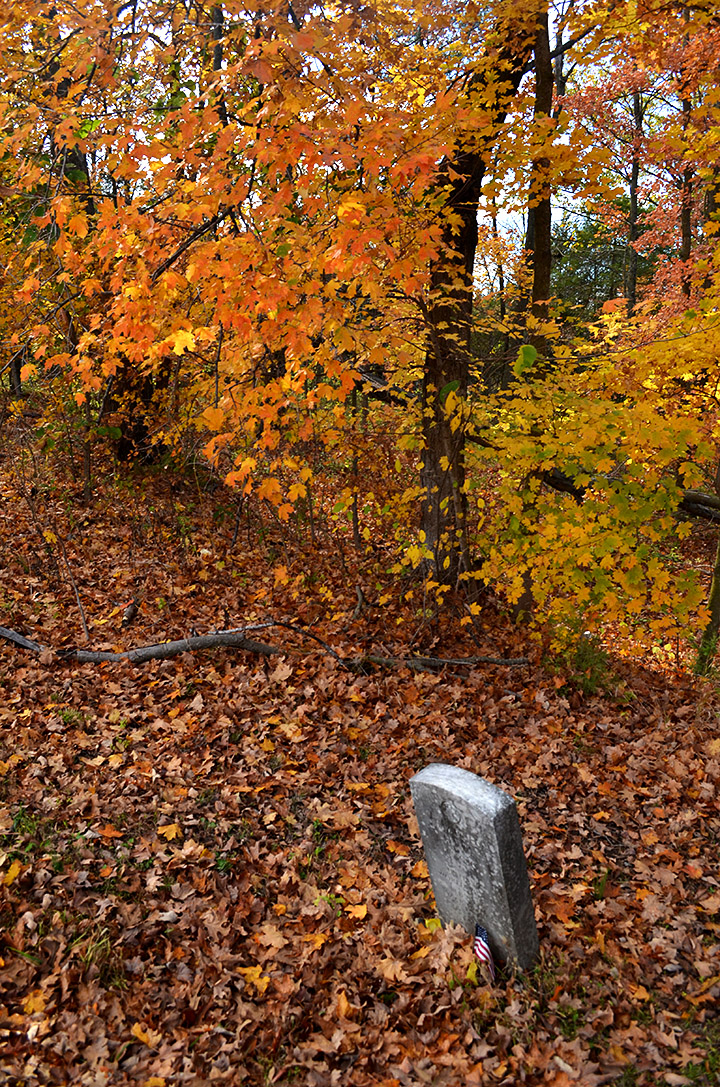 The late-afternoon sun and fall leaves made it a place of quiet beauty. A quick Google search didn’t turn up much information about the cemetery or the church it served.
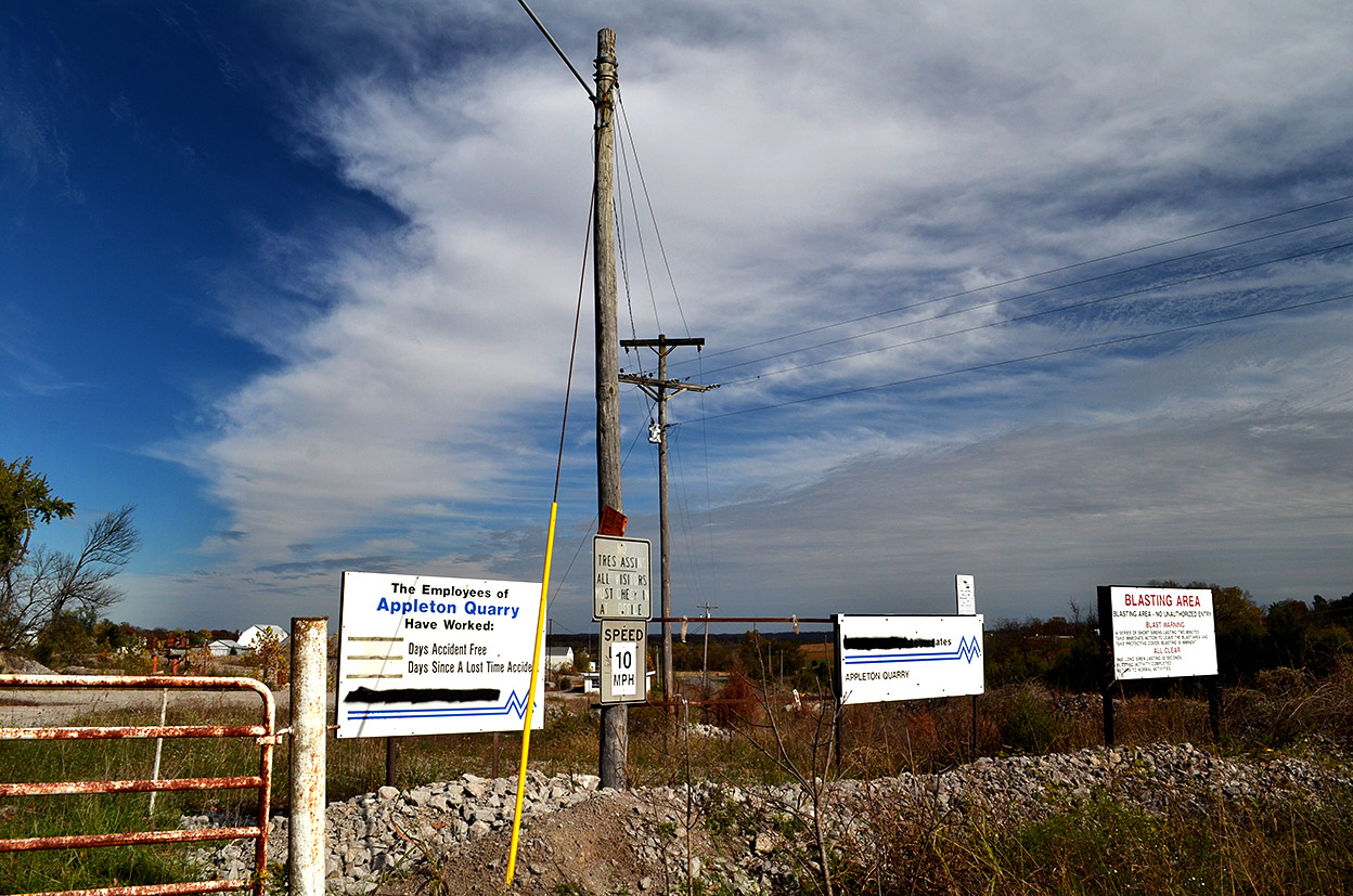 I’m sure the cemetery is a lot more peaceful since it’s neighbor, the old Appleton Quarry, has ceased blasting.
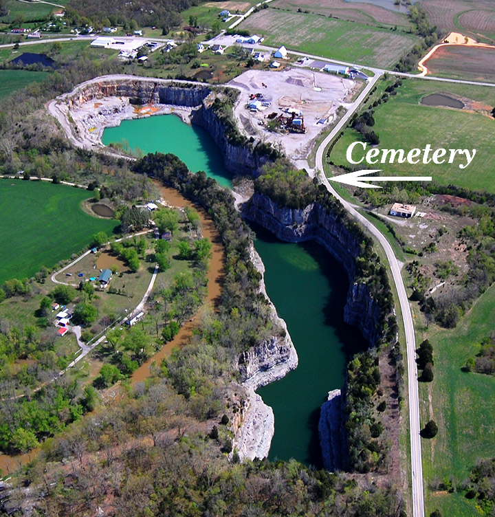 This aerial photo taken in 2011 clearly shows how the quarry left a little plug of land where the cemetery is located. It’s much like how the cement plant quarry has mined around the Natatorium.