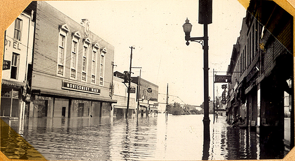
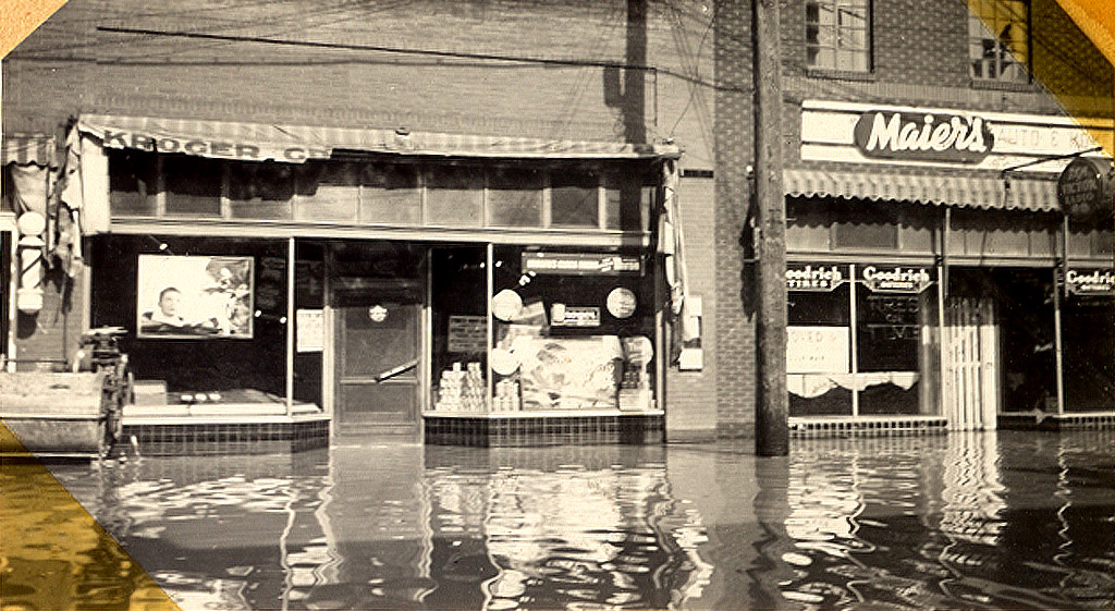
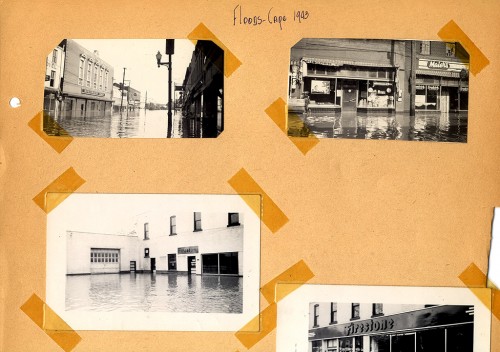
 The river is still rising at Cape. The crest was pushed back a day. They’re predicting it will hit 42 feet on Friday and stay there for about a day before going down fairly quickly. That got me digging for one of Dad’s scrapbooks where he had posted photos from the Flood of 1943, when the river crested at 42.4 feet in May of that year.
Was 1943 flood higher than 1844 flood?
 Minutia is important in a small town. The December 8, 1943 Missourian had a fascinating debate about whether or not the Flood of 1943 beat out the Flood of 1844. The convoluted way it’s written signals to me that the reporter didn’t quite understand what he was writing about. Here is the account:
Some facts about high stages of the Mississippi River at Cape Girardeau, including determination that the May 1943 mark was higher than the 1844 flood have been established. There was some contention shortly after the 1943 record flood that the water did not set a new mark.
1943 was 9/100ths of a foot higher

City Engineer John R. Walther and T.E. Bliss, division engineer for the Frisco Railroad, went into the matter on a mathematical basis recently and came to the conclusion that the 1943 flood was 9/100ths foot higher than the flood crest of July 4, 1984.
The engineers determined tht the 1844 mark was actually 42.31 feet for Cape Girardeau and that the high mark for May 1943 was 42.4 feet, which was the U.S. Engineers’ record.
Went looking for nail
 Mr. Walther and Mr. Bliss checked the actual height of both a mark and a nail in the former Houck building at Independence and Main streets, which have long indicated the previous high crest, and found them to both show the 1844 mark to have been 42.31 feet.
River gauge established
 This was arrived at from the city datum, which was established officially long ago for the purpose of fixing levels. It is officially described as being 50 feet below the high water mark of 1844, government records state. They city river gauge later was established through city ordinance. The gauge’s zero is 7.75 feet above the city datum.
The mark for 1844 was commonly known for some years as 42.5 feet, but the engineers say this was an approximation and was not correct. Until a few years ago, the U.S. Department of Agriculture had published the 1844 Cape Girardeau mark as 42.5. In more recent years, the government mark referred to in reports was the 1927 stage of 40.04 feet.
“This settles argument”
 The engineers, when making the check on river marks, notched the 1943 peak for the water on an east wall of the Frisco passenger depot. The plan is to place a marker there, showing how high the record flood – set on May 27, 1943, actually was.
Referring to the engineering checks recently made by himself and Engineer Bliss, who also resides here, Engineer Walther said: “I believe this settles any argument about the 1943 stage of the river being a record.”
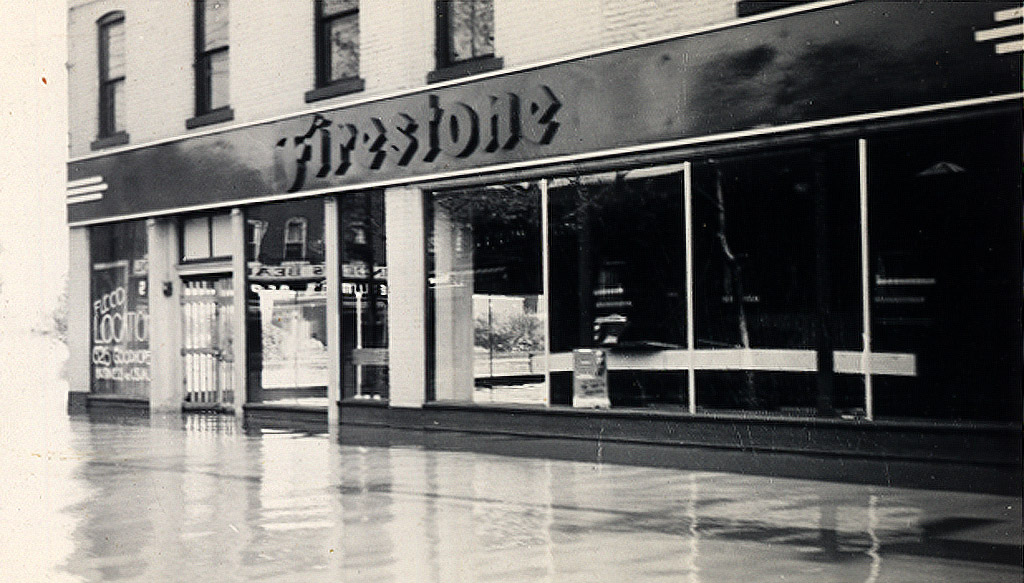
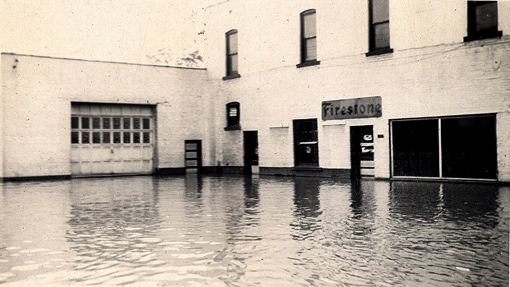
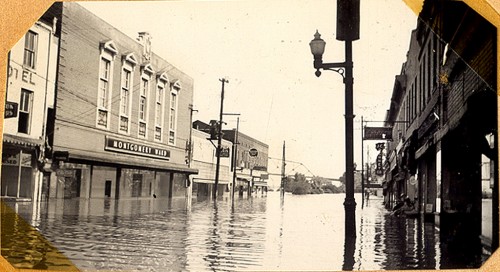
The Firestone building today
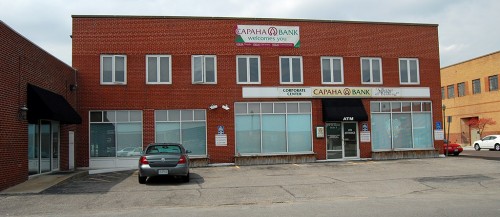 Well, not EXACTLY today: this photo was taken April 5, 2010. Even though the river is about at the same stage as it was in 1943, the floodwall is doing a good job of keeping Main Street dry.
Floodwall and downtown
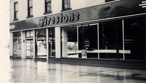
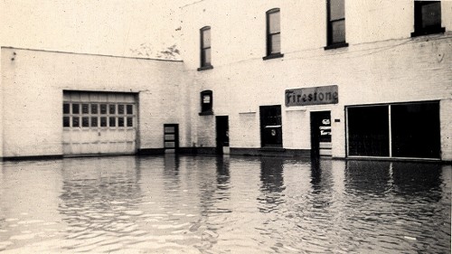
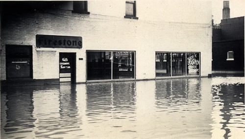
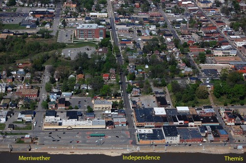 This is the general area that flooded. Firestone was at the southwest corner of Main Street and Independence.

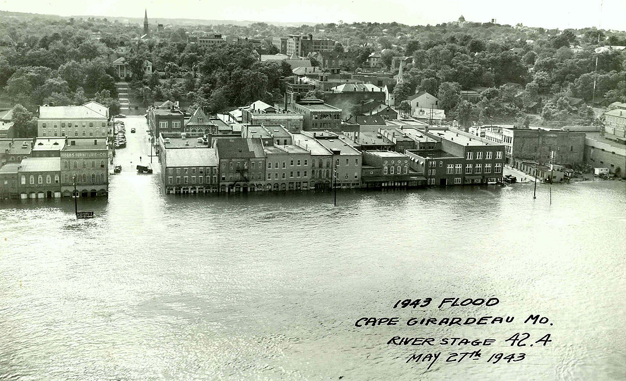 After I ran photos of the Flood of 1943 from Dad’s scrapbook, a member of the Lamkin Family sent me this aerial photo of the flood. I asked who took it so I could credit the photographer, and he said, “No idea. It hung in my grandfather’s office for as long as I recall.”