Blechle’s Grocery

Blechle's Grocery 1227 Broadway 03-11-1967
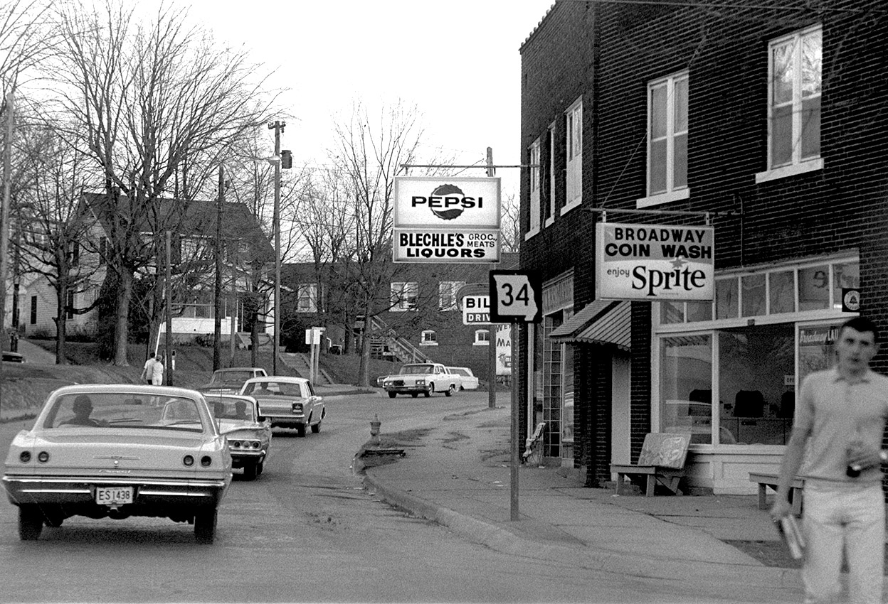
This corner, just east of Park Avenue on Broadway, looks quite a bit different today. Turn to Google’s Street View to see a recent photo. On March 11, 1967, the buildings on the right housed Blechle’s Grocery (that’s the way it’s listed in the City Directory. Since it’s adjacent to the SEMO campus, the sign emphasized liquors, though).

The the two buildings on the right have been spiffed up. What used to be the Broadway Coin Wash is now a boutique. What used to be the grocery is an empty storefront in the Google photo.

Things that are gone

There are some things in the picture you won’t see today

  • The brick building around the curve used to be Werner’s Super Market. The university knocked down the market and most of the houses in the area.
  • A newspaper rack in front of the grocery.
  • A sign for a public telephone over the fuzzy guy’s head on the right.

The 1968 City Directory said Ruth Froemsdorf lived at 1231A Broadway, which would have put her above the coin wash. Another section, with more detail confirmed that she she was the third grade teacher at Trinity Lutheran School.
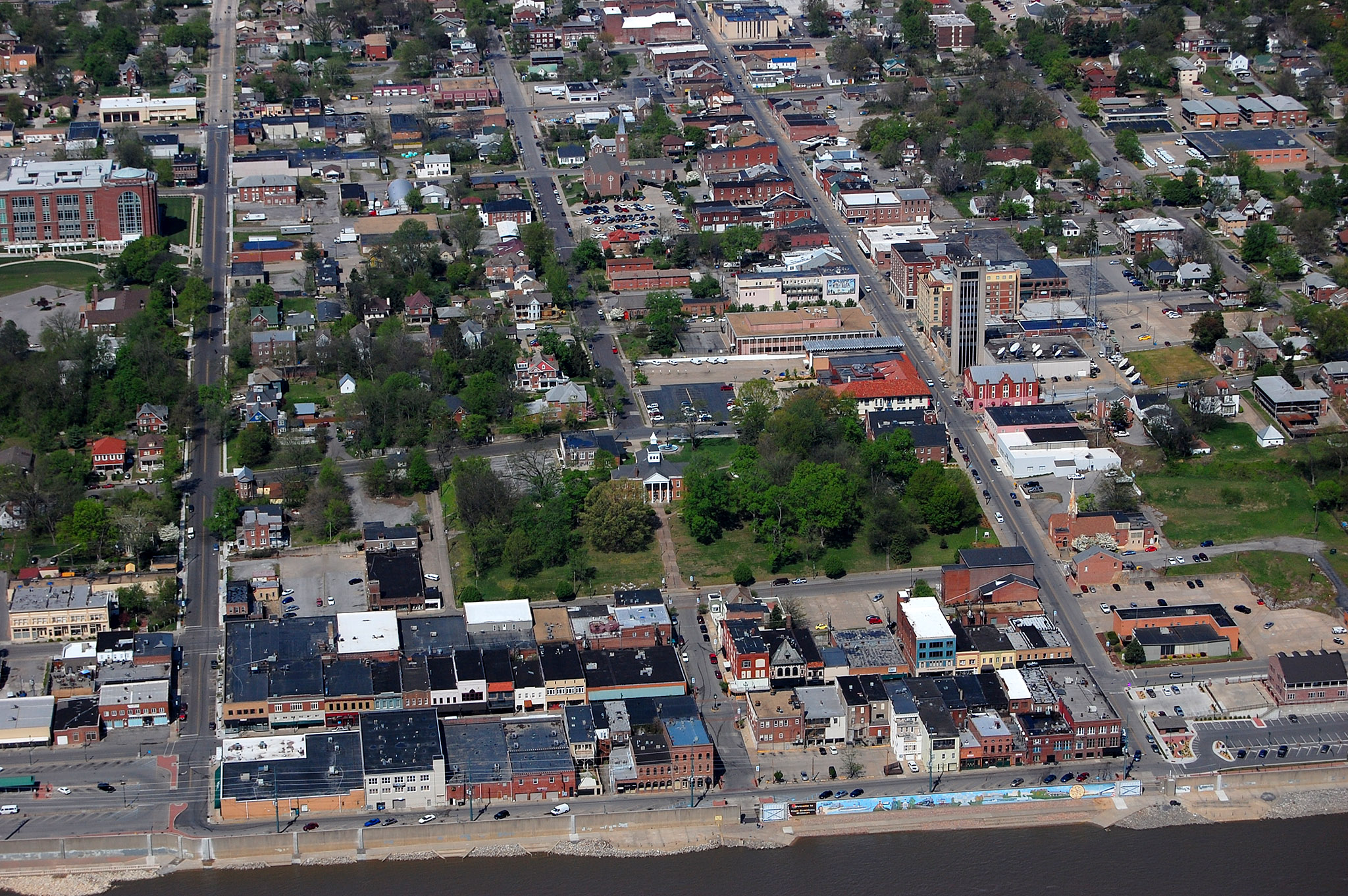
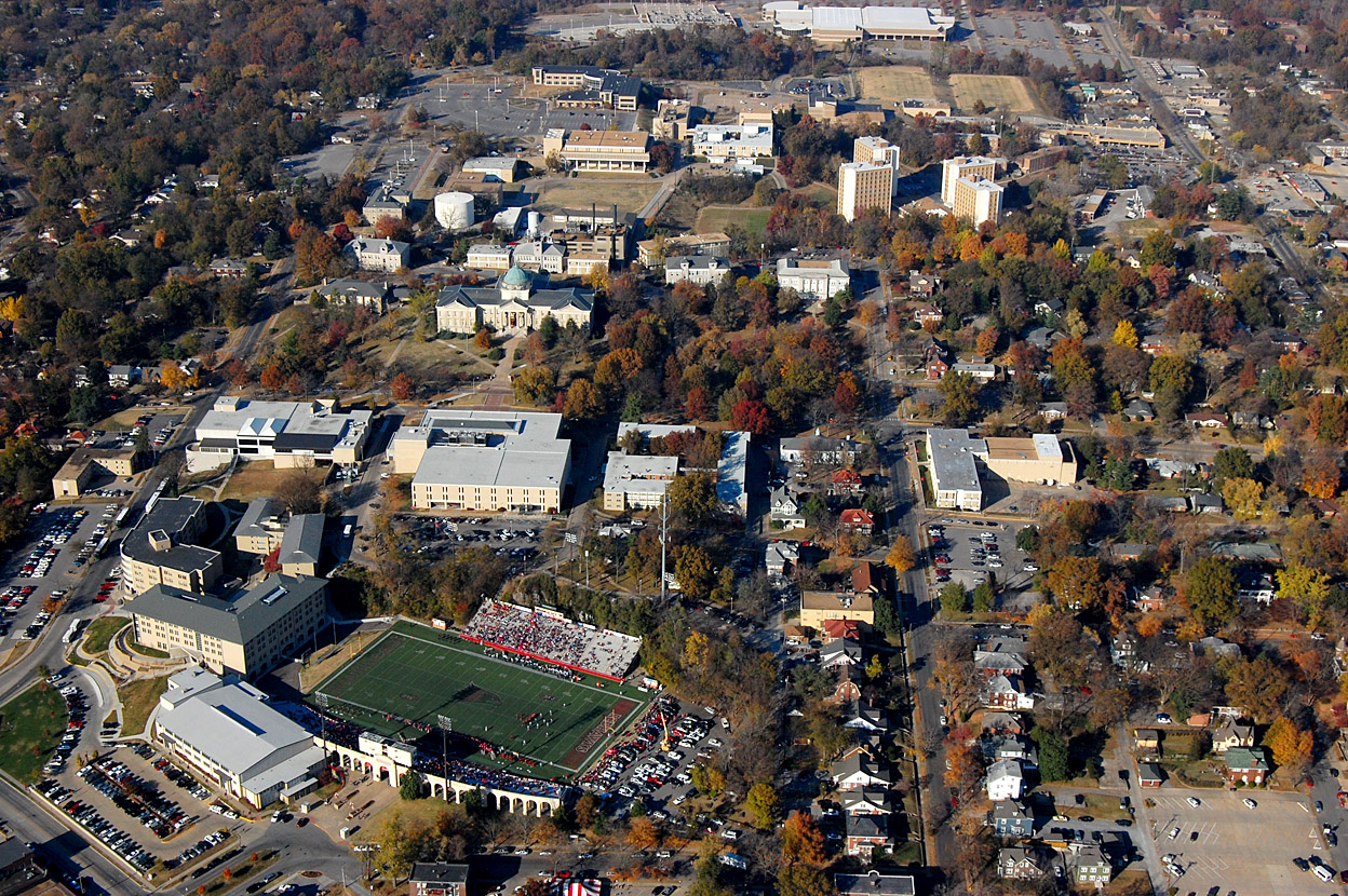
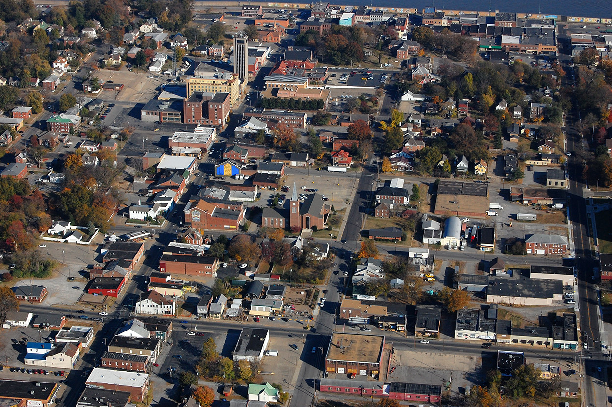
Aerial of the area

Aerial of Broadway including Houck Stadium 11-06-2010
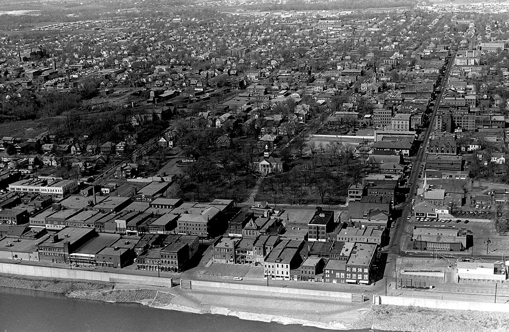
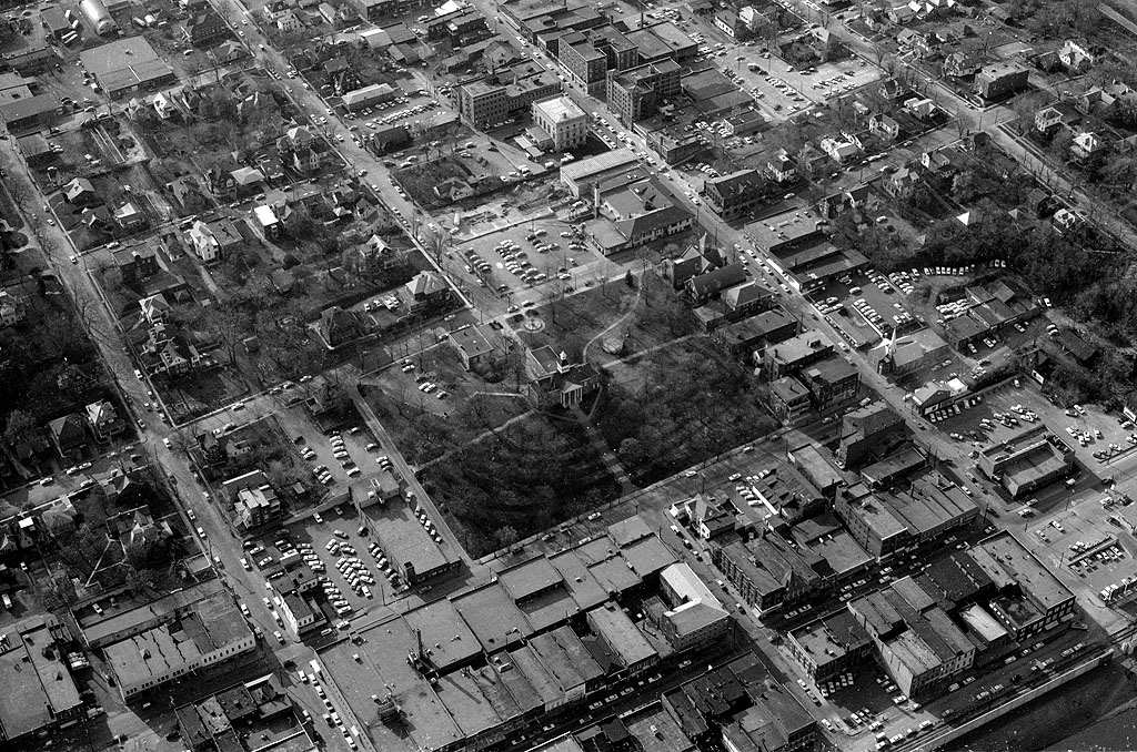
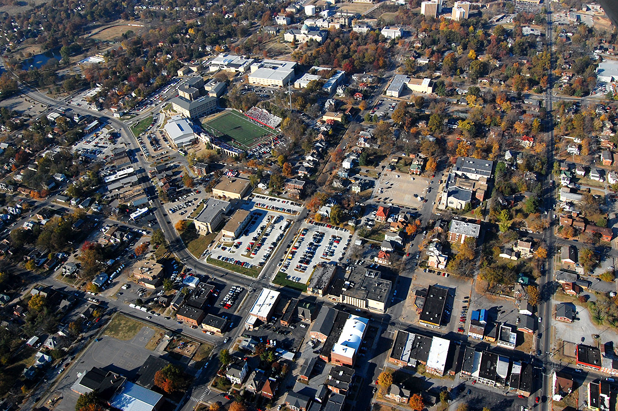
This November 2010 aerial shows Broadway from just west of Park Avenue and Capaha Park on the left to Sprigg Street on the right. You can see what it looked like in 1966 here.

Click on the photos to make them larger.

Downtown from the Air

Aerial of Downtown Cape 04-17-2011When I ran the picture of the Town Plaza from the 1962 Girardot, I commented that the shopping center wasn’t much different than downtown’s Main Street, except that it had ample and free parking.

That got me to thinking of this 2011 aerial of the Old Town Cape shopping area. You don’t realize how compact Cape Girardeau is until you see that downtown was essentially bounded by Broadway on the north and Independence on the south. Themis hit a dead end at Spanish at the foot of the Common Pleas Courthouse hill. (Click on the photos to make them larger.)

Not a lot of changes

Cape Girardeau Downtown District looking up Broadway; 1960s aerial photoThere are a few buildings gone and a few new buildings, but the aerials from the middle to late 1960s look remarkably like the 2011 photo.

This post has a collection of links to stories about Main Street businesses.

It WAS the Junior High School

Aerial Photos of Central High School on Carruthers Ave 04-17-2011When I asked readers to help me identify a building yesterday, it didn’t take long before Dennis Mize, Jim Feldmeier, Charlie Holt, Tim Ludwig, Keith Robinson and Dave let me know that it was Central Junior High School. This aerial isn’t from the same angle, but you can see the boxy shape and ramp that confirm what the guys were saying.

Here’s a new mystery

SEMO Academic HallWhen Neighbor Bill and I looked at this picture, I said I thought the crane was probably working on the highrise dorms that would have been north and east of Academic Hall. He said he woke up at 3 a.m. with the revelation that the crane was working on the KFVS-TV tower across from The Missourian.

I’m not convinced. If that’s the case, then what is the building to its left that has a rounded rooftop? Click on it to make it larger, if that helps.

SEMO campus with dorms

Aerial Southeast Missouri State University 11-06-2010Here’s a a 2010 aerial of the SEMO campus with the high rise dorms in it for comparison.

Downtown aerial

Aerial Broadway - Sprigg - Independence 11-06-2010_9143This aerial shows the KFVS-TV tower at the top left. The square is bounded by roughly Broadway – Themis – Sprigg and Main Street.

Common Pleas Courthouse 1964

Aerial Common Pleas Courthouse 04-14-1964This 1964 aerial centered on the Common Pleas Courthouse was taken before the KFVS-TV tower was built. There’s a parking lot across from The Missourian where it will be built.

I hope one of these will help you figure out the mystery building.


Frederick W. and Mary Karau Pott House

Frederick W and Mary Karau House 10-31-2009There is a striking two-story white house at the corner of Themis and Pacific across from Trinity Lutheran School that I’ve always wondered about. I paused on a Halloween afternoon’s bike ride in 2009 long enough to pop off a couple of frames.

It turns out there’s a world of information about it in its National Register of Historic Places registration form. If you are a fan of architectural detail, it’s worth a read.

History of Pott house

Frederick W. Pott was born in Prussia in 1839. He and his parents came to Cape Girardeau in 1854. Father and son joined the Union Army when the Civil War began, and Frederick was captured in the Battle of Shilo. After the war, he found employment in the milling industry. He married Mary (or Maria) Karau in 1865. They eventually had 11 children.

In 1877, he built Planters Mill at the foot of Main Street. Within four years, he owned the mill free and clear. The coming of the railroad to Cape Girardeau kicked off a boom, and around 1885 the Potts commissioned the building of this house at 826 Themis Street for their growing family. By 1888, Pott had increased the capacity of Planters Mill from an initial daily output of 80 barrels of floor to 200 and employed at least 10 men.

Disaster stuck when a fire swept through the mill on March 27, 1909. Pott’s insurance only partially covered the loss of the mill, elevator, warehouse and a large quantity of wheat, flour and bran that had been stored on the premises. The total loss was estimated at $50,000. He died the next year, in 1910.

Became office for doctors

Aerial photos of Trinity Lutheran School neighborhood 11-06-2010The house remained in the family until 1938, when it was sold to D.W. Hope, a Cape physician. According to the historic places register application, professional offices were developed in the building after it was acquired by Dr. Hope, listings in city directories from 1942-1973 indicate. The H-R-S Company was formed by Dr. Hope and three other doctors: A.J. Rasche, Frank W. Hall and Mitchell H. Shelby.

The next owner was James McHaney, who sold the property to Steven and Emily Mellies on April 28, 1995.

The house is the white building at the top center of this November 2010 aerial photograph. Trinity Lutheran School is in the center.