 I made a swing up to Cape Rock to check out the river level and the huge sandbar hugging the Illinois banks. After taking a couple of shots, I pulled into the small park at the bottom of The Rock to get a different angle. You can click on the photos to make them larger.
Tracks were open
 The BNSF tracks were clear to the south. As soon as I crossed the main line and siding and looked north, I spotted the sunken barges I posted on October 21.
Where’d that train come from?
 I spent about 45 minutes shooting the barges, then turned to see a long freight blocking my path back to the parking lot. This young fisherman was stuck on the wrong side of the tracks, too. Since these cars were parked on the siding, I thought maybe they were making way for a faster freight on the main line. Since most local trains aren’t that long, I decided to start walking south to see if I could get around it.
This one one of those situations where Plans A, B and C all involved swimming: I had the Mississippi River to my east; if the train extended south to Red Star, I was going to run into Sloan Creek; if it went too far north, there was Juden Creek to contend with.
Does this thing have an end?
 About a quarter mile down the tracks, I ran into two fishermen walking north. “How far does this thing stretch to the south?” I asked.
“A long way,” one replied.
“Well, the head end of it is out of sight at Cape Rock, so I’m going to keep walking south.”
Way off in the distance, I could hear a train horn. Probably blowing at the crossings in town, I thought. Shouldn’t be too long before it passes, then the train on the siding will pull out, I was hoping. The clouds were building up, the wind was getting stronger and all I was wearing was a light long-sleeve shirt covered with a wool vest I had picked up for twelve bucks off a remaindered rack at Monteagle Pass.
Walking on railroad ballast is no fun, but I didn’t have much choice: there had been a rain recently that made the non-gravel areas full of soft mud. Adding to my distress was the audio book I had been listening to on the trip: Stephen King’s The Long Walk. I kept fearing that if my pace dropped below four miles an hour that someone would terminate me.
A little beyond this point, I ran across a bunch of bones on and around the track. They were too big to be a dog and they weren’t human, so I assumed that a deer picked a bad time to cross the tracks. I picked up a clean piece of vertebrae as a souvenir for Brother Mark.
Here comes the local

It was taking a long, long time for the northbound train to get here for all the whistling it was doing. When it pulled into sight, it had two power units, which meant that it was probably the local freight I shot back in April 2010.
Caboose confirmed it
 When the caboose passed, I knew it was the local, probably headed to Proctor & Gamble to drop cars. I decided I’d start walking north again, figuring that once the local passed the stopped freight, it would pull out of the siding.
Getting ready for crew change
 Then, the local started backing up and conductor Randy Graviett popped out of the caboose. He explained that they needed to do a crew change. They were going to back the train up far enough he could hop on the engine and go up north of Cape Rock to pick up a new crew. He said the train on the siding was being held up until a dispatcher in Texas told it to proceed.
Delay let me shoot Dredge Potter

By the time I made it north to the parking lot across from Cape Rock, the freight on the siding had pulled out. That was the good news. The bad news was that the local was blocking my path north and south as far as I could see. While I was waiting for the train to move, I spotted the Dredge Potter and her pushboat, The Prairie Du Rocher headed upriver. Not a bad day when you can shoot three stories in a three hours.
I was beginning to get chilly, so I decided to see how far north the local stretched. I finally came upon the head end about half-way to Twin Trees Park. Once I got back on the road, I started counting train cars. I can’t remember now if it was 29 or 39 cars back to the parking lot. I’m going to guess my total walking for the afternoon was about four or five miles on railroad ballast.

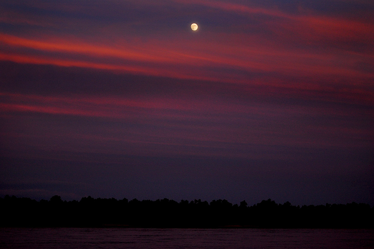 While looking for photos to go with the Flood of 1943, I ran across these photos shot on the riverfront August 11, 2011. The moonrise isn’t pink like everybody is posting this week, but the sky certainly was. (You can click on the photos to make them larger.)
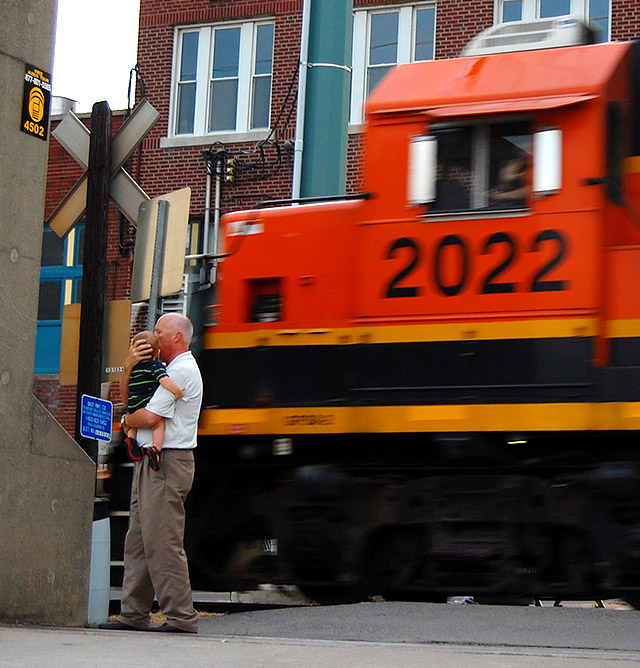 This toddler doesn’t quite know what to make of that loud thing going by, even if the crewman is giving him a friendly wave. I miss the old steam engines we had when I was a kid his age.


