Bill “Not Billy” Beal

Bill Beal at Turner-Phifer-Underwood-Robinson Family Reunion 07-21-2012
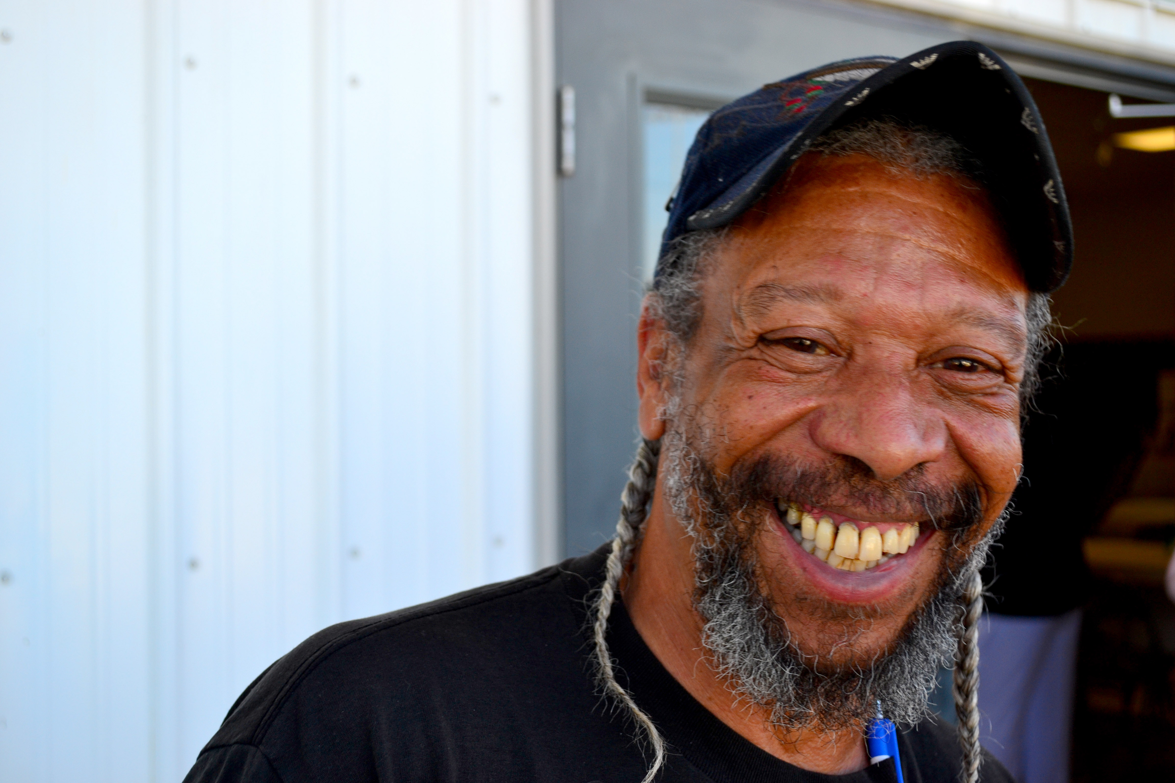
I’ve been working like crazy transcribing interviews and editing videos to try to get them ready for the Vine Street Reunion at the end of this month. I had forgotten how much I enjoyed talking with Bill Beal at a 2012 family reunion. (He’s been trying to shed the “Billy” nickname as long as I’ve been trying to retire “Kenny.”)

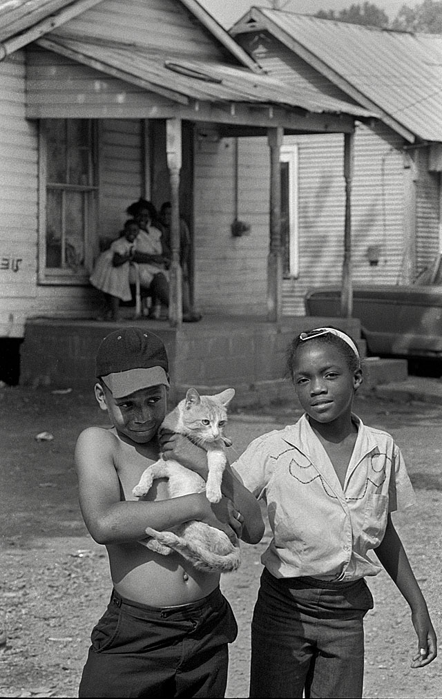
Bill was one half of one of my favorite photos from Smelterville in 1967. He said he was 10 or 11 when I shot the picture with him, Margaret Turner and a cat. His sister, Fay Beal Powders, said “Not many people had cats, but mother let us have cats because I loved them.” Bill, she said, was a twin, and so was Margaret, his cousin.

Bill and Margaret

Smelterville 06-04-1967 27He dropped out of Central High School when he was 17 and went into the military. “I wanted to get out of Cape and I wanted to better myself. I was a ground pounder [in Vietnam]. Carried an M60 around.”

“A scrawny guy like you carried an M60?” I interjected.

“A big M60 and belts,” he said. “Then I got into sniper. I really enjoyed that. It’s not all what they say it’s cut out to be,” he continued. “When you go into sniper, you might be off in that drain pipe over yonder and you have to sit there for two or three days. You can’t move, and that’s it. I mean, bugs bite you and you can’t move. Snakes run across you and you can’t move.”

“Would you do that part of it again?” I asked.

“Yessir. In a heartbeat. In a heartbeat, I would.”

Dad was a truckdriver

Turner-Phifer-Underwood-Robinson Family Reunion 07-21-2012Bill’s dad was a truck driver for the cement plant until he died of a massive heart attack when Bill was about 8 or 9. When he got out of the military, he thought, “maybe truck driving is in my blood.” He’s been an owner-operator for more than three decades, and “I put three stepkids through college.”

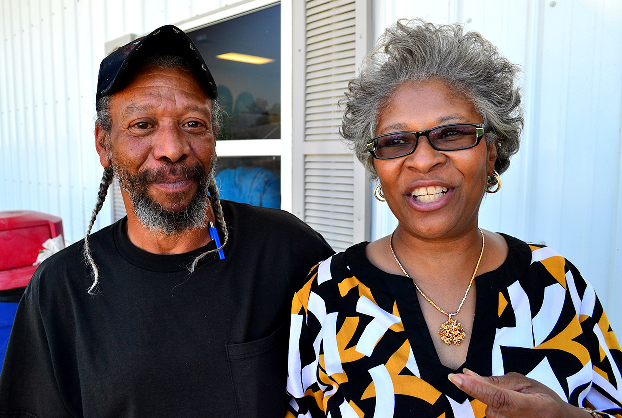
That’s Bill’s sister, Fay, with him.

Happy memories of Smelterville

Bill Beal and "Tube" Wren Smelterville 06-05-1967
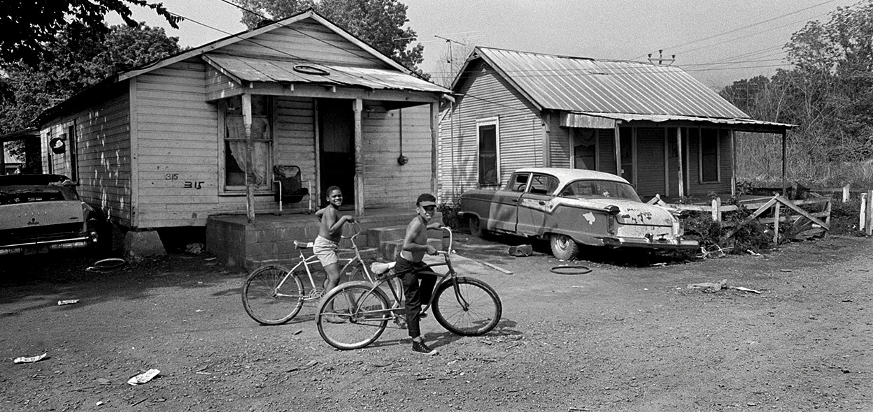
Echoing the sentiment I’ve heard from everyone I’ve interviewed, Bill had happy memories of growing up in Smelterville: “We didn’t go hungry. We weren’t dirty. We weren’t nasty. We had clean clothes. All the relatives, we lived together. It was like a little community down there like you’d have up in the mountains. Everybody knew everybody in that community.”

Bill is on his bike in the foreground.

“Back then, we didn’t care what nationality you were or what color. We all got along. You’d go out and get into a fight right now, then later on that night, you were all sleeping on a pallet or in a bed together. It didn’t make no difference. You all ate at the same place. If momma cooked something or grandma cooked, or whoever cooked, everybody ate. We didn’t care who you were or where you came from. Even the – they called them hobos that used to ride the trains and such – momma and grandma even fed them.”

Life could be hard

Smelterville 06-04-1967 12
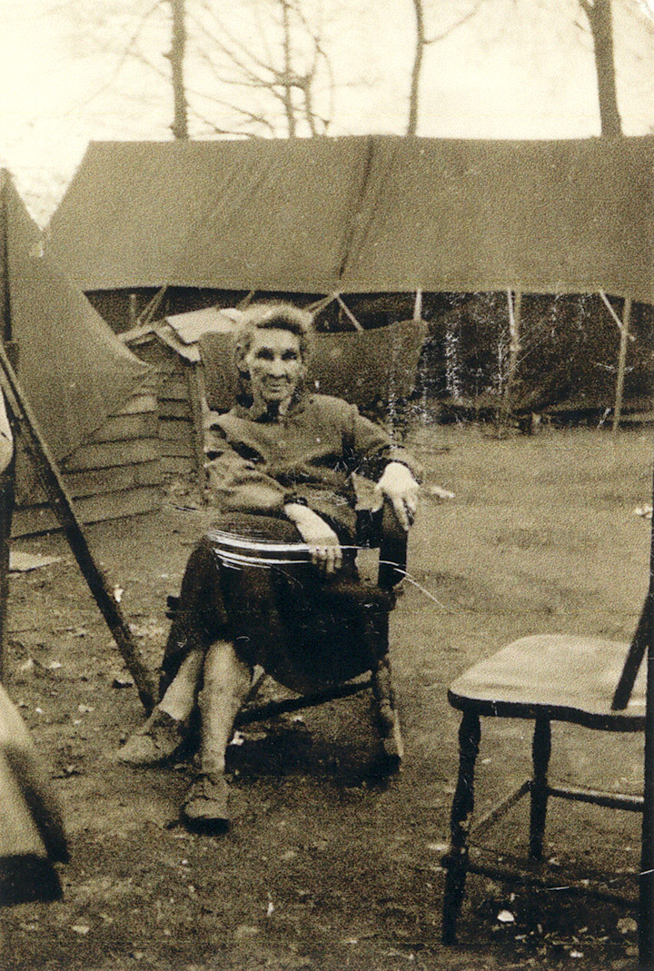
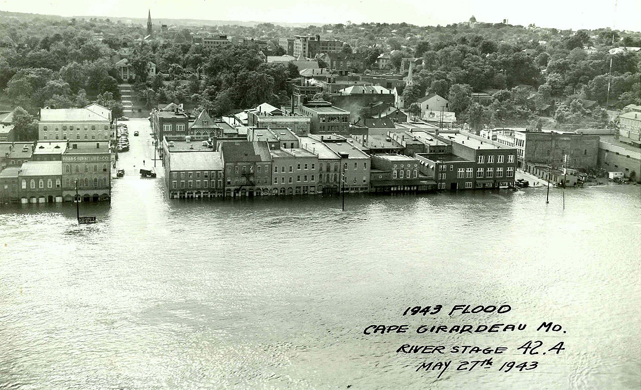
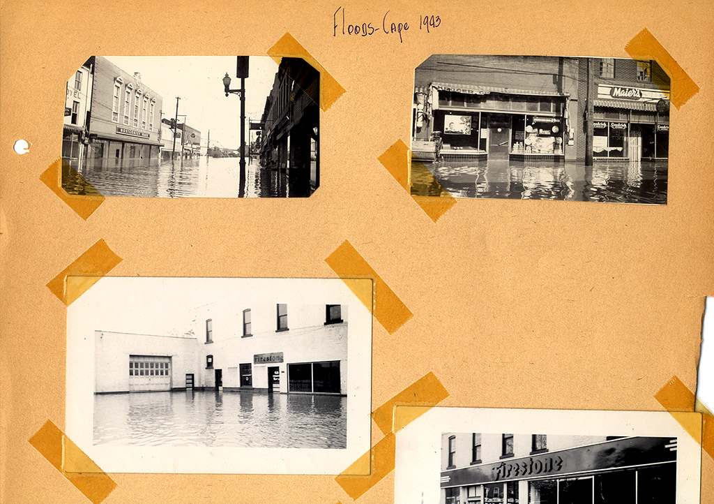
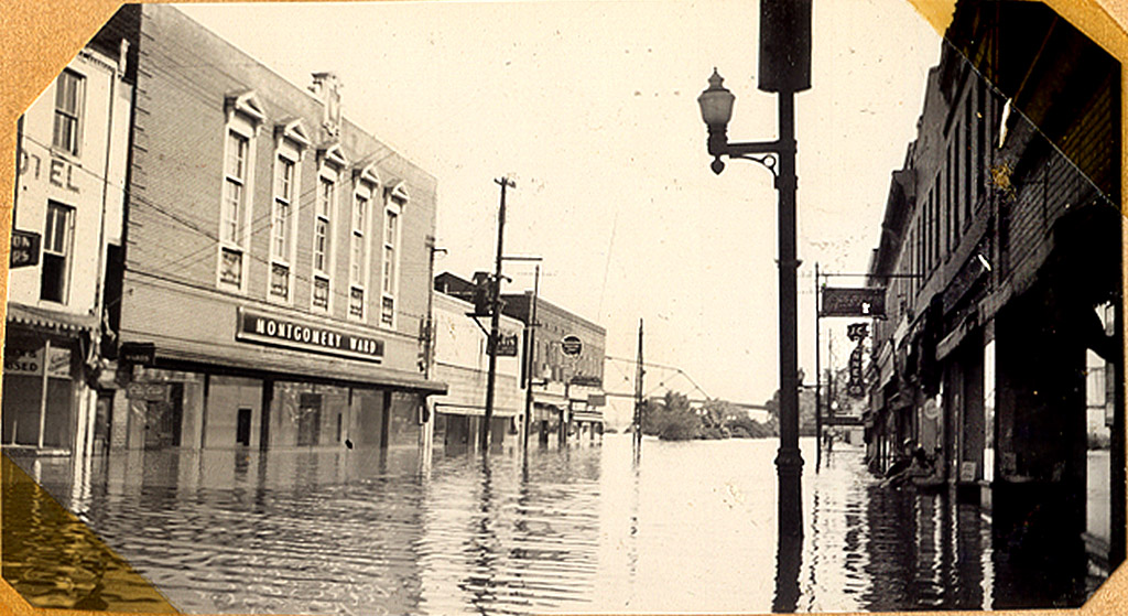
“We had the community pump. Later on in life, we actually had running water in the house, once we ran lines into the house. We still had wood stoves. We didn’t have any propane gas or anything like that. We always moved up north for the floods. Then, when the river went back down, we went in and scrubbed the floors and walls, threw the snakes out and rebuilt what had to be rebuilt to make it livable.”

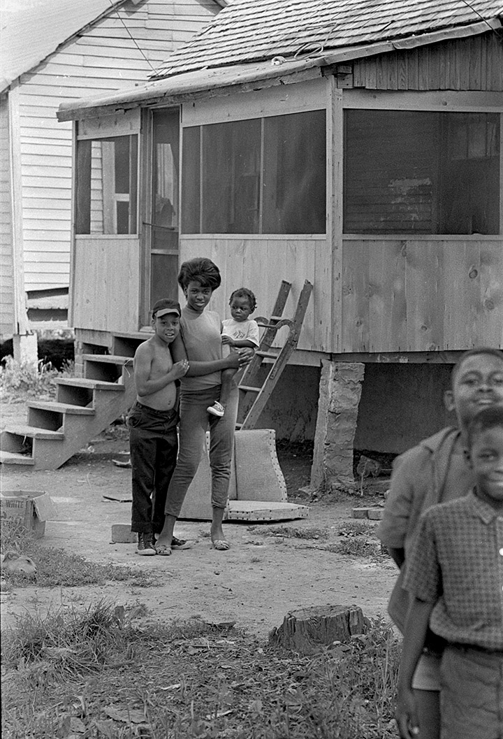
Looking back at the pictures, he said, “brings back memories. After so many years, you don’t remember, but once you start back looking, yeah, it brings back memories of where we come from and where we are today. You know, what we went through to get where we’re at.”

That’s Bill on the left next to his cousin, Mary Jean Phifer. The baby name is unknown. The two boys at the right are Mark Turner, Margaret Turner’s twin brother, and “Jim Dandy” Wren.

Other Smelterville stories


Eugene Beckett’s Smelterville Treasures

Eugene Austin Beckett MapI hinted yesterday that I many have to cut back on blog posts while I rush to finish an update to my Smelterville stuff before the Vine Street Reunion July 25-27 and put together a workshop in Athens, Ohio, in August.

I’ve spent most of the past week editing video interviews. Today I waded through emails and comments from people who talked about Smelterville. That’s where I stumbled across a treasure trove of information. Just about this time last year, I got an email from Eugene Beckett. He said he had some photos of the area in the ’30s, ’40s and ’50s, plus a map that he had put together showing many of the landmarks. I asked if he could send me the info.

Consigned to the Future Basket

When it arrived, I looked at it hurriedly and put it in my Future Basket. Well, today, I took a closer look and was floored by what he had sent.

It dovetailed directly with my workshop topic. He did everything I’m going to encourage the participants to do

  • 1. Make or collect the photographs
  • 2. Document when they were taken
  • 3. Write a description of what they show.

(Basically all the stuff I wish I had done for the past half century)

He went the extra step of producing the map of an area that doesn’t exist today.

Legend for map

1   –  City Pump. The only water between the railroad and the river.
2   –  Funny Ferrell’ Store
3   –  Ben Cannon’s Church
4   –  Old foundation of the Lead Smelter plant
5   –  Central Packing Co.
6   –  Fish Market
7   –  River Navigating Light
8   –  Blue Hole Garden Barbecue (the old Blue Hole Garden was at the bottom of toll-gate hill where they build the new hwy.)
9   –  Standard Oil Service Station
10 –  Federal Material Co. Office
11  – Kelley’s Store
12  – Sandy Beach.
13  – John Deiteker’s Store
14  – Lane’s Market
15  – Railroad switch house
16  – Booker T’s scrap yard

I told Curator Jessica that she needs to find a Eugene who has done that kind of documentation in the scores of old coal towns in SE Ohio that are ghost towns or merely memories. The goal of our workshop is to encourage people to go out today to start the documentation that will be invaluable in 30 or 50 years. I’m just beginning to realize what a resource my files are, and I’d like to encourage others to produce similar collections.

Living in Houck Woods during flood

Sarah Addie Bequette Houck Wood escaping flood in 1940s courtesy Eugene Beckett_11aOne of Eugene’s photos is of his grandmother, Sarah Addie Bequette in a tent village in the Houck Woods up Tollgate Hill where Smelterville residents fled Mississippi River floodwaters. I’m going to guess this was the Flood of 1943. I had read accounts of that, but here is an actual photograph of one of those refugees. Eugene also wrote an extensive biography of Mrs. Bequette.

Here’s why his detective work and captions are so important: if you look at the photo without the background, you might think she’s on a camping trip or that there’s a tent revival set up in the background. Filling in that detail about the flood places it in historical context.

Thanks to Eugene for sharing his family documentation.

How to stay up to date

I used to be able to post links to new stories on Facebook, but FB has changed the way it delivers status info to your timeline. If you “liked” a page in the past, you would get updates delivered to you. Now, FB is playing games to force folks like me to pay to “boost” our posts. If we don’t pay, only about 10% of my readers receive status reports.

Here’s an easy and free way to stay up to date on my new posts: sign up for the blog’s email notification service. It’s free, you get only one notice a day and I promise not to spam you. It’s as easy as clicking on THIS LINK or the “Manage Subscriptions” link at the top left of the page.

I don’t need Facebook when I have loyal readers.

1943 Flood Aerial

Cape Downtown 1943 FloodAfter I ran photos of the Flood of 1943 from Dad’s scrapbook, a member of the Lamkin Family sent me this aerial photo of the flood. I asked who took it so I could credit the photographer, and he said, “No idea.  It hung in my grandfather’s office for as long as I recall.”

Themis Street is on the left and Broadway is on the right. You can see the steeple of Trinity Lutheran Church and the Academic Hall dome in the background. Buckner-Ragsdale is the three-story building on the right, at the foot of Broadway. The St. Charles Hotel is the tall, light-colored building on the left side of Themis. The building with the checkered tile and sharp-peaked roof is Hecht’s Department Store. The Sturdivant Bank Building is between the St. Charles and Hecht’s.

Click on the photo to make it larger.

Here are some earlier stories about Buckner’s and the Lamkin family.

Flood of 1943

Photos of Main Street during 1943 Flood from LV Steinhoff's scrapbookThe river is still rising at Cape. The crest was pushed back a day. They’re predicting it will hit 42 feet on Friday and stay there for about a day before going down fairly quickly. That got me digging for one of Dad’s scrapbooks where he had posted photos from the Flood of 1943, when the river crested at 42.4 feet in May of that year.

Was 1943 flood higher than 1844 flood?

Photos of Main Street during 1943 Flood from LV Steinhoff's scrapbookMinutia is important in a small town. The December 8, 1943 Missourian had a fascinating debate about whether or not the Flood of 1943 beat out the Flood of 1844. The convoluted way it’s written signals to me that the reporter didn’t quite understand what he was writing about. Here is the account:

Some facts about high stages of the Mississippi River at Cape Girardeau, including determination that the May 1943 mark was higher than the 1844 flood have been established. There was some contention shortly after the 1943 record flood that the water did not set a new mark.

1943 was 9/100ths of a foot higher

Photos of Main Street during 1943 Flood from LV Steinhoff's scrapbook

City Engineer John R. Walther and T.E. Bliss, division engineer for the Frisco Railroad, went into the matter on a mathematical basis recently and came to the conclusion that the 1943 flood was 9/100ths foot higher than the flood crest of July 4, 1984.

The engineers determined tht the 1844 mark was actually 42.31 feet for Cape Girardeau and that the high mark for May 1943 was 42.4 feet, which was the U.S. Engineers’ record.

Went looking for nail

Photos of Main Street during 1943 Flood from LV Steinhoff's scrapbookMr. Walther and Mr. Bliss checked the actual height of both a mark and a nail in the former Houck building at Independence and Main streets, which have long indicated the previous high crest, and found them to both show the 1844 mark to have been 42.31 feet.

River gauge established

Photos of Main Street during 1943 Flood from LV Steinhoff's scrapbookThis was arrived at from the city datum, which was established officially long ago for the purpose of fixing levels. It is officially described as being 50 feet below the high water mark of 1844, government records state. They city river gauge later was established through city ordinance. The gauge’s zero is 7.75 feet above the city datum.

The mark for 1844 was commonly known for some years as 42.5 feet, but the engineers say this was an approximation and was not correct. Until a few years ago, the U.S. Department of Agriculture had published the 1844 Cape Girardeau mark as 42.5. In more recent years, the government mark referred to in reports was the 1927 stage of 40.04 feet.

“This settles argument”

Photos of Main Street during 1943 Flood from LV Steinhoff's scrapbookThe engineers, when making the check on river marks, notched the 1943 peak for the water on an east wall of the Frisco passenger depot. The plan is to place a marker there, showing how high the record flood – set on May 27, 1943, actually was.

Referring to the engineering checks recently made by himself and Engineer Bliss, who also resides here, Engineer Walther said: “I believe this settles any argument about the 1943 stage of the river being a record.”

The Firestone building today

Main Street building that once housed Firestone 04-05-2010Well, not EXACTLY today: this photo was taken April 5, 2010. Even though the river is about at the same stage as it was in 1943, the floodwall is doing a good job of keeping Main Street dry.

Floodwall and downtown

Aerial Downtown Cape 04-17-2011This is the general area that flooded. Firestone was at the southwest corner of Main Street and Independence.