SEMO’s Gum Tree

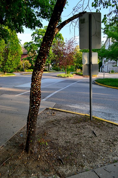
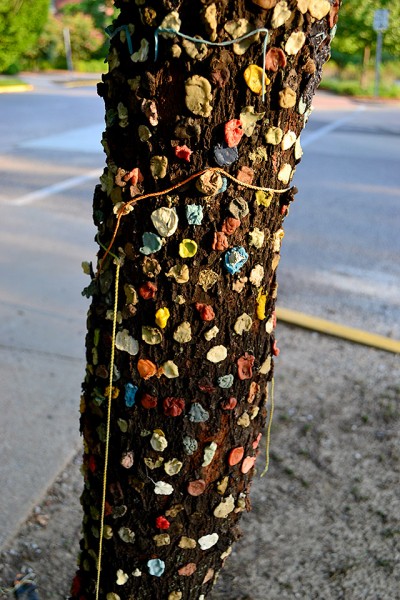
At the top of SEMO’s Cardiac Hill is another campus landmark: Gum Tree Version II (at least). I call it Version II (at least) because a March 14,2002, Missourian story says that the original Gum Tree was chopped down by vandals in 1989. The tree can be found at Pacific Street and Alta Vista Drive. (Click on the photos to make them larger.)

Where was the original tree?

This isn’t the location of the Gum Tree I remember. I’m pretty sure it was in the median of front of Academic Hall, just on the west downhill side of Normal. Or, someplace close to that. I vaguely remember shooting a picture of it, but I haven’t stumbled across it yet.

I can’t claim that I ever stuck a wad on the tree. I wasn’t much of a gum chewer. I don’t know if that was the tree that was murdered in 1989. If it wasn’t, then this tree would be Version III.

Is the tree a biohazard?

I’m surprised that some loss control zealot hasn’t removed the tree as a biohazard. There’s no telling what lurks on those expelled globs.

Yes, THAT Santa Anna

Here’s an interesting factoid: “Development of Chicle Gum came with a big breakthrough in 1869… Exiled Mexican former president and general, Antonio Lopez de Santa Anna (infamous for his victory over the Alamo defenders) was living in New Jersey. He brought a ton of Mexican chicle with him, in hopes of selling it. He persuaded Thomas Adams of Staten Island, New York to buy it… Adams intended to vulcanize the chicle for use as a rubber substitute. But his efforts at vulcanization did not work. However, Adams noticed that Santa Anna liked to chew the chicle. Disappointed with the rubber experiments, Adams boiled a small batch of chicle in his kitchen to create a chewing gum. He gave some to a local store to see if people would buy it. People liked his gum, and before long his business was quite successful.

Gum’s more fluorescent today

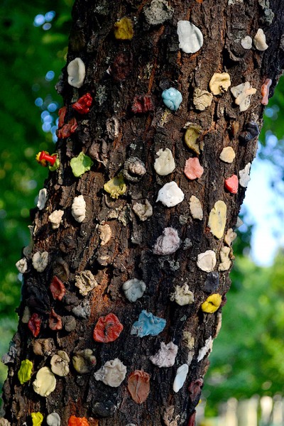
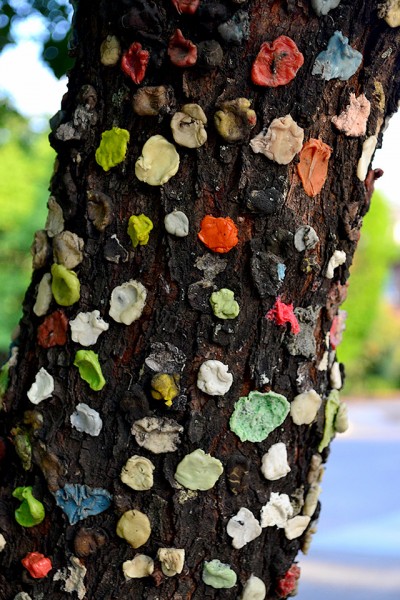
Our gum was pretty bland. Bubble gum might have ended up a weak pink, but your basic Spearmint and Juicy Fruit chewed down to a boring gray. This tree has some bright colors.

I was looking at a site that will sell you Old Time Candy. Here’s a sample of brands I remember:

  • Bazooka Bubble Gum
  • Beemans Gum
  • Big Red Gum
  • Black Jack Gum
  • Not remembered: Bubbaloo Liquid-filled Bubble Gum
  • Bubble Gum Cigars (in blue and pink) for birth announcements
  • Bubble Gum Cigarettes (I don’t remember gum ones, but do recall the hard candy ones)
  • Bubble Yum
  • Chiclets
  • Clove Gum
  • Dentyne
  • Doublemint
  • Double Bubble
  • Fruit Stripe Gum
  • Juicy Fruit
  • Spearmint
  • Teaberry
  • Trident

SEMO’s Cardiac Hill

Several of my readers have mentioned Cardiac Hill on the Southeast Missouri State University campus. They’re mostly crazy folks like Terry Hopkins, who participated in track, a sport where you run even if nobody’s chasing you.

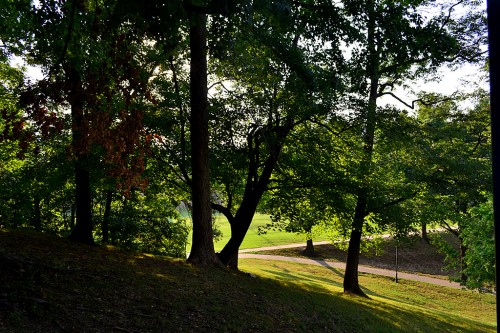
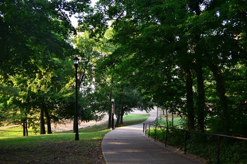
It’s quite a bucolic sight, looking off to the west of the path that leads from the Academic Hall area down to The Towers and other student housing. Even on an afternoon when the temperatures are sliding to around 103, the shade and greenery have a cooling effect. You can click on the photos to make them larger.

Cardiac Hill’s not so tough

In 1990, we took the Great Trip Out West, which included the Grand Canyon. I knew that you should never walk DOWN further than you are able to walk up, so I discouraged Wife Lila and Sons Matt and Adam from going down too far on a day when the temperatures came close to the surface of the sun as measured from Mercury.

When it came time to turn around (actually, when it was PAST time to turn around), I got about 15 steps and found myself with my hands on my knees, bent over, watching sweat splash onto my Redwing boots. Adam, who was about 10, kept scampering around us wanting to keep going. Finally, hoping he would get lost or eaten by a goat, we turned him loose.

When we looked up, we saw him seemingly half a mile ahead of us hanging over a lookout point with some concerned-looking adults. We could make out that they were having a serious discussion, probably about his welfare. Finally, he leaned way out and pointed to us. He was probably telling the strangers, “Those are my parents, if they live.”

Learning from the Grand Canyon

Even though it didn’t look like Cardiac Hill was all THAT steep and it wasn’t all THAT long, I used the Grand Canyon Rule and went down only about a third of the way, not quite to the emergency stanchion that I assume is the half-way point.

I DID mention that it was 103 in the shade, right?

I’m going to use a different rule next time: Take the temperature (103), subtract my age (65) and subtract the grade (12.5 degrees, estimated). The result (103-65-12.5) = 25.5 feet, the distance that I should consider walking down Cardiac Hill. I was going to build in humidity, but that would have left me with a negative number to walk.

Thanks to Dr. Bambi, AKA the Yarn Bomber, who told me how to get to Cardiac Hill.


Old Jackson Road

These pictures were taken at the intersection of County Roads 618, 620 and 306. Let me tell you how we got there.

When we moved out on Kingsway Drive, we – like most folks – called it Old Jackson Road. If you didn’t take Highway 61 through the 10-Mile Rose Garden to get from Cape to Jackson, you’d go by way of Old Jackson Road. You’d coast down from our house near Kurre Lane, make a sweeping right-hand curve past the Cape La Croix Creek concrete marker (it’s been moved) and keep on going. There was no such thing as Lexington in those days.

Girls sure were careless.

Just before you got to where Route W turns to the right, you’d cross an old steel bridge over 3-Mile Creek (where there was a deep swimming hole). It’s concrete these days and the water’s too shallow to swim.Thinking back on it, that area might have been used for more than swimming. We boys were mystified about how so many girls lost their underwear there.

After you passed the Seabaugh farm on the left, you’d curve around to go through the Houck Railroad Cut that features prominently in Steinhoff family lore. (Dynamite was involved.)

618 is closed for construction

Finally, you’d come to a place where you had to turn left to go over I-55. That’s the intersection of 618, 620 and 306. That’s where the first picture with the Road Closed sign was taken. If you went straight, you’d climb a short hill, then plunge down a steep hill with a sharp curve at the bottom. That’s significant because the last time I did that ride on my bike, I didn’t realize I could go that fast. When I hit the curve I became very aware of how tiny, tiny my bike tires were and how much it was going to hurt if I misjudged the curve and painted the blacktop with skin crayon.

If you survived the curve, soon you’ve find yourself staring at – and being stared BACK at – by the exotic animals that inhabited 5H Ranch. BUT, we couldn’t go that way Saturday because of the Road Closed sign.

Abandoned quarry

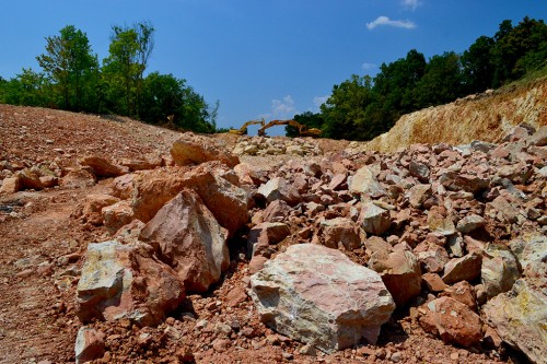
If you made the left turn and crossed I-55, you’d enter a curve that swept to the right and downhill. On the left was where Bill Hampton lived. His family owned Hampton’s Bakery on Broadway across from Houck Stadium. Bill shot our wedding in 1969. Just before you crossed a bridge at the bottom of the hill, there was a hill with an abandoned quarry cut into it.

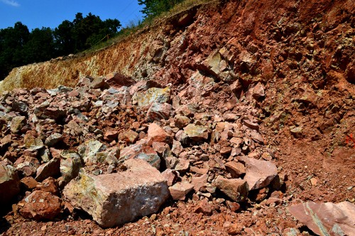
You can tell from this cut why they hadn’t bothered to work it much. There’s some limestone, but it’s not of very good quality. The quarry would have been off to the left behind the trees in this photo. The road to it has been overgrown for years. About a half mile down the road was the turnoff to Old McKendree Chapel.

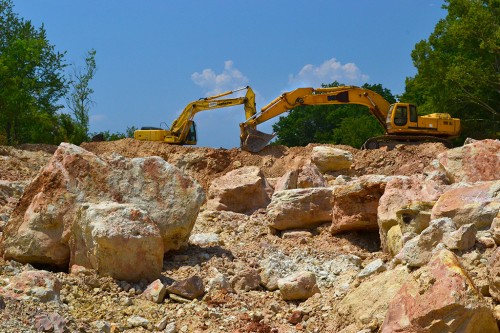
Hill has been taken down

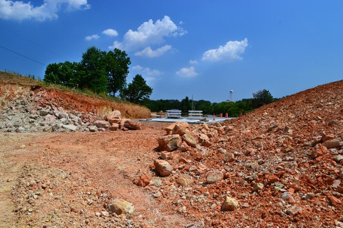
Looks like the hill has been taken down enough that the ride down 618 isn’t going to be as exciting as it was.

 View back to Cape

You can see how much the grade has been flattened in this photo looking back toward Cape. It’ll be easier to climb on icy days (and on my bike).

It’s not just concrete

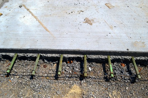
You’re driving on more than concrete when you go down the road” there’s an awful lot of steel in that slab. I hate to think how much of that rebar I humped one hot summer.

Allenville Fish Feeling Heat

Even though Cape temperatures hit 103 to 107 (depending on the sign) Mother and I went exploring in the Allenville area. I wanted to see how hard it would be to get to the Allenville railroad bridge that’s been in the news of late. In the process, I took pictures of the St. Louis Iron Mountain Railway tracks when I came across their crossings south of Dutchtown. They’ll be part of another story.

When we headed south out of Allenville on County Road 238, we came around a curve to see a pickup truck sitting in the middle of the one-lane bridge over the Diversion Channel. Well, it might be two-lane, but they’d have to be two bicycles or two REALLY friendly cars. Based on the skid marks and the way the guard rail is a little wavy, I’d say that some vehicles have not met those requirements. (Click on the photos to make them larger.)

After a short pause, the truck crossed the bridge, we gave each other the wave you do in the country, and we went down Hwy N to check the railroad bridge. Looks like it’s going to be easier to get to it from the south than from Allenville.

Signs with bullet holes worry me

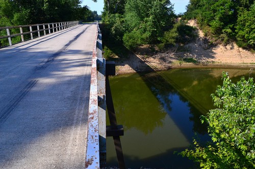
On the way back north, I decided to stop to shoot some pictures of the road bridge.

There must be members of a “well regulated militia” running around Allenville enjoying their Second Amendment rights to shoot at road signs where bullets would strike an oncoming car if they miss (or, based on the number of through and through holes even if they HIT the sign).

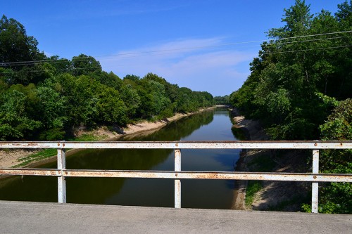
View downstream

This is where much of the water being drained out of Swampeast Missouri goes on its way to the Mississippi River just south of Cape. If the Mississippi backs up or there’s a lot of rain, this ditch could be 15+ feet higher.

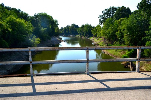
Greens make it look cool

Don’t let those greens fool you. My shirt was soaked with sweat when I got back to the car. This is looking upstream.

Holy Cow! Look at the fish!

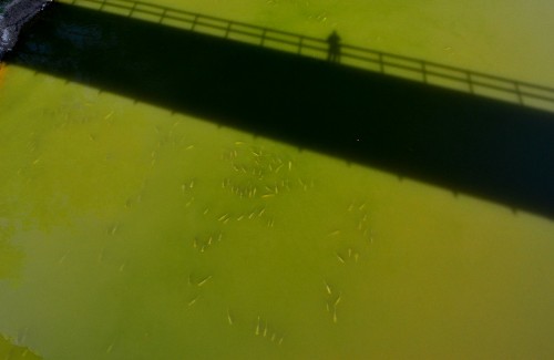
Now I see why the pickup truck was stopped on the bridge. The hot weather and low water brought what I assume to be hundreds of carp to the surface. Fish that could easily go 2-1/2 to three feet were snurfling along the surface like goldfish in a tank. (It’s worth clicking on these shots to make them larger.)

For you folks who complain that you never see a photo of me, that’s my shadow. I think it’s a pretty good likeness.

Turtle comes up for gulp of air

A pretty good-sized turtle surfaced for a bite of air, then slipped back under water.

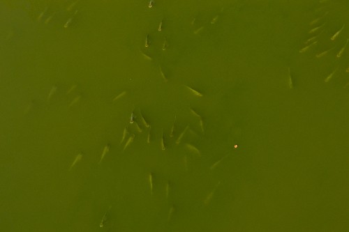
Open mouths

I bet most of these fish could swallow a softball without straining too much. The bright object in the right center of the picture is a leaf floating downstream.