
 The water in the cement plant’s quarry is a little lower than when neighbor Bill Bolton took his photos earlier in the month, but there’s still a lot of water in the bathtub. Here are pictures of the ebb and flow of water in the pit since 2002.
Pumping water into Cape LaCroix Creek
 One reason they’re gaining on it is a new pipeline pumping water into Cape LaCroix Creek at South Sprigg. I don’t know if both pipes were being used at one time or if the one is being held as a spare.
It’s only fair that water be pumped back into the creek because that’s where some of it is seeping from.
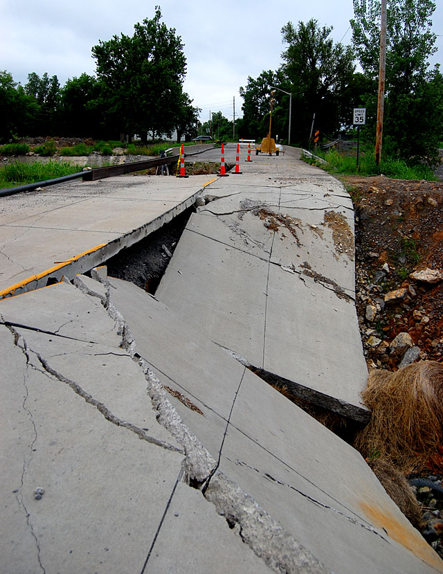
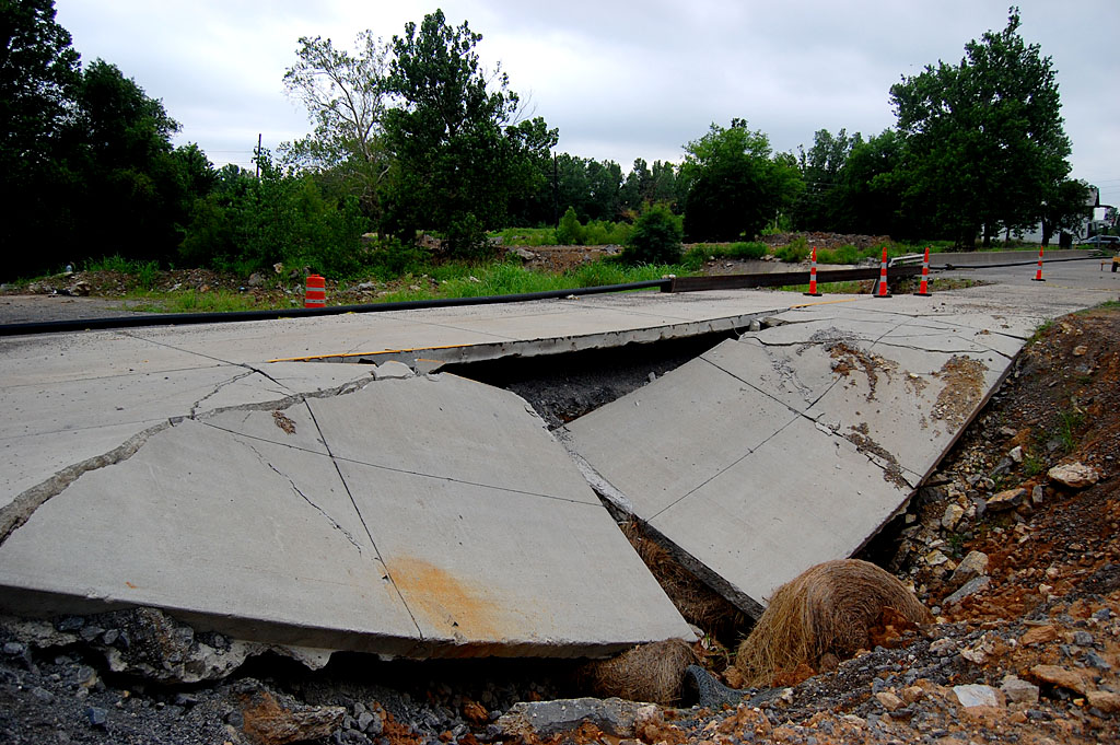
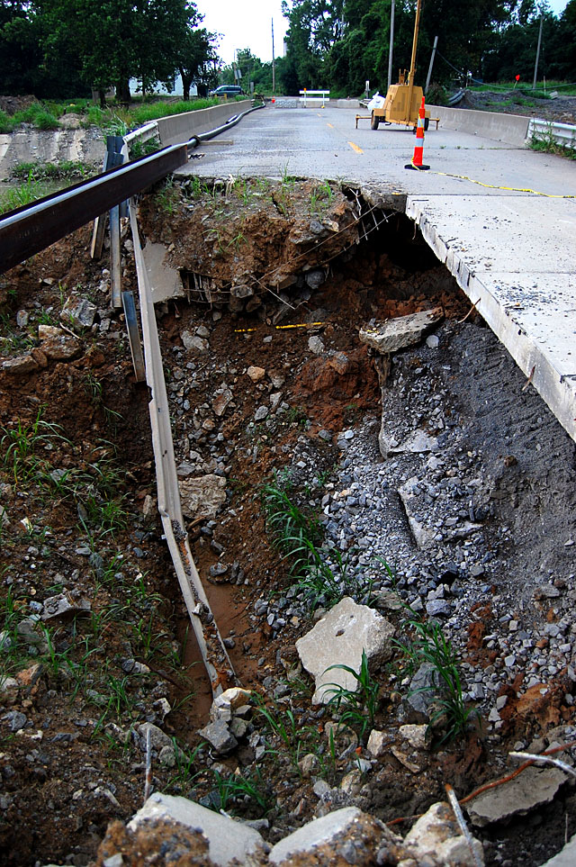
Sinkholes present challenge
 Getting TO the quarry was a bit of a challenge. You can’t get there by going south out of Cape on South Sprigg. It’s closed at Cape LaCroix Creek because of some massive sinkholes. We had to come in from the west.
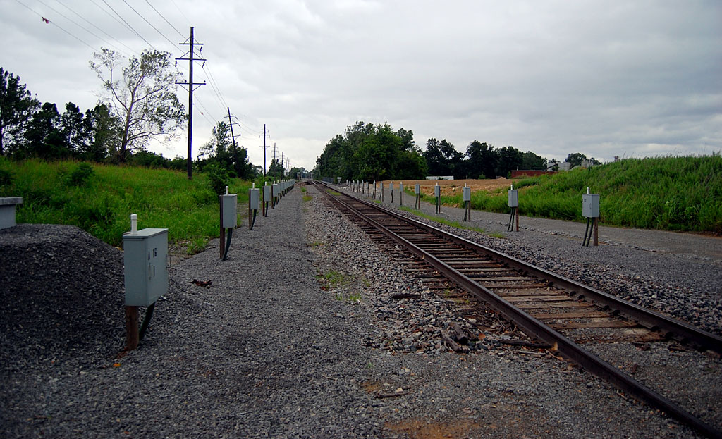
Devices along railroad tracks
 I don’t know what these devices are along the railroad tracks north of the cement plant and south of the creek. Railroads have been using defect detectors for years to find overheating wheel bearings, called “hotboxes;” loads that have shifted; how many axles are on the train; objects sticking out and other anomalies. The devices transmit a radio report to the crew when it passes.
Until regular reader and train buff Keith Robinson chimes in, I’m going to speculate that these devices may be looking for changes in the track that would signal a sinkhole has opened up or swallowed the track.
Gallery of photos
Here are more photos of the Sprigg Street sinkholes and the railroad devices. Click on any image to make it larger, then click on the right or left side to move through the gallery.
These shots look like my old stomping grounds where I once worked are becoming a total mess to grt to!
Joe Whitright “45”
These shots look like my old stomping grounds where I once worked are becoming a total mess to get to!
Joe Whitright “45”
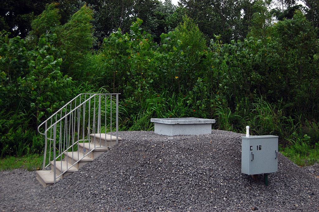
Ken, what are seen along the tracks are individual GPS receivers that are being used to monitor the elevation and latitude/longitude of the track to warn of the development of a sinkhole under the track. The steps lead to an underground cellar where all the data is collected and relayed to BNSF HQ in Dallas.
A sinkhole developed under the track in that area a few years ago.
Keith,
I knew I could count on you for an answer. Not a bad guess on my part, but I was thinking of a less elegant method.
I thought maybe they were using something as simple as mercury switches to detect a change in angle or some kind of accelerometer like you’d find in your smart phone to detect orientation.
I assumed those raised platforms were monitoring wells. Guessed wrong on that one.
If Bloomfield Rd. was a dangerous situation that required immediate action, what’s this?
Looks like South Sprigg Street will never be a through street again.