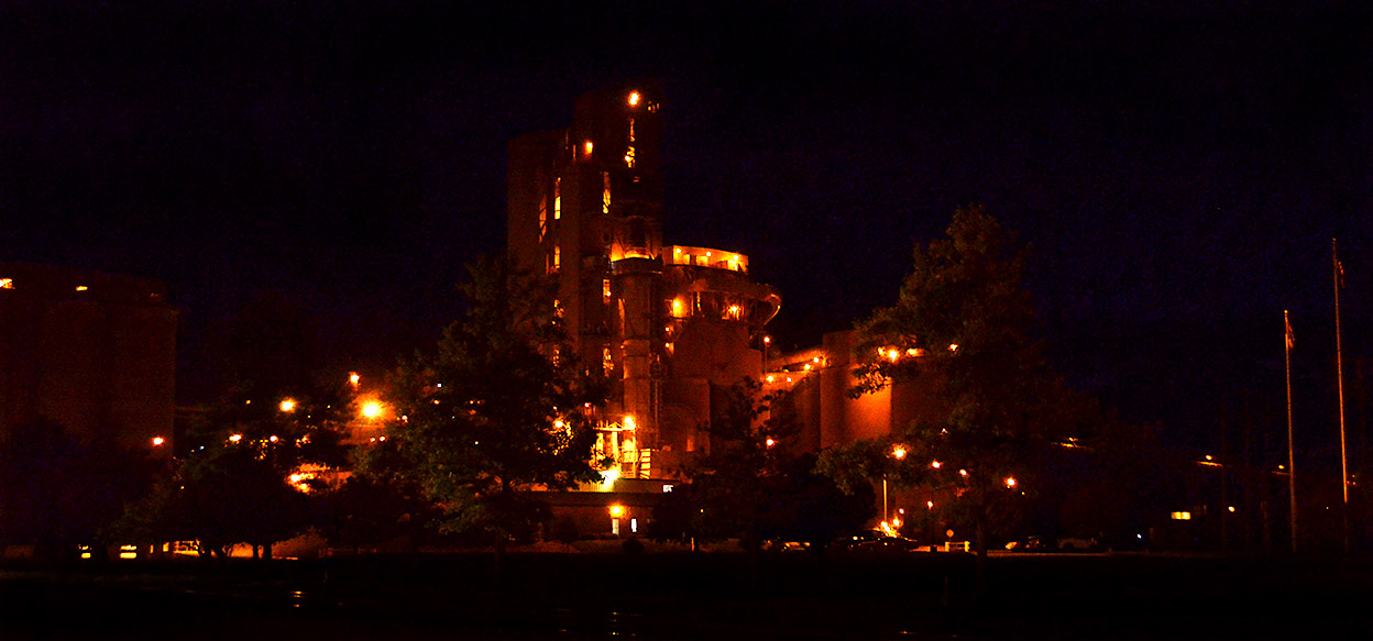
 Once you’ve said Buzzi Unicem Cement Plant at night, you’ve said it all. Click on the photo to make it larger.
Here’s a link to some other cement plant stories.

Cape Girardeau History and Photos
News photos that have grown whiskers and have become history
Once you’ve said Buzzi Unicem Cement Plant at night, you’ve said it all. Click on the photo to make it larger.
Here’s a link to some other cement plant stories.
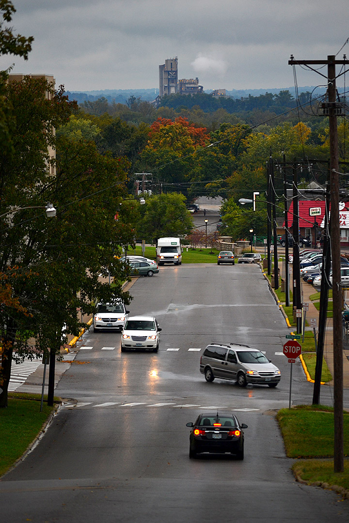
I wanted to get an updated photo of the dome of Academic Hall to contrast with the shiny copper dome I took in the spring of 2013. On my way down North Henderson on a drizzly afternoon, the cement plant popped up above the horizon.
As you can see, the trees around here are just starting to turn. I was afraid all the dry weather would cause the leaves to turn brown and fall off before we saw the neat colors.
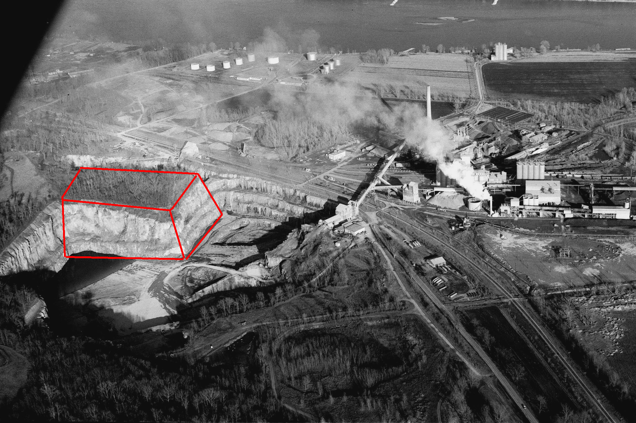 After I ran photos of the cement plant quarry yesterday, reader Keith Robinson sent me this sequence of photos of the caverns being blasted. He annotated my1966 aerial to show where the blast was centered.
You can see to the right of the “box” the narrow wall that divided the “Blue Hole” from the main quarry. Keith said family friend Burl Medlock made it possible for him to take the photos.
He said the blast used 300 tons of explosives and loosened 1.5 million tons of rock. The surface area was estimated at 6 acres and was up to 200 feet deep. Here’s The Missourian’s version of the blast.
Click on any photo to make it larger, then use your arrow keys to move through the gallery.


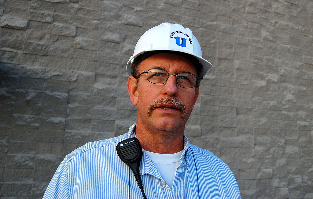 Without thinking I had a chance in the world of success, I approached Buzzi Unicem plant manage Steve Leus in the fall of 2010 to ask for a tour of the cement plant and quarry. That usually results in months of getting bounced from corporate type to corporate type, ending up in a “No.”
I showed up in Steve’s office with a stack of prints I had taken over the past 40 years from the air, from inside the caverns, from the quarry’s edge, and of the plumes of white particulate that used to belch from the stacks of the plant. We had a great conversation, then he handed me a hard hat and we were on our way. THAT’S the kind of manager I like to deal with.
There are some stories that paralyze me because they are special to me. This is one of those. I kept putting off and putting off publishing it because I wanted to research the history of the plant that has changed names many times, boil down Steve’s explanation of how rock becomes cement and do it right.
 Today, more than three years later, I figured I’d better pull the trigger on this puppy and start publishing it in bits and pieces. I am NEVER going to do all that research and transcribe the paper and digital notes I have. Let’s get real: I’m a photographer, not a historian. I’ll let the photos speak for themselves.
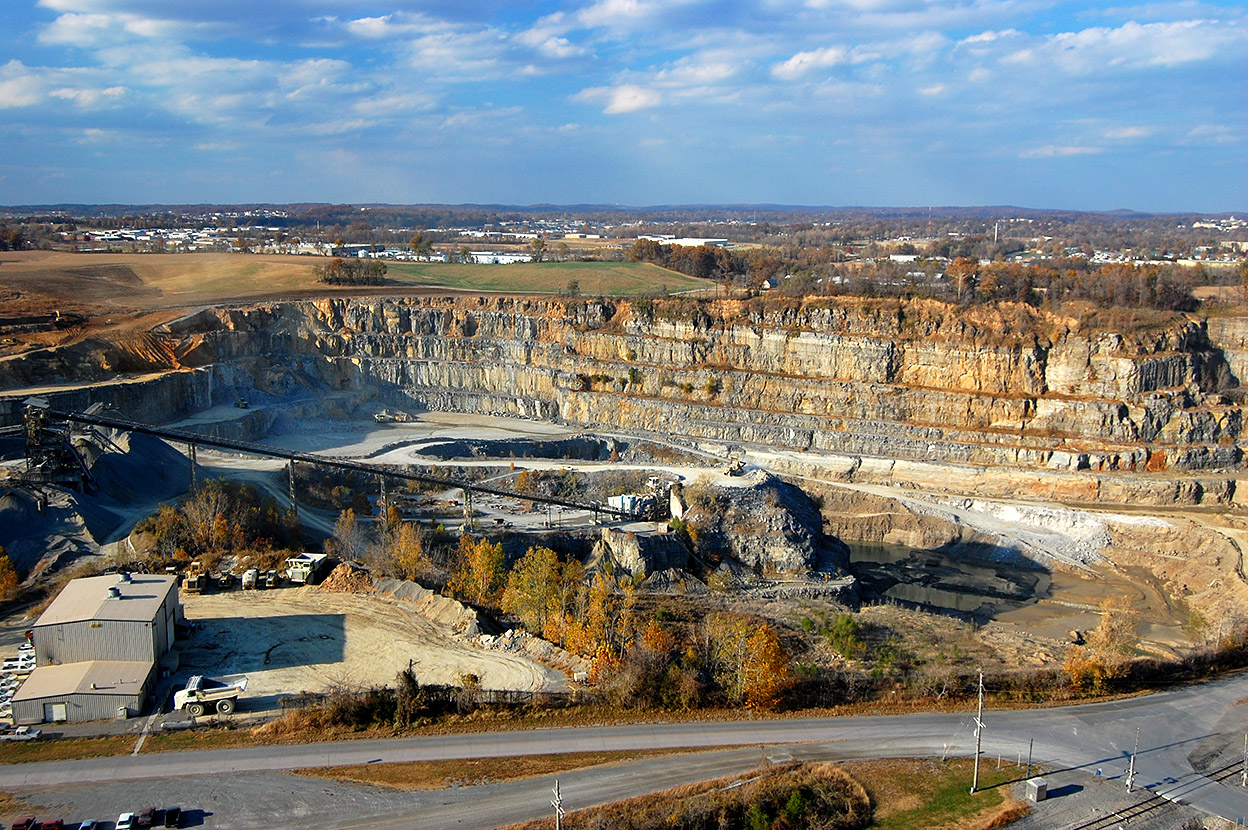
Part One will show the huge hole in the ground from the top. Well, not ALL the way from the top. I’ve got a bunch of aerial photos over the years that will run later.
Sometime in the future, I’ll publish photos taken from the bottom of the quarry including the tunnels that you are driving over when you are on Sprigg Street.
Unfortunately, NOBODY, Steve said, is allowed in them. There’s no danger of Sprigg Street collapsing, but safety regulations are a lot more stringent than they were a hundred years ago.
 If I remember my history and what Steve told me, the rounded area on the far right was what was popularly known as the “Blue Hole,” called that because of the color of the water that filled it. At one time, this area was two quarries. When the caverns were blown, it became one big hole.
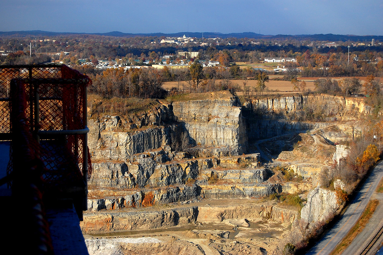
You can see the dome of SEMO’s Academic Hall sticking up in the center of the photo.
Some of the photos look a bit repetitious, but there are subtle difference in all of them. Click on any image to make it larger, then use your arrow keys to move through the gallery. Thanks to Steve for sharing a part of Cape that has fascinated me since I was a kid.


