A Rainy Night in Cape Girardeau

Rainy streets in Cape 02-18-2013
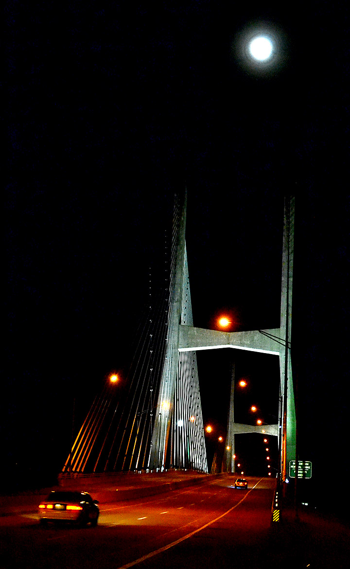
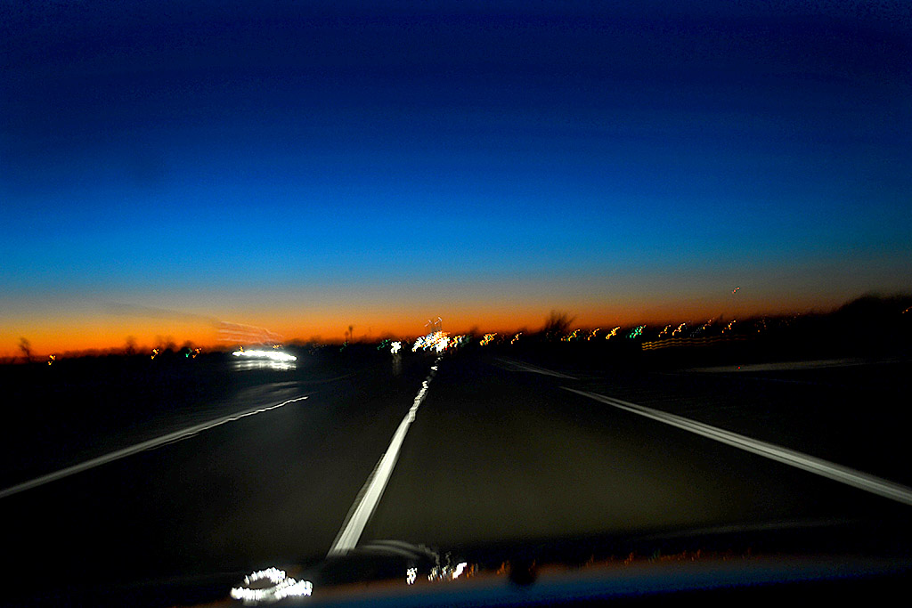
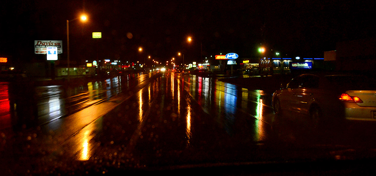
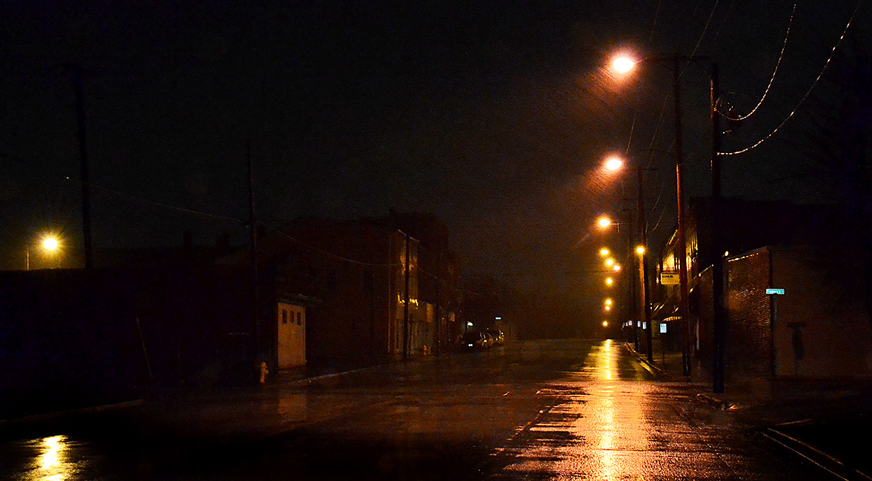
Ever wonder why car ads always show wet roads, but it’s never raining? It’s because all the reflections are REALLY neat.  This is southbound on Kingshighway south of Broadway. (You can click on the photos to make them larger.)

I had to make a run to UPS to send a thumb drive full of photos to the Athen (OH) Historical Society and Museum. When I stopped by there last month, I left off a bunch of photos I took when I worked in Athens back in the late ’60s and early 70s. Friend Jan and I had barely gotten out of town when curator Jessica Cyders pinged me to ask if I thought it would be possible to put together an exhibit on the Martin Luther King National Day of Mourning I shot in 1968 by February 27 to cap off a Black History Month conference. Since Jessica and Danielle Echols were doing to do most of the heavy lifting, I agreed.

I’m flying out to speak to the group at the end of the month, and I’m busy putting together a show catalog right now. It’s neat that someone thinks my old stuff is worth sharing.

Tuesday I’m supposed to speak to a historical preservation class at Southeast Missouri State University. I threw in a lot of new Cape-specific stuff this afternoon, so what I say is going to be as big a surprise to me as it will be to the class.

Stop light at Pacific and Independence

Rainy streets in Cape 02-18-2013After I dropped the drive at UPS, I decided I’d drive around looking for rain art. Photographers always thought life was unfair. Reporters did weather stories by calling the weather bureau, digging out clips about the Last Big Storm and, if they could be bothered, looking out the windows. Photographers had to get their shoes muddy.
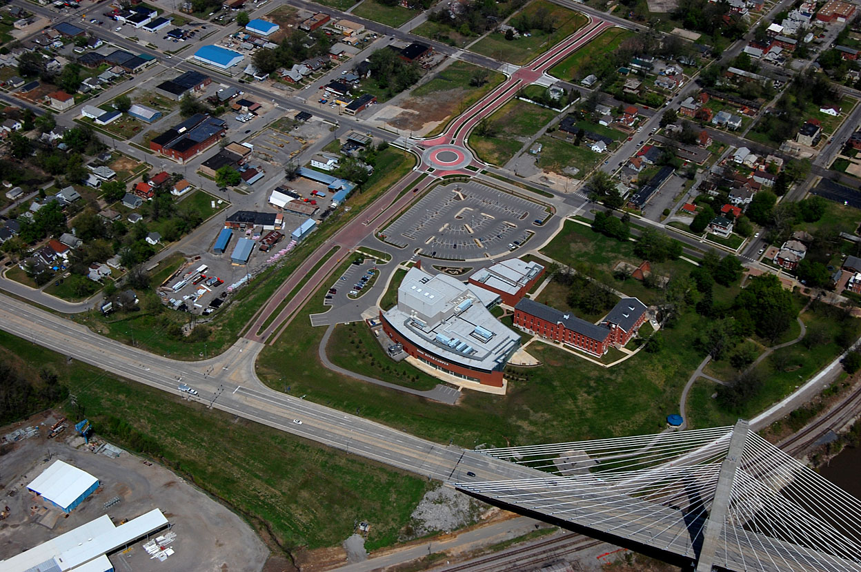
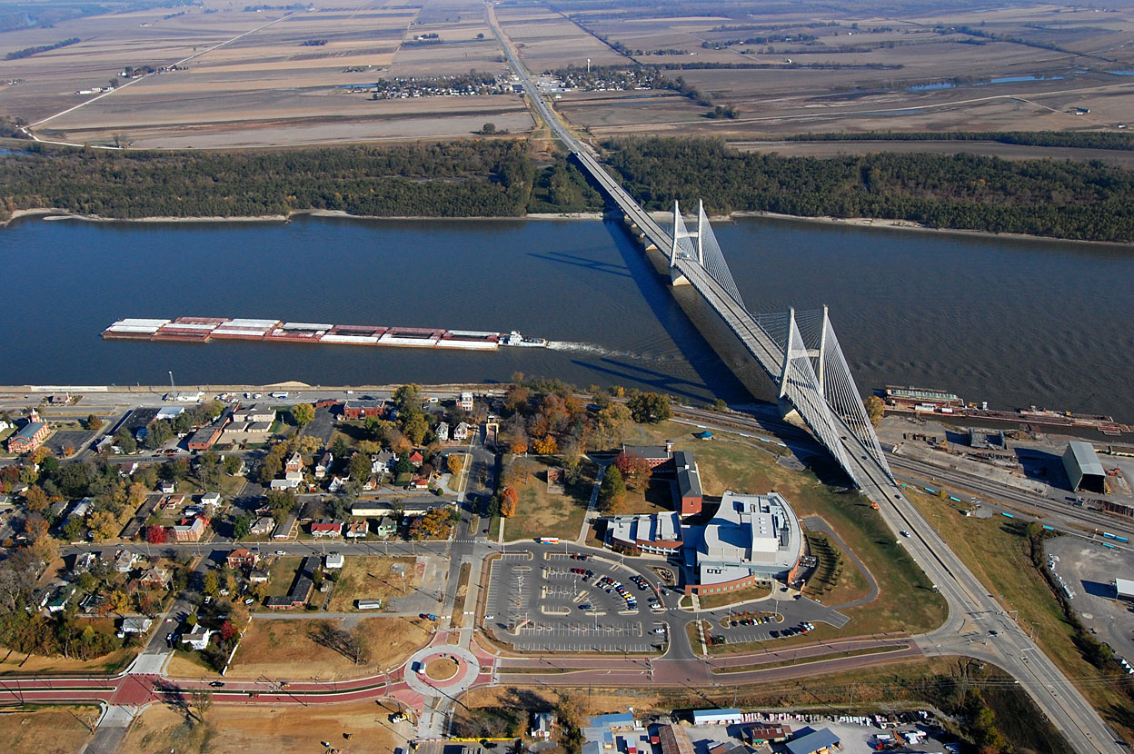
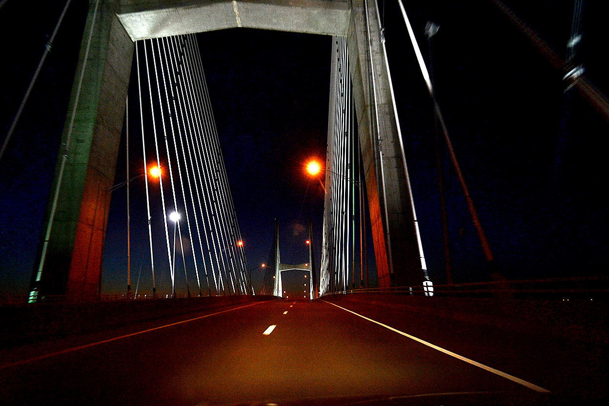
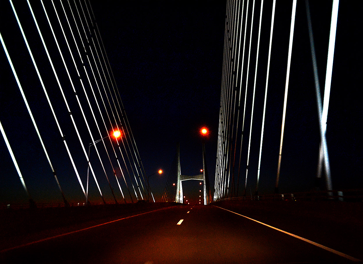
Old Traffic Bridge

Rainy streets in Cape 02-18-2013Downtown was kinda blah, so I stopped by what remains of the old Traffic Bridge.

Since I retired, my new contract says that I don’t go hungry, get wet or lift heavy objects. These photos were all taken from inside my van with the heater running.
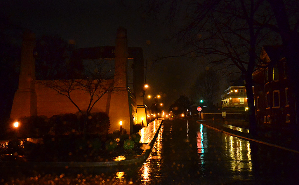
Haarig or Good Hope

Rainy streets in Cape 02-18-2013The wind and rain were really whipping from the south when I paused on Good Hope looking west toward Sprigg. It was coming across the road in sheets.

Pacific looking south from SEMO

Rainy streets in Cape 02-18-2013

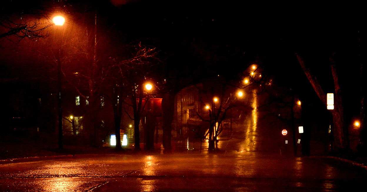
I figured I’d better scope out where I’m supposed to be presenting Tuesday, so I went up Pacific to the Carnahan Building. On the way back I tried to capture the rain coming up the street and down the hill.  These are the times I envy the TV guys with their video. It’s tough to get across the concept of driving rain in a still.

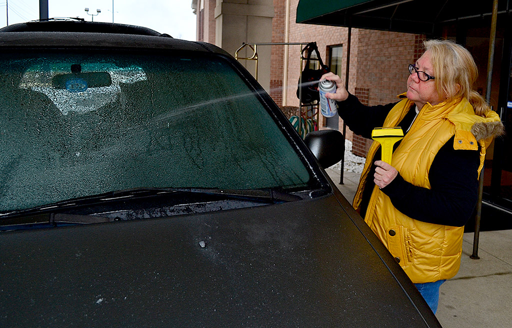
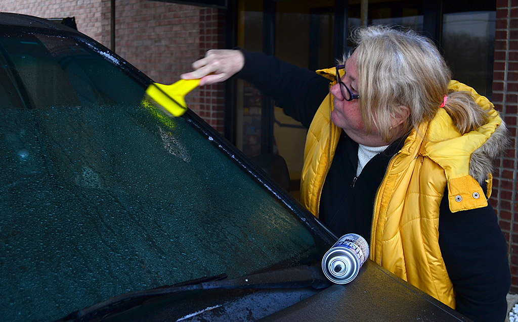
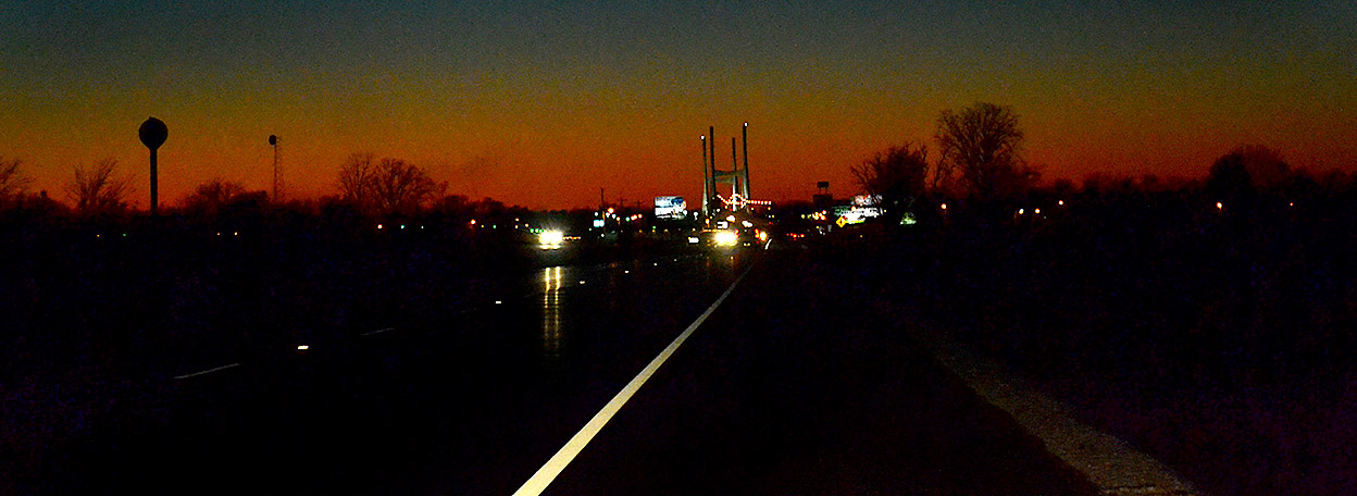
Through the windshield

Rainy streets in Cape 02-18-2013
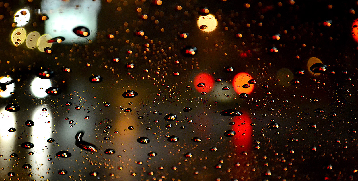
When an oncoming car lit up the water droplets on the windshield, the camera’s autofocus thought that’s what I wanted to shoot. It’s neat, and I’m glad it happened, but it wasn’t my target.

Home, Home Again

Cape bridge full moon 01-25-2013When we were getting close to Cape, I told Friend Jan, “The Cape bridge is really pretty at night. You might want to be ready to shoot a photo when we get closer.”

She started waving her cellphone around, making little squeals of what I hope were pleasure.

I had already called Mother to tell her we were about home and asking her if she wanted us to pick up anything from Hamburger Express. She did.

I had just made the right turn at River Campus to go work my way down William when Jan hollered “STOP!! Turn around! Look at the moon!”

She used up a whole day’s worth of exclamation points in 12 seconds.

So, minutes after entering Missouri, we were exiting Missouri, to go back into Illinois to go back to Missouri. You can see how this has been a long trip.

Day started off with ice

Jan Norris scrapes ice off car in Louisville Ky 01-25-2013

We spent too much time sightseeing on Thursday (pictures to come) to make it all the way from Athens, Ohio, to Cape in one shot, so we stopped on the west side of Louisville. The weather report didn’t look good, so I wanted to be on the west side of town so we wouldn’t hit morning rush hour and snow at the same time.

When I went to load the car, my head and feet almost swapped places. The whole parking lot was a shiny sheet of ice. I’ve never seen an ice sheen that perfectly smooth. The whole car was coated, too. It was time to give Jan a new experience: ice removal.

I handed her a can of spray deicer and a scraper and told her to have at it.

She handled that spray can like a well-trained riot cop with Mace.

“You need a smaller car”

Jan Norris scrapes ice off car in Louisville Ky 01-25-2013When it came time for the scraping, she said, “You need a smaller car. I can’t reach all the way to the middle.”

“No, I need a taller passenger.”

That’s when I came clean: “The deicer speeds the process up, but the car’s defroster would have had the windshield warm enough for the wipers to slide the ice off,” I explained.

I should have waited until she put the can of deicer down before I broke that news.

SEMO Plans to Erase Landmark

River Campus 10-20-2008 First handball court west of the Mississippi RiverThere were a number of things that let me know I was getting close to home: going down that last hill at Thebes Gap, catching the first glimpse of the Mississippi River as it curved around Gray’s Point, spotting the Common Pleas Courthouse and the dome of Academic Hall poking above the trees… Once we made the white-knuckle passage across the Traffic Bridge, I’d look off to the left, not to see St. Vincent’s College, but to spy the strange brick structure on its lawn. I didn’t know exactly what it was, but it was a sign that I was home.

When I researched a piece on the 5th anniversary of the River Campus, I discovered a report filed with the National Register of Historic Places saying the court was constructed in 1843 and was supposed to have been the first handball court west of the Mississippi River.

James Baughn reads the fine print

Aerial photos of Southeast Missouri State University River Campus areaThe December 16 Missourian ran a routine story about the SEMO regents approving 96,000 square feet of new construction at the River Campus. There was an aerial photo overlay, but I’m sure most readers didn’t look at it closely. I’m guilty as charged.

Missourian webmaster James Baughn, who does one of three must-read blogs in the paper, is one of those detail kind of guys who notices things. He discovered that the new construction will erase one of the oldest structures in Cape Girardeau, one built by Joseph Lansman. Who is he? Thanks to Baughn’s research, we find that he was the guy who was probably responsible for SEMO being in Cape in the first place.

Baughn notes “[Louis] Houck was able to work his magic to steer the newly formed Board of Regents toward Cape, but Lansman helped seal the deal. He agreed to donate land he owned at the site of Fort B, the old Civil War fortification on a hilltop north of town, well away from the mosquito-laden swamps. During a crucial meeting at the St. Charles Hotel (built by Lansman), the regents made the final selection of Lansman’s site for the new college.”

SEMO, which touts one of the few undergraduate historic preservation programs in the country, assures us that they will incorporate a “select” number of bricks from the handball court into the facade of the new River Campus building. If they were in Philadelphia, they’d probably scrap The Liberty Bell and incorporate the clapper as a door knocker. I mean, why hang on to that old thing? Nobody’s going to ring it with that crack in it.

Holy Crapola! I’ve been ripped off

Southeast Missouri State University River Campus areaI followed a link on Baugn’s blog to a SEMO publication that details the constuction project. Guess what they have on the first two pages? This copyrighted aerial photo showing the River Campus I shot November 6, 2010. I can’t wait to make some phone calls tomorrow morning to SEMO and the Lawrence Group to talk about appropriating photographs for commercial use without compensation. (As always, you can click on the photos to make them larger.)

Frame Two of my purloined photo shows clearly that they are targeting the lawn and handball court area that gives the site its quiet beauty, second only to the trees area and terraces overlooking the river. (They’ll go next and SEMO will sell “preservation toothpicks” made of the trees.) It would appear to me that there is plenty of space occupied by parking lots that would be perfect for the expansion. Put two floors of parking under the new buildings and you could leave the lawns and terraces alone.

Thanks, Mr. Baughn, for the heads-up.

Bill Emerson Memorial Bridge

We were hitting East Cape just past sunset on the way back from Kentucky Lake. I couldn’t resist shooting some photos of the Bill Emerson Memorial Bridge as we approached it.

No, I wasn’t looking through the viewfinder instead of driving. I was resting my camera-holding hand on the top of the steering wheel and blindly pressing the button. Exposure and focus were done by the camera, for the most part, although the last thing I shot before this was set to underexpose 1.3 stops.That was probably a lucky thing because a normal exposure would have been too light.

If you like the photo, I’ll take credit for picking the best frames out of about 60 shots.

Bridge photo gallery

Click on any picture to make it larger, then click on the left or right side of the image to move through the gallery. The distant shot is blurry because the camera was set to a slow 200 ISO for a previous shoot in bright sunlight. When I noticed the exposure sounded like it was about two seconds long, I pulled off to the side of the road and told the camera to shift to a more sensitive “film” setting when the shutter speed fell below 1/30 second. The shot above was 1/30 of a second at an ISO of 1100.