
 It’s pretty easy to tell Wet Cape from Dry Cape during the 1993 flood. This aerial photo shows the Red Star District looking south from about 4th Street. The city’s floodwall is barely keeping the Mississippi River out of the town. (Click on the photos to make them larger.)
Buyout left green spaces
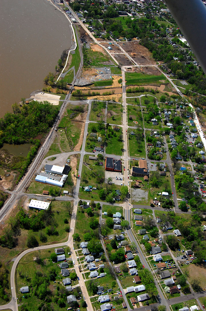 This 2011 aerial shows a lot of empty green spaces left after many residents took buyouts to keep from going through this again. This is looking south from just below Johnson Street. The photo was taken just as clearing for the Casino was beginning.
2011 Red Star looking west
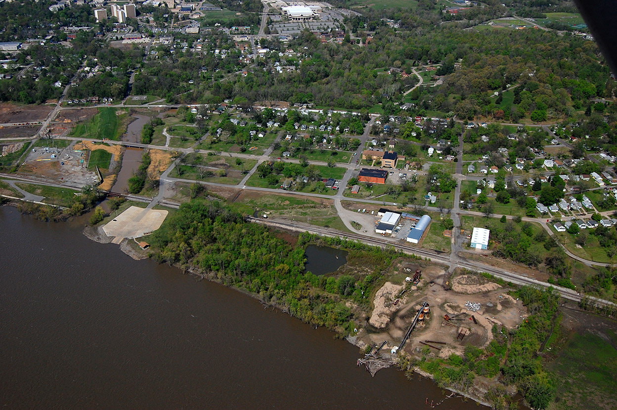 This aerial showing the Cape Girardeau Sand Company and what is left of the Red Star District was taken April 17, 2011. The concrete pad at the left of the photo is what we used to call Honker’s Boat Dock. To the left of Sloan Creek is the area that is being cleared for the Isle Casino Cape Girardeau. The light-colored building at the top center is the Show-Me Center.
The 1993 picture is dramatic! It looks like the levee / floodwall could be topped at any time.
I have some other shots from the same flight that show just how close it came to the top in the downtown area. I decided to save those for a night when I want to go to bed early. Stay tuned.
Hi Ken, I lived in Red Star most of my life. My grandfather had a grocery store next to our home in the 1200 block. We were very fortunate that the water never got into our home. We had seep water in the basement but no real damage. Water came within 2 houses of our home. Water Street was 1 block east and it was always flooded. Thank you for the pictures
Ken, someone told me that the floodwall is a foot or so, higher than the Illinois side. Do you know anything regarding that?
Thanks,
Jim Pierce
I don’t know. The flooding on the Illinois side is caused by water that backs up from streams feeding into the Mississippi. It’s that backflow that is the problem, not overtopping the levee.