Bloomfield Road Opens

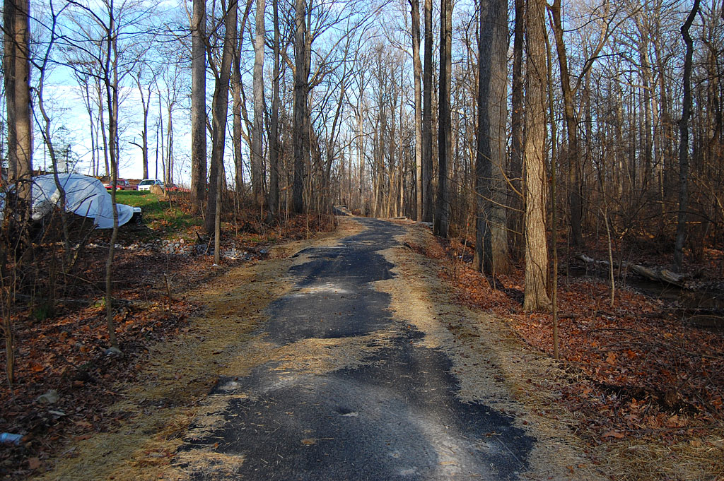
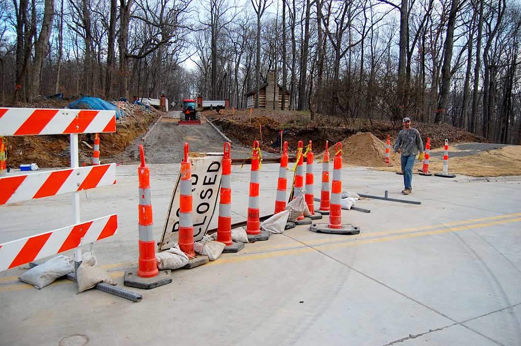
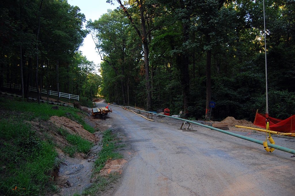
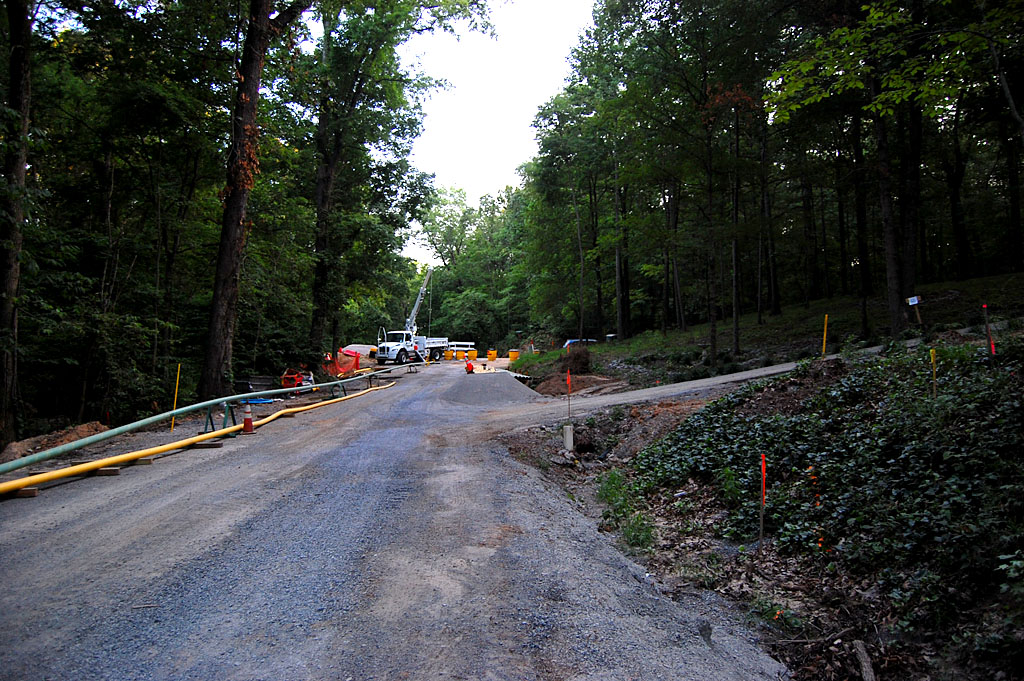
The paper said Bloomfield Road was going to open today. TV news said it was going to open, but the signs said “Local Traffic Only” when we pulled up there this afternoon. Figuring that Mother was local and I had Florida tags and could claim I was lost, we kept driving. Before long, though, it was obvious that the road was blocked, so I grabbed my camera and started hoofing it. (Just as I was starting to leave, “Ryan” (no last name given) started removing the barricades from the road.) Click on any photo to make it larger.

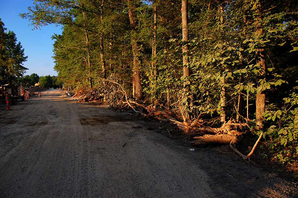
I gotta tell you I really didn’t want to do this story. I’ve written about how I feel about the loss of an historic scenic road too many times. It’s a battle lost. I was going to make a strong case for trying to save the last segment, but I’ll show you tomorrow why I’m not even sure that battle’s worth wasting energy on. By the way, I refer to Phases 1, 2 and 3: the section in front of Campster School (1); this section ending at the Benton Hills intersection (2), and the final section, from the Benton Hill intersection to Hwy 74 (3). News stories refer to phases up to 5, but they’re dealing in more detail than I am. Sorry for any confusion.

How does it look?

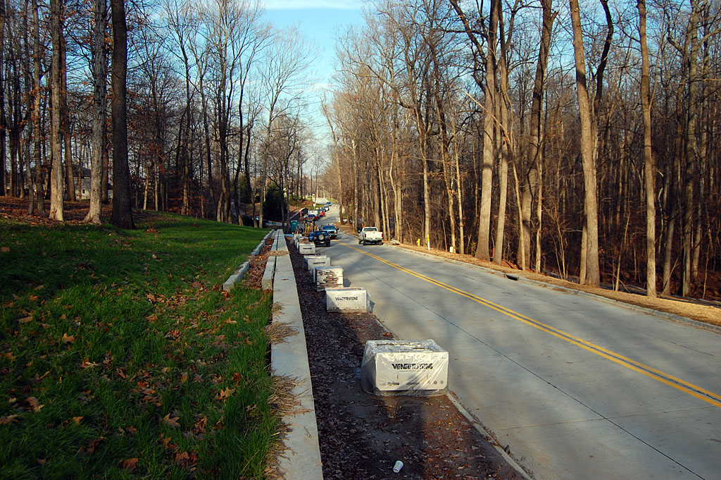
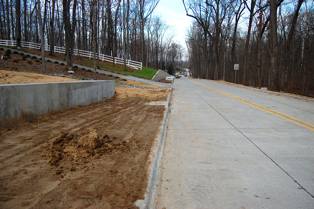
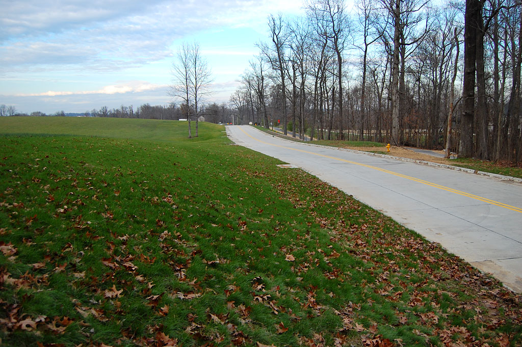
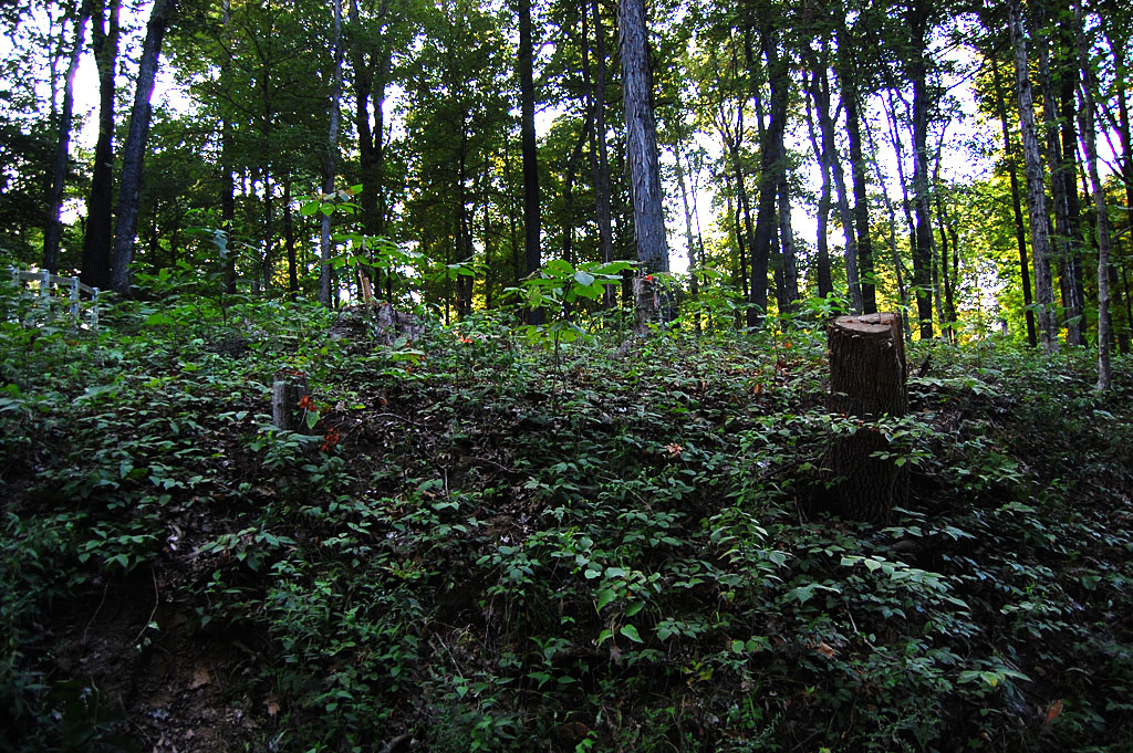
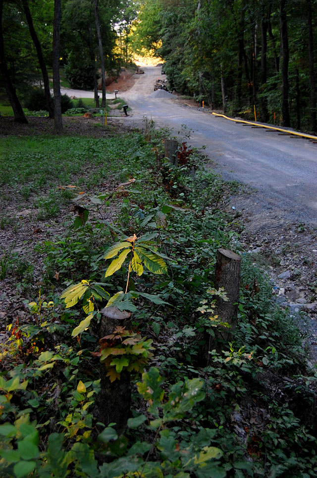
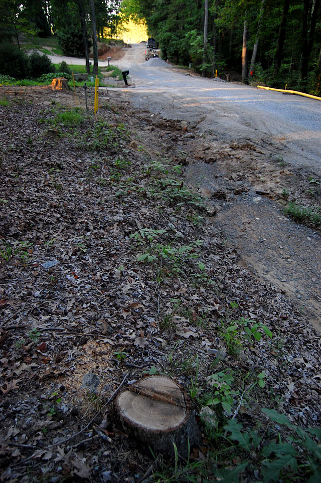
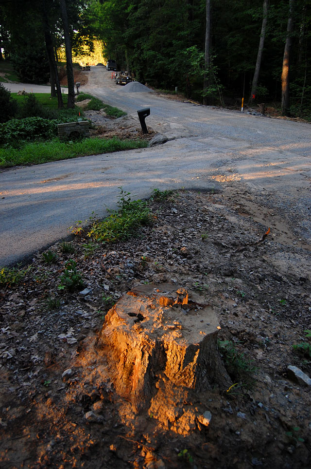
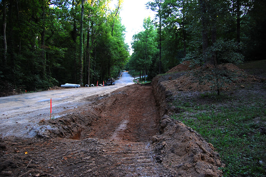
Well, if you hadn’t seen it before, you’d think it looks pretty good. If you’re looking for the trees you knew and loved, they’re pretty much gone. “It won’t take long for the trees to fill back in,” a workman told me.

“Trees that are two or three feet around?”

“Well, uh, no, THOSE trees won’t come back quickly.”

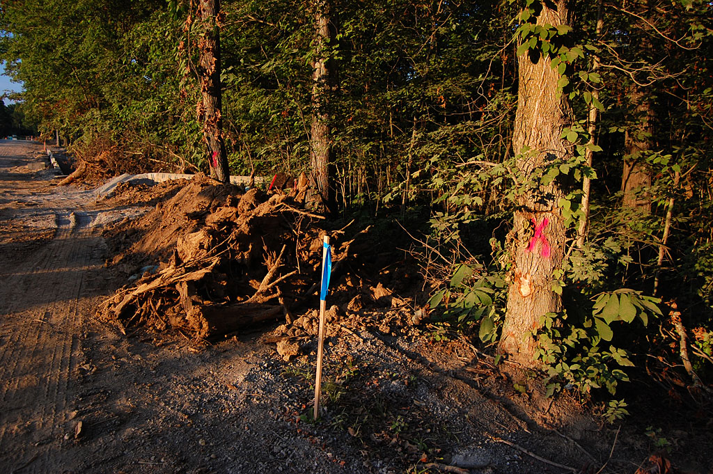
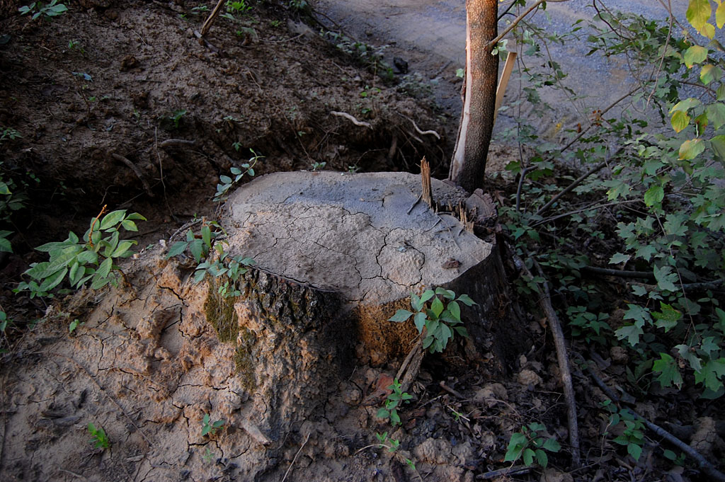
Did they “minimize” tree loss?

On July 21, I wrote this:

Remember back in May when the city held a meeting to talk about the $1.25 million road-widening project? City officials said that as many as 150 trees would have to be taken down in order to widen the road from 22 feet to 28 feet. City Engineer Kelly Green was quoted by Scott Moyers as saying that the city has taken measures to minimize the loss of trees, but that some would have to come down in order to widen the road.

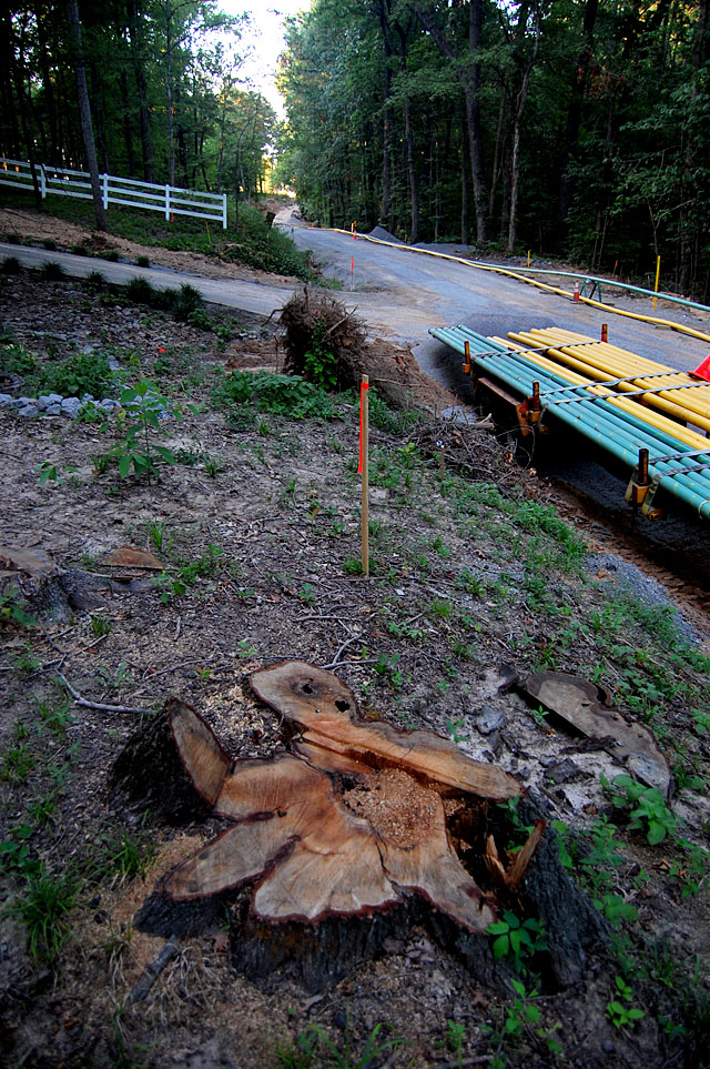
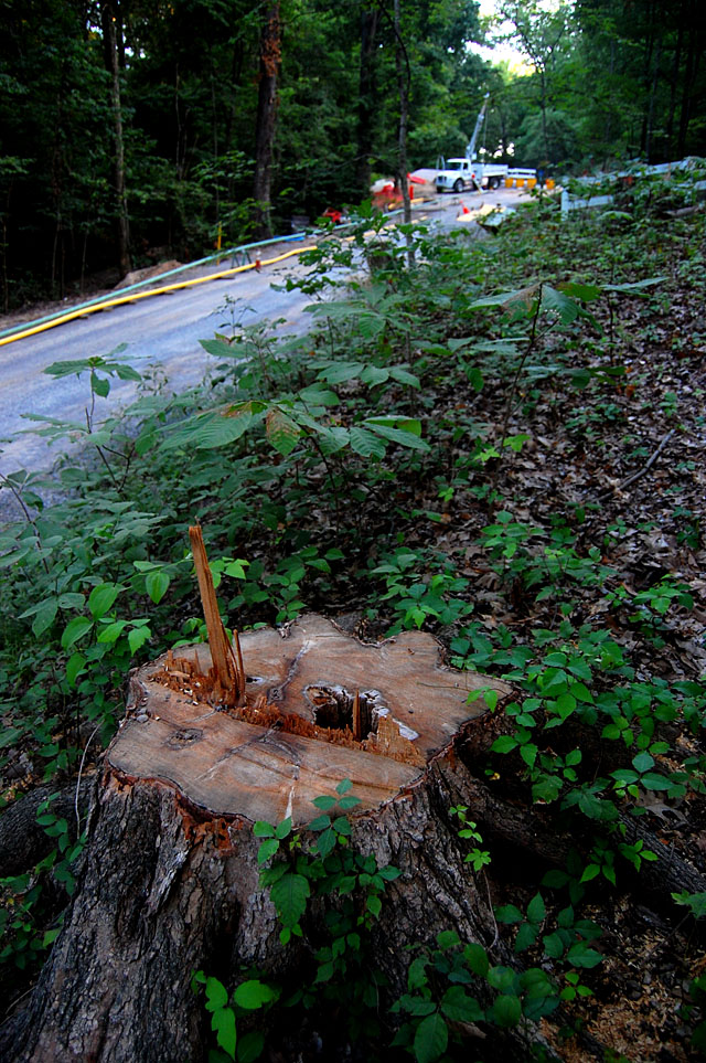
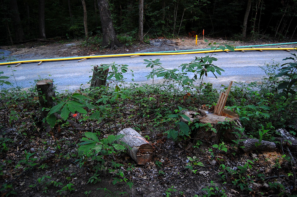
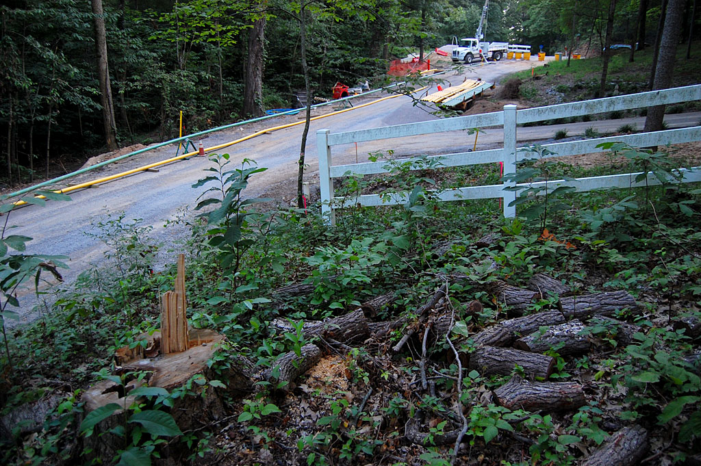
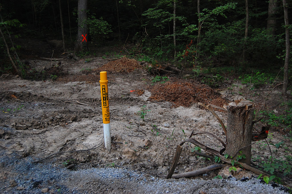
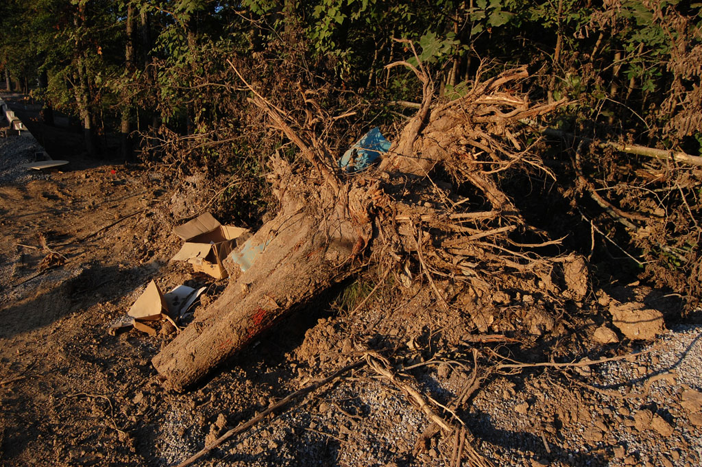
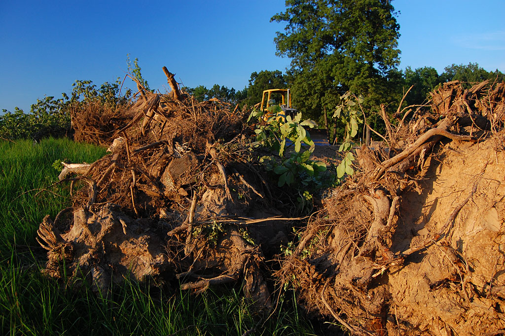
I’m going to say that ALL of the trees that appeared to be close to the right of way line were cut down except for the two next to the portable toilet. I might give the credit for saving three, but I think the one if the foreground was a little bit outside the line. If the city engineer or anyone else involved with the project would like to show me any stealth trees I missed, I’ll be around until the end of the week.

Any good news?

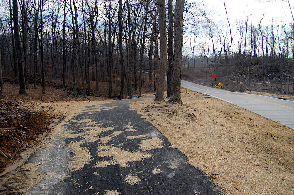
The project DID result in the construction of a nice, hilly curvy bike / ped path. The only problem is that it starts and stops without connecting to anything. The kinds of folks who find trail riding appealing aren’t going to brave traffic on Bloomfield Road to get there on their bikes.

How fast will traffic move?

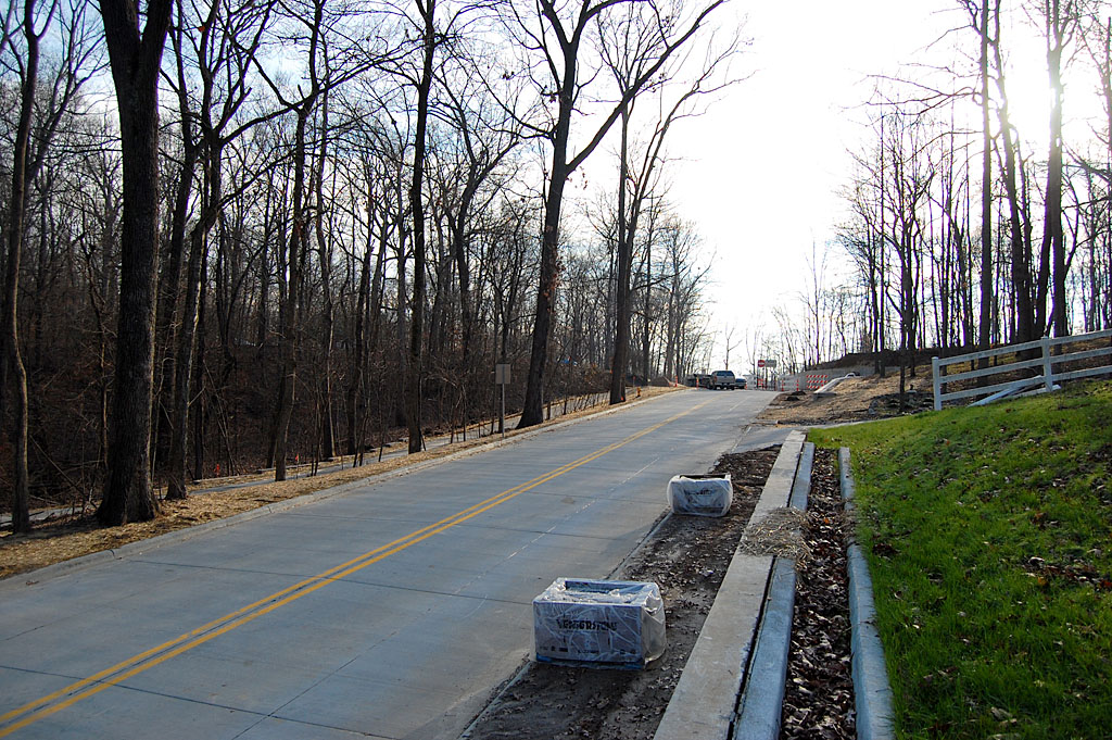
The speed limit on the new section is 35 mph, the same as the old road. When I commented to my workman friend that one of the problems with the old road was that the 35 mph limit wasn’t enforced and that cars were moving at 45 or 50, he just sort of snorted and said, “at least.” So, how fast do you think they’ll go on a wider, straighter road? I’d love to rent a radar gun and log the average speeds once the road is fully open. Better yet, I’d love to sit out there with a speed cop who needs to make a quota.

Note those trees on the right side of the road? How long will it be before a speeder hits one of those and the outcry is to cut them “for safety?” And, if Mount Auburn Road is any indication – it was originally billed as a scenic drive – we can anticipate a push to make it four lanes within the decade.

Large Wooded Homesites

After all, those people who moved out to the country to enjoy their “large wooded homesites” and golf communities can’t be delayed a few minutes to appreciate the nature enjoyed by generations of the rest of us.

What about the final phase?

When I wrote about the project in July, I was hoping that it would be possible to rally enough support to see that the beauty of the final section of Bloomfield Road was preserved. I’ll post photos tomorrow to show why it may not be worth the energy and shoe leather to do it. I’ll also show the one thing on the final phase stretch that SHOULD be preserved for historic reasons.

Here are other stories about road “improvements”

Photo gallery of Bloomfield Road

Here are more photos of the new section of Bloomfield Road. Click on any photo to make it larger, then click on the left or right side to move through the gallery.

City “Minimizes” Tree Loss on Bloomfield Road

This afternoon, Mother, Advance reporter Madeline DeJournett and her blackberry pie-baking fiance, J.D. Braswell, and I met with Advance historian Paul Corbin for three hours of history, gossip and tales about that small town.

During the course of the conversation, the topic of trips to Cape came up. Mother mentioned that her grandmother would always buy a pot when she shopped in Cape so that they could stop for a drink of water at the spring on Bloomfield Road..

Paul said his mother told him about going there on their shopping trips to Cape.”It took one whole day to get from Greenbrier (west of Advance) to the spring. They stayed all night at that spring. They took potatoes to sell and sorghum molasses, probably chickens and everything. They’d take some hay to put in the wagon – they’d sleep in the wagon.” The next day they’d go on into Cape to do their business and return to the spring to sleep that night. “It took three days to make the trip.” Paul is 97, and Mother will be 90 this fall.

I’ve been avoiding going down Bloomfield Road. Not because of the inconvenience, but because I didn’t want to see what had happened to this historic and scenic highway. It was late in the afternoon, so I decided to take the plunge. After writing about the construction plans, I felt like I should see how bad it was.

Tree loss to be minimized

Remember back in May when the city held a meeting to talk about the $1.25 million road-widening project? City officials said that as many as 150 trees would have to be taken down in order to widen the road from 22 feet to 28 feet. City Engineer Kelly Green was quoted by Scott Moyers as saying that the city has taken measures to mimimize the loss of trees, but that some would have to come down in order to widen the road.

Maybe they are just cutting saplings

The loss of a few saplings can’t be THAT bad. Surely they’ll spare the grand old trees that have been providing travelers shade since the horse and wagon days, right?

Big trees are cut, too

In order to get an idea how large some of the trees were, I put a dollar bill on some of the stumps. A dollar bill is exactly six inches wide. Based on that, this tree had to have been close to 30 inches across. That tree was probably a good size when the Corbins and the Welches were camping and drinking from the spring just up the road over a century ago.

They are ALL cut

In fact, it looks to me like every tree inside the right of way on the west side of Bloomfield Road is slated for removal or has already been cut. The only shade on that side is what’s provided by trees that are on private property.

Why is this important?

We’ve lost this stretch of road. These trees won’t be replaced in our lifetimes, our children’s lifetimes nor our grandchildren’s lifetimes. They’re gone and they ain’t coming back.

Moyer’s story went on to say, “And the loss of trees may not end there. While no specifics have been planned for the next phase, if it’s similar to this summer’s work, more trees will come down in two years. Project manager David Whitaker said the city is starting with the concept that the next phase will be similar to the work this summer, but added that input from the meeting Thursday could change the nature of the work in 2013.”

Make your voices heard

If you want to save what I think is the most unique section of the road, from what used to be Mount Tabor Park to Hwy 74, you had better start gearing up now. Watch the paper for notices of meetings and GO to those meetings to let the officials know that clear cutting the last section of roadway is not acceptable.

Do you want this or another Mount Auburn Road?

Stopping or modifying the last phase is going to be tough because the city is going to drag out the “safety” argument, saying that it’s dangerous to have a widened road feeding into a narrow one.

To that, I say “balderdash.” If the old Bloomfield Road was unsafe, it was because the speed laws weren’t enforced. Generations of drivers managed to navigate that road. Wider roads simply breed higher speeds and more traffic, which calls for more wider roads.

Alternative routes exist

There are alternative routes for drivers who feel the need to speed instead of appreciating the quiet, cool beauty of an historic roadway.

I want my grandkids to be able to show their grandkids where their great-great-great-great-great grandparents once camped when it took three days to make a 60-mile round trip.

Photo Gallery

Here’s a photo gallery that shows just how well city officials preserved the trees along Bloomfield Road. Keep them in mind when you start hearing talk about planning of the last phase. It may already be too late. Click on any image to make it larger, then click on the left or right side to move through the gallery.

Rev Up the Chainsaws

This was the “after” photo of one of my favorite pictures. You can see the “before” photo on my 2010 Earth Day page. It was taken in Athens, Ohio, but there will be plenty of opportunities to duplicate it along Bloomfield Road in the coming months.

150 trees to die

I haven’t heard from any of my readers who attended the meeting yet, but The Missourian had a Scott Moyers story about the Bloomfield Road public hearing posted before I went to bed.

City Engineer Kelly Green said the city has taken measures to minimize the loss of trees, but that some would have to come down to widen the road from 22 to 28 feet. “Some” is as many as 150.

Bottom line: the project will start in June and dozens of trees have already been marked for removal.

All about safety, city says

City officials, Moyers wrote, say widening Bloomfield is crucial for making safer a road that is the site of several accidents a year and even a occasional road fatality.

I didn’t do an exhaustive search, but I put “Bloomfield Road” into The Missourian’s search box. Not a single accident popped up. There were plenty of  Police Reports listing people who LIVED on Bloomfield Road who had been picked up for driving drunk or stealing things, but no accidents.

How does it compare to other roads?

I’m sure there are some. What I’d like to see is how Bloomfield Road’s accident rate compares to other streets with similar traffic volumes. What makes Bloomfield Road “crucial?”

I’m going to bet that if I HAD turned up accident reports, they wouldn’t have been “accidents.” I bet they would have been “crashes,” attributable to speeding or unsafe driving, things that can be prevented by law enforcement, not road widening. All road widening will do will be to increase speeds and traffic volume.

Roundabouts and other traffic calming devices constrict traffic to slow it down. Isn’t that what Bloomfield Road does naturally?

What do we do now?

It’s too late to save the section from the city to Benton Rd. That train has left the station.

Project Manager David Whitaker said that the next phase, which will take out what I think is the prettiest section – from Benton Road to White Oaks Lane – is starting with the concept that is similar to the work this summer, but that input from Thursday’s meeting could change the nature of the work in 2013.

Engineer Green said that nothing was set in stone for the next phase and they would compile the input from Thursday night’s meeting.

Here’s your civics class homework assignment

There’s your homework assignment: stay on top of the next phase. Make sure your input is “compiled” and not composted.

I’ll try to keep on eye on it, but I’m 1,100 miles away. You are the folks who live there and will have to show up for meetings.

Other road “improvement” stories

The Bloomfield Road spring

Mount Tabor Park at most scenic crossroad site in area

Mount Auburn Road started as a scenic drive

Snake Hill

Have we lost Bloomfield Road?


Have We Lost Bloomfield Road?

One of the last scenic roads leading into Cape Girardeau is Bloomfield Rd. When I wrote about a spring alongside the road near Elmwood Apr. 2, 2010, and ran this photo, I wrote under it, “This view, by the way, is the reason Bloomfield Road SHOULDN’T be widened. There should be some roads left that let us appreciate what the area was like before it became paved over. If the road isn’t fast enough for you, then don’t move out there. Ditto Route W. OK, rant off.”

Public Meeting May 26

I happened to see this “Bloomfield Road Improvement Meeting May 26” announcement on the city’s website. Now, when I see something labeled “Improvement,” that’s a signal that it’s a done deal, even without the meeting.

For some of us, widening the road, increasing the speed limits and cutting down the canopy of trees that makes Bloomfield Road special isn’t an “improvement.”

Here’s the full announcement:

Phases 4 and 5 of the Bloomfield Road Improvement Project will be discussed during a public meeting on Thursday, May 26 at 6:30 p.m., at the Osage Centre.

Information will be provided regarding traffic control during phase 4. Affected areas include Bloomfield Road between Stonebridge Drive to just south of the Benton Hill Road intersection. Phase 4 construction is slated to begin mid-June, with utility relocation occurring prior.

Citizen input is requested regarding phase 5, which includes Bloomfield Road west of the Benton Hill Road intersection to White Oaks Lane.

How long before it is Mount Auburnized?

When Mount Auburn Road was proposed to link Hopper and Gordonville Roads in 1961, it was billed as “scenic route west of Cape.” Before long, it turned into a four-lane expressway that gobbled up the front yards of the homes along it.

What happens to the Bloomfield Spring?

My great-great grandmother, my grandmother and my mother all stopped for water at this spring on their treks from Advance to Cape to go shopping. Some of those trips were made by wagon.

This spring, which refreshed travelers for more than a century is right off the roadway. Will it be lost to future generations?

How about the Elmwood Gates?

The old gates that guard the entrance to Elmwood aren’t far off the roadway. Will they get taken out this time or will they be around until the road is four-laned?

Where is Dennis Scivally?

When the first road in Cape County was paved in 1920 – the stretch of South Sprigg called Tollgate Hill – Dennis Scivally, the engineer in charge of the project said, “Several walnut trees had to be cut down, but care will be taken to cut down no trees not absolutely necessary to remove. It is the plan to retain the beauties of the road as well as make it good for traveling over. Along most of the distance are now growing beautiful trees. These will be cared for, underbrush and weeds will be removed, painted signs along the way will be tabooed, as well as signs tacked to trees.”

Where is our Dennis Scivally today?

What can we do?

If I was in Cape, I’d show up at the meeting on May 26 at 6:30 p.m. at the Osage Center. I’m sure it’ll be an exercise in futility, but I’d feel better for having given it a try.

Just do me a favor: if and when they DO chop down the trees and destroy the spirit of the road forever, put in bike lanes. We might as well win SOMETHING out of it.