Is Cairo Worth Saving?


By the time you read this, Cairo may or may not still be there. It all depends on how much higher the river gets and whether the Corps of Engineers has to blow the levee at Bird’s Point to reduce pressure on the city’s floodwall.

I’m not going to get into the Sophie’s choice argument about whether farms in Missouri should be flooded to save a city in Illinois.

I am going to spend several days sharing photos that I hope will answer those folks who ask, “Why should we care about Cairo?”

Fort Defiance

I was on my way back to Ohio Oct. 14, 1968, when I shot this photo at Fort Defiance, the southernmost point in Illinois, where the waters of the Mississippi and Ohio Rivers meet  It’s long been one of my favorite pictures.

Songwriter Stace England wrote an album of songs about Cairo. One is titled,  The North Starts in Cairo, where he points out that black bus travelers coming from the South were segregated from whites by a curtain until they crossed the Ohio River into Cairo. Here’s a sample of The North Starts In Cairo. It’s worth buying the whole Greetings From Cairo, Illinois album. (If you click on this Amazon link, I get 6% at no additional cost to you.)

It’s a great selection of songs, all historically accurate and done in a variety of ways.

Where the waters mingle

It’s just as pretty today.

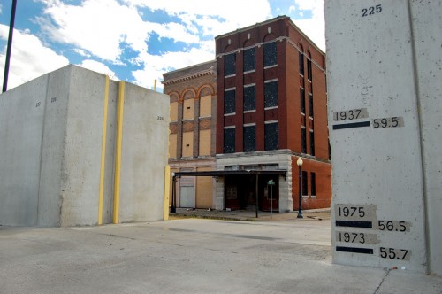
How safe is that flood gate?

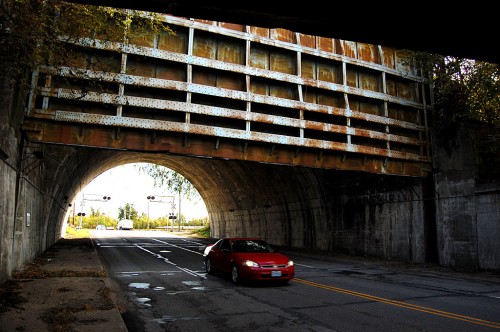
I’m sure that everyone who has driven under the massive flood gate at the north end of the city has wondered, just how safe is that thing, anyhow?

A plaque in the tunnel says “The Big Subway Gate” was built in 1914. It’s 60 feet wide, 24 feet high and five feet thick. Even though it weighs 80 tons, it has a counterweight that weighs almost as much, so it can be operated by two men, one at each end.

The other thing that Dad always impressed upon me was that Cairo was a notorious speed trap. Don’t go even one mile per hour over the limit, he warned on every trip through.

My first riot
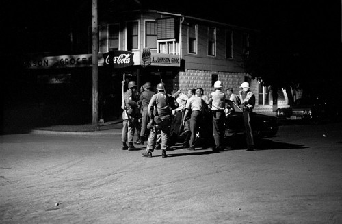
I covered my first riot in Cairo. Actually, by the time I got there, the National Guard had been called out and things had pretty much settled down. Still, I learned some lessons that served me well during the turbulent 60s and 70s and 80s.

I’ll have photos from July 1967 and will touch on the turmoil that sent the city’s population into a freefall.

Elegant mansions

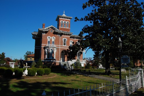
Cairo is noted for its historic buildings. The Magnolia Manor is one of the most famous. Within a block of it, I saw one that could be fixed up equally as nicely for an unbelievably low price.

I have to admit that I haven’t spent much time on the pretty side of town. Years ago, when I was first getting into this racket, someone asked, “Do you want to shoot for National Geographic?”

I responded, “I don’t think that’ll work out. National Geographic photographers stand on trash cans to shoot pretty pictures of roses. I trample roses to shoot photos of trash cans.”

Collapsing buildings
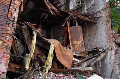
It’s equally noted for its decaying buildings. I took this picture Oct. 28, 2008.

Whole block knocked down
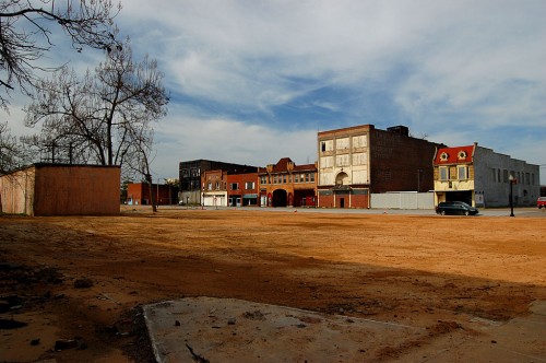
When I came back in April of 2010, the whole block had been knocked down.

“Why?” the sign asks
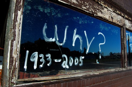
“Why?” reads the sign on what I think had been a bar. I’m assuming the 1933-2005 refers to the years of operation.

The bigger question is “Why didn’t a city located at the confluence of two of the nation’s largest rivers ever meet its potential?”

I ask your indulgence while I step outside Cape County for a few days to share with you some of the hundreds of photos I’ve taken in Cairo over the last nearly 50 years.

I hope it’ll still be there on my return. The bridge leading to Wickliffe was closed, so I couldn’t go that way on my way back to Florida this trip.

Cape Mississippi River Bridge RIP (Rest in Pieces)

The old Cape Mississippi River Traffic Bridge was an adolescent adrenaline rush, a white-knuckled journey of fear and angst; it was an inconvenience, it was the site of personal and family tragedy. It also opened up Cape Girardeau to Illinois and points east when it became the first bridge across the Mississippi River between St. Louis and Memphis.

It was a part of our lives, indicated by the number and variety of the comments left on yesterday’s post about a crash on the bridge.  The span, which was 4,744 feet, 4 inches long, opened to traffic August 22, 1928. A contractor used explosives to drop the bridge into the Mississippi August 3, 2004.

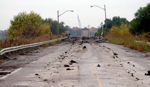
The approach to nowhere

The steelwork has all been removed, but they were still working on removing the bridge piers when I shot this photo from the Illinois side of the river in October of 2004.

Piers the last to go

The massive piers that held the bridge up were the last parts to be demolished. This photo shows the flood gates that are closed, blocking north and south rail traffic when the river gets high. I prowled around under the bridge here and picked up a few souvenir pieces of steel. The Missourian said 160,000 rivets were used in building the bridge.

Missouri approach turned into scenic viewing area

The decorative archway over the Cape approach to the bridge has been preserved and a portion of the span has been turned into an attractive viewing area. I wish that the whole bridge could have been preserved for bicycles and pedestrians like the Chain of Rocks Bridge north of St. Louis, but the Coast Guard considered having two bridges that close together to be a navigation hazard.

Mississippi River Traffic Bridge Photo Gallery

Here is a collection of photos taken of the bridge’s last days in the fall of 2004. Click on any photo to make it larger, then click on the left or right side of the image to move through the gallery.

St. Charles Hotel: General Grant Slept Here

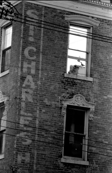
I shot this photo of birds flying around inside the St. Charles Hotel on March 11, 1967, and it ran on the front page of The Missourian on March 13. It had been sold Dec. 16, 1965, and was in the process of being razed when I took the picture. The roof had been removed and the interior was being gutted.

Gen. Grant slept here

Gen. U.S. Grant was registered in Room 5 for 50 days during the Civil War. Carrie Nation, of axe-wielding, saloon-busting fame, was a guest in 1907.

The building was completed in January of 1861. It was THE place to stay at the time. It was four stories tall, had verandas, an observatory, views of the river and large ventilated rooms.

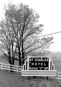
The rooms had electric fans, according to this sign taken between Cape and Jackson April 13, 1967. Of course, by this time, the roof was off and ventilation was plentiful. I wonder what the $1.50 room looked like.

I stayed in an old hotel with spacious rooms in Piedmont for $2 a night during that era, so it’s possible that you COULD get a room that cheaply. The bathroom was down the hall, but it WAS inside.

The Missourian carried a notice of sale July 23, 1965. In it, it mentioned that the hotel building was four stories tall, had 70 feet of frontage, 50 rooms to rent and three tenants on the first floor (with written leases expiring at different times).

St. Charles Drug Store

The St. Charles Drug Store must have been one of the tenants, because a story on Jan. 18, 1967, said that the store was moving to the southwest corner of Broadway and Main St., to the building formerly occupied by the Singer Company. The move was going to require extensive renovations to the ground and second floors of the property.

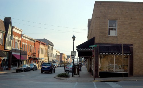
Here’s a 2009 photo of the corner of the property where the Singer Company / St. Charles Drugstore was located.

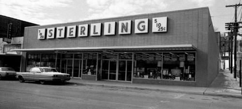
Sterling’s replaced St. Charles Hotel

I shot this photo of the Sterling Store in January 1968. It must have been a cold day, because there is snow on the car parked in front of the store.

When I was home the last couple of times, I walked all of Main St., Broadway and Water St. shooting landmark buildings. The Sterling store must have been non-memorable enough that I didn’t waste any electrons on it.

Links to other photos

The Singer Company building and the St. Charles show up in the backgrounds of earlier stories I’ve posted.

[Editor’s note: things will be a bit slow here for a couple of days. I’m loading up the van to head back to Cape for the reunion, so I may not be posting until I get set up at my Mother’s house again. Hope to see a bunch of you there.]


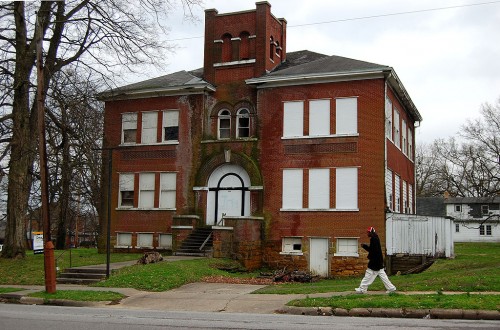
Jefferson, Oldest Standing School in Cape

I went K through 8 at Trinity Lutheran School, so I don’t have much first-hand knowledge of Cape’s public schools. In fact, it was a bit of a challenge to locate Jefferson School, which turned out to the the oldest standing of Cape’s schools.

Located at Jefferson and Ellis

The school was built in 1904. You can read an excellent history of the school, which includes contemporary photos of the interior by downloading the National Register of Historic Places registration form. It’s a large document, so right-click on the link, then choose Save Link and open the file later with Adobe Acrobat.

Population quadrupled

The Civil War slowed population growth in Cape, but the population nearly doubled between 1900 and 1910, and had almost quadrupled by 1925 to 15,258. Much of the growth was in the working class neighborhoods in the area served by Jefferson School.

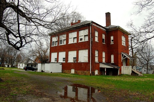
The building had four class rooms on each floor, with a central hallway and two narrow stairwells.

Was Black School 1953-1955

In 1953, Cape Girardeau schools were still segregated. Black students attended John S. Cobb School (originally named Lincoln School)  until the school was destroyed by a fire. White students attending Jefferson were sent to May Greene School, and the 108 Black students were sent to Jefferson School.

Bob Miller wrote an interesting piece for The Missourian when classmates celebrated a school reunion in 2004.

When the school system was integrated in 1955, the school was closed.

Became apartment building

At some point, the interior was converted to apartments, with two apartments on each level.It also served as a union hall.

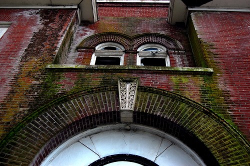
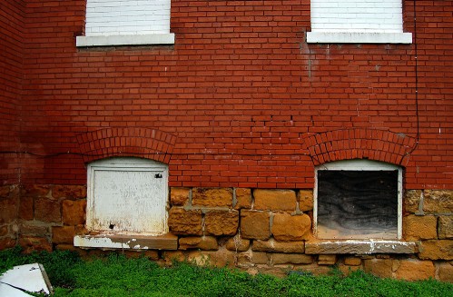
Much of the original wood trim, stairwells and windows are intact. Years of neglect, water damage and vandalism, have taken their toll.

I asked the developer who converted Schultz School into very attractive senior housing if he had considered taking on Jefferson School as a project. He said the building didn’t have enough possible living space to make it practical from his viewpoint.

Gallery of Jefferson School photos

Click on any image to make it larger, then click on the left or right side of the photo to move through the gallery.