Coming back from shooting the Tower Rock Quarry, Friend Shari suggested we go downtown to the Bluegrass festival. Rather than taking my normal route out of Altenburg, I said, “Let’s take the scenic route. That should drop us on 177 and we can go in from the northeast side of Cape.” (You can click on any photo to make it larger, by the way.)
“Let’s take the scenic route” would have been something I would liked to have said when we were dating, except that (a) I didn’t have my license yet and (b) Dad was a pretty good guy, but I’m not sure he, as designated driver, would have gone along with the idea. So, four decades too late, I’m married, in a minivan, in broad daylight, taking the “scenic route.” Somehow it just isn’t quite the same.
We went straight UP
I didn’t realize just HOW scenic it was. Shortly after turning off Hwy CC from C toward the Apple Creek Conservation area, we went straight up. I mean like waiting for the oxygen masks to deploy from the overhead storage compartment straight up. We were headed for the ridges.
See, back in the days before heavy construction equipment was even thought of, road builders didn’t have the ability to cut the tops off hills and fill in the valleys. You rode the ridges, which are generally pretty twisty-turny.
Shades of Wolf Creek Pass
 A line from Wolf Creek Pass, a C.W. McCall song about a couple of truckers with a load full of chickens who lost their brakes on the downhill side of the Continental Divide came to mind. “Well, from there on down, it just weren’t real purdy; it was hairpin county and switchback city. One of them looked like a can of worms; another one looked like malaria germs.”
I looked at the GPS and told Shari, “We’re fixin’ to come up on a curve that would let us touch our tail if this thing was just a little longer.” I forgot to mention that Hwy CC turned into CR 535, which is gravel. We hit on uphill stretch that was so steep that we lost traction and I thought we were going to have to back down to the bottom to get a fresh run at it. It WAS scenic, however.
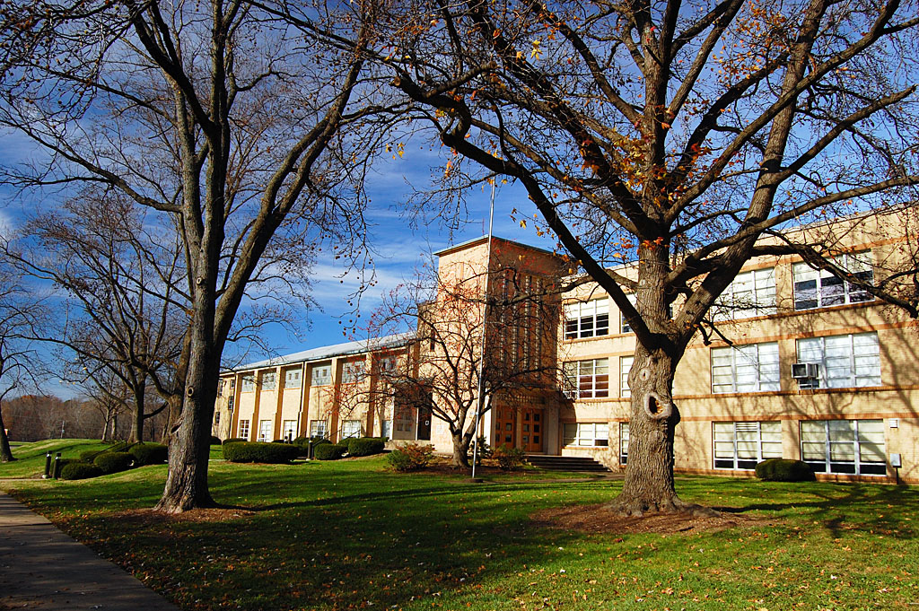
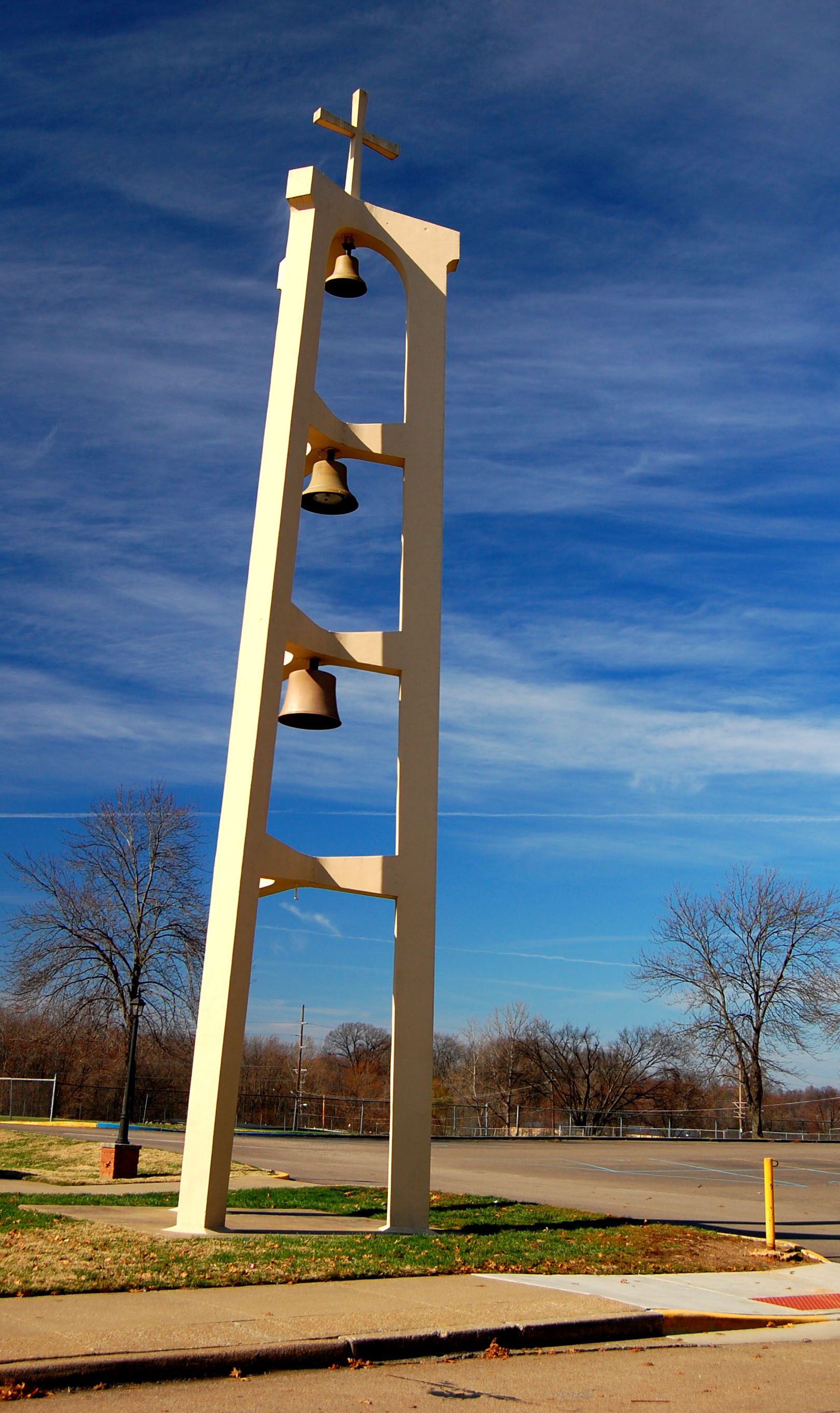
Church at the top of the hill
 Finally, we hit the top of a hill where there was clearing. On the top of that clearing was a white frame building that looked like a church or a school house. I tried to make out a name, but couldn’t. It was getting late in the afternoon, so we kept plugging on.
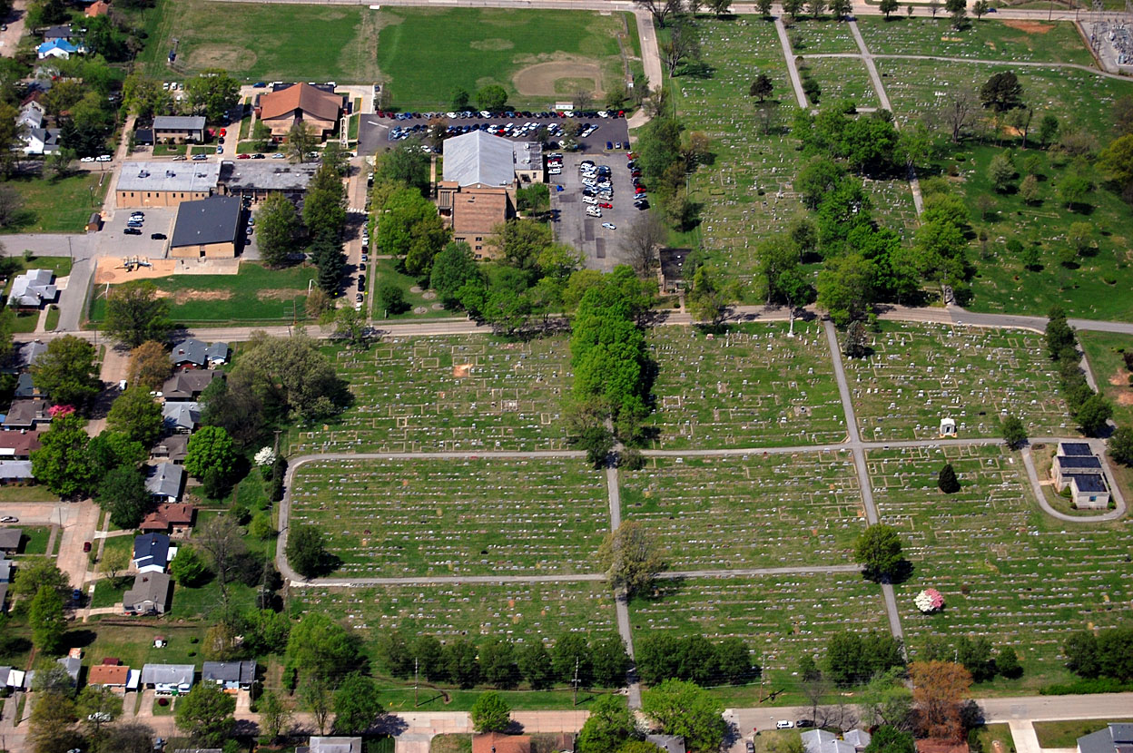
Proctor & Gamble aerial
 Eventually, we turned off CR 535 onto CR 525 and I saw on the GPS that we were getting closer and closer to the Mississippi River. Finally it dawned on me that we were coming into Neely’s Landing from the north. CR525 became Hwy J and hooked around the Proctor & Gamble plant. I had photographed it from the air in the spring, but didn’t have a clue how big it was until we kept passing gate after gate. That took us onto 177 like I had predicted. Eventually we made it to Water Street and heard some good music.
Let’s go back to the school
 A couple of days later, I said to Mother, “Hop in the car. I’m going to see if you’ve ever been on this road before.” Unlike with Shari, we started on the south end of the road. She knew where Proctor and Gamble was, thought she had been through Neely’s Landing, but didn’t think she’d ever been up in the ridges around Apple Creek Conservation area.
I wanted to take a second gander at this building. It appeared to be in good shape. The paint was peeling off it, but it looked like a bad paint job, not neglect. There’s a chain link fence around the property that’s so new it still has the bar code stickers on it.
Looking through the window
 The windows looked like they had been replaced not long ago; the pews, which looked padded, appear to either be new or in extremely good shape. The floor looks solid and the walls have either been stripped of paint or they’ve been recently plastered or drywalled.
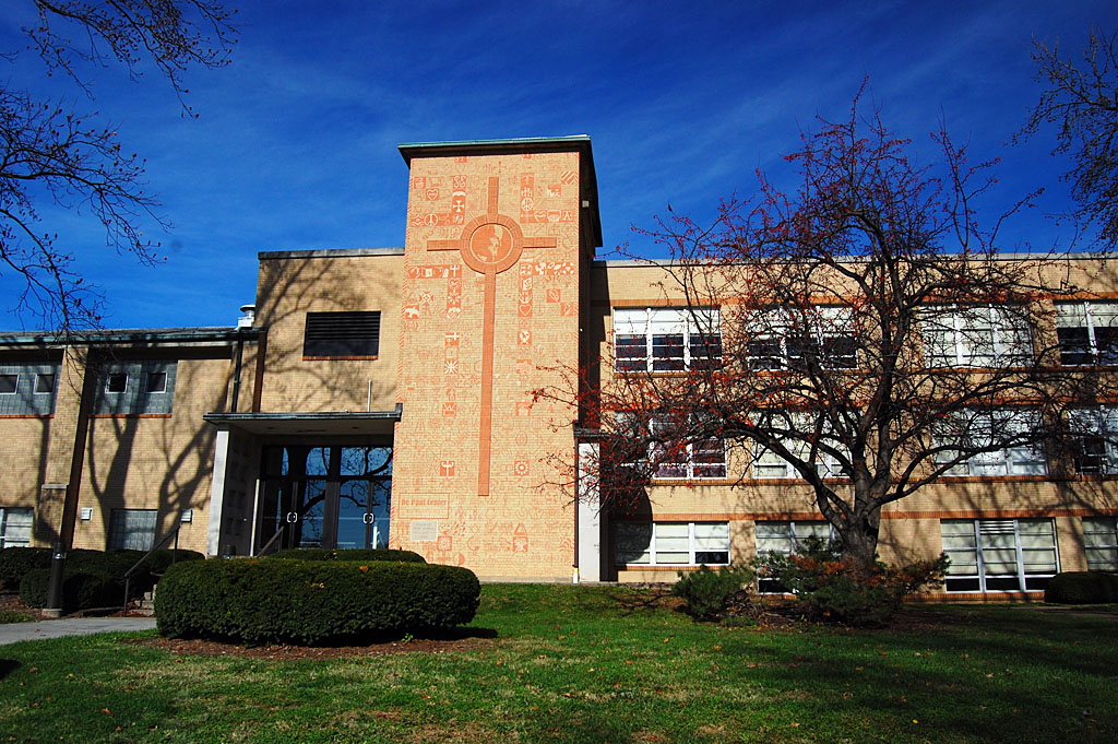
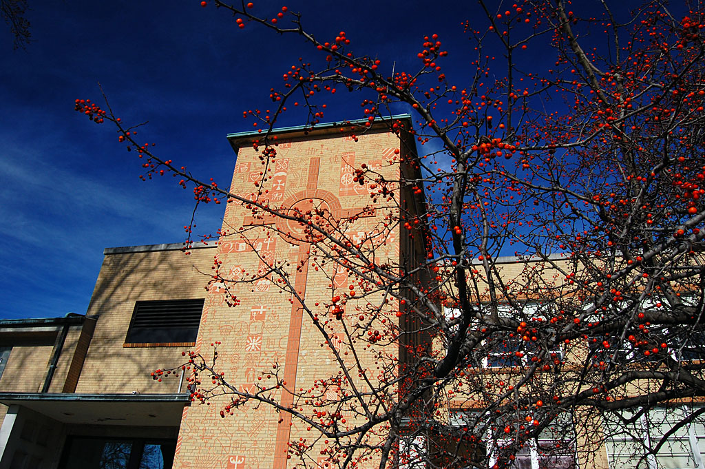
No name on the building
 There’s a wooden plaque that looks like it might have contained a name at one time, but there’s no visible writing on it today.
Small cemetery behind church
 There’s a small, well-kept cemetery behind the building.
The gravestones are relatively new
 I didn’t spend much time poking around, but one of the oldest markers I saw was for a World War II PFC named Ralph Craft. He was born (it looked like) Sept. 6, 1925, and died Oct. 17, 1946.
This stone, which looks like it might have been chipped by a mower, only dates back to 1949.
Some markers are from the last decade
 A large percentage of the makers are from the late 1990s up to as recently as 2010.
Restroom facilities out back
 An outhouse serves as a restroom.
Child’s grave has surprise
 I always have a strong emotional response when I see a child’s stone in the cemetery. This one was particularly touching because of the toys on the right side of the stone. I don’t know if they are still there because there’s little traffic in the cemetery or if any visitors who do come this way respect what they stand for.
While photographing this pair of stones – a brother and a sister who died of unrelated causes – I thought something looked odd, but couldn’t quite place what it was. Then it dawned on me: the statue of the dog is holding a lantern. And, the bulb in the lantern was glowing in the late evening light. (You might even be able to see it in the photo if you look closely.) That’s when I noticed it was a solar light.
Blumental graves gave clue
Reader Keith Robinson was in town visiting his dad and stopped by. I was describing my mystery when he suggested we pull up Google Maps to see if we could spot the building. Indeed, it was clearly visible, but unidentified. Up the road a piece, though, was a marker for High Hill School.
I did a search of Missourian archives for High Hill and came up with some obits for several people, including Michelle Blumenthal. They mentioned interment in High Hill Cemetery. A couple of them said the deceased had been members of High Hill Church of God.
Michelle’s brother, Christopher Michael Blumenthal, died at 12 of complications from heart surgery in 2003. Dammit, it’s OLD people who are supposed to die, not kids.
So, it looks like the cemetery is named High Hill and the church might be as well, although I don’t know if it’s still a Church of God congregation. I don’t know if High Hill School still exists, either. Looks like another excuse to take the scenic ridge route.

 Someone on Facebook asked about the County Farm Home that was located at what is now North County Park. I mentioned that I had taken a photo of the small monument “IN MEMORY OF THOSE WHO DIED IN OUT COUNTY FARM HOME” when I did a story about Memorial Park Cemetery on the other side of the highway.
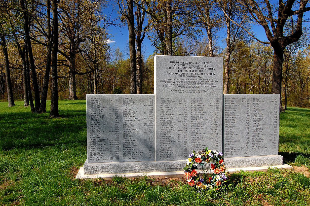
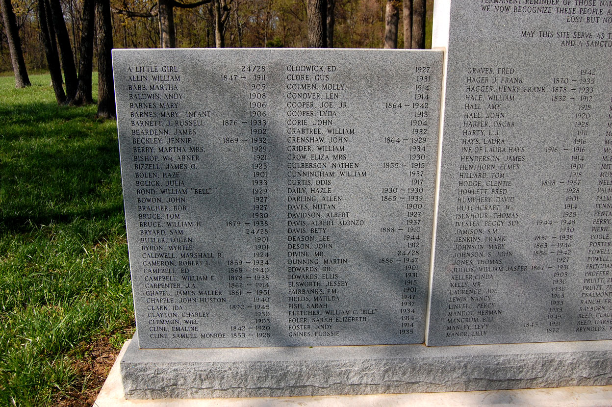
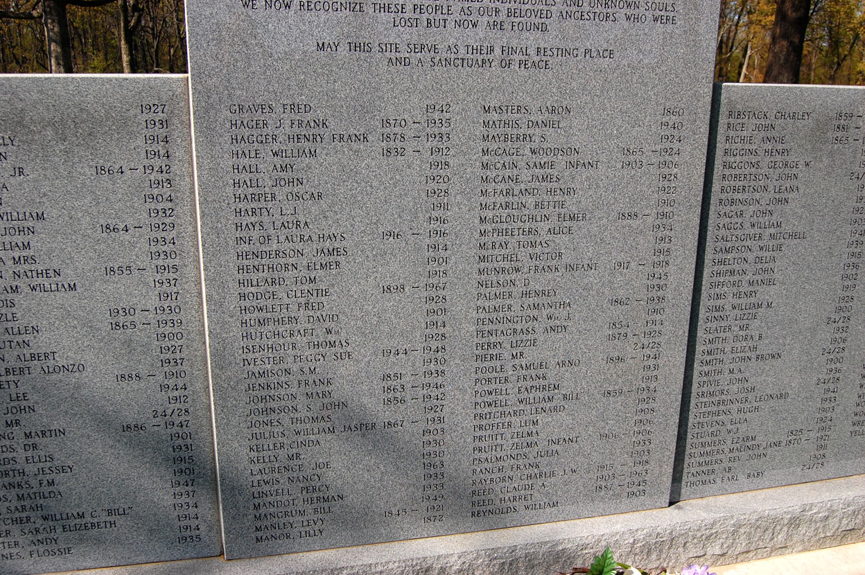
 That reminded me that I had photographed the much more touching Stoddard County memorial across from the Bloomfield Missouri Veterans Cemetery and just down the road from the Stars and Stripes Museum and the Stoddard County Confederate Memorial.
 This memorial has been erected as a tribute to all those men, women and children who were laid to rest in the Stoddard County Poor Farm Cemetery in Bloomfield, Mo.