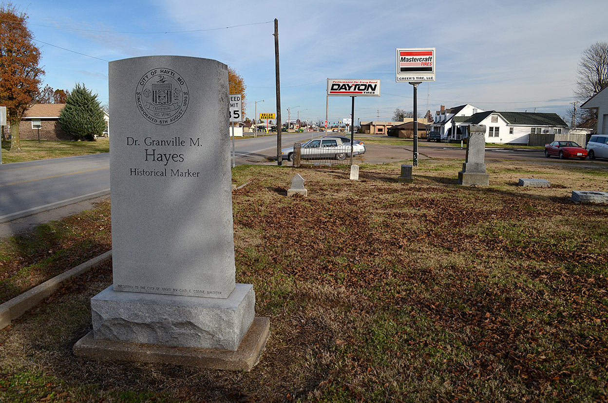
 Mother has some serious eagle eyes. She can spot a tiny cemetery on the side of the road faster than Curator Jessica. On the way back from interviewing Bishop Armour in Hayti for my New Madrid baptism project, Mother pointed out some tombstones alongside the road mixed in with some strip malls and commercial buildings. It was worth a U-turn.
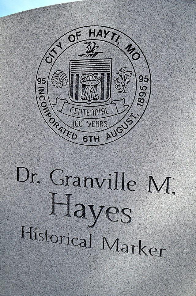
Dr. Granville M. Hayes 1827 – 1899
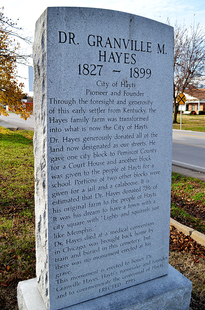 A tall stone dominates the tiny Hayes Cemetery. It says, Through the foresight and generosity of this early settler from Kentucky, the Hayes family farm was transformed into what is now the City of Hayti. Dr. Hayes generously donated all the land now designated as our streets. He gave one city block to Pemiscot County for a Courthouse and another block was given to the people of Hayti for a school. Portions of two other blocks were given for a jail and a calaboose. It is estimated that Dr. Hayes donated 75% of his original farm to the people of Hayti. It was his dream to have a town with a city square with “Lights and squirrels just like Memphis.” Dr. Hayes died at a medical convention in Chicago and was brought back home by train and buried in this cemetery, but there was no monument erected at his grave. This monument is erected to honor Dr. Granville Hayes, Hayti’s namesake and founder and to commemorate the centennial of Hayti. Erected 1995.
History is like a bumper sticker
I was talking with Dr. Lily Santoro about doing a presentation for her SEMO historical preservation class. I hope I can get across to the students that historical markers are like bumper stickers: they are a quick read, but they may not tell the whole story.
When I searched for Dr. Hayes, not a lot popped up, but what did was fascinating.
At the time the Hayes and their daughters donated the land, the Pemiscot county seat was located at Gayso, several miles to the east. Louis Houck (remember him) and J.E. Franklin were promoting a railroad from Caruthersville to Kennett. They reached an agreement that they would run this road through the Hayes land if they would lay out a town on it and deed every alternate lot to Houck and Franklin. Block 29 was dedicated to be used for a courthouse and the other stuff mentioned on the memorial.
Then, partially because of a conflict between the “wets” and the “drys, Caruthersville, not Gayso City / Hayti was made the county seat. The June 9, 1910, Hayti Herald bannered a headline, “Likened Unto An Octopus – Caruthersville Has Waxed Fat at the Expense of the County Which Like a Lamb, Lies Dumb Before Its Sharers.” [Editor’s note: I wonder if the paper meant “shearers?”] Anyway, you don’t get to read many stories today where the word “Judas” is used twice on the front page. They, obviously, weren’t happy at the way things worked out. If you like the days when newspapers had real fire in them, check out this link.
Now it gets REALLY confusing
Here’s where it REALLY got confusing. Since Block 29 wasn’t used for a courthouse, there was a bunch of wrangling over who should get the land. The matter hadn’t been decided when The Hayti Herald weighed in again on January 26, 1911. It did a pretty good job of summarizing the issues, but this nice turn of phrase jumped out: “So the county has itself no power to act in the matter, even in a thousand years or a million years or when Gabriel blows his horn, except to use the property for courthouse purposes, for the reason that every lot that has ever been sold in the City of Hayti have been sold with reference to this plat.”
Supreme Court Judgement
I’m not even going to try to interpret the twists and turns of Williams et al. v. City of Hayti (No. 17705) as reported in the Southwestern Reporter, Volume 184. You can read the Missouri Supreme Court Rehearing Denied March 30, 1916, report for yourself. I made a wise decision to go into photography and not law way back in high school. Taking pictures doesn’t make my head hurt.
Dr. Granville didn’t get Hayti made into the county seat and he didn’t get his courthouse. Now that I know what to look for, I’ll have to see if he got “a city square with ‘Lights and squirrels just like Memphis.’”