Corn, Sunset and Pipeline

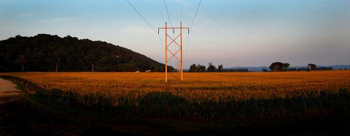
I was rocketing along a levee road trying to get a good angle to shoot the suspension pipeline over the Mississippi River between Grand Tower, Ill., and Wittenberg, Mo., when I saw the sun light up the tassels on on a corn field. It was worth stopping for 45 or 50 seconds. Click on the photos to make them larger.

Longest suspension pipeline in the world
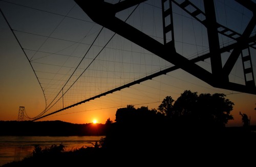
When it was built, this pipeline was said to be the longest in the world. Someone saw some of the photos I’ve taken of it over the years and suggested it would be a nice souvenir photo book to go along with a couple others I’m working on.

I have shot it from below while working on a story about a ferry that crossed under it; I’ve shot it from the north, west, south and the air. This was the first time I’ve shot it from the Illinois side.

Must be getting old

I had been there about an hour earlier and got some nice pictures, but after heading north along the river and not finding a good angle, I decided to race the sun back to here. I made it with about five minutes to spare. When I blasted over the top of the levee and screeched to a halt, Mother yelled, “Whoa!”

She never yells. “Whoa!”

She yells “Gun it!”

She must be getting old.

Jackson High School

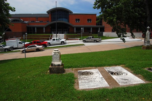
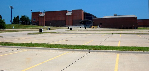
I was over at the Jackson Cemetery looking for grave markers for Find A Grave, a website that runs requests for photos of stones for people doing genealogical work and the like. When I got to the west end, I noticed that Jackson High School was a lot bigger than it was when I worked at The Jackson Pioneer.

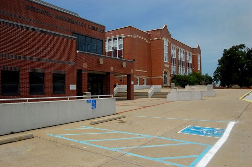
Science / Mathematics Building

I was encouraged to see a building devoted to science and mathematics. A newly-built high school in town that shall be nameless seems to have plenty of facilities for athletics, including a new football field, but the emphasis didn’t appear to be on academics.

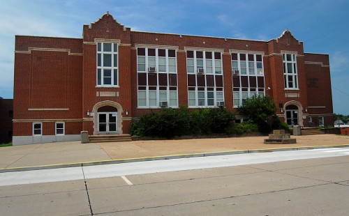
Old building looks well-maintained

I know I must have been in the building lots of times when working for The Pioneer, but I can’t picture what the inside looks like.

Jackson’s stadium a federal stimulus program

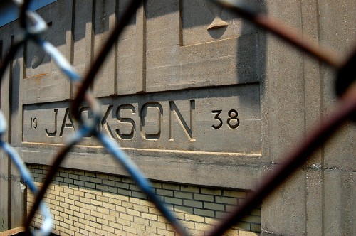
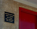
Jackson High School’s football stadium was one of the WPA’s projects designed to put people back to work during the Depression. It was built in 1938. It’s amazing how many Cape County buildings were built under those stimulus projects. They might have been make-work jobs, but they’ve provided a lot of value to the community over the last three-quarters of a century. Jackson’s swimming pool, also built in 1938, was another WPA program.

Acres of parking lots

Here’s a view of the school from the west showing acres of parking. Contrast that with the aerial photos of the school I took in the 1960s.

Jackson High School Photo Gallery

Click on any photo to make it larger, then click on the left or right side to move through the gallery.

The Benton Hills

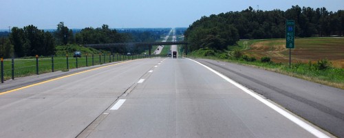
Just as I crested the hill near the 82.8 mile marker southbound on I-55 Monday, I grabbed my camera off the center divider to photograph the Benton Hills. I read a novel once that said that just south of Cape Girardeau you go down a hill that marks the end of civilization before entering the Bootheel and The Old South.

The Benton Hills are part of Crowley’s ridge that begins just below Cape Girardeau and extends south to Helena, Arkansas.

Most prominent feature in Mississippi Valley

Although it averages only three to twelve miles across, its height, up to 300 feet above the flat lowland, makes it the most prominent feature of the landscape of the Mississippi Valley from Cape Girardeau to the Gulf of Mexico, per SEMO’s Center for Regional History. Until the ridge was broken at the Thebes Gap, the Mississippi River used to run down the lowlands through Advance and Arkansas, with the junction of the Ohio and Mississippi Rivers being as far south as Natchez, MS, instead of Cairo, IL.

The Hills could play a part in The Next Big One, an earthquake like the New Madrid Earthquake that sent the Mississippi running backward and rang church bells in Boston.

River’s Going Down

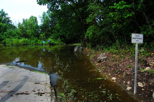
When Buddy Shari and I tried to visit Wittenberg June 27, we encountered a sign that read “Road Closed.”

“Only one lane is closed,” I assured her as I dodged around the sign.

When we hit a sign that warned, “Road under water 500 feet,” I said, “We don’t have to worry for 499 feet.”

When we got to where the photo was taken, I said, “Looks like it’s only a couple of feet deep. We should be able to make it.”

“Let me out here,” she said.

“See, that’s the difference between you and my mother. Mother would say, ‘back up about a hundred feet and get a run at it.”

Muddy and dusty today

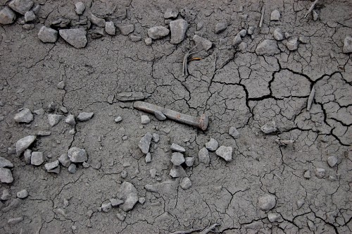
The road was passable today. I went down to Frog Town (once a Wittenberg suburb) where the old train depot was. The gravel road was a little wet in some spots and would kick up dust in others. There’s a general coating of dried mud over everything.

Broadway floodgate open

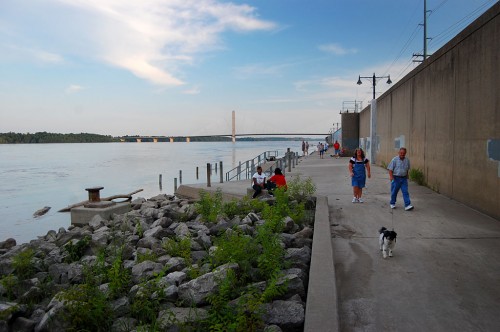
The river’s still high enough that the Themis floodgate is closed. The Broadway gate, which is on higher ground, was open July 13 and lots of people were taking advantage of it. What’s really nice is that folks become friendlier as soon as they step onto the riverfront. It’s easy to strike up a conversation with perfect strangers. Even the dog gave me a welcome slurp when I held out my hand.

I used to dislike the floodwall because it blocked the view of the river. I’ve grown to appreciate it because, on the other hand, it also blocks out the noise and bustle of the city, creating a quiet space where you can listen to the water going by or have a pleasant conversation.