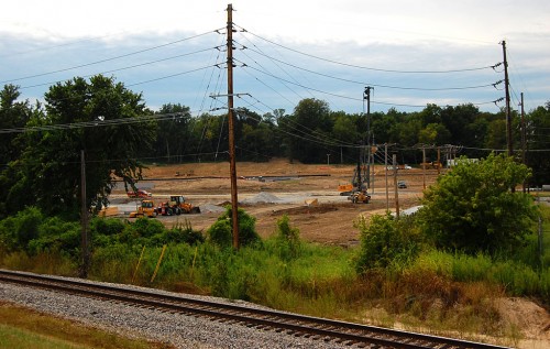
 I was riding my bike north on the new (to me) river trail that ends at Sloan Creek. I could hear construction equipment on the land side of the floodwall, so I welcomed an opportunity to go up a gravel road leading to the top of the levee to take a peek. Here’s what I saw. This is on the north end of the Casino construction zone. (You can click on the photo to make it larger.)
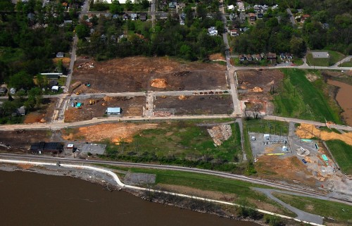
Aerial from April
 This is what the area looked like in April. The recent photo was taken just south of the power substation in this picture. You can see the white concrete river trail running along the water’s edge. Where the concrete seawall ends and the earthen levee begins, it jogs to the east. Just beyond it, you can see the gravel access road I went up. The photo was taken on the south end of the gravel area, looking slightly southwest.
Here are other casino area aerial photos taken in April 2011 and November 2010.

Ken, if you notice, there is a brick structure in the lower left of the above aerial photo. That structure was built around 1908 and was the Morrison Ice and Fuel Company. It remained as such until sometime around 1931, when it is identified on Sanborn maps as Riverside Ice and Fuel Company. This business made ice for sale to city residents and also served the local railroad by providing ice for the old ice-cooled reefer cars.
Thanks, Keith. I shot a few frames of it in 2009 and have always wondered what it was used for.
I wonder if it’s been knocked down yet and if not, how long it’ll be before it’s history, too. It looked like it was in pretty good shape.
Ken, there is a great view of the construction progress from Mill Street, at the upper left of your aerial shot.