 I’m working on a big project on Wittenberg, a once thriving German community in Perry County that couldn’t stand up to the 1973 and 1993 floods. When I was there before this year’s flood, it was down to two buildings and three residents.
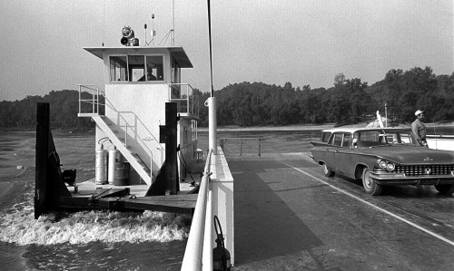
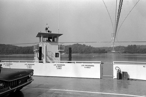
Here are photos I took of the Tower Rock Ferry shortly after it started operating in October of 1966. That’s my 1959 Buick LaSabre station wagon in the photo. (I point that out because there’s a group of folks who collect them and search out every picture they can find of them.)
Ferries have served since 1870s
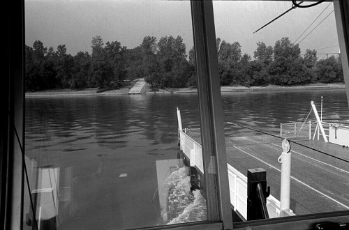 Mary Beth Mueller Dillon’s book on Wittenberg says that The Wittenberg Ferry & Reality, a large ferry, operated between Grand Tower and Wittenberg, a “favorite crossing place for covered wagons.”
Ferry stories in The Missourian
- Mar. 2, 1927 – The Wittenberg Ferry is now running again for the season. Your business is appreciated. Otto Lungwitz, Owner.
- Mar. 17, 1932 – The Wittenberg ferry has not been in operation because of ice. Drivers of several cars have been disappointed. The ferry will start service again as soon as the ice is gone.
- Mar. 23, 1932 – The Wittenberg ferry was busy Sunday, with no ice in the river. Ray Murry has bought a 1911 model Buick, said to the oldest car in good running condition in Perry County.
- Mar. 31, 1932 – The Wittenberg ferry is busy transporting corn trucks, as large supplies are coming from Illinois to Missouri.
Inmans start Grand Tower Ferry
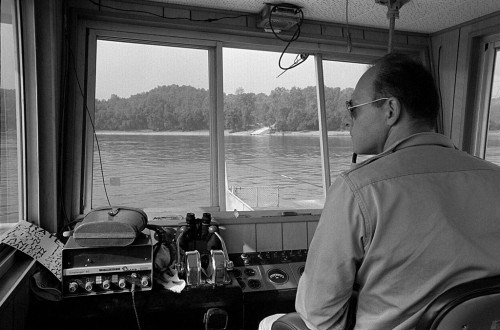 A newspaper story Oct. 7, 1966, said that dual ribbon cutting ceremonies in Missouri and Illinois will mark the start of ferry service between Wittenberg and Grand Tower, Ill. Mrs. Charles Inman, who with her husband, will officially christen the pusher boat, Miss June. The barge and push boat, which can haul six cars at a time, was built in St. Louis.
The Miss June will succeed Miss Bertha, which served from Oct. 1922, to May 1942, under the management of Otto L. “Nick” Lungwitz. The ferry was discontinued when it became too small to accommodate modern vehicles. The journey will take motorists under the 2,150-foot Texas-Illinois pipeline bridge, the longest such bridge in the world.
Crosses under Texas-Illinois pipeline
 Sally Wright Brown wrote a story Nov. 24, 1974, about June Inman being the second licensed woman towboat operator in the United States. Her family has been in the ferry business since 1895. Her husband had been piloting the boat until he took a job at the East Perry Lumber Co. in Altenburg.
The Miss June was attached to the middle of the barge with a hinge. When the ferry reached the far shore, the push boat would pivot on the hinge to set up for the return trip.
“Floating section of a highway”
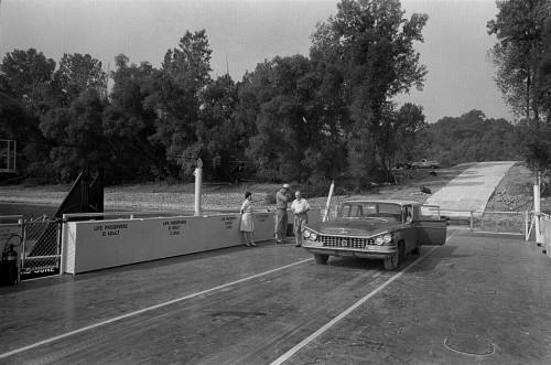 Someone described ferries as being a “floating section of a highway.”
This “floating highway” saved drivers a 70-mile round trip drive to Chester, Ill., or Cape to take a bridge across the Mississippi River. When the service started, fare for a car was $1.50, later raised to $2.50. A tractor trailer cost $3.50.
I don’t have the exact date when the ferry ceased running. The Dillon book said that the Inmans ran it from 1966 to 1976.
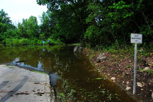 When Buddy Shari and I tried to visit Wittenberg June 27, we encountered a sign that read “Road Closed.”
 The road was passable today. I went down to Frog Town (once a Wittenberg suburb) where the old train depot was. The gravel road was a little wet in some spots and would kick up dust in others. There’s a general coating of dried mud over everything.
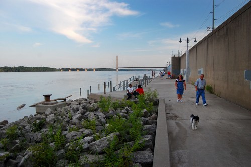 The river’s still high enough that the Themis floodgate is closed. The Broadway gate, which is on higher ground, was open July 13 and lots of people were taking advantage of it. What’s really nice is that folks become friendlier as soon as they step onto the riverfront. It’s easy to strike up a conversation with perfect strangers. Even the dog gave me a welcome slurp when I held out my hand.
