I Loved My Red Wing Boots

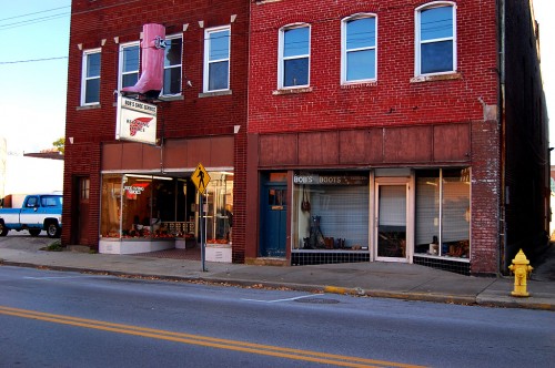
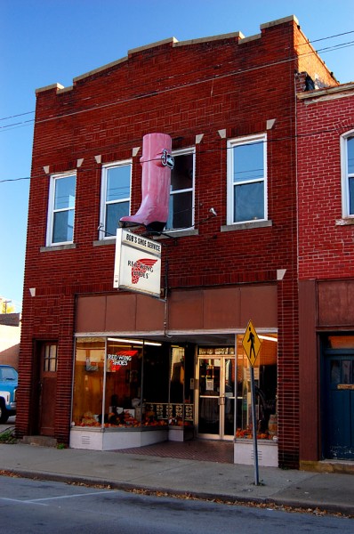
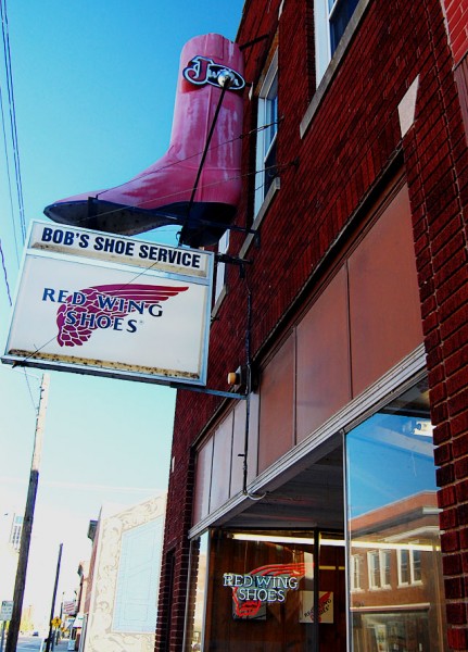
I made semi-annual pilgrimages to this building displaying a boot for at least 20 years.

The Missourian announced on Jan. 27, 1985, that Bob’s Shoe Service at 515 Broadway was expanding. Owner Bob Fuller bought the building on the right from C.W. Bauerle, doubling his space from 1,500 square feet to 3,000.

The story said that Fuller had “been in the shoe repair business for 32 years, and in addition to this engaged for a time in making saddles, and at the present produces leather belts and other items. Fuller is assisted in his business by his sons, Wade and Scott.”

I’m not sure exactly when I bought my first pair of Red Wing boots, but it was sometime between The Athens Messenger and The Gastonia Gazette in the late 60s – early 70s.

Shoes through the ages
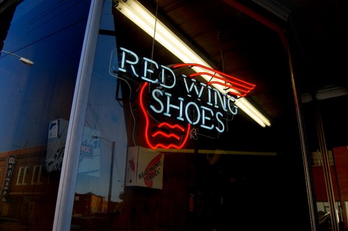
[Note the reflection in the bottom left of the photo. Click on it to make it larger. The Walther’s sign hadn’t been changed to Discovery Playhouse yet. These pictures were taken Oct. 24, 2009.]

I was no stranger to manly, blue collar shoes. Even back in grade school I wore a modified high lace-up combat-style boot. When I worked for Dad one summer, I had some low-cut work shoes that were sturdy and serviceable.

I think I wore loafers in high school. Not penny loafers, I’m positive. No tassels, either.

When I went away to college, I recall going through a Hush Puppy suede shoe stage. At some point, I bought some fur-lined slip-on boots in Ohio that were nice and warm when it got cold and nasty. I wore them until they became, shall we say, odoriferous, and I passed them on to Brother David, who wore them many more years. He lived in Oklahoma, where standards were lower.

Red Wing boots: perfect photographer shoes
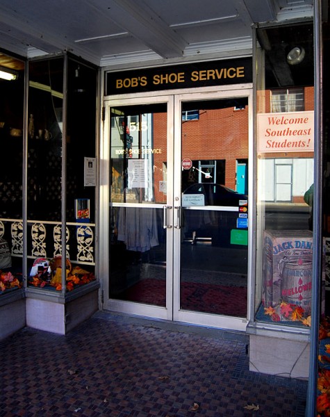
Something lured me into Bob’s, where I discovered the Red Wing work boot, which I thought was the perfect footwear for a newspaper photographer.

  • They were quick to slip into.
  • If you polished them, they’d take a shine like an expensive dress shoe.
  • If you put mink oil on them, they’d get soft and repel water.
  • They were high enough that you didn’t have to worry about wading through water, sand or mud. (And, it didn’t matter if your socks matched. You couldn’t see them.)
  • You could climb rock cliffs, walk through construction sites without worrying about stepping on nails and be reasonably certain that you were safe from snakebite as long as you were around lazy snakes.

No BS uniform
Every once in awhile I’d want to go onto a construction site to shoot pictures, but some foreman would say, “Well, I’D give you permission, but you have to have a hard hat and the right kind of shoes. Safety regulations, you know. Sorry.”

I’d walk back to my car and dig out my safety-approved white hard hat. On the front of it was a drawing of a bull squatting down making a deposit, surrounded by the international symbol for “No.” I’d return to the foreman, don my “No BS” hard hat, hike up my pants leg to display my Red Wing boots and say, “OK now?”

Rarely did the foreman come up with another hoop for me to jump through.

Boots cost more than a suit
The only drawback was that the boots cost $75 in the days when you could buy a SUIT for $25. OK, let me amend that. I could buy a suit for $25.

Despite the high cost – more than half a week’s pay – I usually had at least three pair of the boots in wearing sequence.

  • A new pair for when I needed to be presentable – that set was polished.
  • The ones I wore for work – mink oiled and waterproofed.
  • A beat-up pair kept in the trunk for truly grody situations.

It just dawned on me that I haven’t seen a pair of Red Wing boots in the closet since Son Matt got big enough to wear my shoes.

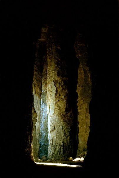
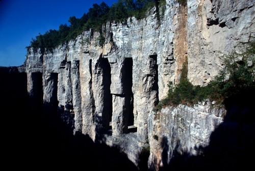
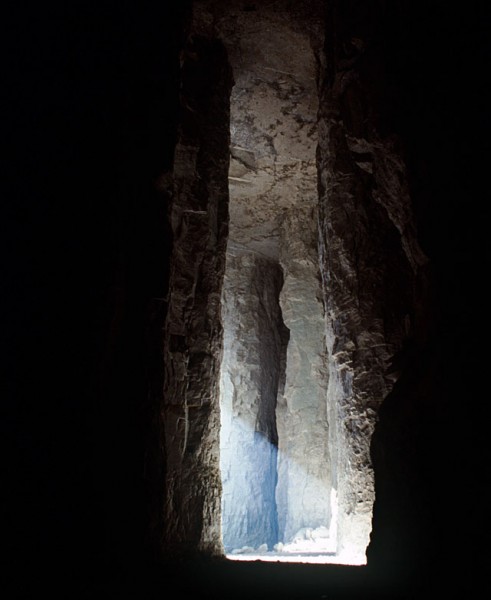
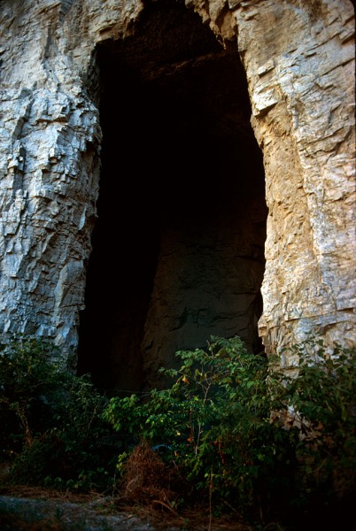
Cement Quarry Caves

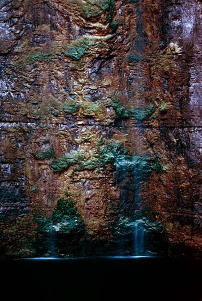
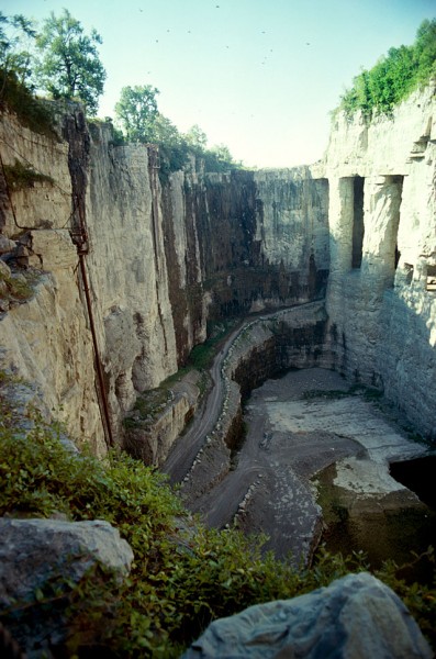
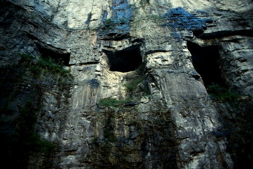
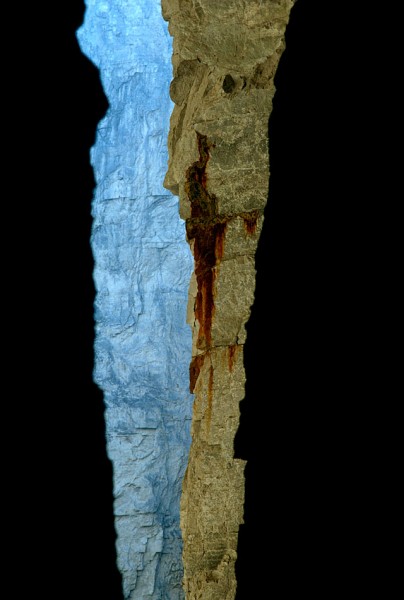
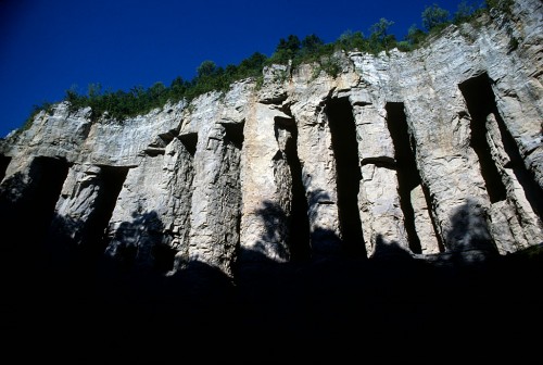
Sometime back in the 70s, I heard that the Marquette cement plant was going to blow the caves that had been made to quarry limestone in the days before heavy equipment made removing overburden easy. (Click on any photo to make it larger.)

It might have been The Missourian’s story with a whole page of Fred Lynch photos on Page 6 that tipped me off. Here’s the link to the story about the caves. You’ll have to page back to see his pictures.

Pitched story to architectural magazine

I pitched the story idea to an architectural magazine. They wouldn’t give me an assignment, but they said they’d look at whatever I shot. I don’t recall if they eventually turned the story down or if I never got around to submitting it to them. I think it was the latter.

So, the Kodachrome slides spent 30-plus years in storage, where the color shifted slightly.

Edward Hely founded company in 1904

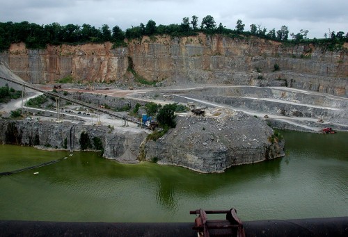
The Missourian’s story said that Edward Hely started the stone company in 1904; it bore his name until 1931, when it became the Federal Materials Co. The quarry was known as the Blue Hole because of the color of the water when it filled up.

Marquette Cement bought the property in 1976.

By the time Marquette Cement bought the property in 1976, the two quarries were separated by just about 100 feet, most of which was taken up by a network of caves. Federal Materials found it easier to dig horizontally to extract the limestone than to remove 35 to 50 feet of overburden – earth and lower grade stone – to get to the rock.

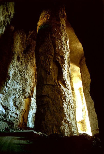
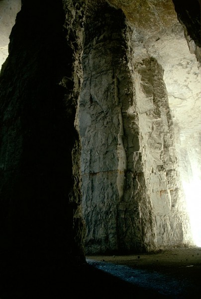
When the tunneling stopped, the quarry was about 375 feet deep. The pillars averaged 150 feet in height and were 35 to 45 feet in diameter.

Caves collapsed in 1981

In its May 17, 1981 edition, The Missourian pulled out all the stops to cover the collapse of the caves. Fred captured the action and reporter John Ramey wrote a first-person account of seeing a million tons of rock collapse on itself. The story said that crews spent two months drilling 850 blast holes and loading them with 600,000 pounds of dynamite. Some of the deepest 200-foot holes contained as much as 1,400 pounds of dynamite.

You could walk a long way

Present-day Buzzi Unicem plant manager Steve Leus was part of the team that handled the blast. When he gave me a tour of the plant and the quarry last fall, he said, “I was in the caves myself. It was massive. You could walk a long way before you came to the end of that cave.”

Columns were massive

“The columns were massive,” he continued. “They had to be to hold up that roof.”

They way they mined in those days, he explained, was “they drilled into the side of the limestone, then they blasted, then they mucked it out. Basically what they ended up doing was tunneling.”

You wouldn’t make that mistake twice

“They had a feel for what size column to leave to support the roof, and, if they didn’t, they didn’t make that mistake twice,” Leus said.

Some of the tunnels are under Sprigg

Leus pointed out some of the tunnels that extend under Sprigg Street. “We don’t know how far back they go,” he said. Present-day safety regulations make it complicated to enter what is considered a mine, so no one in recent history has explored the caves. (I’ll have pictures of those in the future.)

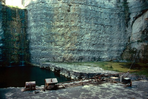
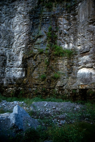
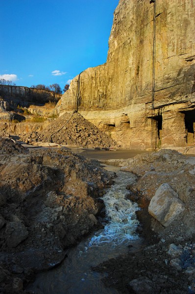
Seep water poured down sidewalls

Ground water would find its way into seams and leak down the walls of the quarry. Pumps would send it on its way through underground pipes until it made it back to the Mississippi River.

Quarry was about 375 feet deep

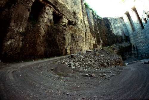
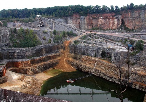
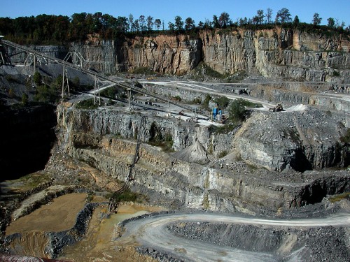
When Marquette Cement acquired the Federal Materials quarry, the deepest part was about 375 feet deep. Access to to the bottom was over rough, steep and curving haul roads.

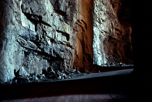
Shafts of light and darkness

You were constantly moving into areas of shade and darkness when you drove along the haul road and through the caves.

Enough stone for another 10-15 years

Leus said there is enough stone in the quarry to last for another 10-15 years. They’re expanding to the north and west now since they’ve gone just about as deep as practical at this point.

A 1981 story estimated the reserves would last about 30 years, so either production has slowed or more rock is being extracted than predicted. The cement plant owns property near Scott City that could be mined in the future.

A place of beauty

There was something to shoot in every direction. This made me think of the grand canyon.

A shame to lose them

It was a shame to lose these beautiful features, but safety regulations would bar anyone from seeing them today, so it may be better that the stone was turned into the Bill Emerson Memorial Bridge and roads and buildings in the region.

More photos to come

I’ll have more photos of the quarry and the cement plant taken last fall. Some of the photos from the 9th floor of the plant show spectacular views all the way to Academic Hall. The day was so clear that Crowley’s Ridge was visible in the distance.


Cement Plant Quarry Fills Up

Whenever I’m in Cape, I hop on my bike and take a run down to South Sprigg to look over the edge of the cement plant quarry. I’ve always been fascinated by the place.

I saw a brief story in The Missourian in the past couple of weeks that the high water and flooding has caused the quarry to fill up. I kept waiting for a longer piece and now I can’t find the original one.

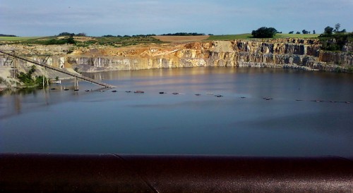
In the meantime, my mother’s neighbor across the street, Bill Bolton, sent me this photo showing that the water is way above the conveyor belt that carries the blasted material over Sprigg St. to the cement plant.

Last week there was a story in the paper saying that huge sinkholes have opened up and swallowed so many pieces of Sprigg Street that it’s closed “indefinitely.”

2002 Blowout

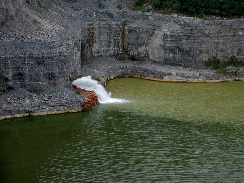
To put Bill’s photo in perspective, there was a huge blowout in July 2002 where a 25-foot-tall plume of water came blasting in. You can click on any photo to make it larger.

Conveyor area still dry

Even with that massive inflow of water, the conveyor area was still high and dry.

By fall 2002, flow was stopped

By my October 2002 visit, the flow had stopped and pumps had taken the water level down substantially.

Nearly drained by October 2003

The water was almost completely gone by Oct. 15, 2003.

Fall 2010 aerial photo

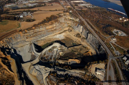
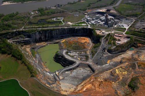
This is what the quarry looked like from the air on Nov. 6, 2010. The paved road on the right is S. Sprigg Street.

Seep water from Cape LaCroix Creek

Nov. 10, 2010, I took a tour of the cement plant and was given my first trip to the bottom of the quarry since the mid-70s. I’ll run photos of that later, along with pictures of the massive caverns that were blasted out by the early miners.

Buzzi Unicem Plant Manager Steve Leus said the water in the photo was coming in underground from Cape LaCroix Creek. Under normal circumstances, pumps can handle the flow.

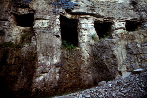
The caves on the right are from some of the early mining. They extend under Sprigg Street. Steve said they’re not sure how far back they go.

Water rising April 2011

The river was just reaching flood stage at Cape when I took this photo on April 17, 2011. The lower portions of the quarry are beginning to hold water, but it’s a long way from where it was when Bill took his photo a few weeks later.

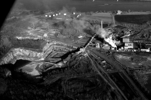
1966 aerial shows expansion

This aerial I shot of the cement plant and quarry shows just how much rock has been taken out in the last 45 years.


Last Wimpy’s Bites the Dust

Generations of Cape Girardeans came of age at Wimpy’s. For most of us it was the grocery store / hamburger joint at the corner of Cape Rock and Kingshighway shown here in this 1966 time exposure. You can see more Wimpy’s photos over the ages and read some interesting comments at my Feb. 8, 2010, posting.

The first Wimpy’s opened in 1942 on the west side of North Kingshighway, near the entrance to Arena Park. Fred and Ethel Lewis ran the establishment while their sons, Freeman and Frank were in the service in World War II.

The youngest brother, Billie (Bill) joined the family business when it moved to the Cape Rock location in 1947. It was a teenage hangout until 1972, when the property was sold to a bank in 1973.

Wimpy’s Skyway Restaurant opened at the Cape Airport in 1960, expanded from 12 to 25 seats in 1961, then closed in 1967.

Moved to 506 S. Kingshighway

Bill opened a new Wimpy’s at 506 S. Kingshighway after the Cape Rock location closed. He catered to the breakfast and lunch crowd.

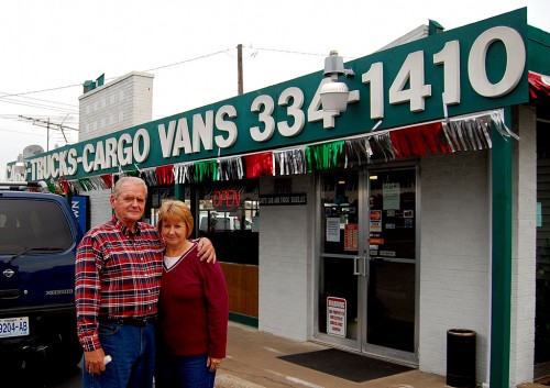
In the late 90s, Gary and Diane Garner, shown above, had a car lot on Morgan Oak. They heard rumors that a new bridge was going to be built. “OK, we’re done,” he said they thought.

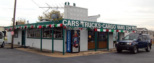
They happened to hear that the woman who owned the Wimpy’s building wanted to sell it after the restaurant closed in 1997, so they moved Gary’s Car and Truck Sales there. I shot this photo Oct. 26, 2009, and didn’t think about running it until Ray Boren (Class of 55) posted a photo and note to a Central newsletter showing that the building had been torn down.

I searched through The Missourian for a story, but couldn’t find anything that would tell what the land will be used for.

All we have left are memories

With the razing of the last Wimpy’s, looks like all we have left will be memories of seven-cent hamburgers, cherry Cokes and endless loops between Wimpy’s and Pfisters.

Lewis Brothers’ obituaries