The Faces of Occupy Cape

The Missourian ran a story about Occupy Cape in the November 6th paper, so I was hoping to run into them. The comments after the story were one of the reasons I’m sometimes ashamed to say I’m from here. Speak Out and the comments that follow stories contain mean-spirited, Yahoo-level talking parts that pass for wit in this area.

In case readers missed it the first time, one of them felt compelled to ask the question, “How about occupying a job?” twice.

Another wrote, “I observed them marching on William, in the hood, not sure what they are protesting Bet you that most of them play dungeons and draggons in their mothers basements.” [Spelling and punctuation as printed in the paper.]

I would encourage you to read the story, then the comments. Some of the demonstrators in this photo posted long, intelligent responses to the jabs and jibes. Click on any photo, by the way, to make it larger.

“Get A Job!”

I spent about an hour on the corner with the group, numbering at most eight, including me. I was surprised at the number of friendly toots and waves they got. Only four people hollered, “Get A Job!”

Eric, who is from the St. Charles area, would respond, “I’m working THREE jobs and going to grad school.”

61-year-old civil engineer

The Old Man of the movement on Saturday was Walden Morris, 61, a civil engineer and an LSU grad. He had been out in Salt Lake City for a year and a half working on a gas and oil pipeline project when he decided to attend a rally just to see what it was all about. Before he knew it, he was on the State Capitol steps speaking to 400 people under the watchful eyes of TV cameras. “I had been waiting for that moment for years. I just let ’em have it.”

“Fed up with the way the country is being run”

Chris McEwen, an art major from Mobile, Alabama, said he “got stranded in Cape for youthful reasons.”

“What was her name?” I asked. He grinned and said, “You got that right.”

He was on the street corner because he’s “fed up with the way the country is bring run.” He’d like to see money taken out of politics.

Came from conservative Democrats

Nathaniel Lee, of St. Louis, came from a family of conservative Democrats. He has a dual major in accounting and international business. He’d like to get his C.P.A. and work as a federal auditor “trying to fix the system from within.”

This IS Cape, after all

The group has a website, Occupy Cape Girardeau.

I had to be amused at a note in the Nov. 12, 2011, General Assembly Minutes: “We opened by appointing by consensus Kerrick Long as this week’s facilitator, after which he read the Principles of Solidarity using the People’s Mic. The principles of solidarity were interrupted when an officer of the Cape Girardeau Police Department arrived and stated that the CGPD received a complaint about the demonstration at Freedom Corner earlier. He said if we did not keep quiet demonstrating by the road, we could go to jail. We apologized, and said we would be sure not to shout too close to the road. He told us we could continue using the People’s Mic at the benches since it was farther from the road.”

Being a bit of a rebel, I’d have asked the cop to bring out a decibel meter to tell me how much more we were disturbing the peace in the middle of the afternoon in a public park compared to other activities in the park. These folks have a lot to learn about civil disobedience and standing up for your rights.

[The Occupy movement doesn’t use mechanical megaphones. They use “The People’s Mic,” where someone who wants to say something speaks in short bursts that are re-shouted by the group. Considering that the largest assembly in Cape has been less than 20, I doubt that hearing the speaker is a problem.]

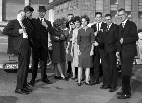
1967 Protest at Petit N’ Orleans restaurant

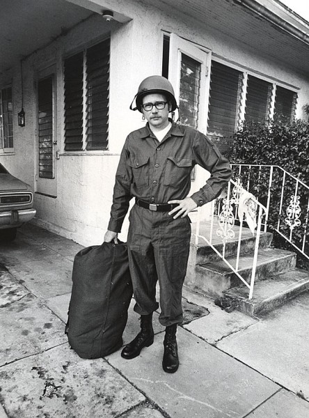
This was the last protest I covered in Cape. These SEMO students were protesting the Petit N’ Orleans restaurant’s dress code in 1967. The cops shut them down, too.

Education costs are rising

Brandon Burton, a pre-veterinary medicine major from St. Louis, is concerned about the rising cost of a college education.

Parts of the Occupy Cape website makes me think I’m back in my treehouse days when I see a whole section in the General Assembly Guide devoted to “Hand Gestures.” The movement strikes me as unfocused and a bit naive at times: long on feel-good rhetoric and short on practical solutions.

I will say, though, if you are tempted to roll down your window and shout “Get a Job!” pull over to the side and talk with these folks. You may find that you have more in common with them than you think. A couple of the members concluded that they and the Tea Party are both saying the same thing: the system ain’t working. They may disagree about what’s broken, how it got broken and how to fix it, but they’re starting from a common viewpoint.


Let’s Save Bloomfield Road Spring

I checked out the middle section of Bloomfield Road yesterday. It’s a nice road if you don’t like trees. So, what can we do to save the last piece, the part from Benton Hill Road to Hwy 74? The answer is, probably not much.

A worker pointed out that the property across from what used to be Mount Tabor Park had been sold and the owners brought in the loggers to clear cut the land. Looks like the really nice trees are gone before the road crews got a crack at them.

Selective cutting

Even where the trees weren’t cut en masse, trees of any size were selectively harvested. It might be that the owner knew the road builders were going to cut them anyway, but it definitely gives you an idea of how tree loss is going to be “minimized” along the stretch.

Days are numbered

This tree probably saw travelers in wagons pulled by horses pass by to shop in Cape. Considering how close it is to the road, I’d say its days are numbered. Just beyond that tree, before the white wooden fence IS something worth preserving.

The Bloomfield Road Spring

I’ve written several times about how my mother and her grandmother used to stop at the spring in the curve of Bloomfield Road just north of Elmwood for water on shopping trips to Cape from Advance. Advance resident and historian Paul Corbin talked about his family camping alongside their wagon on trips to and from Cape.

The spring is still there, crystal clear and running enough to keep ice from forming on it when the nearby ditches were glazed over.

I guess the road folks could put up a tiny marker to remind us of what we’ve lost, not that anybody doing 55 in a 35 could see it or stop to read it.

Wooded homesites; non-wooded roads

A combination of governmental agencies, private logging and people too impatient to drive the speed limit have killed an historic scenic route into Cape Girardeau.

I’d love to save the spring, but I’m not sure that’s practical. If they don’t get it now, they’ll get it when the road is Mount Auburnized to four lanes in the next decade. The clearing of that land signals more development, which means more cars, which means more “need” for speed and “improvements.”

Other road “improvements”

Gallery of Bloomfield Road Photos

These photos show the next and final section of Bloomfield Road that is to be widened. Some are of private property that is adjacent to the road that has been logged. Click on any image to make it larger, then click on the left or right side to move through the gallery.

Bloomfield Road Opens

The paper said Bloomfield Road was going to open today. TV news said it was going to open, but the signs said “Local Traffic Only” when we pulled up there this afternoon. Figuring that Mother was local and I had Florida tags and could claim I was lost, we kept driving. Before long, though, it was obvious that the road was blocked, so I grabbed my camera and started hoofing it. (Just as I was starting to leave, “Ryan” (no last name given) started removing the barricades from the road.) Click on any photo to make it larger.

I gotta tell you I really didn’t want to do this story. I’ve written about how I feel about the loss of an historic scenic road too many times. It’s a battle lost. I was going to make a strong case for trying to save the last segment, but I’ll show you tomorrow why I’m not even sure that battle’s worth wasting energy on. By the way, I refer to Phases 1, 2 and 3: the section in front of Campster School (1); this section ending at the Benton Hills intersection (2), and the final section, from the Benton Hill intersection to Hwy 74 (3). News stories refer to phases up to 5, but they’re dealing in more detail than I am. Sorry for any confusion.

How does it look?

Well, if you hadn’t seen it before, you’d think it looks pretty good. If you’re looking for the trees you knew and loved, they’re pretty much gone. “It won’t take long for the trees to fill back in,” a workman told me.

“Trees that are two or three feet around?”

“Well, uh, no, THOSE trees won’t come back quickly.”

Did they “minimize” tree loss?

On July 21, I wrote this:

Remember back in May when the city held a meeting to talk about the $1.25 million road-widening project? City officials said that as many as 150 trees would have to be taken down in order to widen the road from 22 feet to 28 feet. City Engineer Kelly Green was quoted by Scott Moyers as saying that the city has taken measures to minimize the loss of trees, but that some would have to come down in order to widen the road.

I’m going to say that ALL of the trees that appeared to be close to the right of way line were cut down except for the two next to the portable toilet. I might give the credit for saving three, but I think the one if the foreground was a little bit outside the line. If the city engineer or anyone else involved with the project would like to show me any stealth trees I missed, I’ll be around until the end of the week.

Any good news?

The project DID result in the construction of a nice, hilly curvy bike / ped path. The only problem is that it starts and stops without connecting to anything. The kinds of folks who find trail riding appealing aren’t going to brave traffic on Bloomfield Road to get there on their bikes.

How fast will traffic move?

The speed limit on the new section is 35 mph, the same as the old road. When I commented to my workman friend that one of the problems with the old road was that the 35 mph limit wasn’t enforced and that cars were moving at 45 or 50, he just sort of snorted and said, “at least.” So, how fast do you think they’ll go on a wider, straighter road? I’d love to rent a radar gun and log the average speeds once the road is fully open. Better yet, I’d love to sit out there with a speed cop who needs to make a quota.

Note those trees on the right side of the road? How long will it be before a speeder hits one of those and the outcry is to cut them “for safety?” And, if Mount Auburn Road is any indication – it was originally billed as a scenic drive – we can anticipate a push to make it four lanes within the decade.

Large Wooded Homesites

After all, those people who moved out to the country to enjoy their “large wooded homesites” and golf communities can’t be delayed a few minutes to appreciate the nature enjoyed by generations of the rest of us.

What about the final phase?

When I wrote about the project in July, I was hoping that it would be possible to rally enough support to see that the beauty of the final section of Bloomfield Road was preserved. I’ll post photos tomorrow to show why it may not be worth the energy and shoe leather to do it. I’ll also show the one thing on the final phase stretch that SHOULD be preserved for historic reasons.

Here are other stories about road “improvements”

Photo gallery of Bloomfield Road

Here are more photos of the new section of Bloomfield Road. Click on any photo to make it larger, then click on the left or right side to move through the gallery.

Nash Road Transportation Corridor

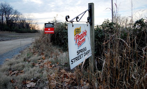
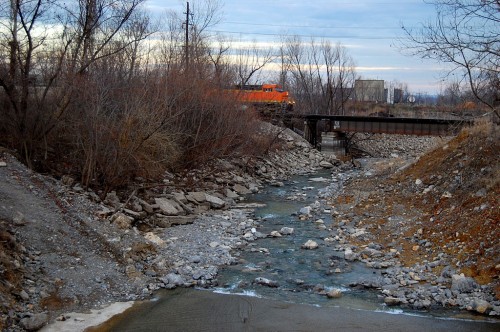
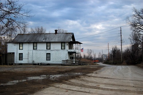
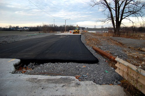
When bicycle tourist John Gorentz, AKA Spokesrider, passed through Cape on his way from Michigan to New Madrid, I tried to pick him a better route to follow than the Missouri River Trail that runs through the hills and curves of New Hamburg. One alternative was to take Nash Road. Unfortunately, at that time is was a dusty gravel road. On a recent trip to the airport to eat, we decided to see if the road was finished. It is and it is really nice. (Click on any photo to make it larger.)

Bloymeyer roundabout

When I was flying aerials in November 2010, I noticed the Bloymeyer roundabout joining Nash Road, Hwy 25 and Hwy 77 had been completed. In this photo, Nash Road comes in from the top left. Hwy 25 from Jackson and Dutchtown is on the lower left and then turns to the right to go to Advance and Bloomfield. Hwy 77, at the top right, goes to Chaffee.

Mario’s Pasta House and a water hole is opening up at the intersection to take advantage of the traffic coming off I-55 and headed through. I wouldn’t be surprised to see other businesses open up, maybe even the old Montgomery Drive-in.

A nail in the coffin for Dutchtown

This is going to put another nail in the coffin of Dutchtown. Northbound I-55 traffic headed to towns south and west of Cape won’t have to go all the way to Hwy 74 and then through Dutchtown. It’ll be able to take a fast (60 mph), straight road with good shoulders straight down to Hwy 25. There’s not much out there yet except farm land, so there aren’t many driveways and side roads to watch.

When Hwy 74 floods at Dutchtown, which it seems to be doing more and more often, traffic has to go all the way to Jackson to get through. Nash Road is on the dry side of the Diversion Channel, so the highway department won’t have any incentive to raise the roadbed in Dutchtown to keep it above water.

Nash Road: south of Diversion Channel

Nash Road starts south of the Diversion Channel and north of the Cape Girardeau Airport.

Road is a shipping hub

I was surprised at the number of warehouses and depots that have grown up on the road.

Railroad derailment

In early October, 15 empty cars on a Burlington Northern Santa Fe train derailed on the tracks that parallel Nash Road. Nobody was injured and no hazardous chemicals were involved, The Missourian reported. I include these photos only because you could see them from Nash Road and because Keith Robinson, a railroad buff, is a regular reader.

Nash Road photo gallery

Here is a gallery of photos taken of and on Nash Road. Click on any image to make it larger, then click on the left or right side to move through the gallery.