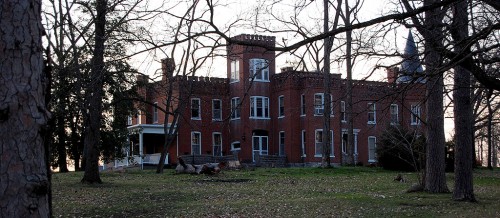
 I knew there was supposed to be a large house located down the gated lane off Bloomfield Rd. past Mt. Tabor as you were heading toward Dutchtown. The property used to be set off with white fences.
When my mother and I were on our way down to see how far the Diversion Channel had backed up, she remarked, “I haven’t been down there in years.”
I confessed that the only time I had been down the road was when I was riding with a deputy sheriff one night. We were cruising around more or less aimlessly when he said, “We’ve been having reports of trespassers down there, let’s take a drive by.”
Right after we cleared the gate, he pointed his spotlight across the grass and said, “Hey! I think that’s a fox. Let’s see if we can catch him,” and went in full pursuit of the animal. Before he had time to get anywhere close, the dispatcher broadcast that the resident of the property thought the trespassers might have come back and asked if any unit was close.
My friend acknowledged the call and said, “XYZ is in the vicinity. We’ll handle.” The dispatcher never knew just HOW much in the vicinity he was.
There weren’t any posted signs
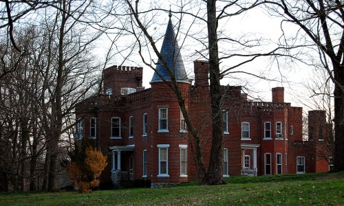 Mother tends to be a little nervous about my sightseeing. “What will you say if anyone stops you?”
I didn’t see a problem
- The gate was open.
- The property wasn’t posted.
- The road is marked on my GPS with a street name.
- I have Florida tags on the car and a bumper stick that says, “When I retire, I’m going to go up north and drive real slow.” (OK, the bumper sticker part is a joke. I’m still looking for one.)
- We weren’t chasing any foxes.
Elmwood is impressive
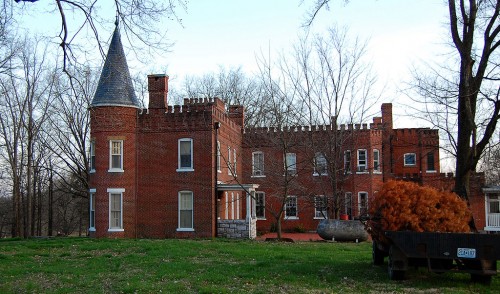 After going down a lane so long that we thought we were on a water haul (fire department term for a false alarm because all you did was haul water), Elmwood came into view.
“Wow,” was all I could say. There are bigger homes in Cape County, but none that look like this one.
The Southeast Missourian published a Bicentennial feature on Elmwood’s history Nov. 1, 1975. It’s worth following the link.
The families of Alexander Giboney and Andrew Ramsay settled in this area when Kentucky became “overcrowded,” the feature explained. Giboney and his wife, Rebecca Ramsey settled on the land now known as Elmwood. The King of Spain granted them title to the land in 1797.
Some time around 1808, plans were drawn up for a permanent home, which was built by slaves. Some were stone masons, some skilled carpenters and wood workers, others were brick makers. The house was modeled after the Ramsay family castle in Scotland, Dalhousie.
900 acres become Dalhousie Golf Club
Ray Owen wrote in November 2005 that about 900 acres of the original land grant had been sold to create the Dalhousie Golf Club. At that time, Pat Evans, a son of Robert Evans and descendant of Rebecca Ramsey, still lived in the mansion and maintained about 70 acres of the property.
Interesting historical Elmwood links
I stumbled across several news stories with historical factoids about people connected with Elmwood.
June 8, 1942: Mrs. Patrick Frissell announced the marriage of her daughter, Mary Giboney Frissell to Capt. Robert Evans.
Aug. 2, 1954: Rebecca Ramsay Houck Frissell died at the family home. Good obit with lots of history. Even though she opposed the 19th Amendment, which gave women the right to vote, she became active politically after it passed.
June 26, 1963: William G. Evans, 17, took off at the same field where his mother, Mrs. Robert C. Evans, flew her solo exactly 24 years before, June 22, 1939. She was the first woman in Southeast Missouri to fly by herself. The flight took place at the old Consolidated School of Aviation field, which later became the headquarters for R.B. Potashnick Construction Co.

