Runoff, Rainbows and Wet Roads

Cape LaCroix Creek 10-13-2014_3208The weather alert radio was busy this afternoon with severe storm warnings, tornado watches and warnings. We did a bunch of running around between showers and drizzles, but beat feet home before the bad stuff got here. The trees bent down for a bit and there were a few times when we couldn’t see across the street, but it moved on quickly.

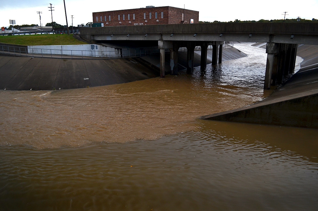
The storm water system constructed in the mid-80s wasn’t nearly so full as it was when a frog-strangler hit in 2011, but you can see it’s still moving quite a bit of water. The lighter-colored water passing under South Kingshighway is Cape LaCroix Creek; the darker water being held back on the right is what drains down from neighborhoods to the north.

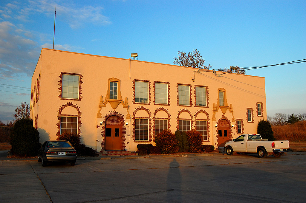
I wonder if the people in that brick office building know that when I was growing up on Bloomfield Road in the ’50s that it was a packing house of some kind. There was a little dam across the creek there and the building discharged something that, when the wind was right/wrong, stunk to high heaven.

Double, maybe triple rainbows

Double rainbow 10-13-2014_3257
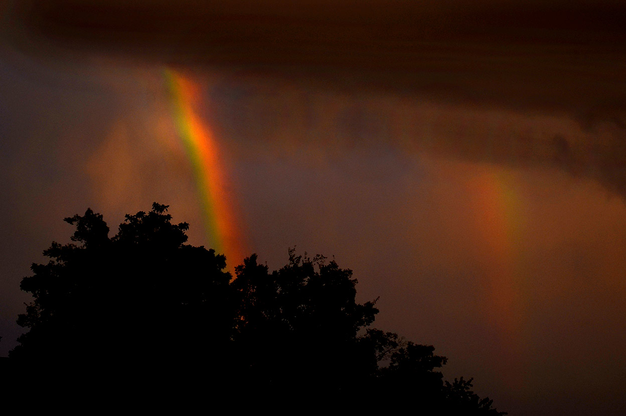
We drove around town for bit, paused at the riverfront, then headed west on Broadway. In the rearview mirror, I could see a rainbow, but wasn’t sufficiently impressed to stop. I pulled into a parking lot to check out the Mexican restaurant across from Houck Stadium. When I looked up this time, the rainbow was much brighter, so I went to the car for my camera. Much to my surprise, when I got out to the street, it had turned into a double rainbow. The second one isn’t quite as bright, but, trust me, it’s there. For a second, I thought I saw a third rainbow, but I could have been mistaken.

Coming into Jackson

Jackson 10-13-2014We were on our way to Jackson shortly after the rainbows when a thin stretch of the horizon under the dark storm clouds flamed bright orange. I rushed out to North County Park to try to get a high, clear vantage point, but the light was gone by the time I got into position.

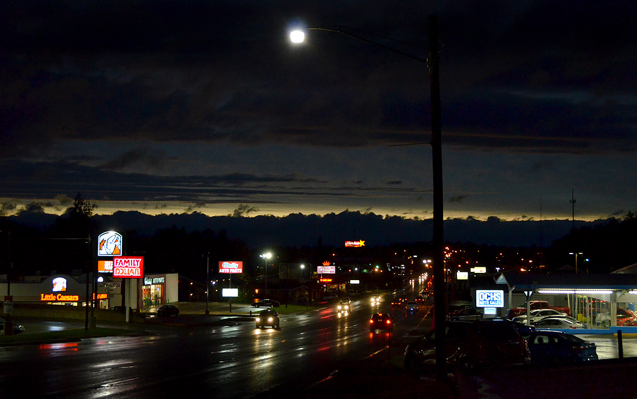
The best I could come up with of the end of the storm was a night shot coming down the hill into Jackson.

Click on the photos to make them larger. There has been a software change that I have to tweak. You can still use the arrow keys to move through the photos and press the X or ESC key to exit them. I’ll see if I can get it to look more like what you were used to seeing.

Serpentine Suggestions?

AerialSouthern Parkway - S Kingshighway 11-06-2010_9075I was scrolling through aerial photos from November 11,2010, when an unusual shape caught my eye. It was in just one frame, and I couldn’t place what or where it was. (Click on the photo to make it larger.)

I called up Google Earth and worked my way along I-55 looking for the serpentine-shaped pavement at the lower left. After determining that the four-lane divided highway wasn’t the Interstate, I figured out that north-south road was South Kingshighway and the major road running east and west and intersecting with it is the Southern Parkway.

Running across the bottom of the photo is the Cape Recreational Trail paralleling Cape LaCroix Creek.

I was confused, though, because something as oddly shaped as my target should pop right out. By looking at the other landmarks in the area, I determined that the building was located on the south side of Commercial Street where it deadends at South Kingshighway. The reason I couldn’t find it is that it’s been wiped out.

I shot my photo in 2010. Google Earth showed it there in 2011, but when they make their last pass on April 1, 2012, the land was in the process of being cleared. Google Earth has a cool timeline slider that will let you step back through all their photos. The track hadn’t been built when they flew over it on on March 26, 1993, but it did appear on March 21, 1996.

So, what WAS it, a go kart track?


Independence Traffic Jam

Traffic Jam Independence - Kingshighway 04-13-1967Yes, children, we had traffic jams in Cape in The Old Days. I shot this one on Independence looking toward Kingshighway on the same day I shot the demolition of the St. Charles Hotel, April 13, 1967.

It took some headscratching to figure out where it was taken. The key landmarks were the bridge over Cape LaCroix Creek, the Wiethop Truck Sales sign, the highway sign pointing to Hwy 61 and the car dealership way off in the background.

I must have been using my 200mm telephoto lens. That would have accounted for the way everything is compressed and looks closer than it really is.

The only thing that’s still there is Wiethop. Moon Distributing Company and Pollack Hide and Fur, which don’t show at that intersection, are long gone. Harris Motor Company has become Aldi’s. The area off to the right contains Kmart, Schnucks, Walgreen Drugs and some other stores.

And, that traffic-jammed two-lane road has become four lanes with a suicide center turn lane.

Cement Plant HQ and Other News

Cape cement plant office building built in 1926 11-10-2010A story in the Nov. 29, 1926, Missourian said “High officials of the Marquette Cement Manufacturing Company and affiliated corporations, have arrived in Cape Girardeau for the dedication late today of the new $50,000 office building near the plant in South Cape Girardeau. The new building, one of the most ornate and substantial in Cape Girardeau, has been completed and is ready for occupation.”

Although the late afternoon sun makes the color much warmer than it really is, the building looks like it has been well-maintained. It IS ornate.

Abandoned oxbows of Cape LaCroix Creek

Cape cement plant office building built in 1926 11-10-2010A view from atop the cement plant shows the headquarters building sitting near oxbows of Cape LaCroix Creek from the days when it used to join the Mississippi River close to the Diversion Channel instead of its present course north of the plant and south of what used to be Smelterville.

Other stories that day

Cape cement plant office building built in 1926 11-10-2010I can’t just read what I was looking for. I always get sucked into reading the stories around my target. Here’s what else was being written about on Nov. 29, 1926.

  • Bandit with mask and gun holds up the Kelso filling station on South Sprigg and makes off with $71 after forcing attendant Ray Ward into a closet and telling him, “Stay there for five minutes or I’ll blow your head off.”
  • Will Rogers not comfortable with his Louisville automobile ride when it hits 60 miles per hour: “Say, we might all get killed.”
  • KMOX in St. Louis to feature organ selections by William Shivelbine, the New Broadway Theater organist, and vocal selections by Dr. Jean Ruff, the Cape Girardeau baritone. The address on “Cape Girardeau,” to have been made by Julien Friant, “will not begiven, the time not being sufficient.”
  • Ernest Wagner, 68, a blacksmith put out of business by the automobile, died.
  • Two marriage licenses not returned to recorder (on the front page, with names, no less).
  • King Solomon takes 40th wife. Says it’s his last wedding, “since this was really and truly a love match.”
  • C. Hale, telegraph operator at Glenallen, writes The Missourian that he was not responsible for the error in a telegram which came here, which due to the transposition of the word “mother” and “motor” caused friends to believe Mrs. Max Weilputez had been drowned. It will be recalled that the message as received here said, “mother drowned,” but should have said “motor drowned.”
  • Geraldine Wilson secretly married to school teacher: Miss Geraldine Wilson, daughter of Mr. and Mrs. Orren Wilson, 1325 Broadway, was married secretly to Frank Jones of Whitewater Sunday. According to Mrs. Wilson, mother of Geraldine, the ceremony took place in an Illinois town and was a complete surprise to her and Mr. Wilson. Mrs. Jones had attended College High School and was a senior at Central this year and would have graduated in voice in the spring. Mr. Jones has attended Teachers College here and is now teaching at Round Pond School near Allenville.