Let’s Save Bloomfield Road Spring

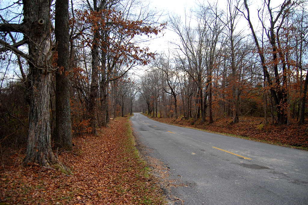
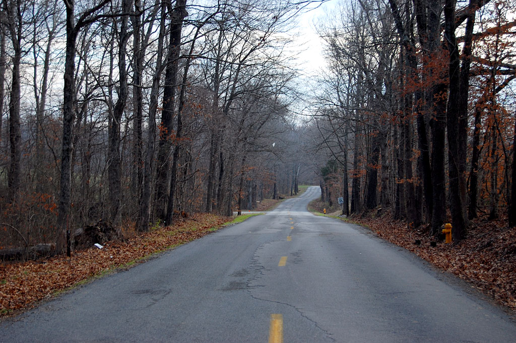
I checked out the middle section of Bloomfield Road yesterday. It’s a nice road if you don’t like trees. So, what can we do to save the last piece, the part from Benton Hill Road to Hwy 74? The answer is, probably not much.

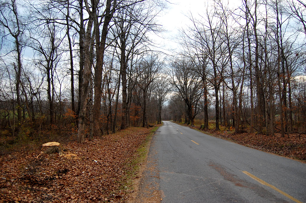
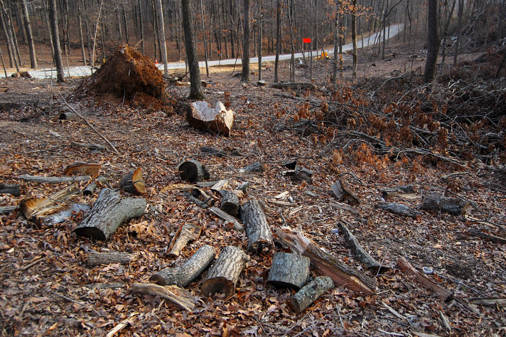
A worker pointed out that the property across from what used to be Mount Tabor Park had been sold and the owners brought in the loggers to clear cut the land. Looks like the really nice trees are gone before the road crews got a crack at them.

Selective cutting

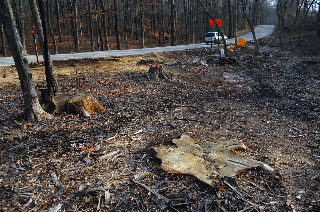
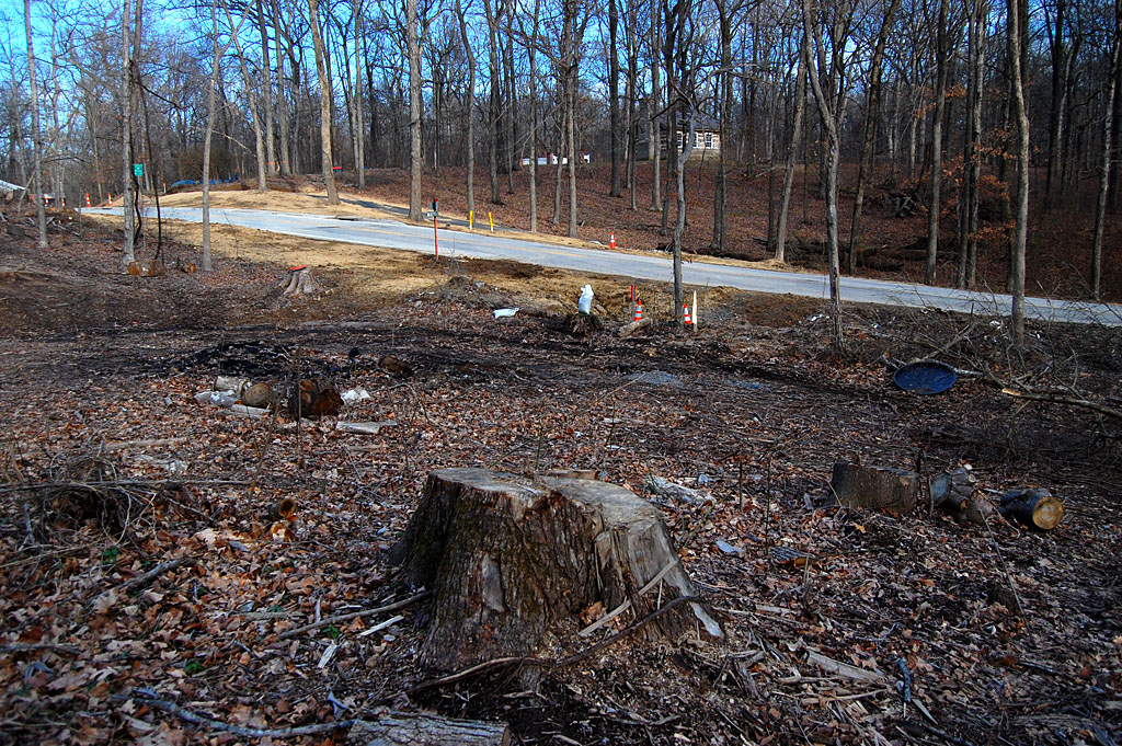
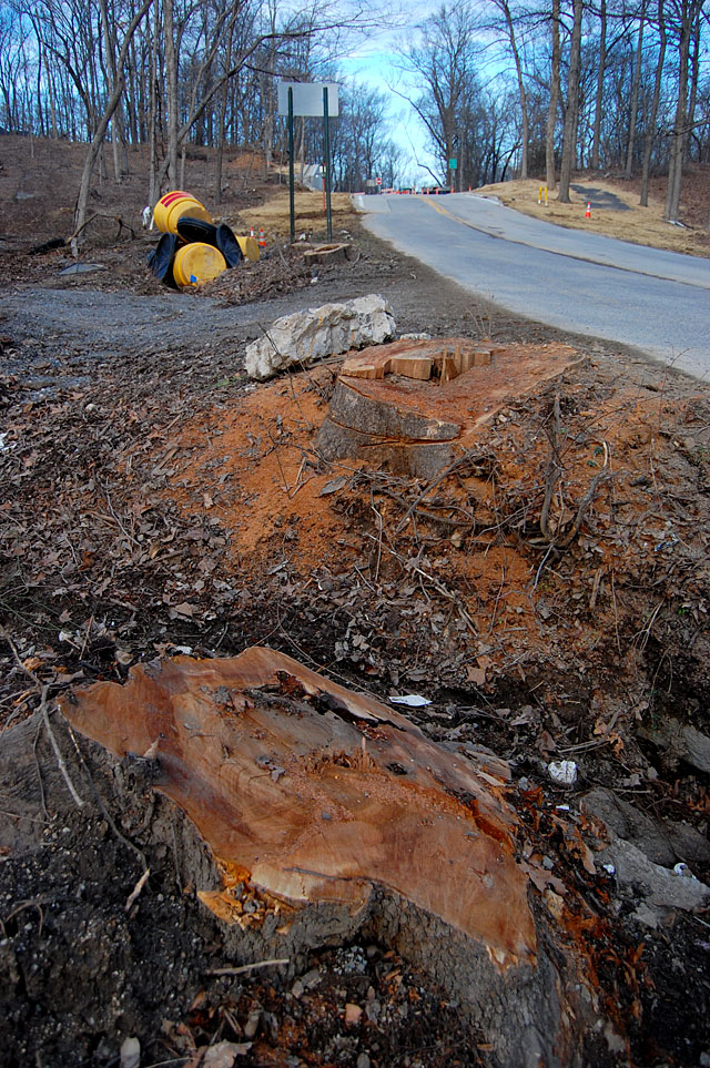
Even where the trees weren’t cut en masse, trees of any size were selectively harvested. It might be that the owner knew the road builders were going to cut them anyway, but it definitely gives you an idea of how tree loss is going to be “minimized” along the stretch.

Days are numbered

This tree probably saw travelers in wagons pulled by horses pass by to shop in Cape. Considering how close it is to the road, I’d say its days are numbered. Just beyond that tree, before the white wooden fence IS something worth preserving.

The Bloomfield Road Spring

I’ve written several times about how my mother and her grandmother used to stop at the spring in the curve of Bloomfield Road just north of Elmwood for water on shopping trips to Cape from Advance. Advance resident and historian Paul Corbin talked about his family camping alongside their wagon on trips to and from Cape.

The spring is still there, crystal clear and running enough to keep ice from forming on it when the nearby ditches were glazed over.

I guess the road folks could put up a tiny marker to remind us of what we’ve lost, not that anybody doing 55 in a 35 could see it or stop to read it.

Wooded homesites; non-wooded roads

A combination of governmental agencies, private logging and people too impatient to drive the speed limit have killed an historic scenic route into Cape Girardeau.

I’d love to save the spring, but I’m not sure that’s practical. If they don’t get it now, they’ll get it when the road is Mount Auburnized to four lanes in the next decade. The clearing of that land signals more development, which means more cars, which means more “need” for speed and “improvements.”

Other road “improvements”

Gallery of Bloomfield Road Photos

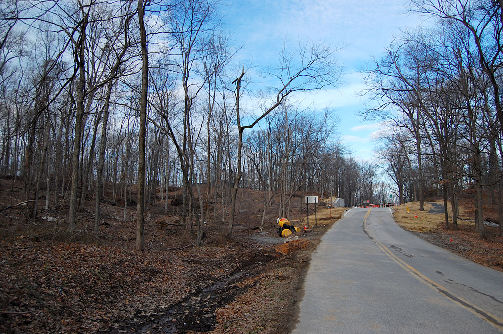
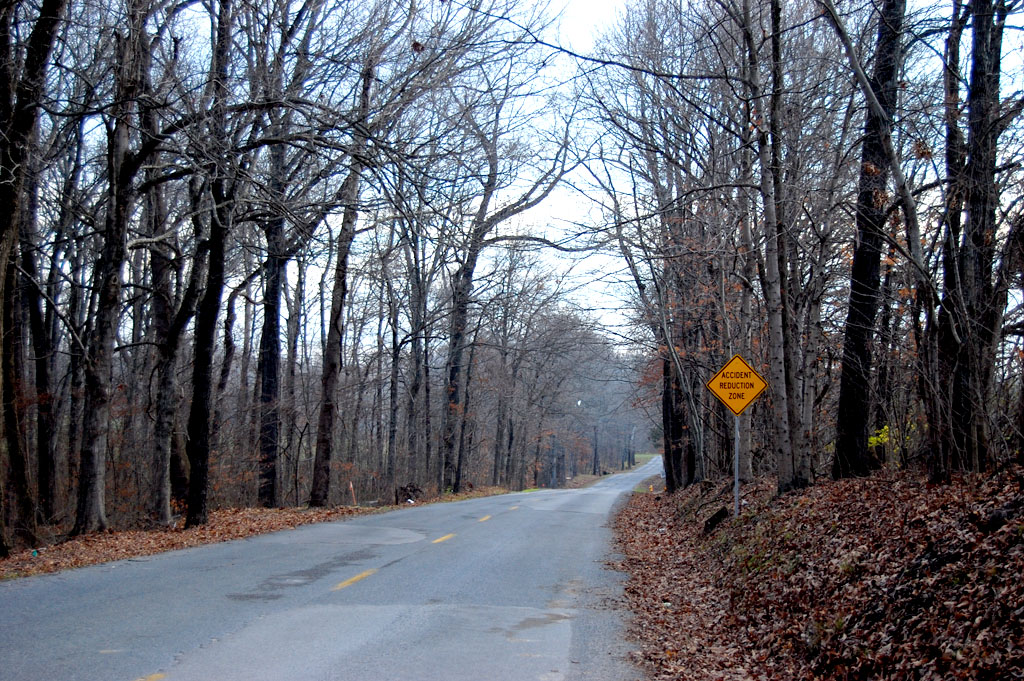
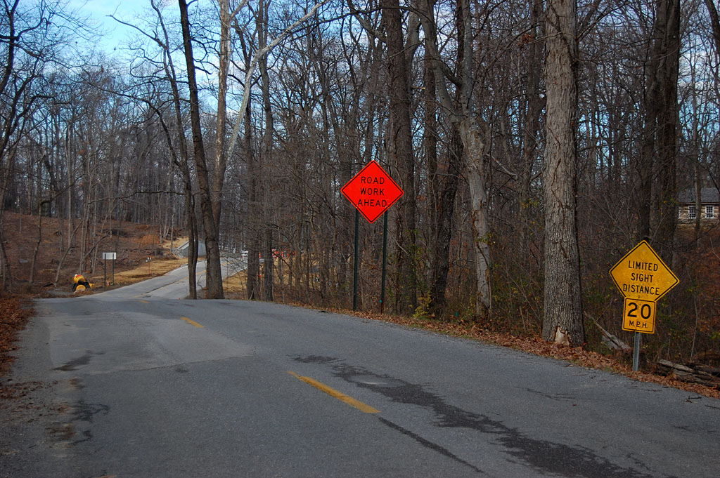
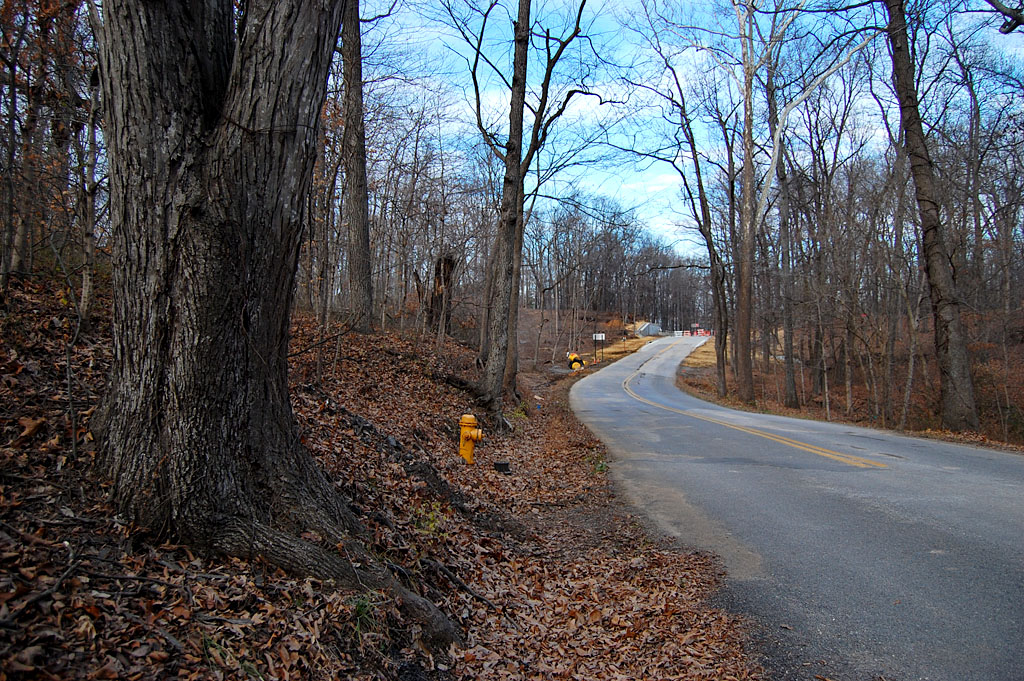
These photos show the next and final section of Bloomfield Road that is to be widened. Some are of private property that is adjacent to the road that has been logged. Click on any image to make it larger, then click on the left or right side to move through the gallery.

Have We Lost Bloomfield Road?

One of the last scenic roads leading into Cape Girardeau is Bloomfield Rd. When I wrote about a spring alongside the road near Elmwood Apr. 2, 2010, and ran this photo, I wrote under it, “This view, by the way, is the reason Bloomfield Road SHOULDN’T be widened. There should be some roads left that let us appreciate what the area was like before it became paved over. If the road isn’t fast enough for you, then don’t move out there. Ditto Route W. OK, rant off.”

Public Meeting May 26

I happened to see this “Bloomfield Road Improvement Meeting May 26” announcement on the city’s website. Now, when I see something labeled “Improvement,” that’s a signal that it’s a done deal, even without the meeting.

For some of us, widening the road, increasing the speed limits and cutting down the canopy of trees that makes Bloomfield Road special isn’t an “improvement.”

Here’s the full announcement:

Phases 4 and 5 of the Bloomfield Road Improvement Project will be discussed during a public meeting on Thursday, May 26 at 6:30 p.m., at the Osage Centre.

Information will be provided regarding traffic control during phase 4. Affected areas include Bloomfield Road between Stonebridge Drive to just south of the Benton Hill Road intersection. Phase 4 construction is slated to begin mid-June, with utility relocation occurring prior.

Citizen input is requested regarding phase 5, which includes Bloomfield Road west of the Benton Hill Road intersection to White Oaks Lane.

How long before it is Mount Auburnized?

When Mount Auburn Road was proposed to link Hopper and Gordonville Roads in 1961, it was billed as “scenic route west of Cape.” Before long, it turned into a four-lane expressway that gobbled up the front yards of the homes along it.

What happens to the Bloomfield Spring?

My great-great grandmother, my grandmother and my mother all stopped for water at this spring on their treks from Advance to Cape to go shopping. Some of those trips were made by wagon.

This spring, which refreshed travelers for more than a century is right off the roadway. Will it be lost to future generations?

How about the Elmwood Gates?

The old gates that guard the entrance to Elmwood aren’t far off the roadway. Will they get taken out this time or will they be around until the road is four-laned?

Where is Dennis Scivally?

When the first road in Cape County was paved in 1920 – the stretch of South Sprigg called Tollgate Hill – Dennis Scivally, the engineer in charge of the project said, “Several walnut trees had to be cut down, but care will be taken to cut down no trees not absolutely necessary to remove. It is the plan to retain the beauties of the road as well as make it good for traveling over. Along most of the distance are now growing beautiful trees. These will be cared for, underbrush and weeds will be removed, painted signs along the way will be tabooed, as well as signs tacked to trees.”

Where is our Dennis Scivally today?

What can we do?

If I was in Cape, I’d show up at the meeting on May 26 at 6:30 p.m. at the Osage Center. I’m sure it’ll be an exercise in futility, but I’d feel better for having given it a try.

Just do me a favor: if and when they DO chop down the trees and destroy the spirit of the road forever, put in bike lanes. We might as well win SOMETHING out of it.


The Spring on Bloomfield Road

When we were driving past the castle called Elmwood, my mother wondered if a spring she remembered as a little girl was still there.

I had heard her talk about it years and years ago, so I thought I knew approximately where it was alongside Bloomfield Rd. I parked my van at Kensington Lane and walked north, back toward the curve in the road leading to Cape.

This view, by the way, is the reason Bloomfield Rd. SHOULDN’T be widened. There should be some roads left that let us appreciate what the area was like before it became paved over. If the road isn’t fast enough for you, then don’t move out there. Ditto Route W. OK, rant off.

Just south of the big tree that’s shown in the photo above and on the west side of the road, I saw a small rivulet of water running toward what used to be the Elmwood estate.

Water boils mark the spring

I didn’t see a pipe running under the road that would account for the stream. When I looked at the pool through a polarizing filter on my camera, I could see beneath the reflections on the water’s surface.

Those black circles mark where water is boiling up out of the bottom of the pool.

I had found my Mother’s spring

“My Grandmother – my Mother’s Mother – Mary Adkins, would always buy some kind of pan at the dime store every time we came to Cape from Advance. On the way back, we’d stop at that spring and dip out a drink in the new pan. She died in 1938, when she was 75 years old, so that was quite a few years ago,” my mother, Mary Welch Steinhoff, recalled.

“I don’t remember what kind of car we had – it was before Model T days. Mother (Elsie Welch) would usually come along; Grandmother would drive. Dad (Roy Welch) never liked to drive.”

Did you stop for a drink on the way TO Cape?

“No, we didn’t have a pan on the way TO Cape.”

“Didn’t you ever think about bringing one along?” I asked?

“No, I guess she wanted a new pan and this was always an excuse to get one.”

View of spring looking south

That white fence marks what used to be the Elmwood property. I don’t know if this is in the 900 acres that were sold for the Dalhousie Golf Club or if it’s part of the 70 acres retained by the estate.

Map showing spring and Elmwood


View Bloomfield Spring & Elmwood in a larger map