Allenville Fish Feeling Heat

Even though Cape temperatures hit 103 to 107 (depending on the sign) Mother and I went exploring in the Allenville area. I wanted to see how hard it would be to get to the Allenville railroad bridge that’s been in the news of late. In the process, I took pictures of the St. Louis Iron Mountain Railway tracks when I came across their crossings south of Dutchtown. They’ll be part of another story.

When we headed south out of Allenville on County Road 238, we came around a curve to see a pickup truck sitting in the middle of the one-lane bridge over the Diversion Channel. Well, it might be two-lane, but they’d have to be two bicycles or two REALLY friendly cars. Based on the skid marks and the way the guard rail is a little wavy, I’d say that some vehicles have not met those requirements. (Click on the photos to make them larger.)

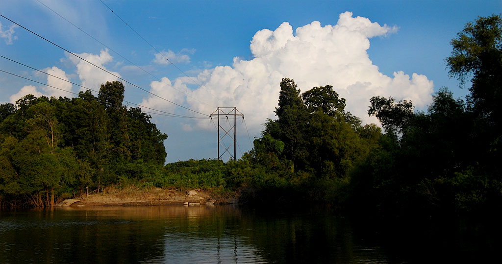
After a short pause, the truck crossed the bridge, we gave each other the wave you do in the country, and we went down Hwy N to check the railroad bridge. Looks like it’s going to be easier to get to it from the south than from Allenville.

Signs with bullet holes worry me

On the way back north, I decided to stop to shoot some pictures of the road bridge.

There must be members of a “well regulated militia” running around Allenville enjoying their Second Amendment rights to shoot at road signs where bullets would strike an oncoming car if they miss (or, based on the number of through and through holes even if they HIT the sign).
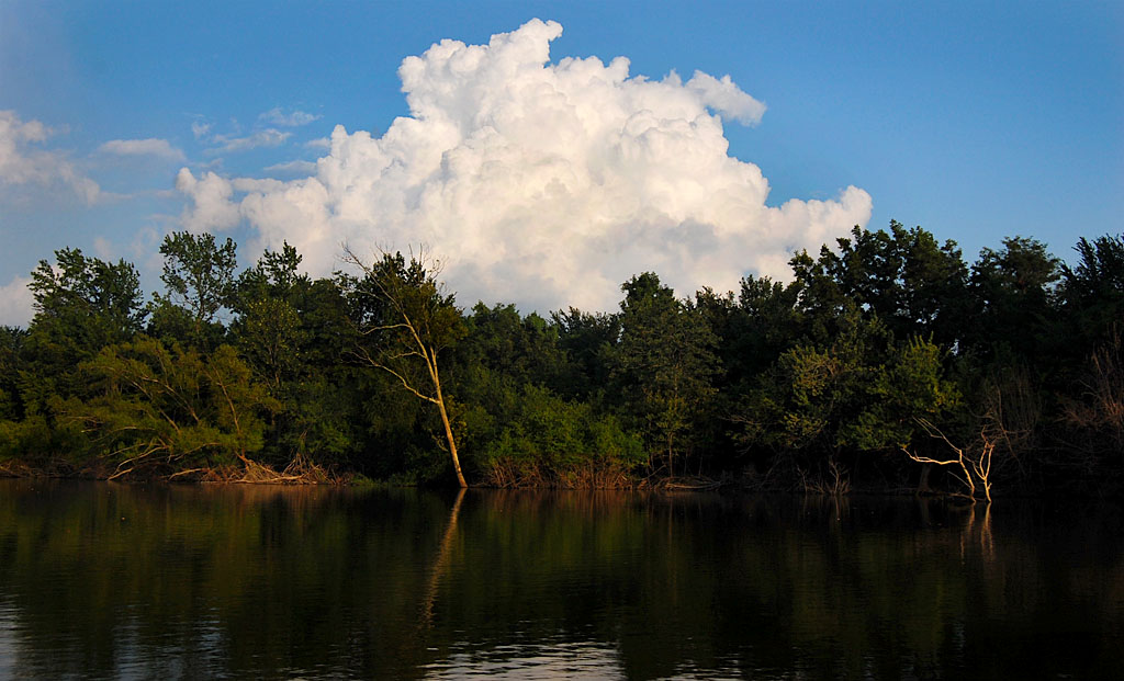
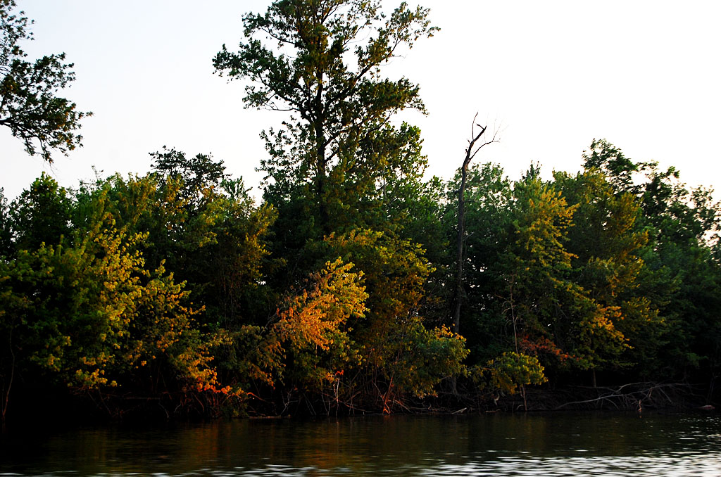
View downstream

This is where much of the water being drained out of Swampeast Missouri goes on its way to the Mississippi River just south of Cape. If the Mississippi backs up or there’s a lot of rain, this ditch could be 15+ feet higher.

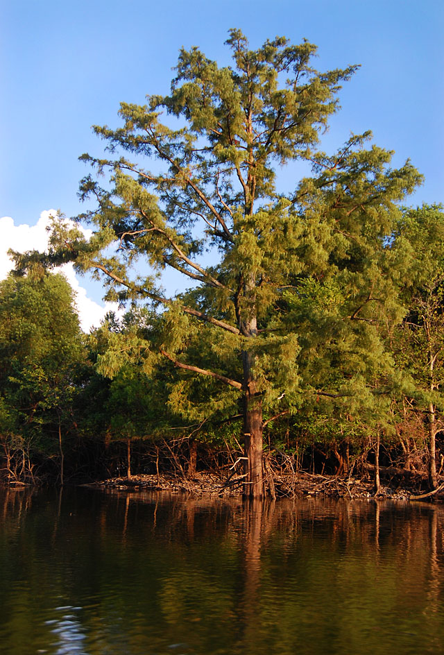
Greens make it look cool

Don’t let those greens fool you. My shirt was soaked with sweat when I got back to the car. This is looking upstream.

Holy Cow! Look at the fish!

Now I see why the pickup truck was stopped on the bridge. The hot weather and low water brought what I assume to be hundreds of carp to the surface. Fish that could easily go 2-1/2 to three feet were snurfling along the surface like goldfish in a tank. (It’s worth clicking on these shots to make them larger.)

For you folks who complain that you never see a photo of me, that’s my shadow. I think it’s a pretty good likeness.

Turtle comes up for gulp of air

A pretty good-sized turtle surfaced for a bite of air, then slipped back under water.

Open mouths

I bet most of these fish could swallow a softball without straining too much. The bright object in the right center of the picture is a leaf floating downstream.


Allenville Railroad Bridge

The Missourian carried a story May 22, 2012, that a Jackson, Gordonville and Delta Railroad plan to abandon a 13-mile section of unused tracks has some Allenville residents worried. They’re not concerned about losing the railroad – it hasn’t carried traffic between Gordonville and Delta since 1997. They’re worried about the railroad bridge and trestle over the Diversion Channel. (Click on any photo to make it larger.)

Tiny town cut off by floods

The story by Shay Alderman quoted lifelong Allenville resident Phil Thompson as saying the town has been hit by 12 floods since 1973. Roads were impassable for about six weeks during flooding in 1993 and 1995. The trestle and bridge were the town’s supply lifeline.

Will bridge end up on scrap heap?

Robert L. Adams, railroad president said the bridge is in such poor condition that he would advise against anyone walking or driving a vehicle across it. I can understand why he’d say that for liability reasons.

I’ll have to take a meander down that way when I go home. At least I’ll know I won’t have to dodge any highballin’ freights in the middle of the channel.

Nash Road Transportation Corridor

When bicycle tourist John Gorentz, AKA Spokesrider, passed through Cape on his way from Michigan to New Madrid, I tried to pick him a better route to follow than the Missouri River Trail that runs through the hills and curves of New Hamburg. One alternative was to take Nash Road. Unfortunately, at that time is was a dusty gravel road. On a recent trip to the airport to eat, we decided to see if the road was finished. It is and it is really nice. (Click on any photo to make it larger.)

Bloymeyer roundabout

When I was flying aerials in November 2010, I noticed the Bloymeyer roundabout joining Nash Road, Hwy 25 and Hwy 77 had been completed. In this photo, Nash Road comes in from the top left. Hwy 25 from Jackson and Dutchtown is on the lower left and then turns to the right to go to Advance and Bloomfield. Hwy 77, at the top right, goes to Chaffee.

Mario’s Pasta House and a water hole is opening up at the intersection to take advantage of the traffic coming off I-55 and headed through. I wouldn’t be surprised to see other businesses open up, maybe even the old Montgomery Drive-in.

A nail in the coffin for Dutchtown

This is going to put another nail in the coffin of Dutchtown. Northbound I-55 traffic headed to towns south and west of Cape won’t have to go all the way to Hwy 74 and then through Dutchtown. It’ll be able to take a fast (60 mph), straight road with good shoulders straight down to Hwy 25. There’s not much out there yet except farm land, so there aren’t many driveways and side roads to watch.

When Hwy 74 floods at Dutchtown, which it seems to be doing more and more often, traffic has to go all the way to Jackson to get through. Nash Road is on the dry side of the Diversion Channel, so the highway department won’t have any incentive to raise the roadbed in Dutchtown to keep it above water.

Nash Road: south of Diversion Channel

Nash Road starts south of the Diversion Channel and north of the Cape Girardeau Airport.

Road is a shipping hub

I was surprised at the number of warehouses and depots that have grown up on the road.

Railroad derailment

In early October, 15 empty cars on a Burlington Northern Santa Fe train derailed on the tracks that parallel Nash Road. Nobody was injured and no hazardous chemicals were involved, The Missourian reported. I include these photos only because you could see them from Nash Road and because Keith Robinson, a railroad buff, is a regular reader.

Nash Road photo gallery

Here is a gallery of photos taken of and on Nash Road. Click on any image to make it larger, then click on the left or right side to move through the gallery.

Diversion Channel Boat Ride

When I wrote about going trotline fishing with Ed and Melinda Roberts this summer, I mentioned that the scenery along the Diversion Channel between I-55 and the mouth of the Mississippi River was different that I had expected. I thought it would be a sterile, straight ditch. It turned out surprisingly beautiful and peaceful. If you’ve always heard about trotline fishing, but never knew exactly what it was, follow the link and watch the video.

My companions were intent on getting their line set out before dark, so everything was shot from a speeding boat. One of these days, I’ll have to rent a canoe or something where I can putter around at my own speed.

Diversion Channel photo gallery

Click on any image to make it larger, then click on the left or ride side to move through the gallery.