Bald Knob Cross Restoration Planned

There was a story in The Southeast Missourian that plans are in place to finish restoration of the Bald Knob Cross. I’d be more excited if I hadn’t heard that for years.

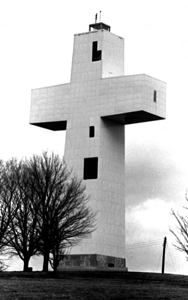
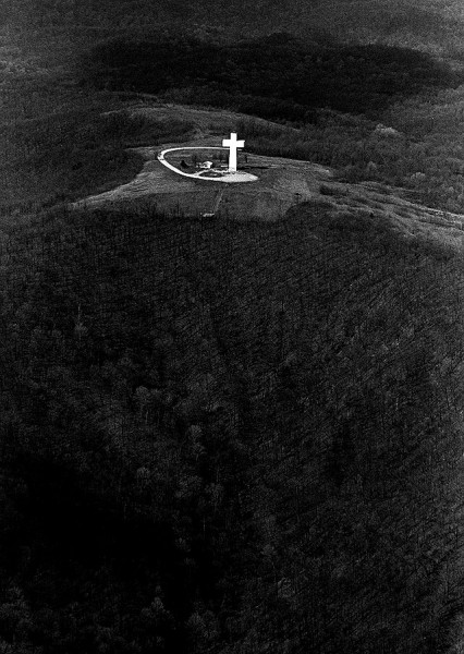
Still, the story jogged my memory that I had shot some aerials and ground shots of the Cross in the late 60s. I was pleased to see that the shot from the air was better than I had remembered. Parts of the film had deteriorated over the years, so my selection of pictures was limited.

Cross stands 111 feet tall, 1,000 feet above sea level

Cross project conceived in 1937

The project was spearheaded by Wayman Presley, who found 116 individuals who raised enough money between 1948 to 1951 to buy the land atop Bald Knob Hill. The foundation was poured in 1953. You can read more at the Bald Knob Cross web site.

Selling pigs raised $30,000

Financial shortfalls have been the one constant throughout the history of the Cross. The Bald Knob web site says that Presley quit his job with the Post Office to throw himself into fund raising. An appearance on This Is Your Life helped, but money was still tight.

A challenge to supporters to raise pigs, sell them and turn the profits over to the cross raised $30,000.

The Cross was completed in 1963

The formal groundbreaking ceremony was held in 1953. The bare metal framework of the Cross stood for several years until there was enough money to cover the superstructure with 900 heavy steel panels with a bright white veneer.

The Cross web site said that 40,000 watts of lighting made the structure visible for 7,500 square miles.

The symbol of peace became a source of conflict

The Cross was supposed to be an interdenominational symbol of peace, but internal conflicts were growing at the same time as the structure was deteriorating.  The disputes became so serious by 2006 the courts stepped in and locked down the properties until everything could be sorted out.

Agreement was reached in 2008

From the web site:

In the summer of 2008 a settlement that was supported by both sides of the conflict began taking shape. In the agreement, all current board members would step down and the court would appoint a temporary transitional board comprised of mostly religious leaders in Southern Illinois. The final legal settlement became official on Christmas Eve 2008. The seven member transitional board met in the middle of January 2009 for the first time. Since that time, the board has been extremely busy. In addition to the obvious challenge of the physical restoration of the Cross, the organizational structure, fiscal policies and procedures, and program development aspects of Bald Knob have been addressed. Physical restoration of the Cross has already begun.

Location of Bald Knob Cross near Alto Pass, IL


View Bald Knob Cross of Peace in a larger map

Here’s another “cross” picture

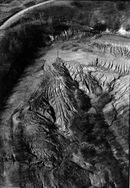
Wife Lila, who was looking over the page before I published it, remarked that the Bald Knob Cross reminded her of a photo I had taken of an abandoned strip mine in Southeastern Ohio in 1969. A power pole caught the late afternoon light just right to look like a cross. The picture ran almost full page in The Athens Messenger on the first Earth Day. It’s always been one of my favorite pictures.

Here’s the background story.

She was right. (Of course, that’s always the case. It goes without saying, but she like to hear me say it anyway.) I’ll let you decide.

It’s Cold, Snow Foolin’

I can see from the weather reports that Cape is colder than West Palm Beach, but we still had ice on our bird bath this morning. The difference is that you folks EXPECT cold weather. It comes to kind of a shock to us South Floridians. Our last ice-on-the-bird-bath experience was last February and our last snow (although some folks claim it snowed or sleeted here yesterday) was 1977.

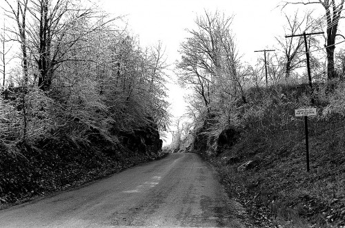
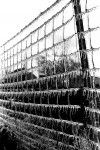
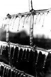
Here are some pictures from the late 60s of an ice storm that blew through Cape County.

Houck Railroad Cut between Cape and Jackson

This is the old Houck Railroad cut on Old Jackson Road between Cape and Jackson before my dad had a contract to widen the road.

Dad’s construction company won the job to blast the rock of the cut so the road could be made wider. One day he came home in a crankier than usual mood.

It seems that someone miscalculated the load of explosives for one of the blasts and a huge boulder went flying though the roof of a nearby house. Nobody was hurt, but it became a piece of family lore forever after. You can’t go past that spot without someone commenting about “the day that….”

Here’s a more recent picture of the cut and an account of a bike ride through it, including a trip over a bridge I’d rather forget.

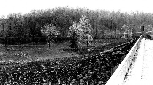
Cape LaCroix Creek Bridge

This looks like the new Cape LaCroix Creek bridge on Route W – Old Jackson Road – shortly after it was built. The view is to the southeast.

If I’m correct, the road running along the bottom of the treeline was a shortcut that followed the creek and bypassed the normal intersection of Old Jackson Road and Boutin Dr. and came out near the Heartland Care Rehab Center. The road has been abandoned for years.

I am told that there was an abandoned old house on that road, just after you crossed a steel bridge, that had a short lane that provided an observation platform for young folks who wanted to watch satellites pass overhead. Google Earth shows that the bridge might still be there, but there are trees hiding where the house used to be, so I couldn’t tell if it had finally fallen in.

Location of Bridges


View Cape LaCroix Creek bridges in a larger map

Here’s a gallery of other ice photos

Click on any image to enlarge it, then click on the left or right side of the picture to move through the gallery.


Cape Girardeau’s Bill Emerson Memorial Bridge

I loved the old bridge, don’t get me wrong. Going across that puppy was a rite of passage when you got your driver’s license.

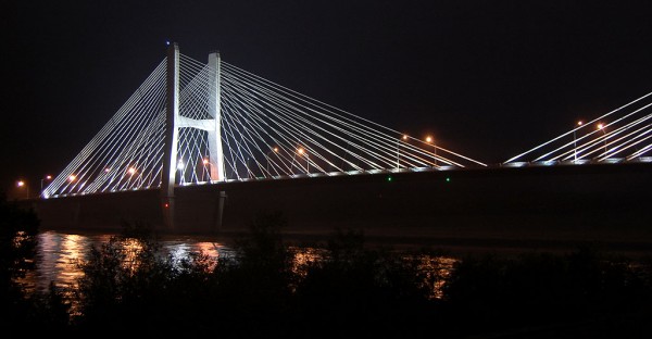
Having said that, the new bridge is beautiful. I’ll post more stuff when I can get home and find my pix of the old bridge, but here are some shots of the Bill Emerson Memorial Bridge at night.

View from near the Themis floodgate

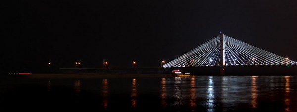
Bill Emerson Memorial Bridge taken near Themis flood gate

For any photo geeks, the picture was taken with a Nikon D-40 DSLR using an ISO of 200 and an exposure of 5 seconds at f/6.3.

There was a barge working its way upstream (note the light streaks) and I was hoping he would shine his spotlight my way to make an interesting light streak. He was, however, more intent on finding channel markers along the east bank than improving my picture. Click on the image to bring up a larger version.

Views from old Traffic Bridge overlook

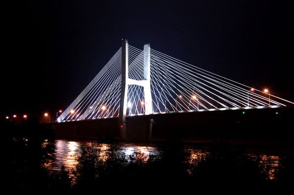
Bill Emerson Memorial Bridge taken from old bridge overlook

These two pictures were shot at about the same time. The only real difference is that I zoomed out to get both spans in the second picture.

I was hoping to pick up some light streaks from vehicles on the bridge, but traffic was light and there was a cold drizzle tricking down my neck. My working philosophy dictated that I wasn’t required to go hungry, get wet or lift heavy objects.

Why would I want to work any harder to produce a blog?

Bill Emerson Memorial Bridge taken from old Traffic Bridge overlook

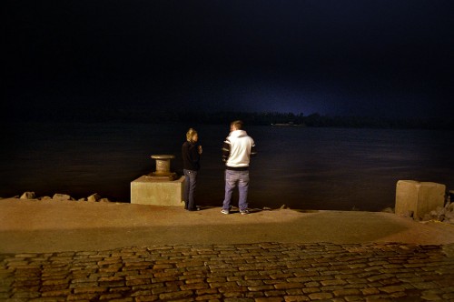
Couple watching river flow by

Couple watching Mississippi River flow by Cape Girardeau

I was too lazy to set up the tripod for this picture, so I hand-held it at at about one second. That’s why the guy is a little blurry from movement.

Editor’s note

This is far from the final look of this site. The WordPress template that Son Matt picked is different than the one used by my other blog, PalmBeachBikeTours.com, and there’s a pretty steep learning curve associated with dealing with a graphics-heavy one like this.

I’m going to be in Cape a few more days shooting new pictures to go along with old ones I’m sure are in the file. After that, I suspect it’ll take me at least a couple of months to get everything organized, scrutinized and digitized. (The only “ized” I haven’t figured out is the monetized one. Maybe I should draft some of the old Girardot and Tiger business staffers to go out and sell ads for me.)

My old earth science teacher, Ernie Chiles, and I are going for a bicycle ride Wednesday. Thursday I’m going over to the old Central High School to see what it looks like after being converted to a junior high school.