Fred Lynch had a Frony picture of cars parked on the Mississippi River wharf before the floodwall was built. I had a couple of frames I took from the air of the downtown area that shows the riverfront area after the floodwall and before the wharf area had been refinished.
(Click on the photos to make them larger. Click on the left or right side of them to step from one to another.)
Many landmarks are clearly visible. The most prominent, in the left center, is the Common Pleas Courthouse, high on a hill overlooking the city. Right behind and above the Court House, look for a white chimney. That’s the Southeast Missourian Tower, which stood 70 or 80 feet above the ground and could be seen as far away as McClure, IL. The tower was razed in 1978 when a new boiler was installed and it became obsolete. It also had shown signs of structural weakness.
Way up at the top center left is Academic Hall at Southeast Missouri State University. The tall, dark steeple of Trinity Lutheran Church is at the left of the frame.
Al’s Shops and the St. Charles Hotel

Here’s a view peeking over the floodwall from the south end of Main Street. Al’s Shops is clearly visible in both the aerial and this photo. Right over the top of Al’s, you can see the sign on the side of the St. Charles Hotel.You also can see the Firestone Store, Woolworth’s, J C Penney’s and Montgomery Wards.
I wonder if all the cars in the parking lot are shoppers or if they are store employees displaced when wharf parking was no longer available.
Stay at the St. Charles for $1.50 a night (and up)
 Here’s a sign on Highway 61 between Cape and Jackson that promised ELECTRIC FANS and room rates of $1.50 a night and up at the St. Charles. It was taken April 16, 1967.
That’s even cheaper than the $2-a-night room I stayed in when I covered a Flying Saucer Convention in a small town in the Missouri Ozarks. I don’t recall if it had electric fans for the addition 50 cents. I know the bathroom was down the hall.
I’m still looking for some pictures I have of the St. Charles being razed. In the back of my mind, I see a crumbling brick wall and a window with either a bird flying through it or sitting on the windowsill.
Funny how some things flicker in and out of your memory.
Downtown Cape Girardeau, looking up Broadway
 The Common Pleas Courthouse is, again central in the photo. Broadway runs from top to bottom at the right of the photo, Themis is behind and in front of the Courthouse, and Independence is at the left of the photo. Buckner Ragsdale is at the foot of Broadway. The building that became Port Cape Girardeau is at the foot of Themis. The peaked roof, one building to the right of Themis on Main St., is Hecht’s. I can’t make out its iconic wind vane in this photo, unfortunately.
The Idan-Ha Hotel at Broadway and Fountain is visible above The Missourian building and across from the Marquette Hotel. The KFVS tower hadn’t been built yet.
National Register Listings
The Missouri Department of Natural Resources has an excellent resource for anyone interested in historical buildings. Go here for a listing for Cape Girardeau County’s National Register Listings. Some of the files are large, so they may not be suitable for folks with slow connections. There are histories of the buildings, maps and photos. It’s a great way to kill some time and learn a lot about the area.
The downtown area is covered by three files all tagged Cape Girardeau Commercial Historical District (with boundary increases).
If you are on Facebook, check out the Old Town Cape fan page and the Cape Girardeau fan page. There’s a lot of interest in Cape on the Internet.
Other visits to the riverfront and downtown area

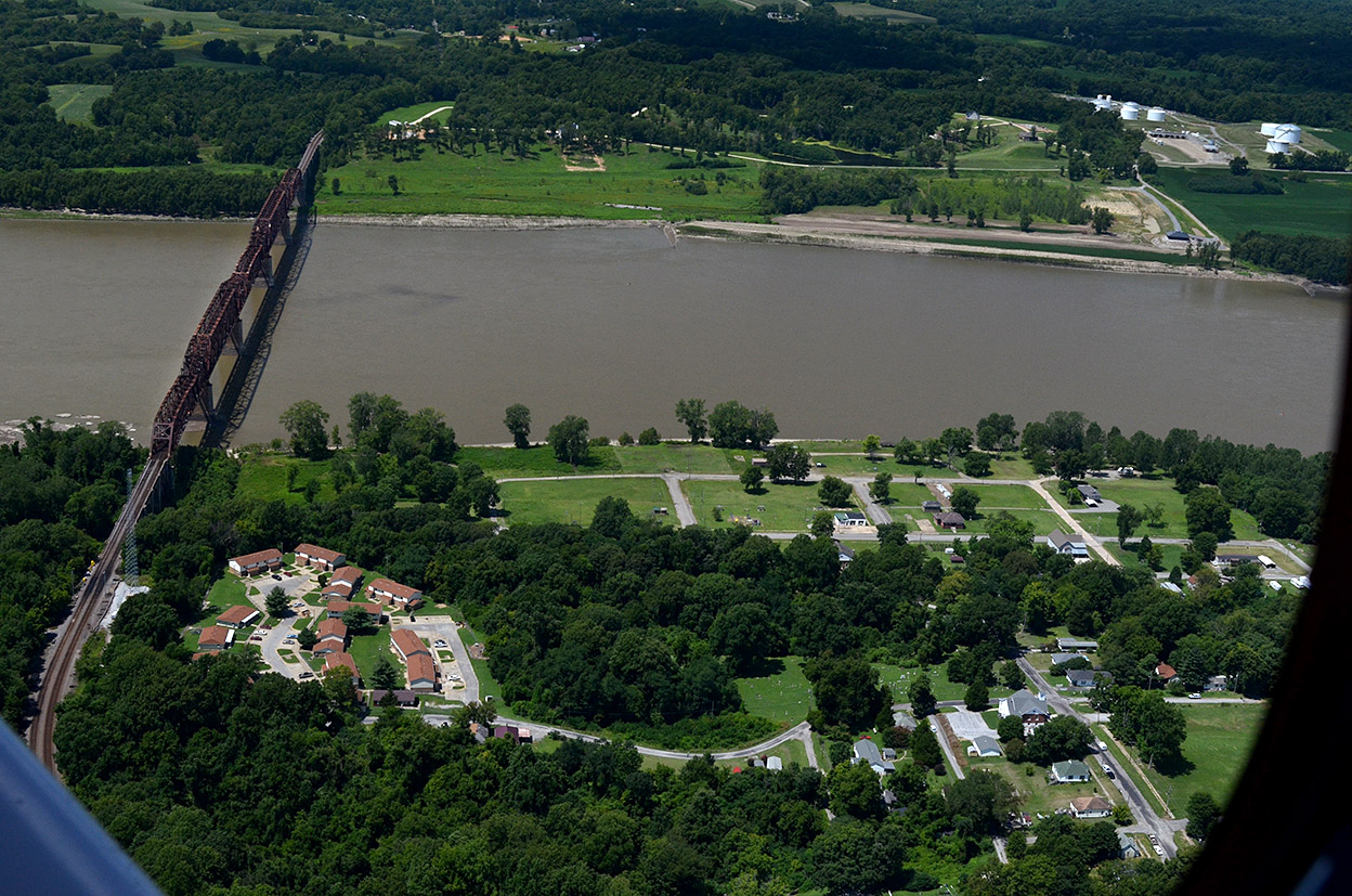
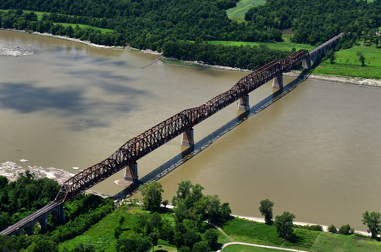
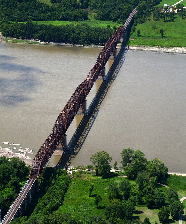
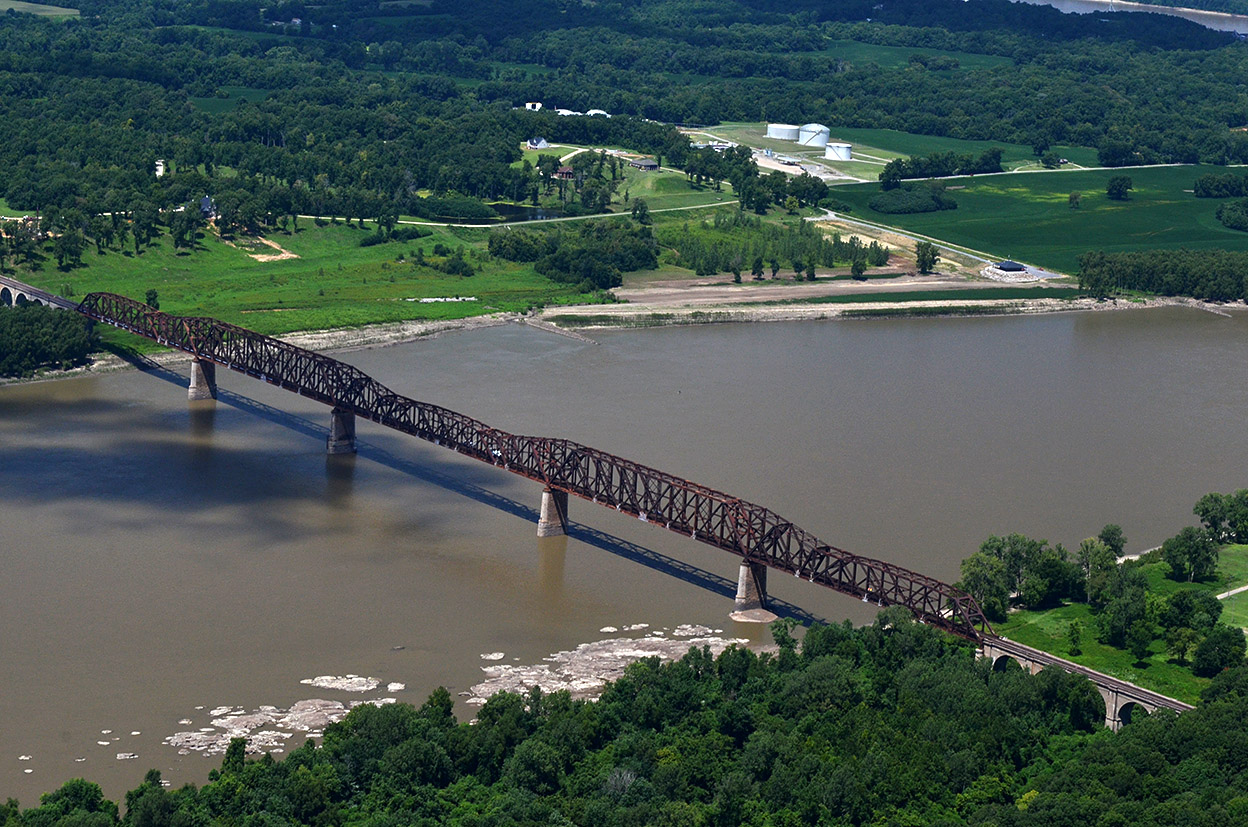 When Ernie Chiles and I made a pass over Cairo and the confluence of the Mississippi and Ohio Rivers on August 13, 2014, we orbited over Thebes for a few minutes to capture the Thebes Courthouse (soon to come) and the 1905 railroad bridge.