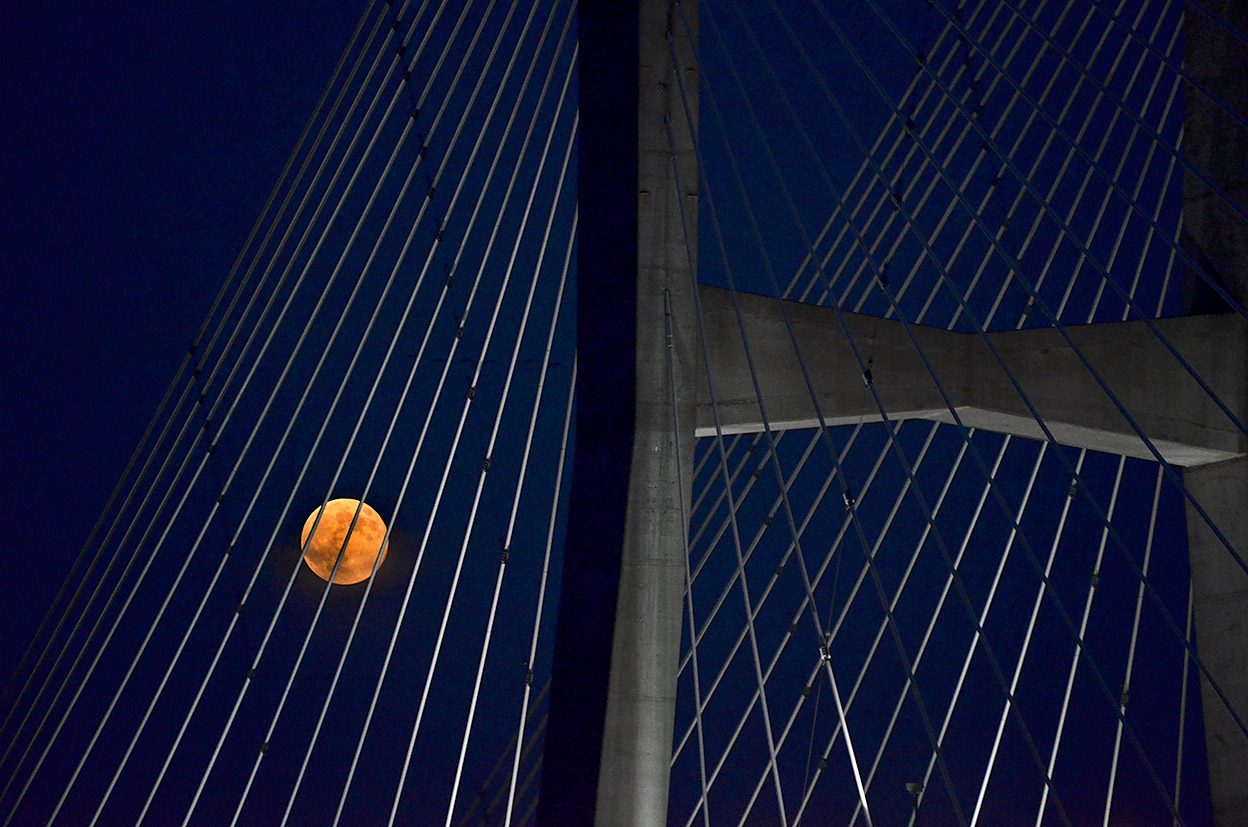
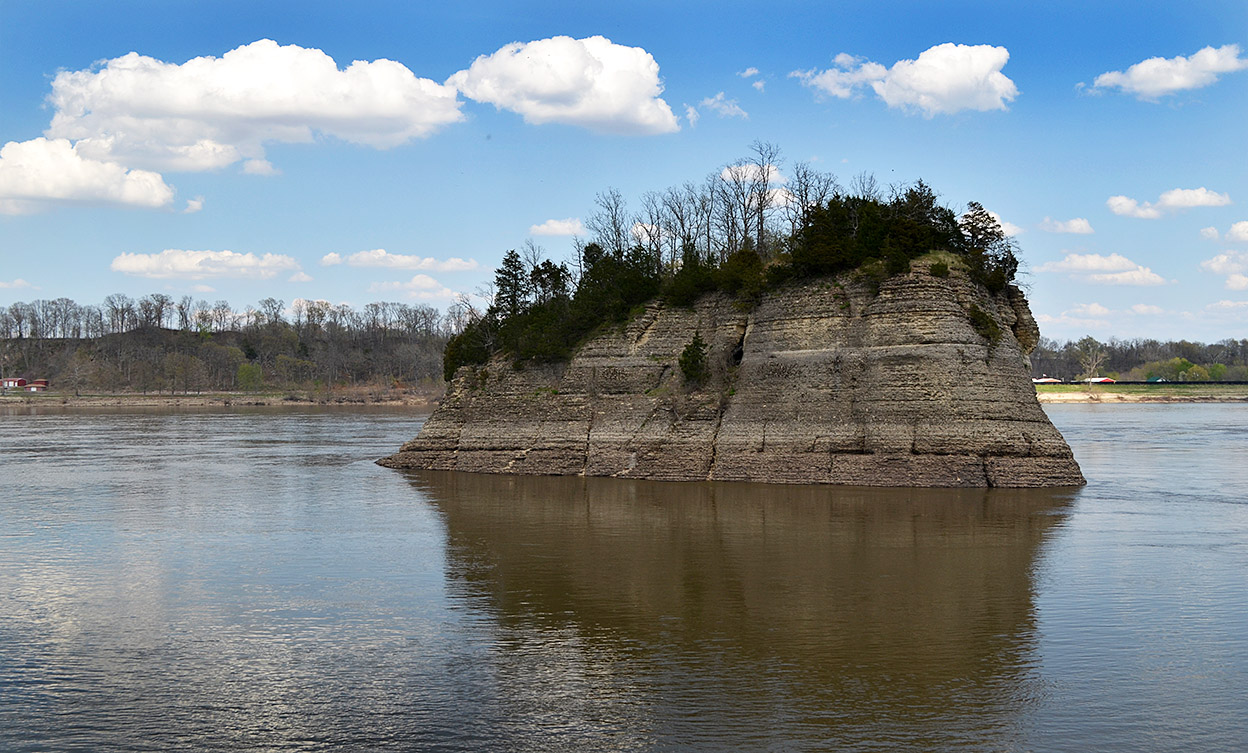
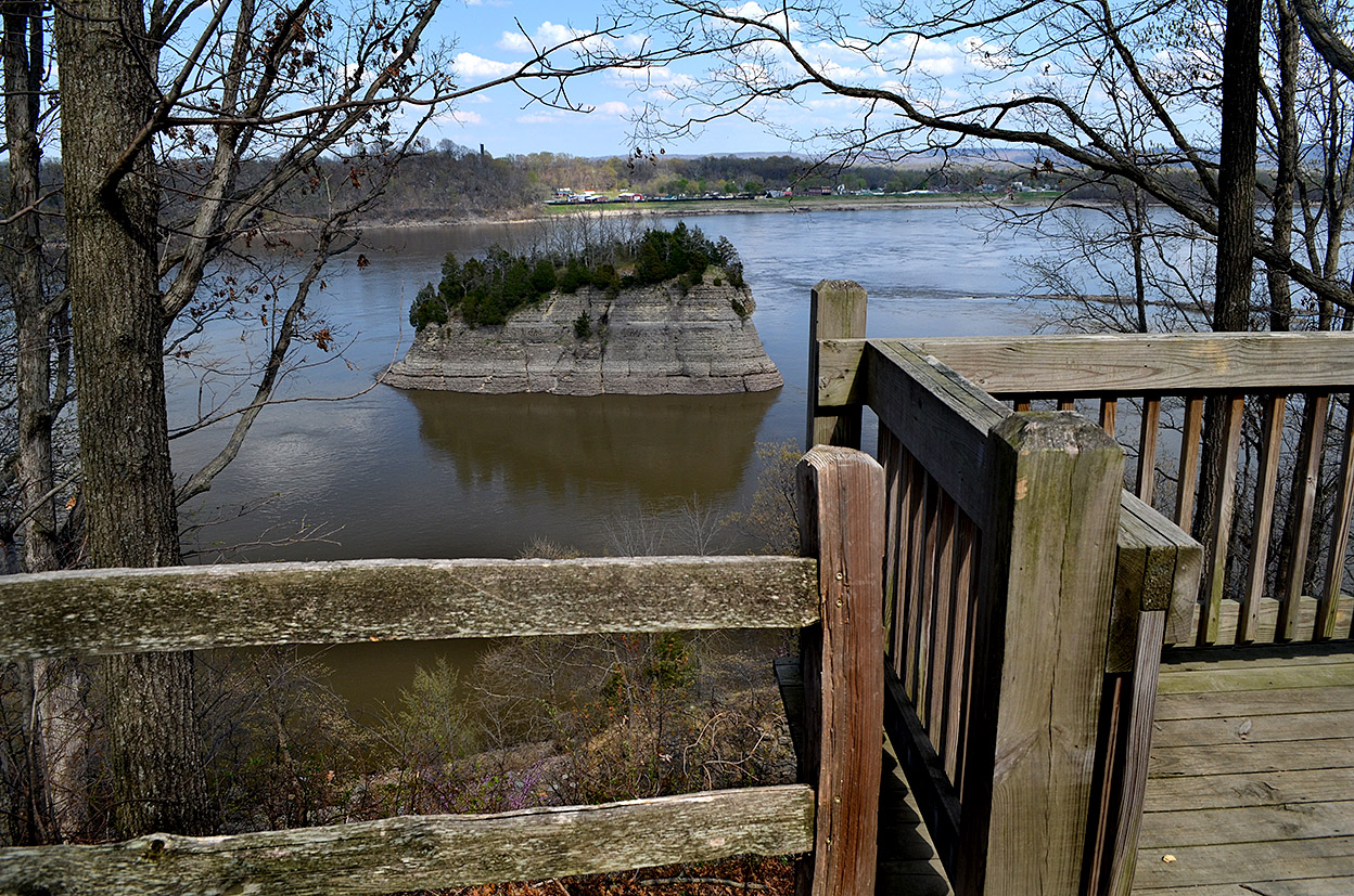
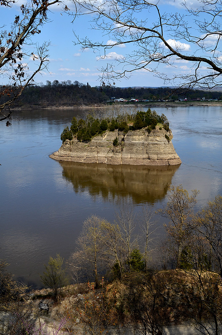
Blunt Nosed Chevrons

Aerials Commerce Area 08-13-2014Ernie Chiles and I were puttering around in the air someplace between lost and found when we spotted these strange structures in the Mississippi River.

You’d think Ernie, my former Central High School earth science teacher would be all up on this kind of thing, but he dodged my question by either (a) pretending he couldn’t hear me over the engine noise, or, (b) saying “look it up and get back to me by the start of class on Monday.”

Click on it to make it larger.

So, I looked it up

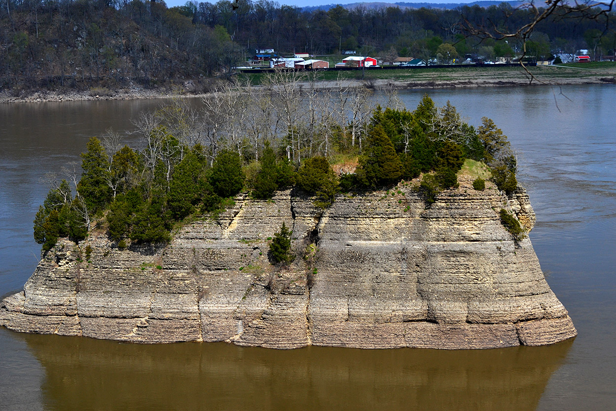
You are looking at blunt nose chevrons. Here’s what the Upper Mississippi River System Environmental Design Handbook has to say about them:

Blunt Nosed Chevrons provide nose protection for islands while providing slower moving waters for fish habitat. Large rock used to provide structural stability and openings for habitat benefits. A navigation structure called a chevron dike was developed to improve river habitat and to create beneficial uses of dredged material. These structures are placed in the shallow side of the river channel pointing upstream. Their effect is to improve the river channel. When dredging is needed to improve the main navigation channel, dredged sediment is deposited behind the chevron dike. These small islands encourage the development of all four primary river ecosystem habitats. In addition, various microorganisms cling to the underwater rock structures, providing a food source for fish.

Fifty-one fish species and a highly diverse group of macro invertebrates have been collected in and around the structures. The 8 years of data also show a high presence of young … and juvenile fishes inside of the structures, which suggests that the structures are being used as nursery habitat. The data also shows that the outside edges of the chevrons are providing excellent habitat for quality-sized catfish. Catch rates inside the chevron have been more than double the catch rates outside of the structures.

[I couldn’t tell where the experimental blunt nose chevrons had been constructed.]
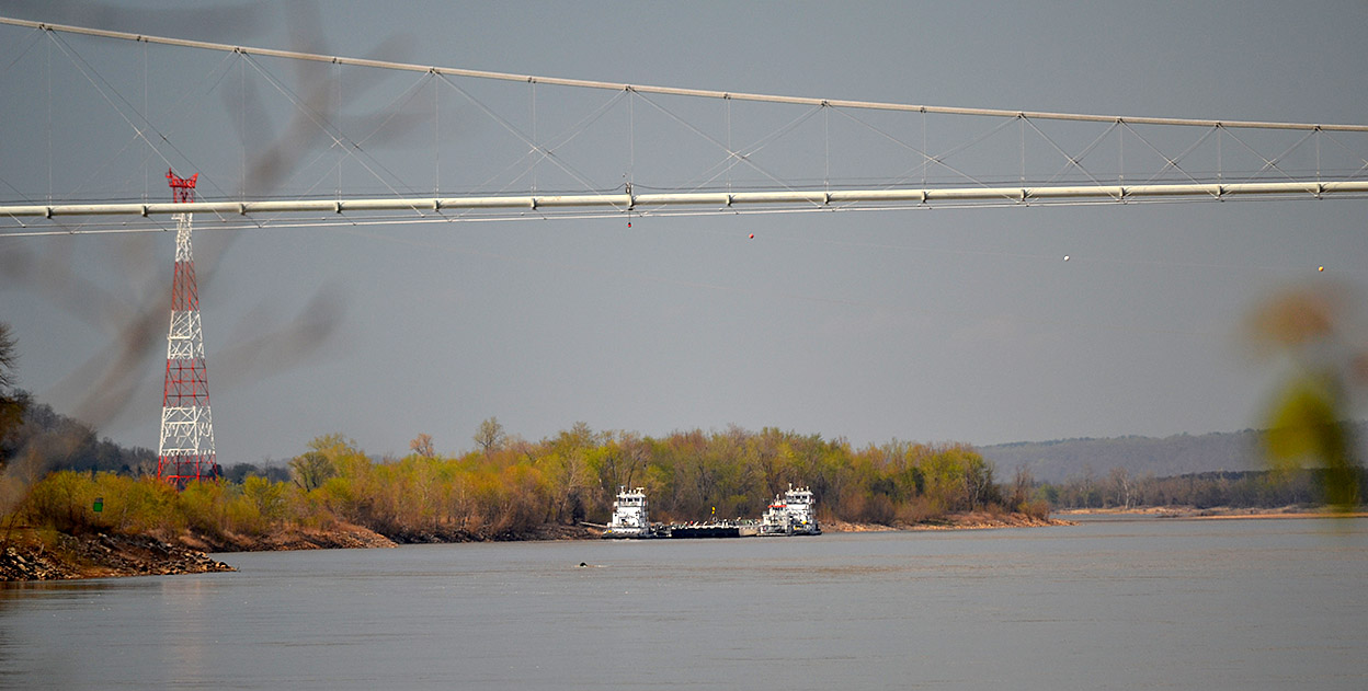
Where were we?

Based on photos taken on either side of the structures, I’d have to guess we were south of Commerce. I tried to find the structures on Google Earth, but the river was a little higher than when Ernie and I were up, so they may have been mostly covered with water. The foliage in the foreground might be on Goose Island, west of Horseshoe Lake.

I hope my extra credit homework will result in Ernie raising my grade in Earth Science circa 1963.

Oh, and in case anyone asks, these are called “river training structures.” The rock things we usually see going from the bank and pointing downstream are called “wing dams.” Newer ones are “notched,” which still help maintain the river channel through “scouring,” but do a better job of creating diverse habitats than a solid dike.

August 2014 Super Moon

Super Moon w Bill Emerson Bridge 08-10-2014After reading all the hoopla about yet another Super Moon, I checked the moon tracker on my Droid smartphone and told Mother we’d better saddle up so I’d be ready at 6:46 when the moon was supposed to rise at 110 degrees, slightly south of east. I calculated that the terraces at the River Campus would be a good place to use the Bill Emerson Memorial Bridge as a foreground object.

6:46 came and went. Then 7:00 and 7:15. That’s when I discovered that my moon ap thought I was still in Florida. I was an hour early. I cut a nap short for nothing.

That gave me plenty of time to shoot the trees in the gathering twilight, the river hiding behind a curve and a couple getting acquainted on the old bridge’s overlook before the moon made its appearance.

Super Moon photo gallery

Click on any photo to make it larger, then use your arrow keys to move through the gallery.

North Riverfront Park

Gateway Arch 10-17-2004Brother Mark and I rode our bikes from his house near the Botanical Gardens, past the Gateway Arch, and onto the St. Louis Riverfront Trail, over Chain of Rocks Bridge and into Illinois. You can read an account of our 2004 adventure on my bike blog.

Chain of Rocks Bridge

Chain of Rocks Bridge 10-17-2004The blog has some neat photos and some interesting history of the Chain of Rocks Bridge, which used to be part of U.S. Route 66. The unusual bridge has a 22-degree bend in it to allow river traffic to have uninterrupted navigation of the river.

Quick tour for Curator Jessica

Union Electric Light and Power Co 10-17-2004When I took Curator Jessica to the airport last November, we had some time to kill, so I took her to the North Riverfront Trail where we parked at the Union Electric Light and Power Company. Whenever I park at a trailhead, I scope out the lot for broken glass that indicates that cars have been broken into while their owners were away. Bad guys figure that you’re going to be gone for awhile.

The lot passed that sniff test, but I still felt uneasy for some reason. I’ve parked there before and ridden my bike in the area without my hackles going up, so I don’t know what I was picking up.

Floodwall Art Project

North Riverfront Trail 11-04-2013We passed the Floodwall Art Project, a seven-foot tall, 150-foot long tile mural designed by ceramic artist Catherine Magel and created with the assistance of at least 1,500 youth and adults from at least six St. Louis communities. The mural displays the history of the natural world beginning with microscopic life forms, moves into sea life, graduates to earth creatures, then ends with migrating birds.

Here’s where you can find out more about the Great Rivers Greenway. You can click on the photos to make them larger, too.

I felt uneasy

North Riverfront Trail 11-04-2013Curator Jessica was thoroughly enjoying herself, but my feeling of unease was growing. We were the only ones around, so there was no obvious reason why I was picking up bad vibes, but I suggested that we head back to the car.

This weird feature on a pedestrian overpass is unsettling, but I don’t think it was what was poking at my lizard brain.

I told Jessica that my misgivings were probably unfounded, but I had learned over the years to trust that instinct that something isn’t as it should be. She gave me her normal eye roll and “crazy guy” look, but didn’t object to moving on. I fully expected to see my car broken into when we got back to the parking lot, but everything was as we had left it.

I’ll have to see if I get the same feeling the next time I go there.

Tower Rock Overlook

Tower Rock 04-18-2014I’ve shot Tower Rock from about every angle except underwater (and I came close once to doing that when Brother Mark and I walked over there). I’ve been on the top of it, flown over it and have seen it from both the Missouri and Illinois sides.This is the view from the parking are where most folks see it.

The one place I HADN’T seen it from was the overlook.

In the summer and fall, the leaves are too thick to see anything and in the winter, I’m not crazy about a long, cold walk.

Overlook hangs out over hill

Tower Rock 04-18-2014On April 18, though, I didn’t have any excuses. The day was cool enough that I wouldn’t overheat, the sky was blue and there was no rain around. I drove across the railroad tracks (Stop, Look and Listen) and went up the road a couple hundred yards until I came to a wide spot that looked like the start of the trail.

Mother suggested I take a couple of deep swigs of water before heading up the hill. She said she’d stand by to dial 9-1-1 if I keeled over. I told her not to bother. There’s no signal down there.

The climb is moderately steep in some places, but it flattens out toward the top. You’ll definitely feel a burn in your thighs if you aren’t used to exercise. When you get close to the top, you look at the tiny platform hanging out over space and feel a little twinge of concern, but closer examination shows that it’s solidly built and in good condition.

Didn’t use polarizing filter

Tower Rock 04-18-2014Photo geek stuff: I keep Hoya circular polarizing filters on my lenses all the time. I find that being able to kill reflections improves many photos, even indoors. It also protects the front element of my lens from scratches.

Most folks think of them useful only to make skies darker, but that’s not the case. When I was rotating the filter to get the best result here, though, I quickly saw that the reflection of The Rock in the river added to the photo, so I kept as much of it as I could. It was a lot less interesting picture with the reflection knocked out.

Higher than The Rock

Tower Rock 04-18-2014Overlook is the right word. You are clearly higher than Tower Rock. If you are going to see it, better hurry, I think the trees will have too many leaves for a clear view before long.

Booms for river spill

River activity near Wittenberg 04-18-2014While we were in Altenburg, we heard scuttlebutt that a barge with fuel of some kind had run aground on a sandbar north of Wittenberg and that equipment was being staged at the boat ramp there. We saw about a dozen vehicles and two trailers of orange flotation booms in the parking lot, but there was nobody around to talk with.

Some of the trucks and trailers had “SWS Environmental Service” on their sides.

I called my friends at The Missourian with the tip, but told them I didn’t see much photo opportunity there, and I wasn’t even sure it was worth a story. I haven’t seen anything in the news, so either they couldn’t find out anything or it really wasn’t worth covering.

I didn’t offer up a photo because the last time I went in with a spot news photo I was told they don’t pay even a token amount for submitted photos these days.

Wonder if this was it?

River activity near Wittenberg 04-18-2014On the way from Tower Rock, we could see some activity close to the shore north of Wittenberg. We could tell that it wasn’t a string of barges. I heard traffic on the marine radio about trying to make fast some lines, but they were afraid they were going to foul. The action was too far away to see clearly, plus I was getting hungry.

Click on the photos to make them larger.

If you are interested in my small picture book, Tower Rock “A Demon that Devours Travelers”, stop by the Lutheran Heritage Center and Museum in Altenburg for a copy.