Shoe Factory Neighborhood

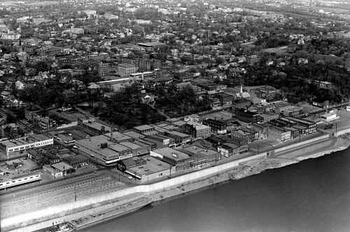
I can’t believe I missed this aerial photo of the old shoe factory plant I shot April 14, 1964, when I ran the piece on the site being the new home of the Isle of Capri Casino. You can clearly see the infamous jog in Main Street that will be straightened.

Jog provided challenge
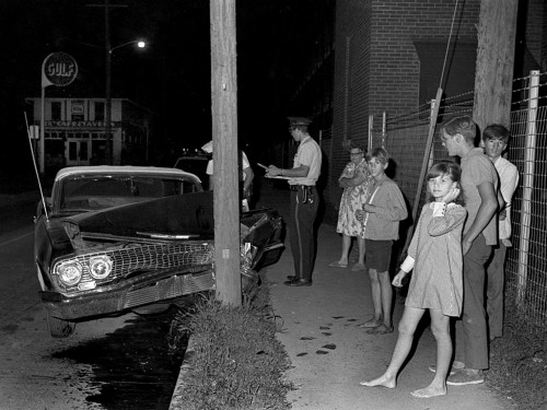
Reader John Burciaga shared this story about the jog: My only brother, Joe, Jr., 9 years older, was quite adventurous as a youngster. He and a buddy used to race side by side from downtown Main St. to the shoe factory site, where the sharp “dogleg” zig-zags left-to-right. This was always late at night, being careful police cars were not around, or traffic from the opposite direction. He never got hurt but I recall he tore a door off–reminding me a bit of the movie Rebel Without A Cause and the great chase to see who would bail out of his auto first before the drop-off.

This undated wreck photo from the 60s probably wasn’t caused by the zig-zag. It happened north of the jog and the car was southbound. You can barely see a building in the background that says “Cafe and Tavern.” The 1969 City Directory didn’t list the full name of the establishment.

Windows were painted
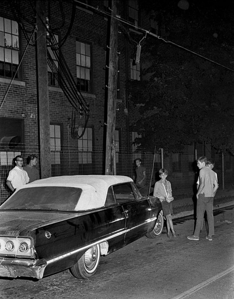
This shot of the wreck from the other direction shows the heavy-duty power lines feeding into the shoe factory and the painted windows. The only reason I can think for painting the windows would be to diffuse the light coming through them so there wouldn’t be any glare inside.

Old building at bottom of Mill Street
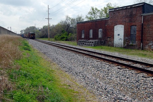
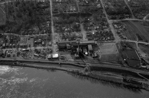
This old building at the bottom of Mill Street and south of the shoe factory, was still there in the spring when I shot a freight train going by.

Fairway Market No. 2
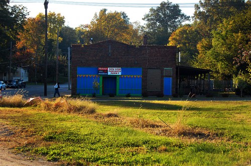
Missourian photographer Fred Lynch ran a Frony photo of shoe factory workers on strike in 1962 in his blog Dec. 3, 2010. He identified a building in the background as being the Fairway Market No. 2.

It’s been a number of things in the intervening years. Oct. 20,2009, a sign on the front of the building said that it was NOW OPEN as Margarita Mama’s. I don’t know how long they lasted or if they are still open. The Missourian had a number of stories detailing problems with the establishment’s liquor license.

I did see a notice that a tax lien against the property was discharged Dec. 10 of this year.

Red Star Baptist Church

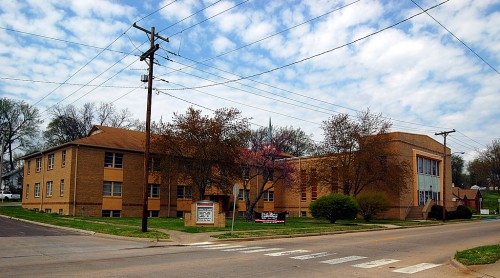
The Red Star Baptist Church is outside the casino area, as far as I know, but I’m tossing in a photo of it since it’s been a Red Star landmark. I remember it being right on the edge of the flood waters in 1993. I’ll revisit that area when those negatives surface.

St. Charles Hotel: General Grant Slept Here

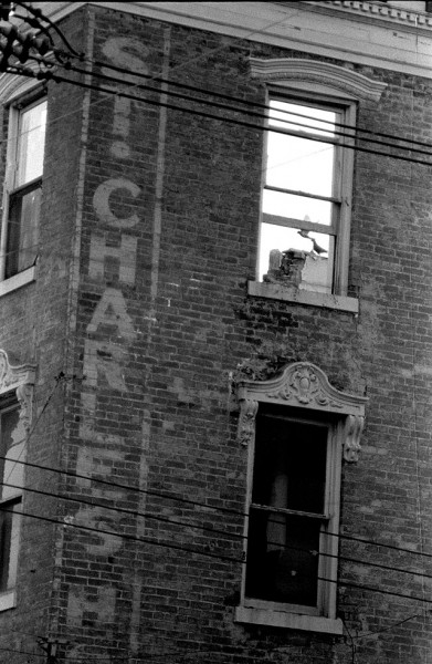
I shot this photo of birds flying around inside the St. Charles Hotel on March 11, 1967, and it ran on the front page of The Missourian on March 13. It had been sold Dec. 16, 1965, and was in the process of being razed when I took the picture. The roof had been removed and the interior was being gutted.

Gen. Grant slept here

Gen. U.S. Grant was registered in Room 5 for 50 days during the Civil War. Carrie Nation, of axe-wielding, saloon-busting fame, was a guest in 1907.

The building was completed in January of 1861. It was THE place to stay at the time. It was four stories tall, had verandas, an observatory, views of the river and large ventilated rooms.

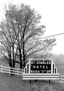
The rooms had electric fans, according to this sign taken between Cape and Jackson April 13, 1967. Of course, by this time, the roof was off and ventilation was plentiful. I wonder what the $1.50 room looked like.

I stayed in an old hotel with spacious rooms in Piedmont for $2 a night during that era, so it’s possible that you COULD get a room that cheaply. The bathroom was down the hall, but it WAS inside.

The Missourian carried a notice of sale July 23, 1965. In it, it mentioned that the hotel building was four stories tall, had 70 feet of frontage, 50 rooms to rent and three tenants on the first floor (with written leases expiring at different times).

St. Charles Drug Store

The St. Charles Drug Store must have been one of the tenants, because a story on Jan. 18, 1967, said that the store was moving to the southwest corner of Broadway and Main St., to the building formerly occupied by the Singer Company. The move was going to require extensive renovations to the ground and second floors of the property.

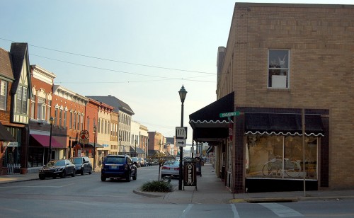
Here’s a 2009 photo of the corner of the property where the Singer Company / St. Charles Drugstore was located.

Sterling’s replaced St. Charles Hotel

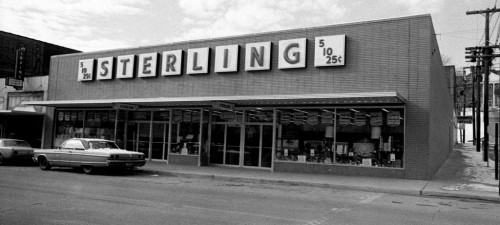
I shot this photo of the Sterling Store in January 1968. It must have been a cold day, because there is snow on the car parked in front of the store.

When I was home the last couple of times, I walked all of Main St., Broadway and Water St. shooting landmark buildings. The Sterling store must have been non-memorable enough that I didn’t waste any electrons on it.

Links to other photos

The Singer Company building and the St. Charles show up in the backgrounds of earlier stories I’ve posted.

[Editor’s note: things will be a bit slow here for a couple of days. I’m loading up the van to head back to Cape for the reunion, so I may not be posting until I get set up at my Mother’s house again. Hope to see a bunch of you there.]


Downtown Cape Girardeau Vintage Aerial Photos from the 60s

Fred Lynch had a Frony picture of cars parked on the Mississippi River wharf before the floodwall was built. I had a couple of frames I took from the air of the downtown area that shows the riverfront area after the floodwall and before the wharf area had been refinished.

(Click on the photos to make them larger. Click on the left or right side of them to step from one to another.)

Many landmarks are clearly visible. The most prominent, in the left center, is the Common Pleas Courthouse, high on a hill overlooking the city. Right behind and above the Court House, look for a white chimney. That’s the Southeast Missourian Tower, which stood 70 or 80 feet above the ground and could be seen as far away as McClure, IL. The tower was razed in 1978 when a new boiler was installed and it became obsolete. It also had shown signs of structural weakness.

Way up at the top center left is Academic Hall at Southeast Missouri State University. The tall, dark steeple of Trinity Lutheran Church is at the left of the frame.

Al’s Shops and the St. Charles Hotel

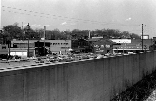
Here’s a view peeking over the floodwall from the south end of Main Street. Al’s Shops is clearly visible in both the aerial and this photo. Right over the top of Al’s, you can see the sign on the side of the St. Charles Hotel.You also can see the Firestone Store, Woolworth’s, J C Penney’s and Montgomery Wards.

I wonder if all the cars in the parking lot are shoppers or if they are store employees displaced when wharf parking was no longer available.

Stay at the St. Charles for $1.50 a night (and up)

Here’s a sign on Highway 61 between Cape and Jackson that promised ELECTRIC FANS and room rates of $1.50 a night and up at the St. Charles. It was taken April 16, 1967.

That’s even cheaper than the $2-a-night room I stayed in when I covered a Flying Saucer Convention in a small town in the Missouri Ozarks. I don’t recall if it had electric fans for the addition 50 cents. I know the bathroom was down the hall.

I’m still looking for some pictures I have of the St. Charles being razed. In the back of my mind, I see a crumbling brick wall and a window with either a bird flying through it or sitting on the windowsill.

Funny how some things flicker in and out of your memory.

Downtown Cape Girardeau, looking up Broadway

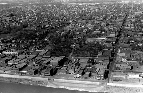
The Common Pleas Courthouse is, again central in the photo. Broadway runs from top to bottom at the right of the photo, Themis is behind and in front of the Courthouse, and Independence is at the left of the photo. Buckner Ragsdale is at the foot of Broadway. The building that became Port Cape Girardeau is at the foot of Themis. The peaked roof, one building to the right of Themis on Main St., is Hecht’s. I can’t make out its iconic wind vane in this photo, unfortunately.

The Idan-Ha Hotel at Broadway and Fountain is visible above The Missourian building and across from the Marquette Hotel. The KFVS tower hadn’t been built yet.

National Register Listings

The Missouri Department of Natural Resources has an excellent resource for anyone interested in historical buildings. Go here for a listing for Cape Girardeau County’s National Register Listings. Some of the files are large, so they may not be suitable for folks with slow connections. There are histories of the buildings, maps and photos. It’s a great way to kill some time and learn a lot about the area.

The downtown area is covered by three files all tagged Cape Girardeau Commercial Historical District (with boundary increases).

If you are on Facebook, check out the Old Town Cape fan page and the Cape Girardeau fan page. There’s a lot of interest in Cape on the Internet.

Other visits to the riverfront and downtown area