The Confluence

Aerials Cairo area Confluence of Mississippi and Ohio Rivers 08-13-2014There was some discussion on a Facebook group about the confluence of the Mississippi and Ohio Rivers at the south end of Illinois at Ft. Defiance. That’s been one of my usual stops every time I’ve passed through, going to or from Cape.

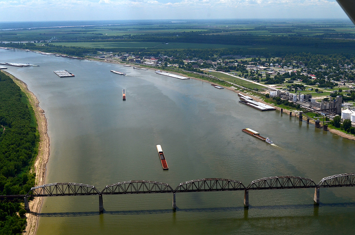
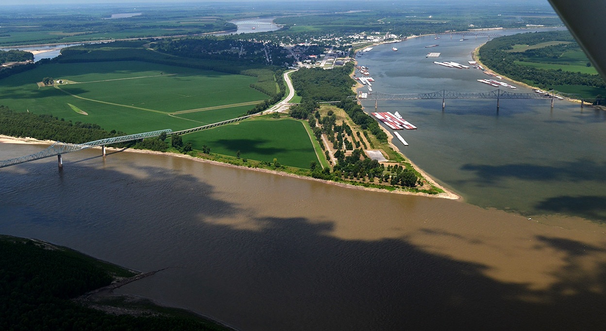
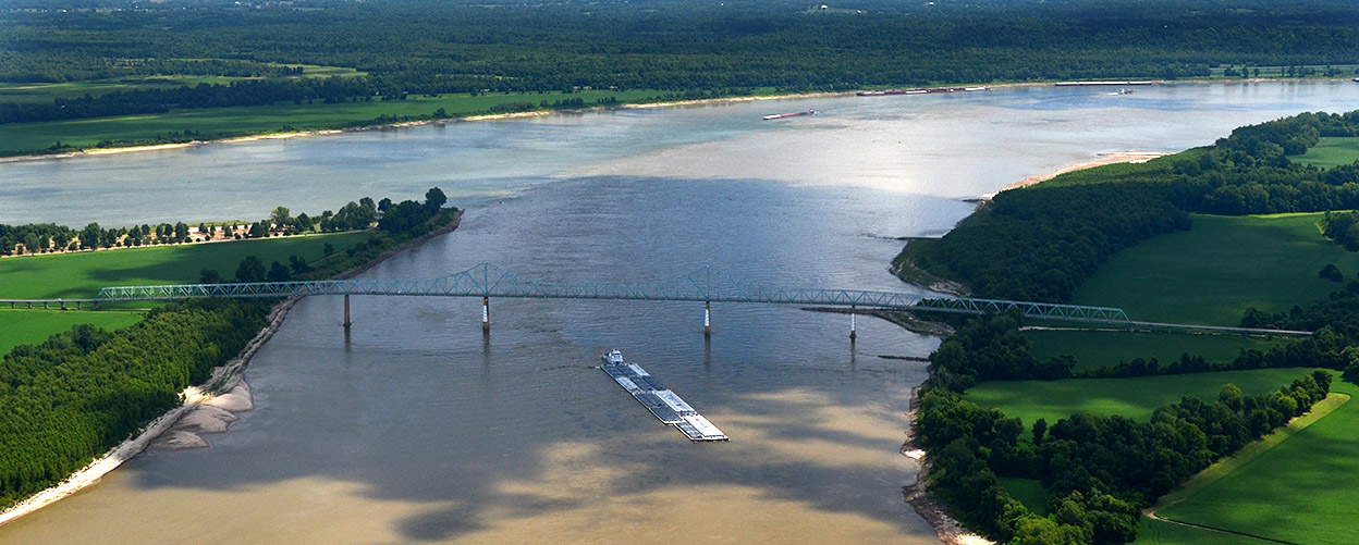
Pilot Ernie Chiles and I picked a bad day back in August 2014 for this particular project: we couldn’t shake the clouds that kept covering the mingling of the waters. In this photo, the Mississippi is the brown mass snaking from the left side of the frame and crossing across the bottom. What’s left of Cairo is in the top middle. The bridge carries traffic from Illinois to Kentucky.

The Muddy Mississippi is higher than the Ohio and it’s “holding back” the greenish waters of the river on the right. Click on the photos to make them larger.
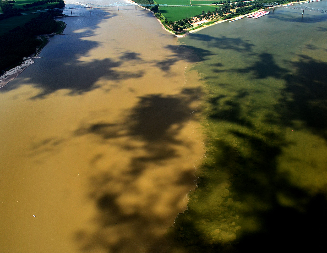
Pushing the Ohio

Aerials Cairo area Confluence of Mississippi and Ohio Rivers 08-13-2014
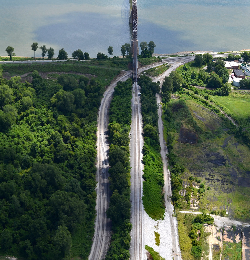
The view looking down the Mississippi shows the muddy water pushing the Ohio way over onto the east side of the river. This bridge links Illinois to Missouri.

Southernmost point of Illinois

Aerials Cairo area Confluence of Mississippi and Ohio Rivers 08-13-2014
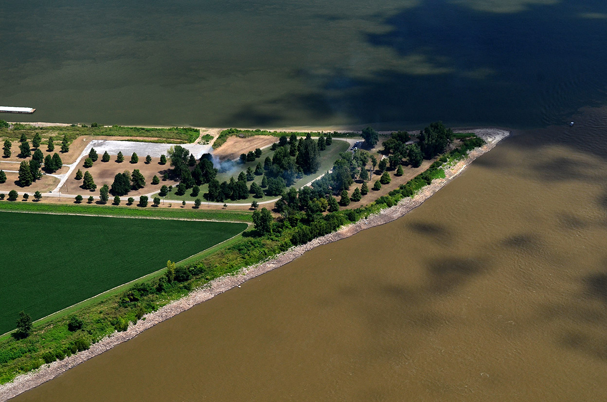
That tiny point of land is as far south as you can go in Illinois. The Mississippi is at the bottom, and the green Ohio, looking almost like a field of grass, is meeting it at the top.
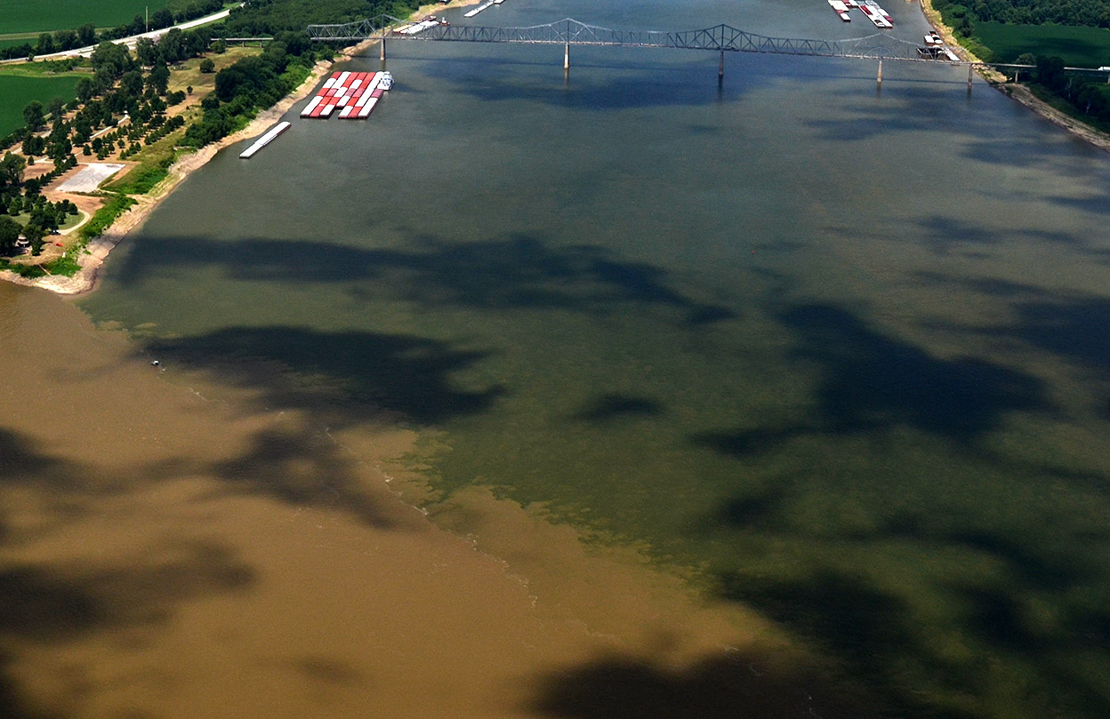
War of the waters

Aerials Cairo area Confluence of Mississippi and Ohio Rivers 08-13-2014The intersection of the two rivers is a bit roiled because a tug steaming northbound up the Mississippi stirred things up.

That’s why it’s called The Big Muddy

Aerials Cairo area Confluence of Mississippi and Ohio Rivers 08-13-2014The Mississippi is divided into three regions. This marks the beginning of the Lower Mississippi. Surprisingly, at the confluence, the Ohio is the bigger river at this point, based on flow, with it’s long-term mean discharge at Cairo being 281,500 cubic feet per second. The Mississippi, measured just upriver at Thebes, is 208,200 cubic feet per second.

On this day, though, the Mississippi was higher and dominant.

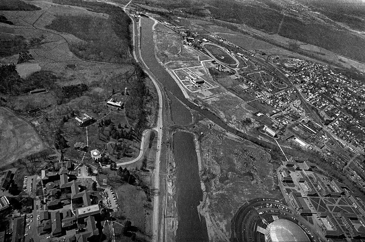
You can see two of my favorite Ft. Defiance photos here. One was taken in 1968, the other in 2010.


Silver Bridge Collapse

Model of Pt. Pleasant Silver Bridge 08-10-1968Chuck Beckley, who was a high school kid working as a lab tech at The Athens Messenger  47 years ago, posted a photo to Facebook of a roadside marker that read:

Silver Bridge Collapse

Constructed in 1928, connected Point Pleasant and Kanauga, OH. Name credited to aluminum colored paint used. First eye-bar suspension bridge of its type in US. Rush hour collapse on 15 December 1967 resulted in 31 vehicles falling into the river, killing 46 and injuring 9. Failed eye-bar joint and weld identified as cause. Resulted in passage of national bridge inspection standards in 1968.

The model above is one that was exhibited at a fair I covered in Point Pleasant, West Virginia.

Who covered it?

Silver Bridge piers 12-06-1969Churck asked Bob Rogers, “Did I pick up film from the bus station for you and Jon [Webb], or Ken for this?”

It wasn’t me. I didn’t start working for The Messenger until the summer of 1968. On that particular day, I was on a train about half-way to Cincinnati headed back to Cape for Christmas break. At one of the stops, a passenger got on and started spreading the word about a big bridge collapse in Point Pleasant. He didn’t have a whole lot of details, and I was anxious to get home to see family and Girlfriend Lila, so I didn’t give it much thought.

I spent a lot of time later covering the building of the new Silver Memorial Bridge. Here are the piers of the old bridge. If the railroad bridge in the background is indicative of how well bridges were maintained in those days, it’s no wonder the bridge went down.

Over in less than a minute

Silver Bridge piers 12-06-1969Even though I didn’t cover the actual tragedy, I’m haunted by the gouges and scars on this pier. In other photos on that roll, you can still see cables and wires dangling down into the water.

The National Institute of Standards and Technology website explained it in chilling detail:

On December 15, 1967 at about 5PM the traffic signal at one end of the Silver Bridge turned red. The rush hour traffic, together with the Christmas shopping traffic, completely occupied the main span of the bridge connecting Point Pleasant, West Virginia with Kanauga, Ohio. Suddenly a loud cracking sound was heard and one of the main towers began to twist and fall.

In less than a minute, all three spans of the bridge collapsed into the icy Ohio River, carrying with them all the cars, trucks, and people. Forty-six died.

[The failure of an eyebar set the chain of events in motion] Once this eyebar failed, the pin fell out, unpinning this part of the suspension chain. The adjacent tower was subjected to an asymmetrical loading that caused it to rotate and allow the western span to twist in a northerly direction. This span crashed down on the western shore, folding over on top of the falling cars and trucks. Loaded by the whole weight of the center span, which had now become unsupported on its western end, the east tower fell westward into the river along with the center span. Finally, the west tower collapsed toward Pt. Pleasant and into the Ohio River, completing the destruction of the Silver Bridge.

Two bodies were never recovered.

 Silver Memorial Bridge

Silver Memorial Bridge 12-06-1969I took this photo of the new Silver Memorial Bridge on December 6, 1969. The replacement bridge opened on December 15, 1969, exactly two years after the collapse.

When I went through that area last summer, I looked for any remnants of the old Silver Bridge. Either I was in the wrong place or every trace of it has been removed. I still think about what it must have been like to have been stuck in that traffic jam nearly half a century ago.

James Baughn’s Bridgehunter website has more information on the bridge and its collapse.

Cairo’s Railroad Bridge

Aerials Cairo area 08-13-2014You can find out more than you ever wanted to know about the railroad industry in general and the Cairo Railroad Bridge in particular at the Bridges & Tunnels website.

By the late 1800s, as many as 500,000 railroad cars a year were ferried across the Mississippi and Ohio Rivers. Bridging the rivers was hampered by the Civil War, economics, engineering challenges and the steamboat industry, which saw railroads as an attack on its livelihood.

Click on the photo to make it large enough to see Cairo on the right and Kentucky on the left . Just beyond the curve in the background is where the Mississippi and Ohio Rivers join at Fort Defiance, the southernmost point in Illinois.

First bridge finished in 1889

Aerials Cairo Railroad Bridge 08-13-2014The first Cairo Bridge was an engineering marvel. The 10,650-foot, 52-truss bridge was the longest steel bridge in the world at the time. The total length, including trestles was 3.875 miles.

On October 29, 1899, the first train, consisting of nine 75-ton Illinois Central Mogul engines, the heaviest ones in service on the line, inched across the span. After they made it across the Ohio River safely, the train reversed and picked up a tenth engine, and blasted across the bridge at full speed. The second train to cross was full of newspapermen. I’m surprised they weren’t the first test train.

The Ohio River and the railroad bridge are in the foreground. The blue-green bridge in the background is the I-57 bridge crossing the Mississippi River into Missouri.

Bridge needed replacing by mid-1940s

Aerials Cairo Railroad Bridge 08-13-2014The website reported that a 6.6 earthquake in the New Madrid Sesmic Zone cracked a pier on the bridge in 1895, but repairs were made right away. A 1946 study showed quite a few dangerous deficiencies. Half a century of pounding by heavy loads had worn out key bars and rollers. An anemometer was installed and trains were prohibited from using the bridge when winds were high.

Work on a replacement that used some of the existing piers started in the summer of 1949; it was completed in May 1952.

This photo shows the east side of the bridge and the high levee that protects Cairo from the north.

Keep me in mind

There’s a small DONATE button at the top right of the post.

Thanks for reading my ramblings and thanks for helping offset my expenses.


The Flood of 1913

Aerial photos of Hocking River relocation 04-09-1970When I moved to Athens, Ohio, in 1967, I sneered at the puny Hocking River: “You call that a river? Where I come from, on the banks of the Mighty Mississippi River, we’d call that a creek at best.”

A year later, the Hocking would flood a significant part of the campus, prompting a major re-routing of the river. In this 1970 aerial, the old channel meandered through the heart of the low part of the campus. A dike or plug kept the old river from flowing down the new, straighter, wider channel during construction. (You can click on the photos to make them larger.)

Muskingum River bridge

Malta OH riverfront 08-24-2014Malta was just down the road from Miners’ Memorial Park and Big Muskie’s bucket, so I paused to give Curator Jessica a chance to photograph this bridge over the Muskingum River because there was talk that it might be replaced. I left the motor running and stayed near the van.

Twin City Saloon

Malta OH riverfront 08-24-2014I was trying to make out what that blue line was on the red building when a guy came out, saw me and started pointing up at it. He walked over and struck up a conversation. He’s the owner of the Twin City Saloon, and that line represents how high the water got during the Flood of 1913.

We chatted a bit, then I mentioned that Curator Jessica worked at the Athens museum and that we were lollygagging around the state visiting interesting places. When she walked back to where we were, he said, “I have something you need to see.”

Jessica gets kidnapped

Malta OH riverfront 08-24-2014I didn’t want to leave the van unlocked and running, so I volunteered to move the van closer and lock it up. When I completed my task, I headed over to where I thought the couple had gone. No bar owner, no Jessica.

“That’s great,” I thought. “I’m going to have to go back to Athens to tell Hubby TJ that Wife Jessica has been sold down the Muskingum River for whatever curators are good for, and that it’s my fault for not keeping track of her.”

I decided to check the bar. It had a Closed sign up, but the door was unlocked. There was Jessica and the owner looking over some cool artifacts that had been in the building for more than 100 years.

The Great Flood of 1913

I can rattle off significant Mississippi River Floods: 1927, 1941, 1973, 1993, 2011, but I had never heard of the Great Flood of 1913. The History Channel said “It is estimated that the Great Flood of 1913 killed more than 1,000 Americans, making it the country’s second-deadliest deluge (behind only the 1889 Johnstown Flood, in which more than 2,200 lost their lives). The destruction cut across 14 states—reaching from Vermont to Michigan to Louisiana—making it the country’s most widespread natural disaster.

“The apocalyptic storm that caused the Great Flood of 1913 impacted more Americans than the San Francisco Earthquake and Fire of 1906, the Hurricane of 1938 and many other better-known natural disasters. So why has history largely forgotten it? Geoff Williams, author of a book on the Great Flood, said it’s because the impacted communities viewed the disaster as a local, rather than a national, calamity. ‘If you lived in Dayton, it was the Great Dayton Flood. If you lived in Indianapolis, it was the Great Indianapolis Flood. People thought of it in very local terms although it was a huge regional flood.‘”

Look at Marietta’s flood levels

Marietta Ohio River 08-24-2014When we got down to Marietta, Ohio, there are some wooden poles that indicate the height of various Ohio River floods over the years. The tall pole at the right shows the March 1913 crest of 58.7 feet. The city’s website said that flood “The flood swept 120 homes away, knocked 200 homes off their foundations and water was eight feet deep in the old Post Office.”

That’s pretty impressive.