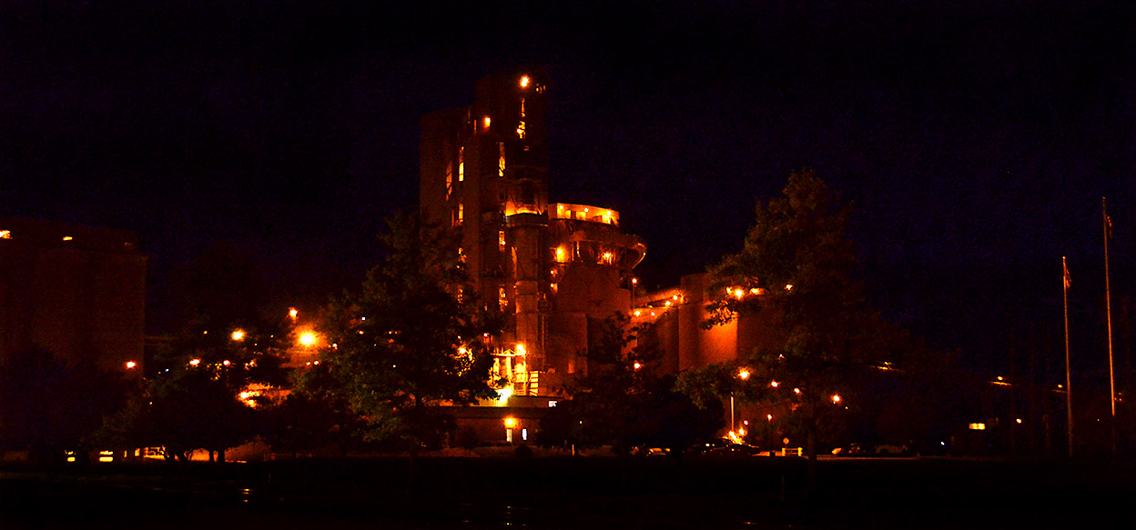
 Once you’ve said Buzzi Unicem Cement Plant at night, you’ve said it all. Click on the photo to make it larger.
Here’s a link to some other cement plant stories.

Cape Girardeau History and Photos
News photos that have grown whiskers and have become history
Photos taken in and around Cape Girardeau, MO
Once you’ve said Buzzi Unicem Cement Plant at night, you’ve said it all. Click on the photo to make it larger.
Here’s a link to some other cement plant stories.
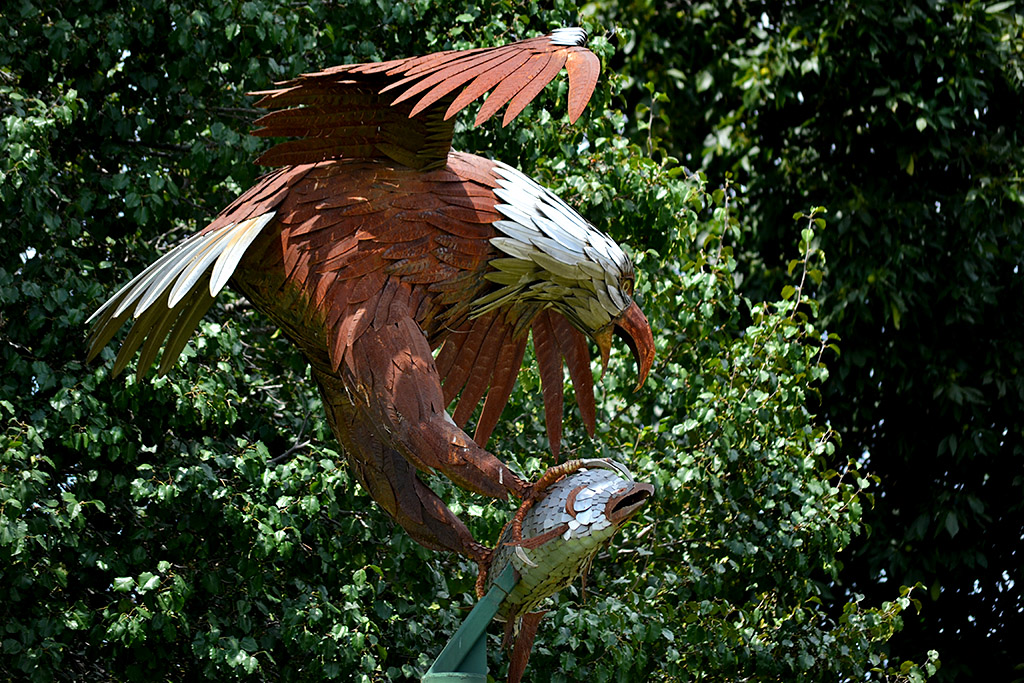 I drove down Lee Avenue in Jackson hoping to find some interesting pictures of Kasten Masonry Sales. On the way down to where the road deadends, I spotted this eagle catching a fish sculpture.
At first glance, it looked too back-lit to be good, so I made a mental note to come back on a day when the light was better. When I looked at it tonight, I decided it wasn’t that bad.
The only problem was that I didn’t know the name of the company.
Google, as usual, was my friend. I used Google Maps to find the street, then switched to Google Earth.
Not only could I see the company’s buildings, but I saw a shadow of the sculpture on the ground. I switched to Streetview and “drove” along Lee Ave. until I spotted the eagle, and lucked out that a sign reading Associated Sheet Metal Company was attached to it.
So, that’s how you can find out stuff.
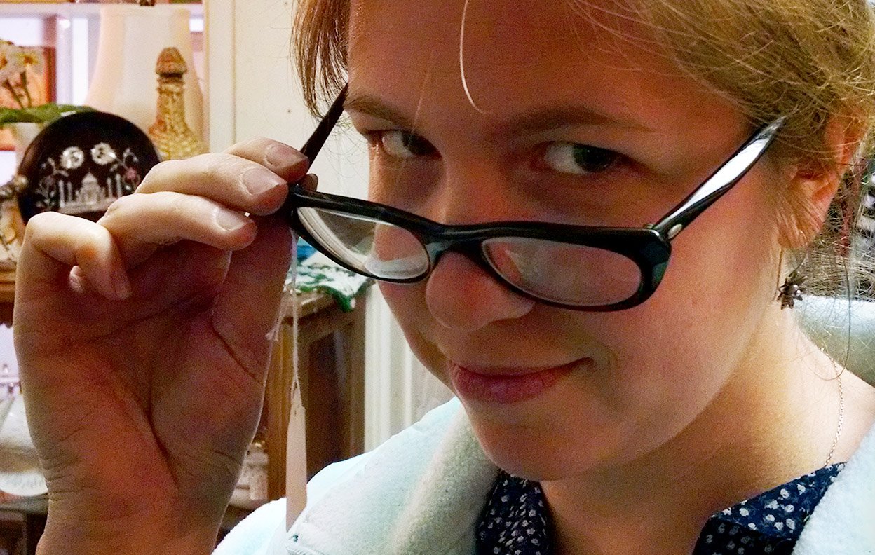 Curator Jessica and I made a quick stop at Annie Laurie’s Antiques Tuesday afternoon. (OK, I made a quick stop; Miz Jessica had to try on hats, dresses, glasses, and fondle plates before she was ready to go.)
This is her practicing her come-hither look accented by a pair of one-dollar glasses. I suggested the Athens County Historical Society could use that in a billboard ad campaign: “Hi, I’m Curator Jessica. Come by the museum and let’s make some history together.”
She didn’t like the idea well enough to pay the buck for the glasses.
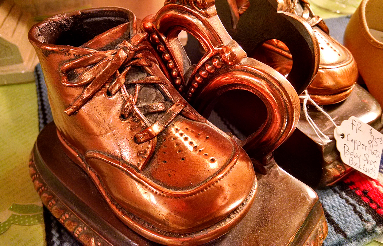 While waiting for her, I spied several pairs of bronzed baby shoes on sale. “I wonder when the last baby shoe was bronzed?” I wondered.
They were common when I was a kid, but I haven’t seen a fresh set in years; my brothers and I didn’t have our shoes preserved, so far as I know.
A Google search led me to the American Bronzing Company’s website. It was founded in 1934 by “Grandma Vi” Shinbach. The company’s website claims it has bronzed more than 14,000,000 baby shoes.
The bronzed shoe isn’t a mold: it’s the actual shoe, although some liberties are taken along the way. Here’s a good video that shows the bronzing process. After seeing how labor intensive it is, I don’t think the $59.95 price for the cheapest pair of shoes is all that out of line.
They do more than shoes: They’ll bronze a cheeseburger for $163.95.
Did your parents bronze YOUR shoes? If so, what did you do with them when you grew up? Did you preserve the shoes of your urchins?
 Mother, Curator Jessica and I took off for Steele this morning – eight miles from the Arkansas border – to photograph a Bootheel farmer I met at the Altenburg museum last week.
No journey ever takes us from Point A to Point B directly back to Point C, so we wandered around in New Madrid County for a bit, then meandered all over places that I’m not sure even the Lady in the Sky who lives in my GPS has ever heard of.
Let me explain the division of labor here: my job is to drive and keep us from getting killed by wayward 18-wheelers. The job of the Road Warriorette is that of Navigator, responsible for directing the Driver toward food and lodging (and, as we will find later, Natural Breaks).
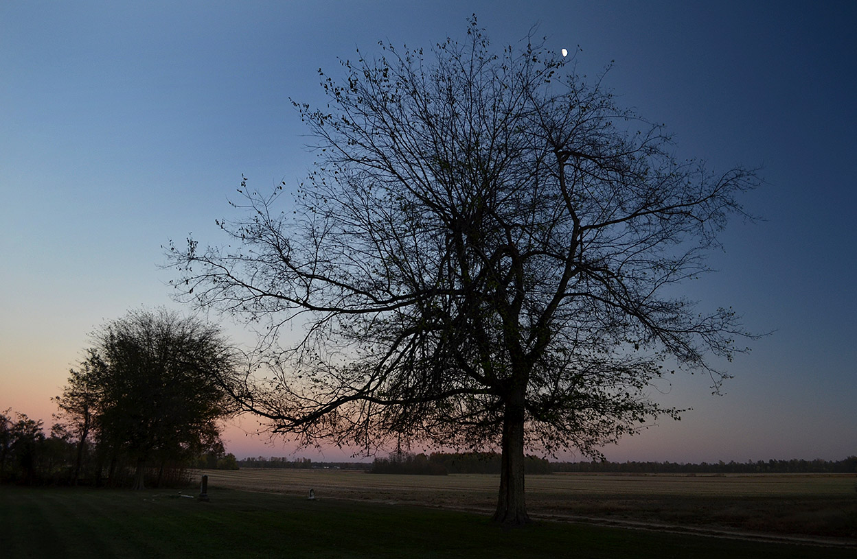
We left New Madrid with the sun high in the sky and decided to find some roads that skirted the Mississippi River, some of which must have followed the paths of drunken cows. Shortly after I pointed out that we had already been through a particular intersection at least twice, we ended up going down a road aptly bearing a sign, Dead End, that led to a well-kept Sugar Tree Ridge Cemetery.
With the sun going down on one side and the moon coming up on the other, I suggested that Mother might want to start rationing the cookies we had brought along: “This might be a long night.”
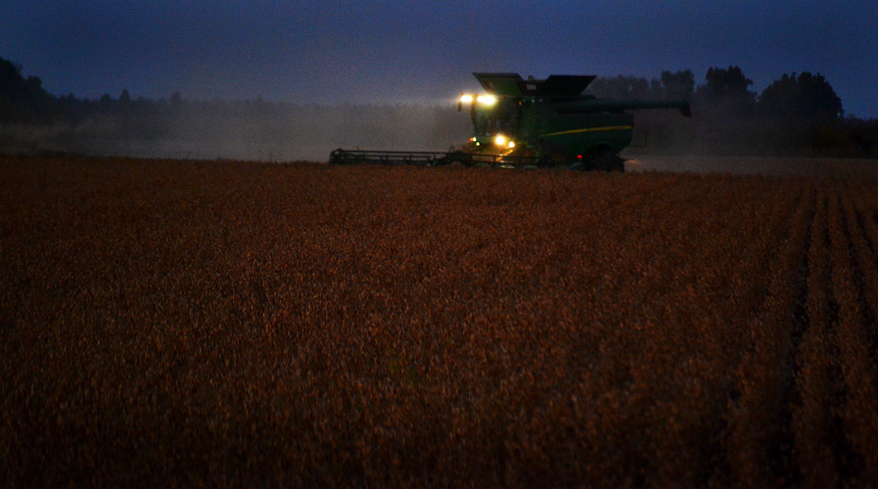 We weren’t the only ones picking our way though the dark: we spotted lights on farm equipment dotting the countryside.
We hadn’t seen a car behind us for an hour, but the moment I stopped in the road to take this photo, I heard the whizzz of one passing us. I’m glad he had room to pass: most of the bridges out there were labeled “One-Lane Bridge.” They didn’t bother to note that the road wasn’t much wider than the bridge.
 With 43 miles to go, my Navigator gently suggested that the trip would be much more pleasant for her if we would stop at the next convenient place for her to take, as they say in the Tour de France, a “natural break.”
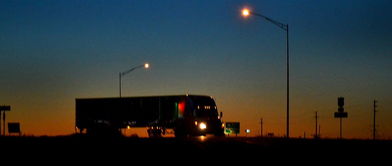
While waiting for a chance to get back on I-55, we spotted this one-eyed truck coming toward us. Navigator Jessica asked if I had ever played “padiddle.”
Having led a sheltered life, I had to confess that I had heard the phrase, but didn’t know exactly how to play it or exactly what it was. My navigator demurred providing details.
Google being our friend, I was enlightened by the Urban Dictionary: A game in which you look for cars with headlight or foglight out (padiddle) [also spelled pididdle] or tail light (pedunk) and call it out. When someone correctly calls a padidle or pedunk, all members of the opposite sex present must remove an article of clothing.
Example: Padiddle! You have to take off your shirts.
Our trip from Missouri to Ohio has just become a lot more interesting.
As always, click on the photos to make them larger. Alas, there are no padiddling photos available.