
 I was scrolling through aerial photos from November 11,2010, when an unusual shape caught my eye. It was in just one frame, and I couldn’t place what or where it was. (Click on the photo to make it larger.)
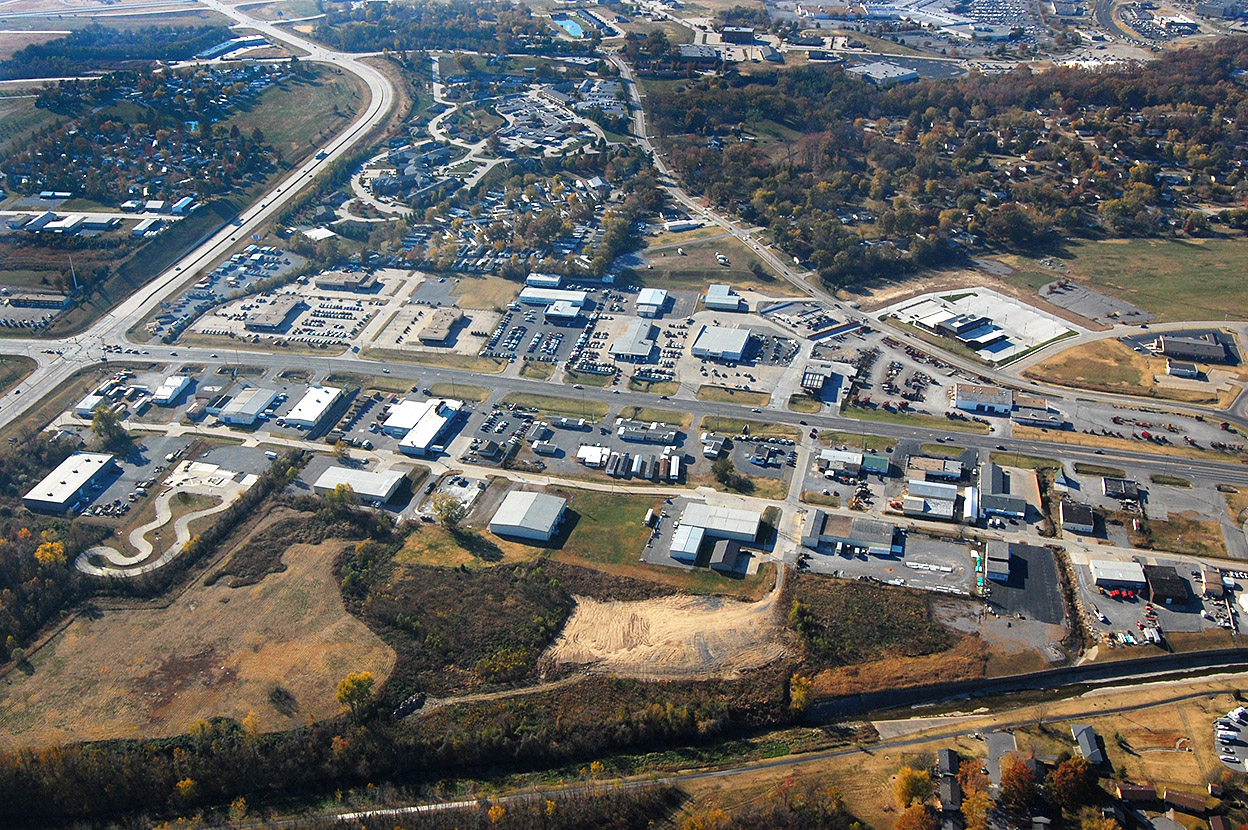
I called up Google Earth and worked my way along I-55 looking for the serpentine-shaped pavement at the lower left. After determining that the four-lane divided highway wasn’t the Interstate, I figured out that north-south road was South Kingshighway and the major road running east and west and intersecting with it is the Southern Parkway.
Running across the bottom of the photo is the Cape Recreational Trail paralleling Cape LaCroix Creek.
I was confused, though, because something as oddly shaped as my target should pop right out. By looking at the other landmarks in the area, I determined that the building was located on the south side of Commercial Street where it deadends at South Kingshighway. The reason I couldn’t find it is that it’s been wiped out.
I shot my photo in 2010. Google Earth showed it there in 2011, but when they make their last pass on April 1, 2012, the land was in the process of being cleared. Google Earth has a cool timeline slider that will let you step back through all their photos. The track hadn’t been built when they flew over it on on March 26, 1993, but it did appear on March 21, 1996.
So, what WAS it, a go kart track?