Kage School Initials Mystery

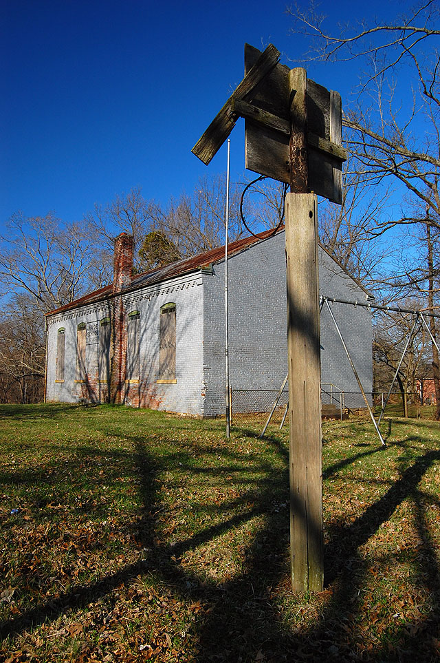
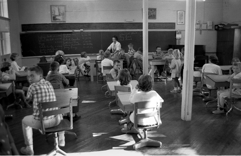
Kage School before it closed in 1966

At the end of November, 2009, I ran this and two other pictures of Kage School shot sometime around 1966, just before the school was closed and 112 years after it opened. Follow this link to read the original story with the history of the school and some other resources.

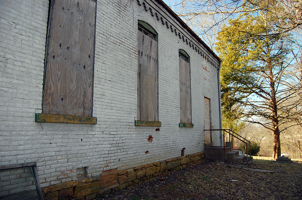
Initials carved into the brick

At the time, I didn’t notice the initials carved into the bricks on the south wall of the school. The odd thing is that no description of the school I’ve read mentions the carvings.

Was this REALLY scratched in 1899?

This building was constructed in 1880, so it’s conceivable that someone with the initials ROL might have scratched his name on the south wall of the building. That’s the side that the 0uthouse was on and the door to the kitchen wasn’t added until years later, so there was some privacy. If the child was waiting for his or her turn in the outdoor toilet, maybe he or she passed the time tracing letters in the soft brick. The “L” has a unique shape that makes me think of a font of that period.

1913 is a little more plausible

WS claims to be from 1913. Discipline was strict in schools of that era. You have to wonder what punishment, if any,  students would receive if they were caught defacing the building. Or, was it a school tradition that was overlooked as long as it was done only on that back wall.

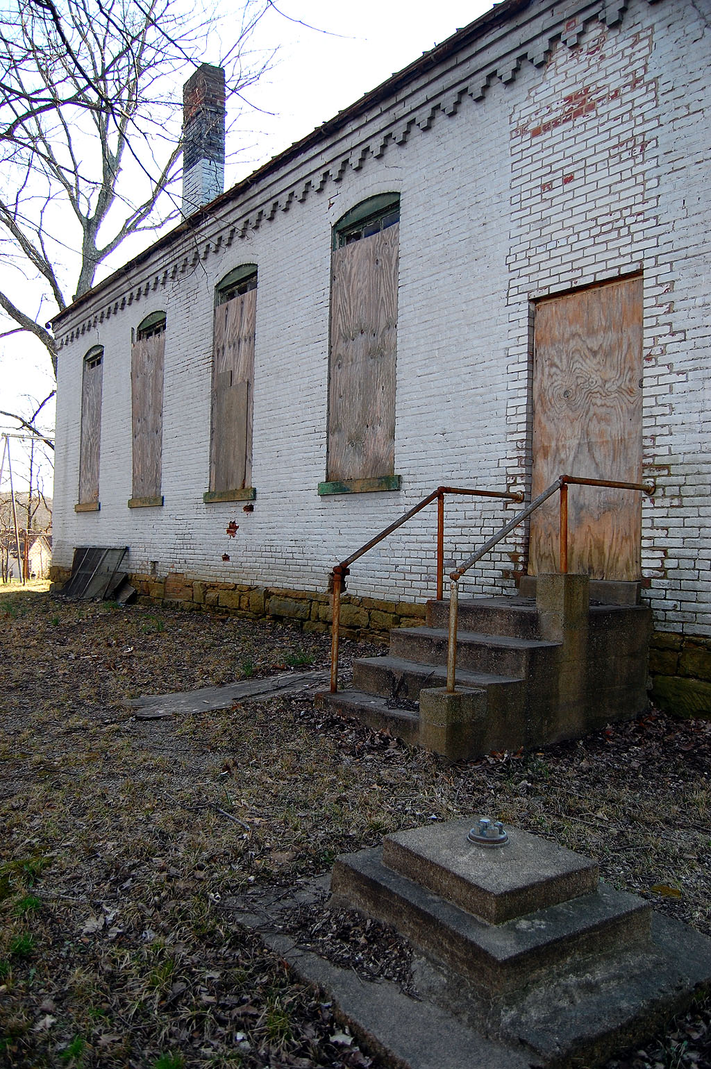
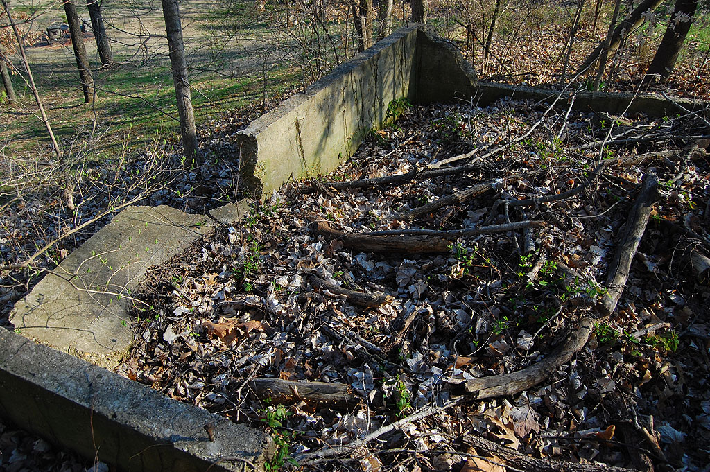
Where was the outhouse?

My 1966 photo showed a small child headed to the outhouse. It’s long gone, but there are two concrete foundations still standing on the south side of the school. The application for the National Register of Historic Places says that one of them was a utility shed and the other was the outhouse.

I’ll have to take their word for it. The one foundation looks too large for an outhouse and the other looks too small for a shed. For obvious reasons, I didn’t dig too deeply into the subject.

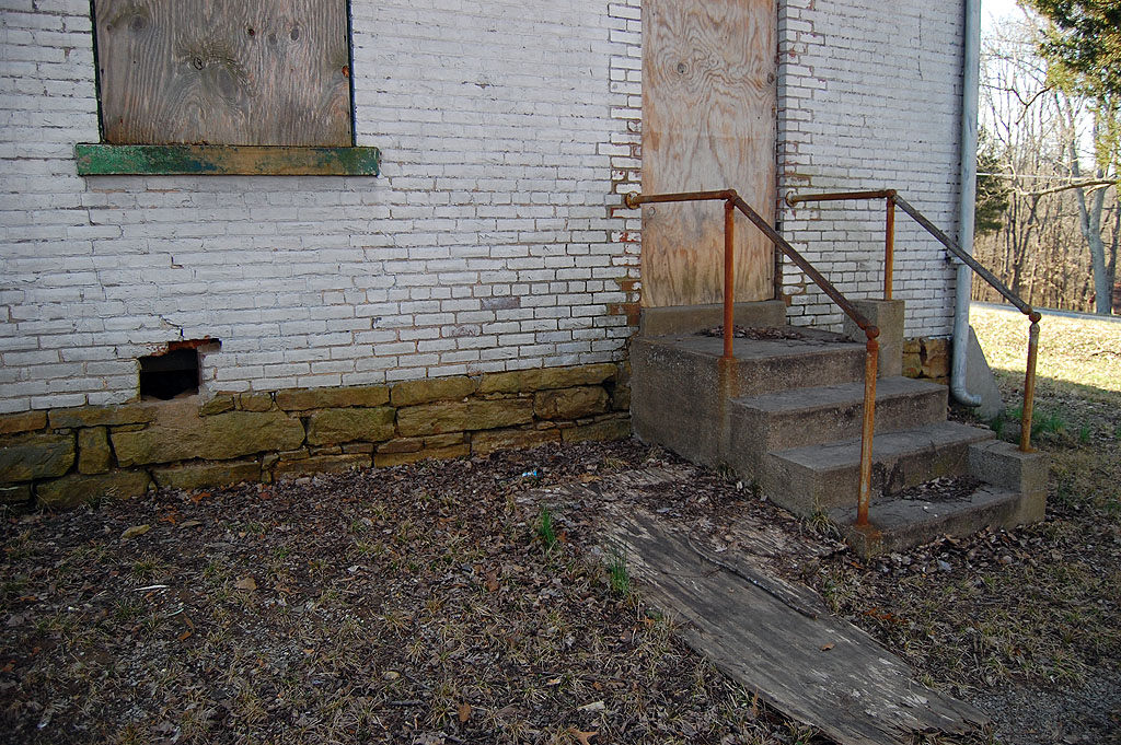
Outhouse or utility shed?

I thought the outhouse was closer to the school, but this COULD be the pit. I tried to convince my brother, Mark, to explore the subject, but he’s not as gullible as he was when he was a kid.

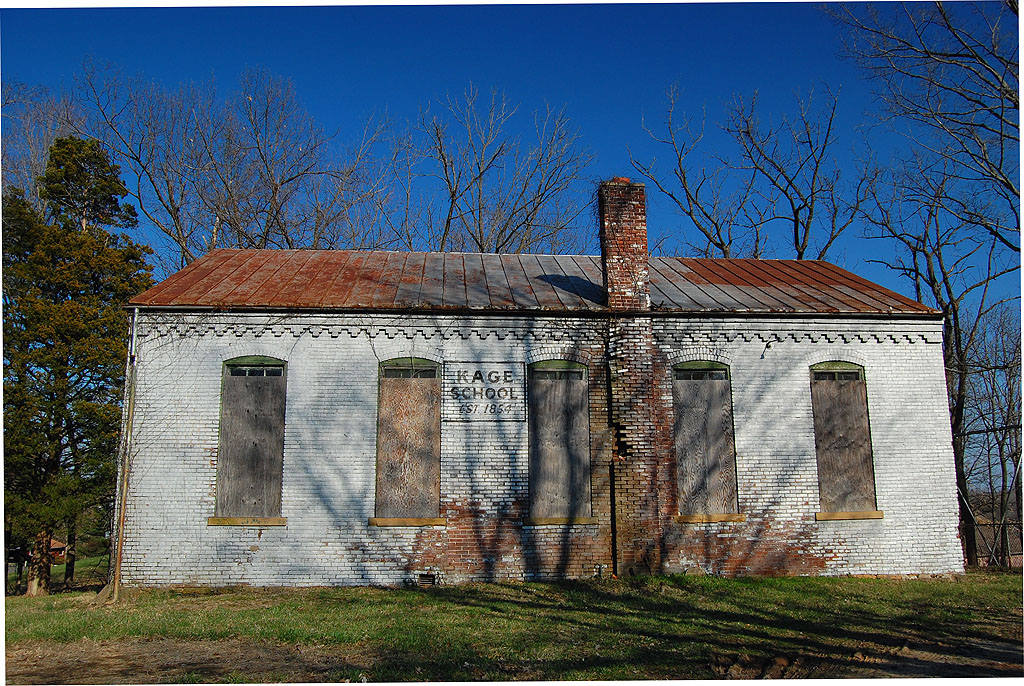
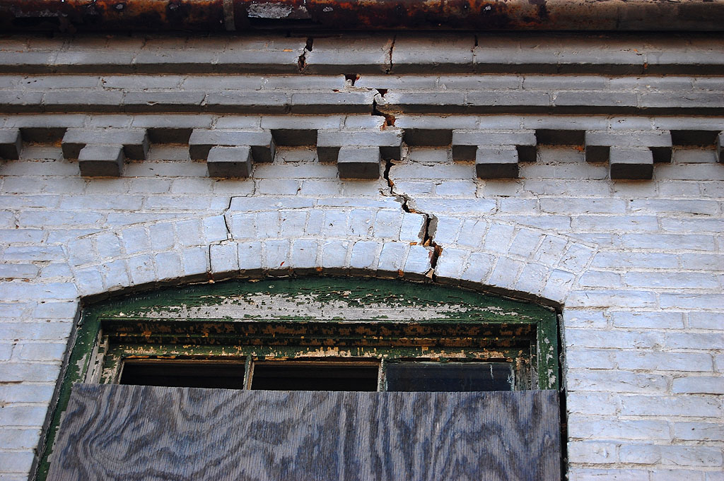
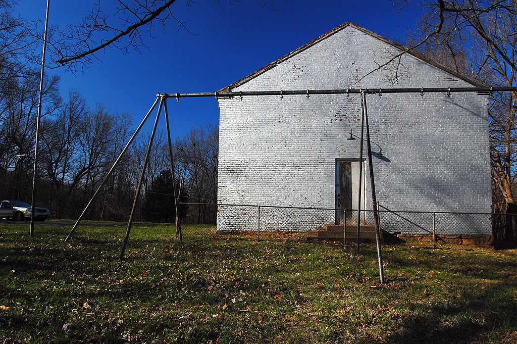
Kage School is crumbling

The bricks in the chimney are beginning to crumble and there are cracks above a window on the southeast side. If anyone is going to step up to preserve this historic building, they’d better do it soon. I encourage you to follow the link to the National Register application to read the fascinating history of the school.

Kage School Gallery of Photos

Here’s a gallery of photos from Kage School. Click on any image to make it larger, then click on the left or right side of the photo to move through the gallery.

Thilenius House Wine Cellar Mystery Solved

Longview AKA the Thilenius House

I ran some aerial photos of the neighborhoods around Capaha Park February 15, 2010, where I asked readers if they could identify the large white house at the bottom of the photo. It had a street or driveway that looked like a question mark leading to and around it. It looked like something I should remember, but I drew a blank.

Sixteen minutes after posting the question, Missourian Photographer Fred Lynch sent me the answer: the mystery house was Longview, also known as the Col. George C. Thilenius House.

You can see the original story and a flood of comments here.

Even though the home is only about two blocks from Cape Central High, is on the second highest hill in the city and has been there since 1870, I had never seen the place.

View from the south

My Mother, who has been just about everywhere there is a where, said she had never been there, either, but knew “about” where it was. Her “about” was good enough. It was at 100 Longview Place, within about two blocks of Central and about two blocks from a house we owned on Themis St. long before Central was even a dream.

Longview Place, is a jog on what, otherwise, would be Whitener St. It’s south of Themis St, west of Keller Ave., east of Sunset Blvd. and north of Independence St.

National Register of Historic Places

Fortunately for the curious, there’s a wealth of information about the property. Want a floor plan of the interior? Want to know about why red tile replaced the original wood shingles in 1926? (Fire.)

Want to know when the house was wired for electricity and received indoor plumbing? (1917.)

The application filed to have the residence listed on the National Register of Historic Places has all of that and more.

It’s available for download here. It’s a huge document that may be too large for folks who don’t have broadband internet connections. If you’re interested in area history, I’d encourage you to snatch it.

Here’s a hint: I kept getting error messages saying the file was damaged when I clicked on it like you would a normal link. That’s probably related to its size. Here’s what worked:

  • Right-click over the link above.
  • Chose Save Link As and download the file.
  • Use Adobe Acrobat to open it.

Wine cellar? Slaves?

Some of the readers mentioned that they had seen or heard of a wine cellar on the property; others wondered if it had any connection to slavery.

Tidbits from the Register document

  • George C. Thilenius and many other German settlers took a strong pro-Union, anti-slavery position in the days leading up to the Civil War.
  • He participated in the first Union triumph of the Civil War, saving St. Louis for the Union.
  • General U.S. Grant ordered the construction of four forts in Cape Girardeau and put Thilenius in charge of them.
  • In 1867, Thilenius paid $1,000 for the 9.56 acre site where Longview sits. Before building his home, he built a three-story brick winery on the site.
  • Construction of the house, which is the only one of its kind in Cape Girardeau, began in 1870.
  • The remains of the old Thilenius Winery are located on the property to the west of the house. The subterranean cellar portion of the winery is all that remains today, and, except for an entrance on the extreme west end, has been covered over with earth. The upper two brick floors of the winery were demolished in 1964.
  • All but 1.4 acres of the original 9.56 acres were sold to a real estate developer in the 1950s.

Longview from the west

Buried Treasure in Capaha Park

My Mother and I were cruising around town knocking off a list of photos that folks had requested. I wanted to get some shots of the pool at Capaha Park and the filled-in pool that preceded it.

While I was shooting the pool, I noticed a guy with a metal detector walking around. When he dropped to one knee and started gouging in the dirt, I went down to talk with him.

“I lost a quarter here in 1957”

When I caught up with him, I said, “I lost a quarter around here in 1957. I think it fell heads-up, so if you find one, it’s probably mine.”

“Well, if you lost it in 1957, it’s a pretty sure bet that it’s made out of silver,” he said, trying to scoop dirt out from under a root.

The fellow was Ron Ethridge, who drove a KAS potato chip truck for some 30-odd years. After he retired from that job, he worked a few other places in Cape, including St. Vincent de Paul for 12 years.

When I mentioned that I was a refugee from The Southeast Missourian, he said, “Then you must know Ray Owen. He and I were buddies over in Cairo.” I told him that I not only knew Ray, but had gone to school with his wife, Sally Wright Owen, Class of 1965.

“That Sally’s a fine gal,” he observed.

Ron started prospecting in the 70s

He celebrated his 69th birthday yesterday. “Climbing up and down in those trucks kept me in pretty good shape.

He admitted, a little sheepishly, that he had recently racked up his knee by slipping on, of all things, a banana peel.

He’s found a few gold pieces and a lot of silver coin over the years – mostly around Cairo. The main value is that it gives him something to do, some exercise and a chance to meet crazy characters who want him to find quarters that went missing in 1957.

There’s more than one Ron around. We saw another fellow with a metal detector working in the Red Star area an hour or so earlier.

Cape Rock, Old and New

The railroad changed Cape Rock

Cape Girardot or Girardeau, founded on Cape Rock, was once an actual cape (a strip of land projecting into a body of water). Sometime in the early 1900s, it was decided that a railroad was more valuable than some rocks sticking 0ut into the Mississippi River, so the promontory was cut to allow tracks to be laid.

The feat was accomplished in time for trains to be able to journey to the World’s Fair in St. Louis in 1904.

This string of rail cars loaded with coal was parked on a siding March 15, 2010, when I drove down to see how high the river was rising. This is looking south from the small parking area on the north side of Cape Rock. Cape Rock is on the right.

View to the north

This shows the track curving to the north, in the direction of Twin Trees Park. The 2009 Tour of Missouri passed by here last summer.

Cape Rock in the Fall

It’s pretty easy to see why Louis Lorimier decided to move Cape Girardeau a couple of miles to the south where the land was flatter. This was taken on a beautiful late October afternoon in 2009. One piece of bad news: there’s a sign that says the park is closed from 11 p.m. to 6 a.m.

Cape Rock mystery

Here’s a photo of some unidentified students with the Cape Rock monument taken sometime in the late 60s. There was nothing written on the film envelope, so I’m open to guesses.

The photo was shot with flash, so it must have been taken late in the day (I don’t do EARLY in the day if I have a choice). They’re wearing short-sleeved shirts and a couple of them have on shorts, so it’s warm weather or they’re a hardy bunch.

They’re doing that photographer-directed, stare at this rock and pretend to be fascinated thing, so something that passes as news is probably being committed here.

Anybody here know these folks?